
![[Siege of Namur] De Stad Namen Met alle de Nieuwe Sterkeens 800 als het is Belegerg Door den Koning Willjam de III | Plan de la Ville et Chasteau de Namur Assiegee Par Roy Guiljaume](/map/small/55872.jpg)
Battle Plan of The Siege of Namur in 1695 Rare Battle Plan showing the lines of for forces of King William III during his siege o the City and Castle of Namur. The view shows the lines during the Second Siege of Namur, which resulted in the retaking...
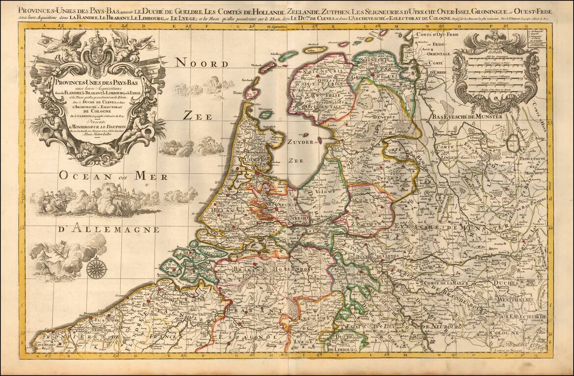
A finely detailed map of the Low Countries, published in Paris. The map illustrates the united provinces of the Low Countries including Flanders, Brabant, Limburg, Lyege, etc. It also notes archdiocese and bishop's palaces throughout the region....
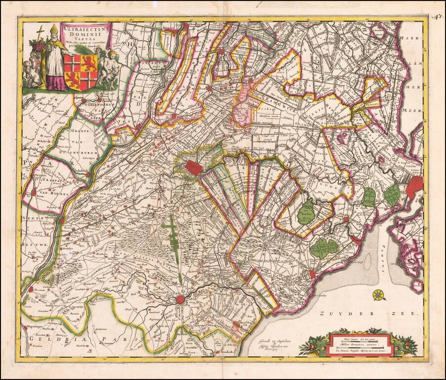
Fine old color example of Justus Danckerts map of the region centered on Utrecht. The map is oriented with west at the top, with Amsterdam at the fair right. Includes decorative cartouche, compass rose, coat of arms, sailing ships, etc.
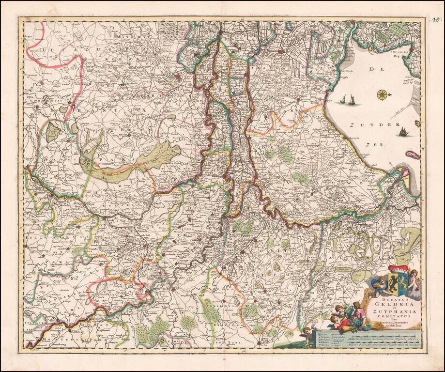
Fine old color example of Justus Danckerts map of Gelderland and Zutphen The map is oriented with west at the top. Includes decorative cartouche, compass rose, coat of arms, sailing ships, etc.
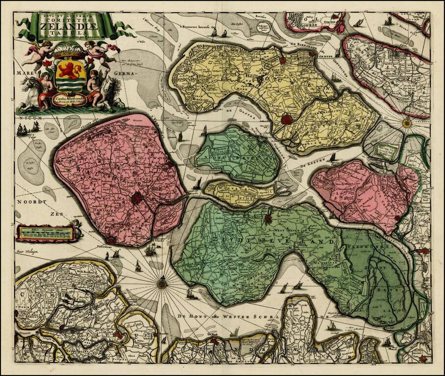
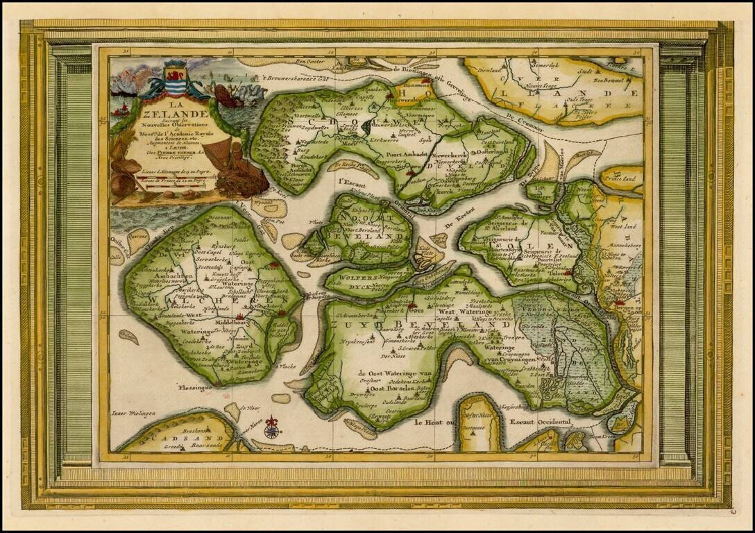
Fine example of Allard's scarce map of Zeeland, in fine old color. Richly embellished, with over two dozen sailing ships, two compass roses, a small distance scale cartouche with a mermaid, and a large title cartouche complete with putti and...

Striking and decorative regional map of the Low Countries, including a very elaborate cartouche and title vignette.
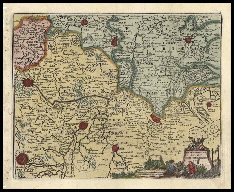
Fine miniature regional map, from an early edition of Afferden's Atlas Abreviado. Includes decorative cartouche, scale of miles and attractive wash coloring.
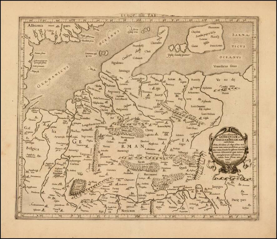
Attractive map of Denmark, Germany, Netherlands and Belgium, on the Ptolemaic model. Mercator originally published this map in his 1578 edition of Ptolemy's great Geography. The present example is the second edition of the map, first issued in 1698....
Fine old color example of Allard's map, showing Amsterdam, Utrecht, Amersfoot, etc. Includes 2 decorative cartouches. Double thick paper and wide margins.
Decorative example of Vander Aa's map of Zealand. Nice example, with the picture frame border, which appeared in Vander Aa's Nouvelle Theatre Du Monde, published in 1713.
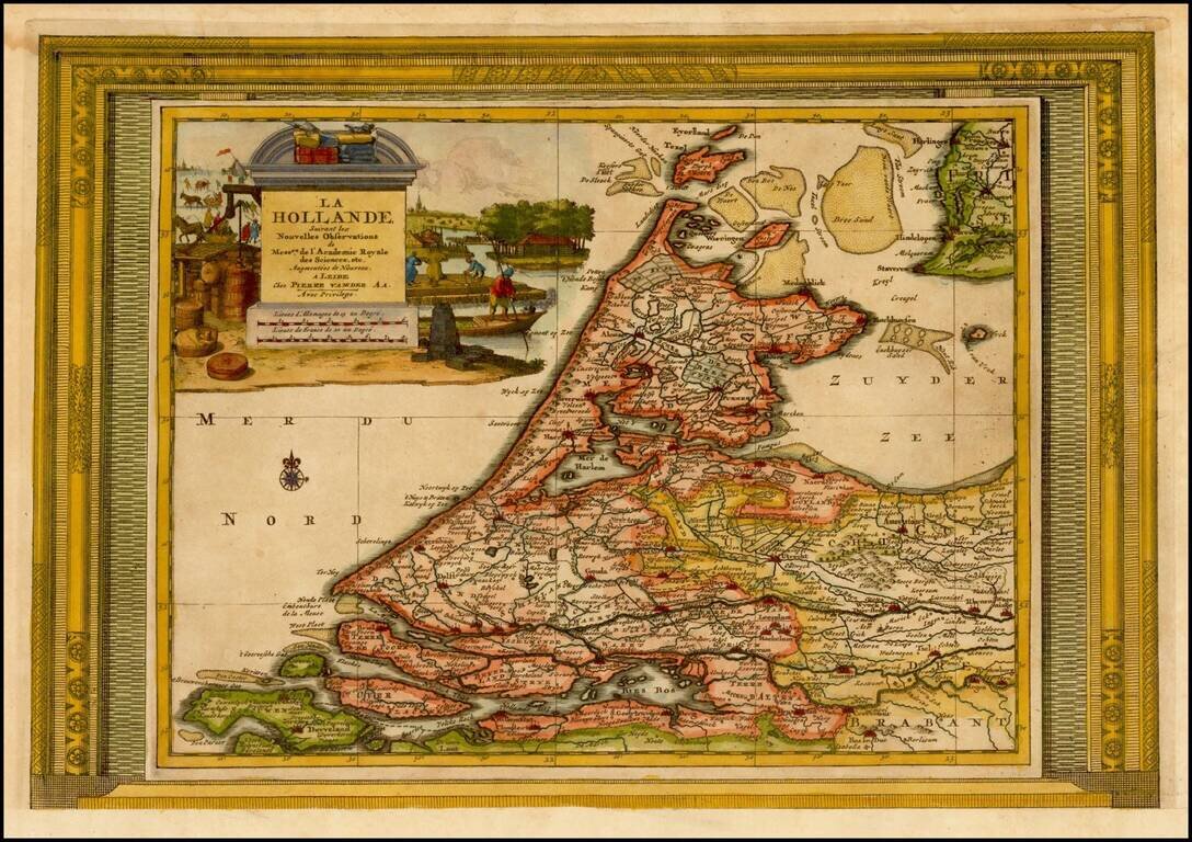
Decorative example of Vander Aa's map of Holland. Nice example, with the picture frame border, which appeared in Vander Aa's Nouvelle Theatre Du Monde, published in 1713.
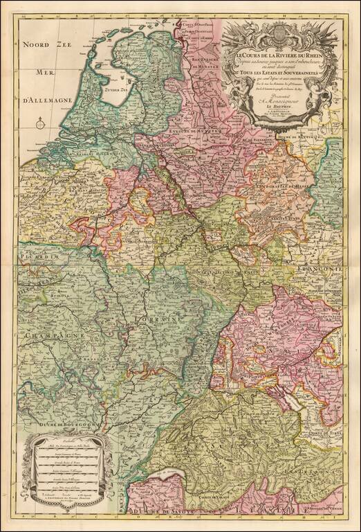
Detailed map the course of the Rhine River, extending from Switzerland to the North Sea. Fine old color and a decorative cartouche.
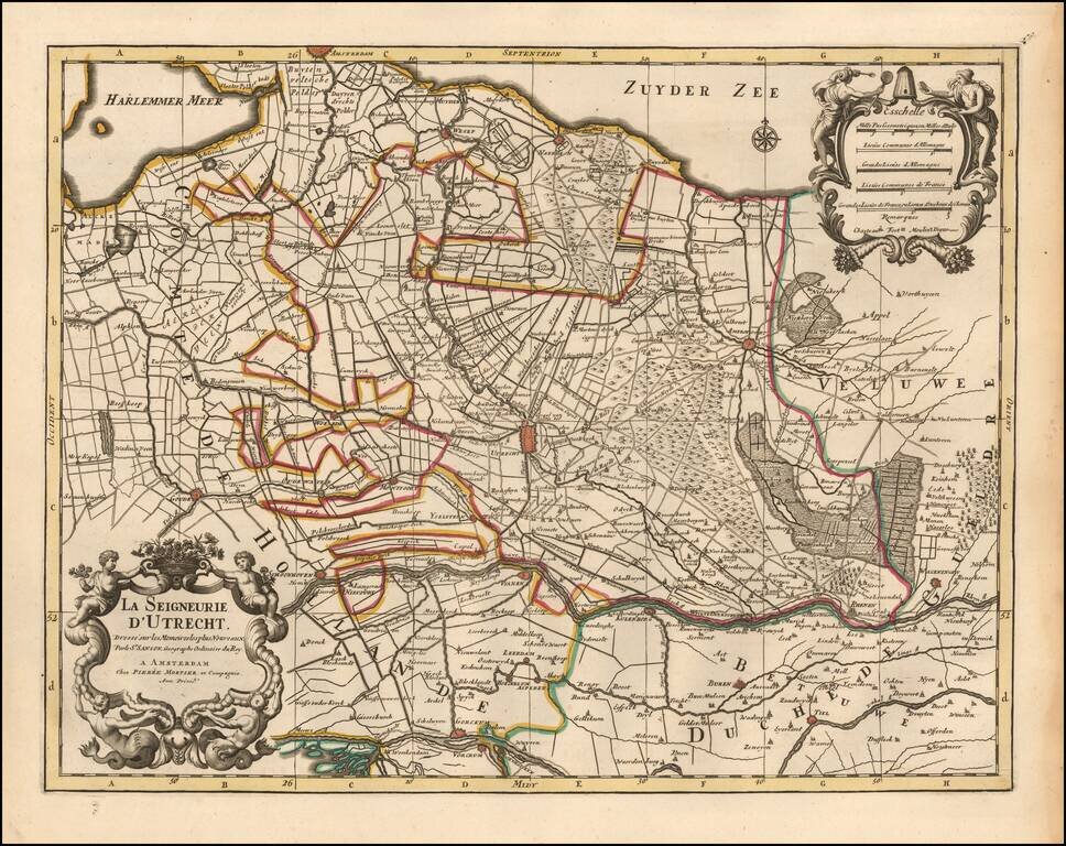
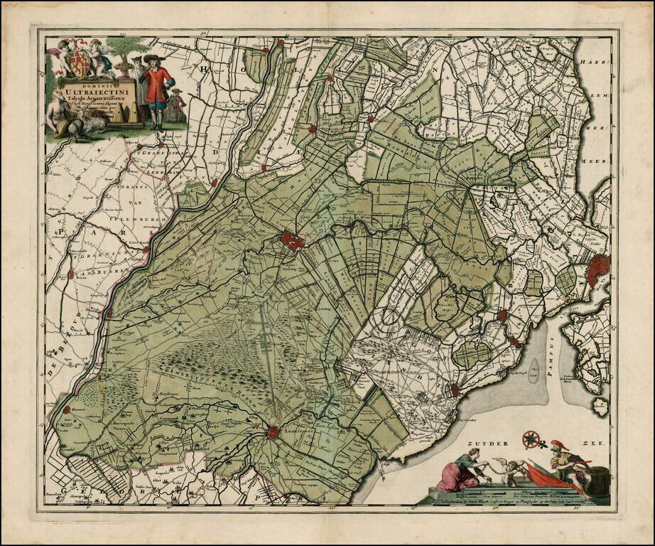
Detailed map centered on the Utrecht region, published in Amsterdam by Pierre Mortier circa 1700. Includes a decorative title and scale cartouche. The map features towns such as Yselstein, Woerde, Montfoort, Kulenborg, etc. and includes roads and...
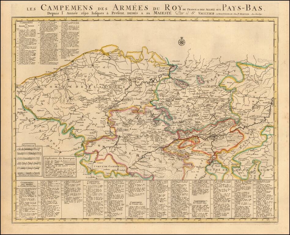
Published by Chez Pierre Mortier in Amsterdam, circa 1700, this "Theatre de la Guerre" (Theater of War) map showcases the intense battles raging in the Netherlands region between the time of the Franco-Dutch War (1672-1678) and the Spanish War of...
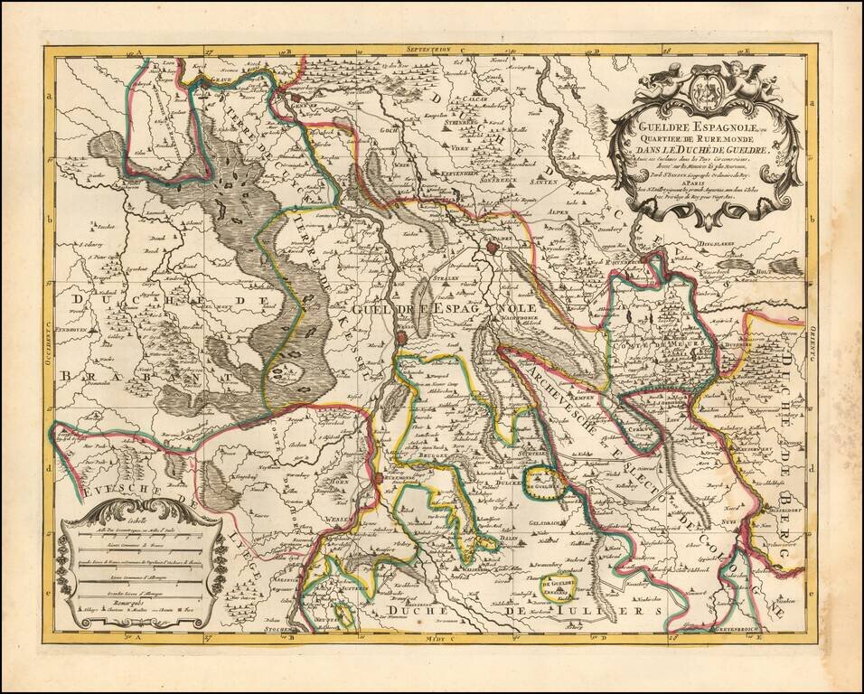
Attractive engraving of Gelderland with the towns of Roermond and Venlo at center. The map is filled with tiny villages, towns, lakes and rivers. Adorned by a decorative strapwork title cartouche and five distance scales. The county of Gelderland,...
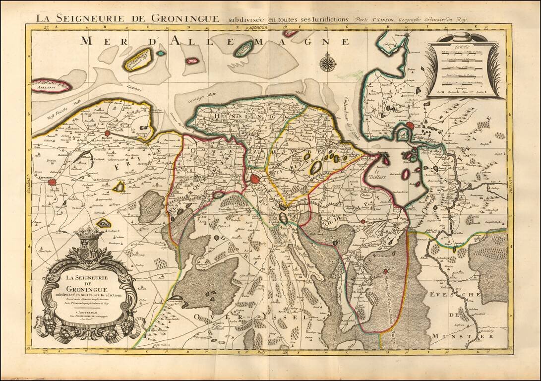
Fine map of the Groningen region, published by Mortier in his Atlas Nouveau. Major towns appearing on the map include Groningen, Winschoote, Emden, Leuwarden, and Dockum.