
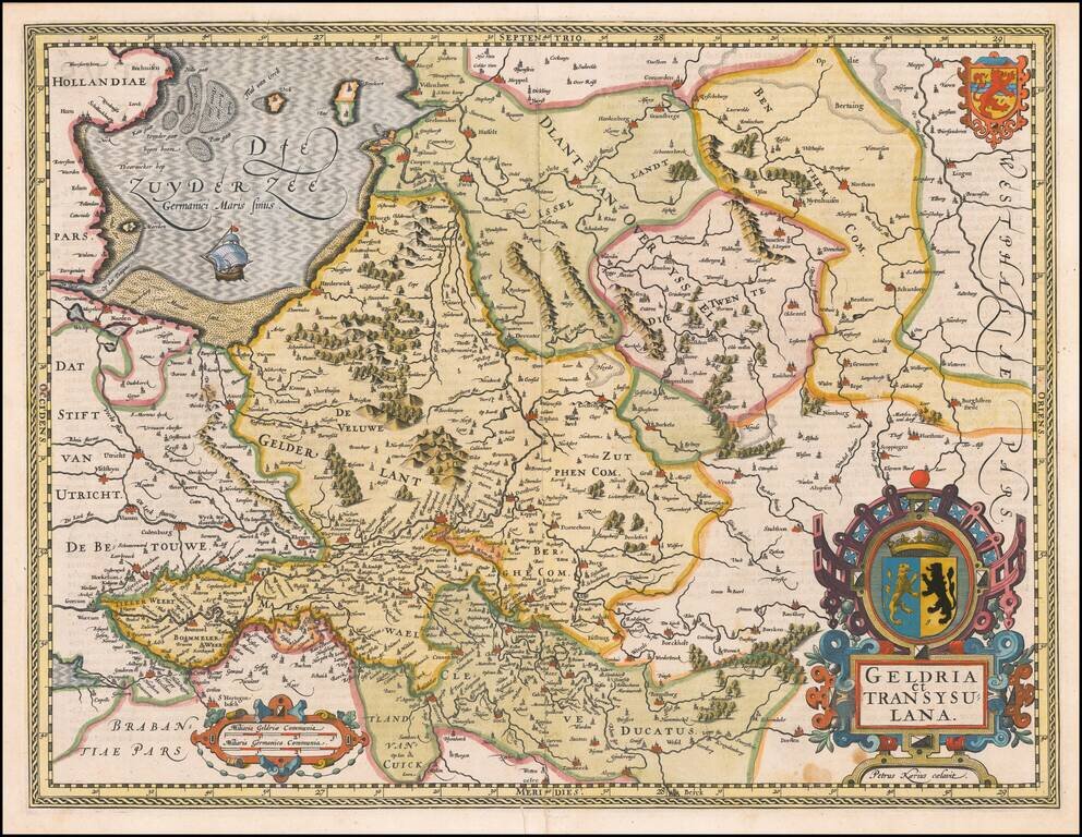
A fine early map of the Gelderland, Overijssel and adjoining regions, which appeared in Petrus Kaerius's (Peter Van der Keere) Germaniae Inferior id est, XVII Provinciarum ejus novae et exactae Tabulae Geographicae, first published in Amsterdam in...
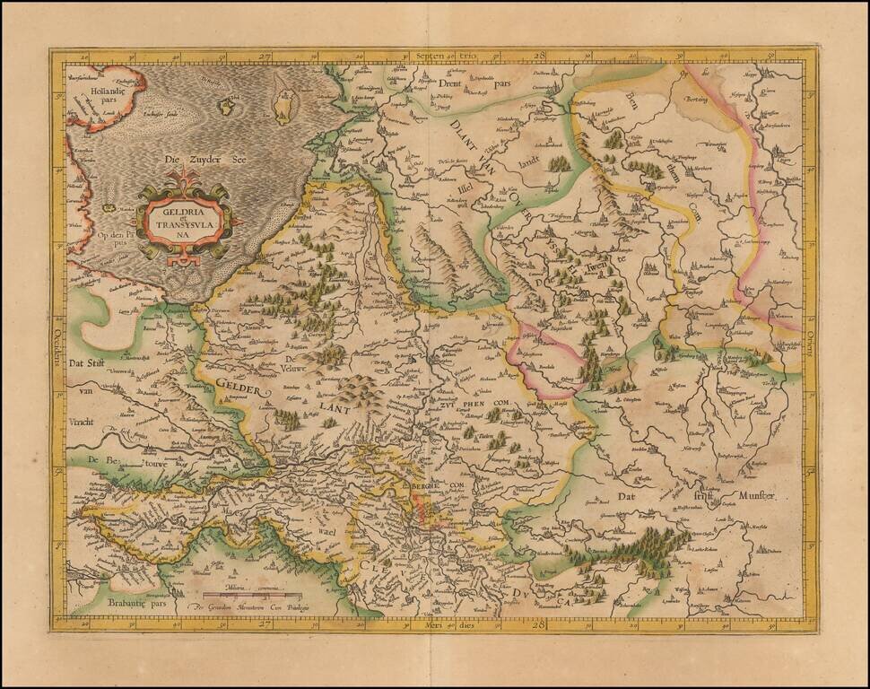
Nice old color example of Mercator's detailed regional map of the Central Netherlands, from Mercator's Atlas Sive Cosmographia.
Rare map of the Holy Roman Empire, published in Paris by Jean Le Clerc. Le Clerc's map is based upon Willem Janszoon Blaeu's map of the same title, first issued in 1606, which includes town views across the top.
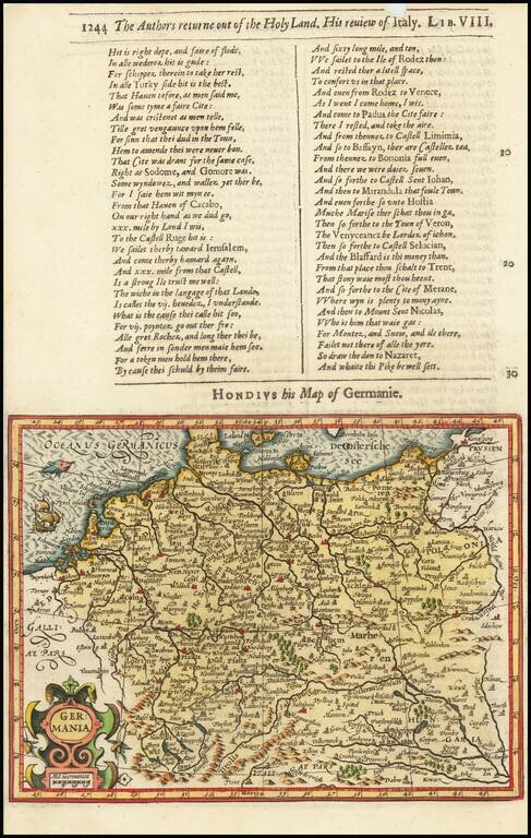
Decorative map of the German Empire, from the Low Countries to Prussia, Poland, Hungary, Austria and Switzerland. Decorative cartouche, sailing ship and coat of arms. From the 1625-26 edition of Purchas His Pilgrims, one of the seminal early 17th...
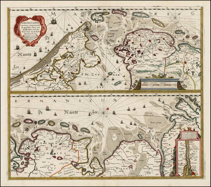
Nice example of Henricus Hondius' map of the Wadden Sea in two horizontal sections, published in Amsterdam. Interesting map of the major shipping routes between the Amsterdam and Hamburg in the Southern part of the North Sea. The map was first issued...
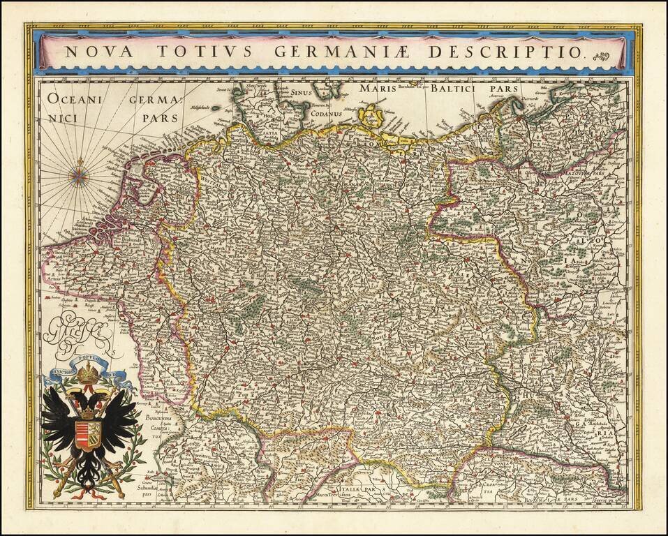
No Text on Verso! Rare edition of Blaeu's map of the German Empire, lacking text on the verso. The map includes the Netherlands, Germany, Switzerland, Austria, Bohemia, Moravia and Poland. This map is scarce, more so without text on the verso.
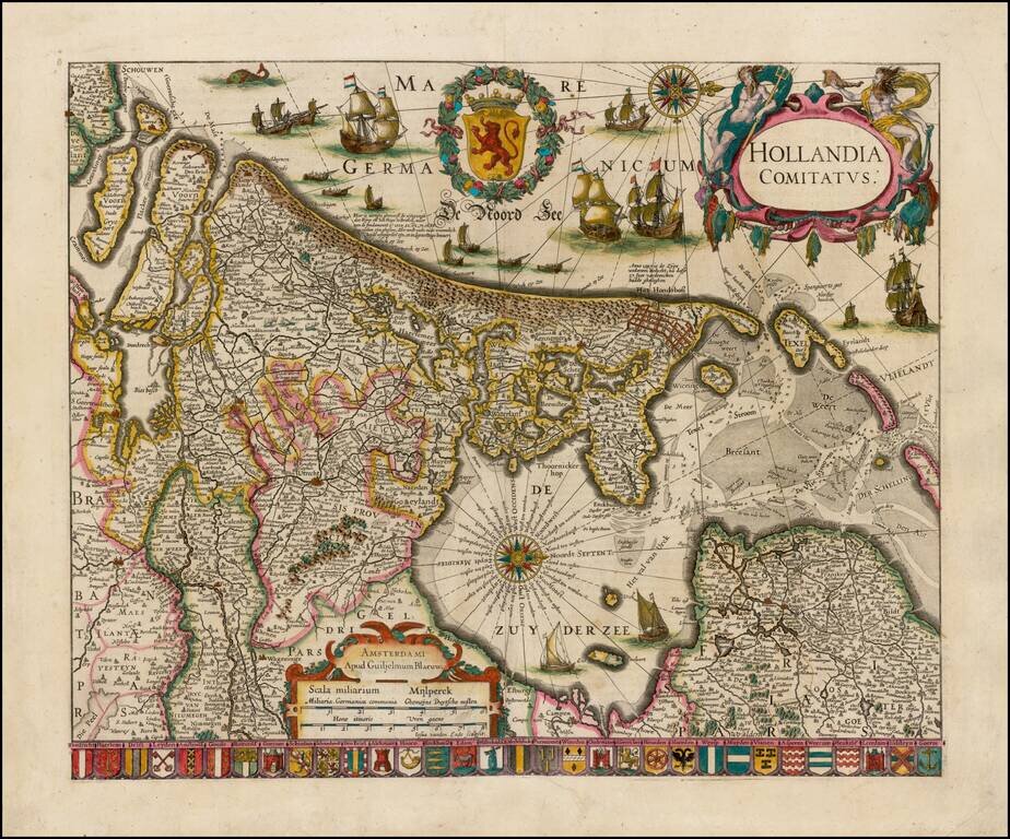
Striking example of Blaeu's rare early map of Holland, oriented with west at the top. The title cartouche is flanked by two sea gods, with 32 coats of arms of the major cities of the Netherlands along the bottom. The present map is known in 4 states,...
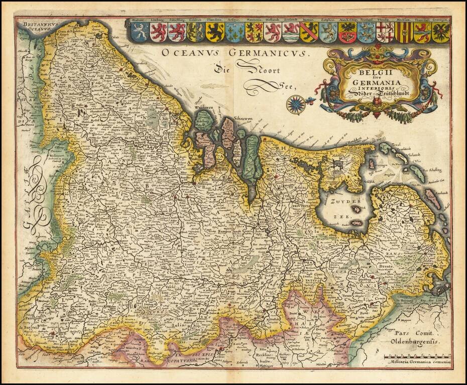
Gorgeous full color example of Merian's map of the Low Countries. Includes an ornate cartouche, compass rose and 17 coats of arms.
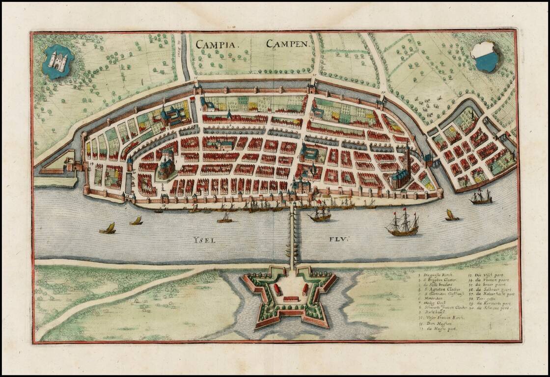
Striking view of Kampen on the Ysel River, with 2 coats of arms. Shows town plan, fortified walls, bridge, canals, etc.
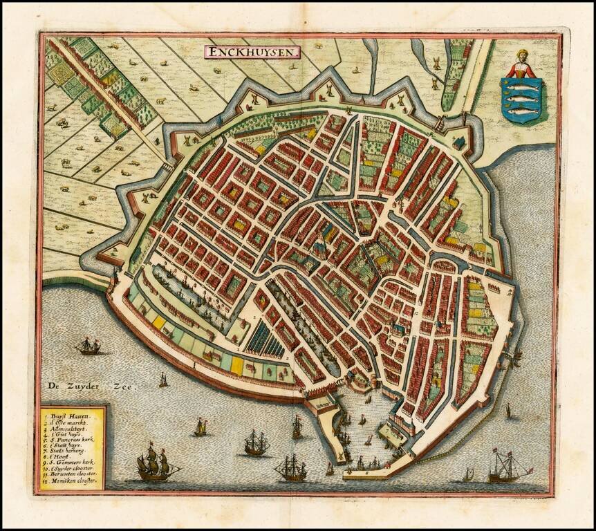
Detailed view of the city of Enckhuysen, from Merian's Neuwe Archontologica Cosmica . . ., published in 1638. Shows town plan, buildings, churches, bridges, fortified walls of the city, etc. Large coat of arms, ships in the harbor and a barge, with...
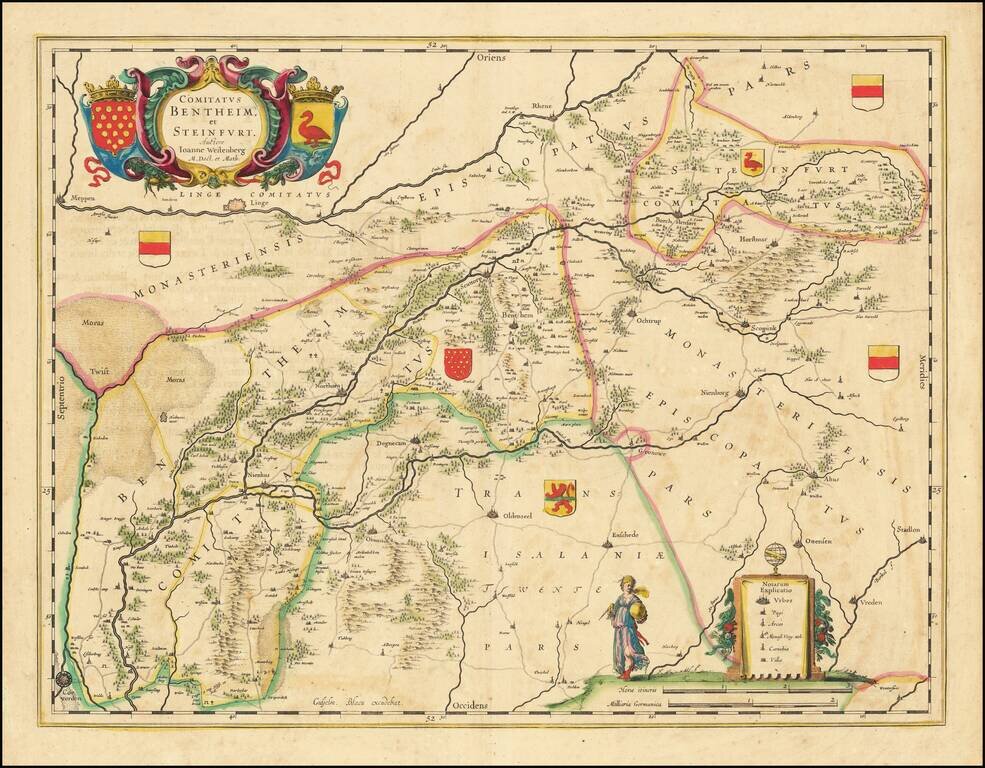
Gorgeous regional map of a portion of the Netherlands. The map shows Meppen, Linge, Rhene, Borchstenfort, Scopink, Nienborg, Ochtrup, Horstmar, Seuttorp, Benthem, Northorn, Degnecam, Oldenzeel, Enschede, Ottensen, Stadlon, Vreden, Otmarsch, Nienhus,...
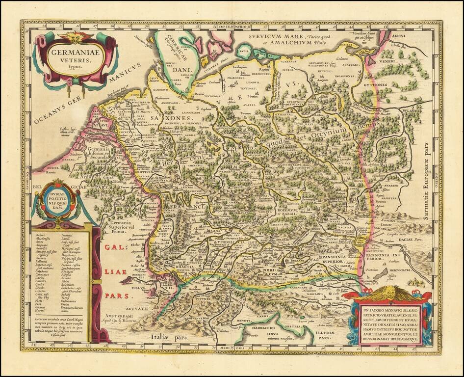
A Plethora of Anicent Place Names Striking example Blaeu's map of the Ancient German Empire in Northern Europe, based upon an earlier map by Ortelius. Extends from the Adriatic (Hadriatici Sinus) to the Baltic (Suevicum Mare) and the Vistula and...
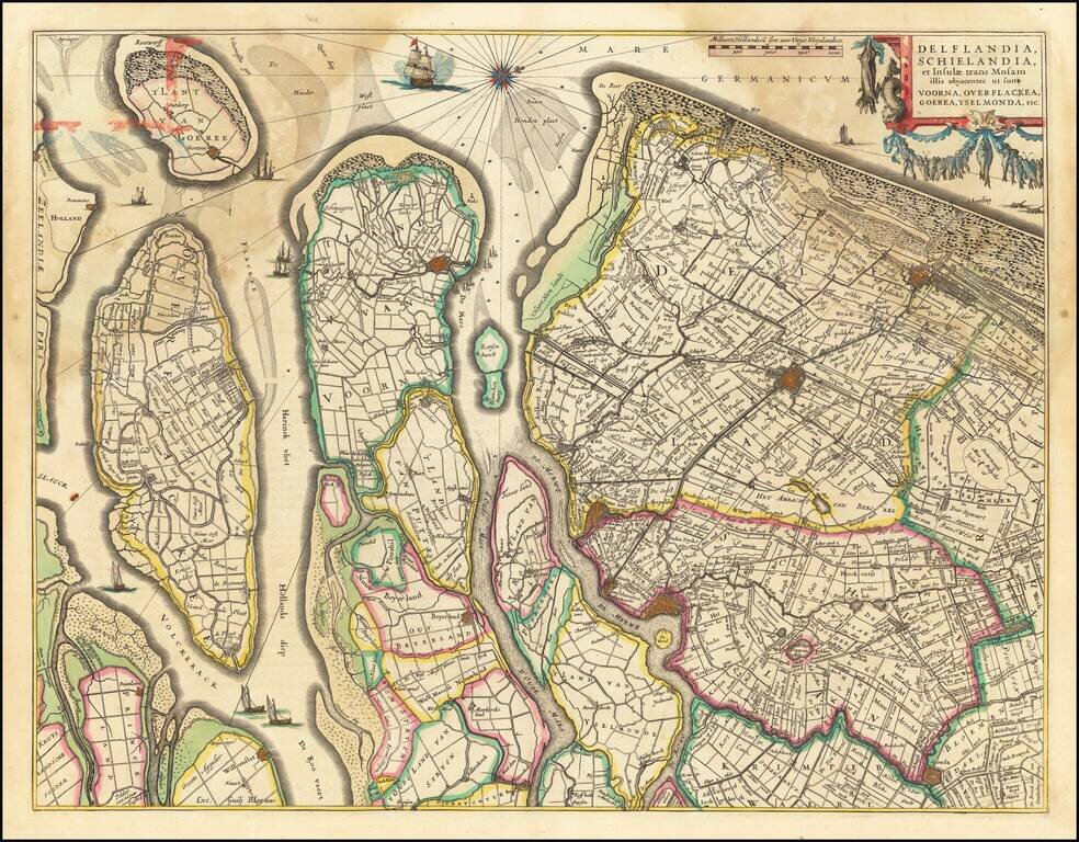
Nice old color example of Blaeu's regional map of Southern Holland. The map shows the estuary of the River Maas and extends from 's-Gravenhage to Gouda in the north and from Ouddorp to Steenbergen in the south. Cities, such as Rotterdam, Delft, and...
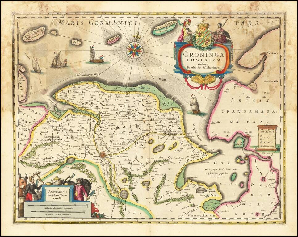
Old color example of Blaeu's map of Groningen. Includes two large cartouches, coat of arms, four sailing ships, compass rose and rhumb lines.
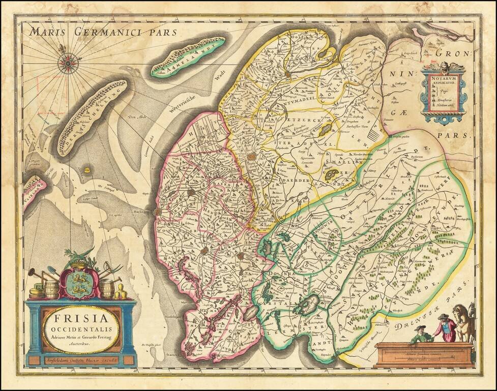
Blaeu's map of the region extending from Kuynder and Staveren in the south to Dockum and Oosdon in the north. Three cartouches, coat of arms, compass rose and rhumb lines.