
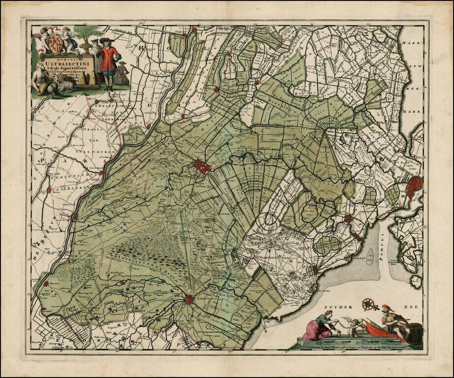
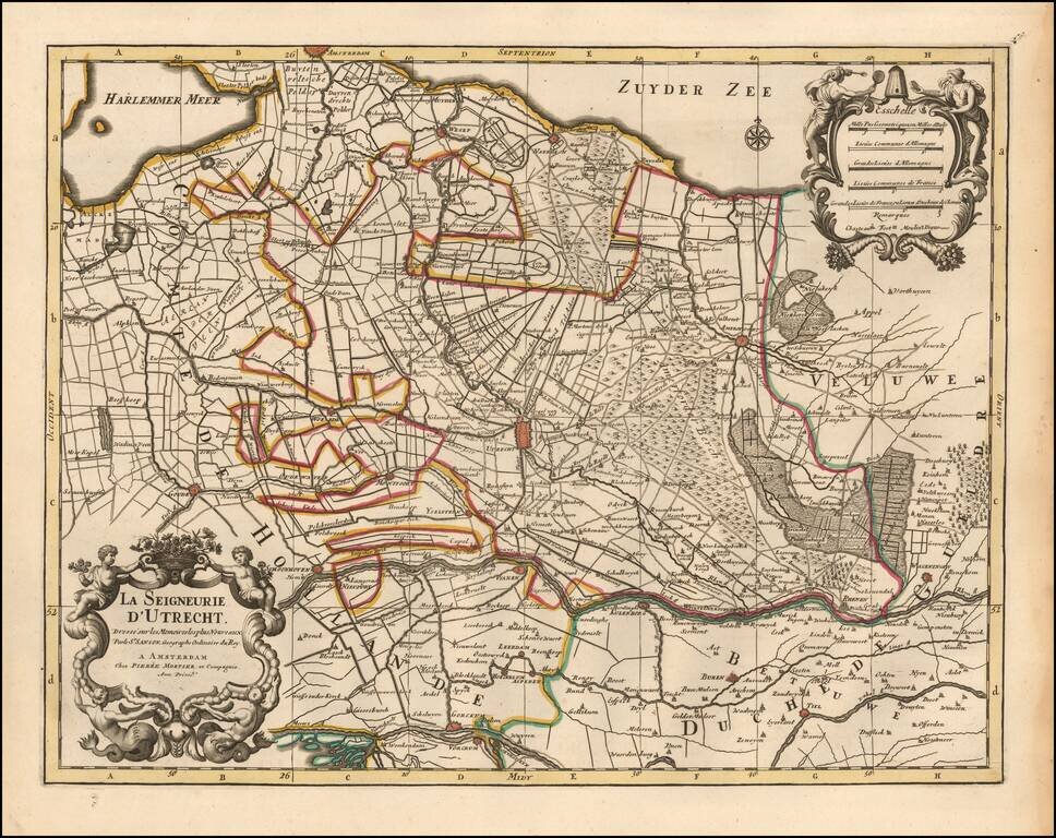
Fine old color example of Allard's map, showing Amsterdam, Utrecht, Amersfoot, etc. Includes 2 decorative cartouches. Double thick paper and wide margins.
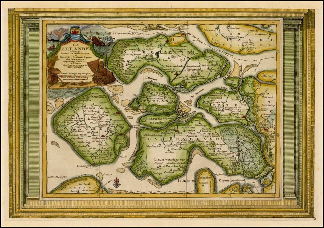
Decorative example of Vander Aa's map of Zealand. Nice example, with the picture frame border, which appeared in Vander Aa's Nouvelle Theatre Du Monde, published in 1713.
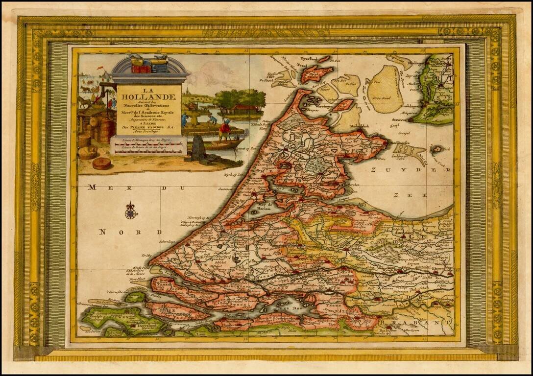
Decorative example of Vander Aa's map of Holland. Nice example, with the picture frame border, which appeared in Vander Aa's Nouvelle Theatre Du Monde, published in 1713.
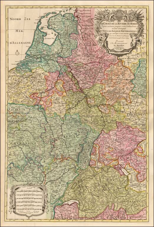
Detailed map the course of the Rhine River, extending from Switzerland to the North Sea. Fine old color and a decorative cartouche.
Detailed map centered on the Utrecht region, published in Amsterdam by Pierre Mortier circa 1700. Includes a decorative title and scale cartouche. The map features towns such as Yselstein, Woerde, Montfoort, Kulenborg, etc. and includes roads and...
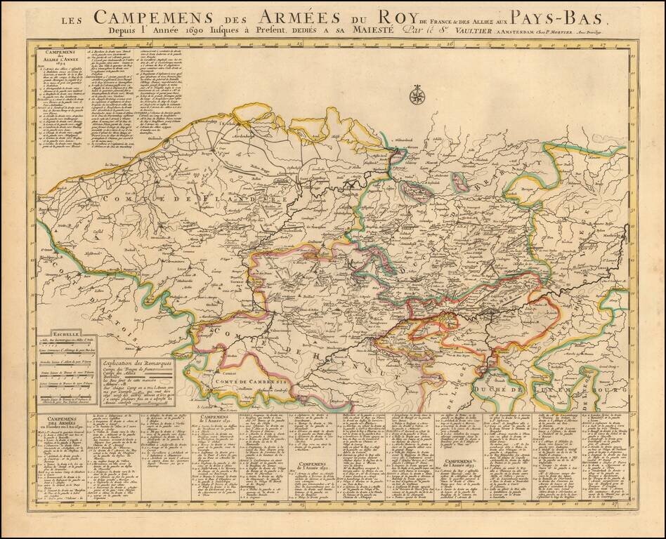
Published by Chez Pierre Mortier in Amsterdam, circa 1700, this "Theatre de la Guerre" (Theater of War) map showcases the intense battles raging in the Netherlands region between the time of the Franco-Dutch War (1672-1678) and the Spanish War of...
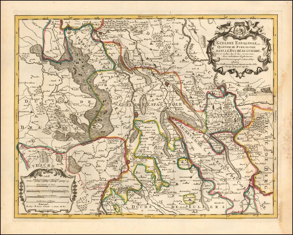
Attractive engraving of Gelderland with the towns of Roermond and Venlo at center. The map is filled with tiny villages, towns, lakes and rivers. Adorned by a decorative strapwork title cartouche and five distance scales. The county of Gelderland,...
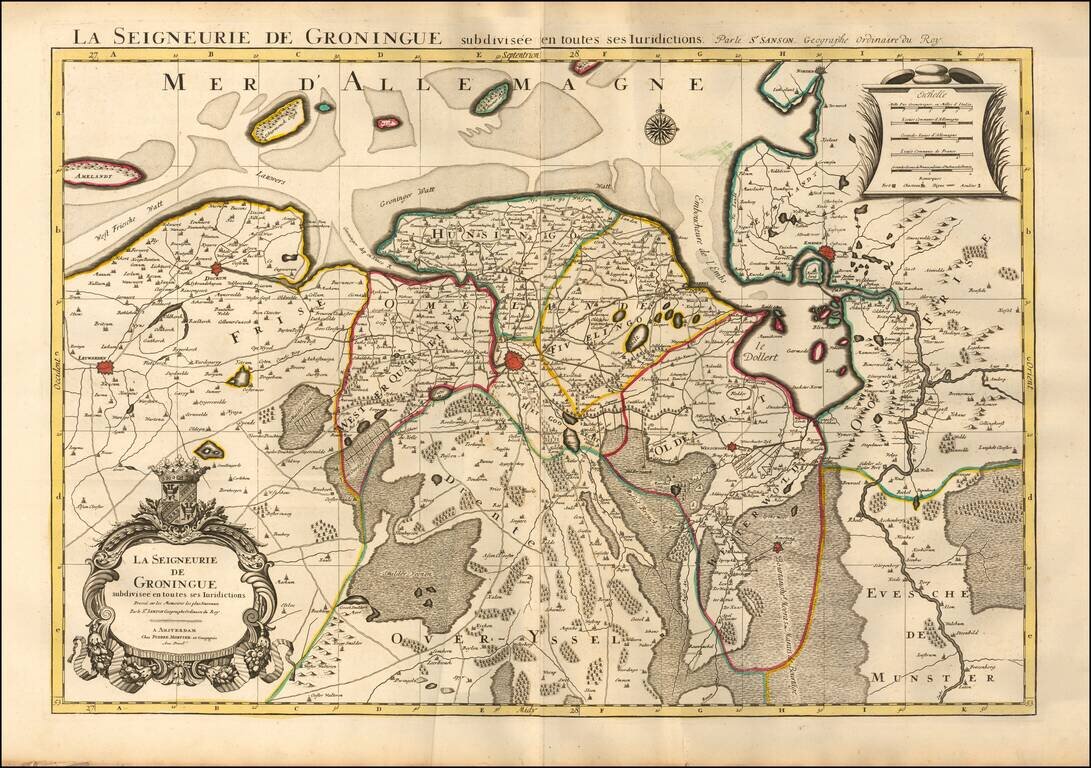
Fine map of the Groningen region, published by Mortier in his Atlas Nouveau. Major towns appearing on the map include Groningen, Winschoote, Emden, Leuwarden, and Dockum.
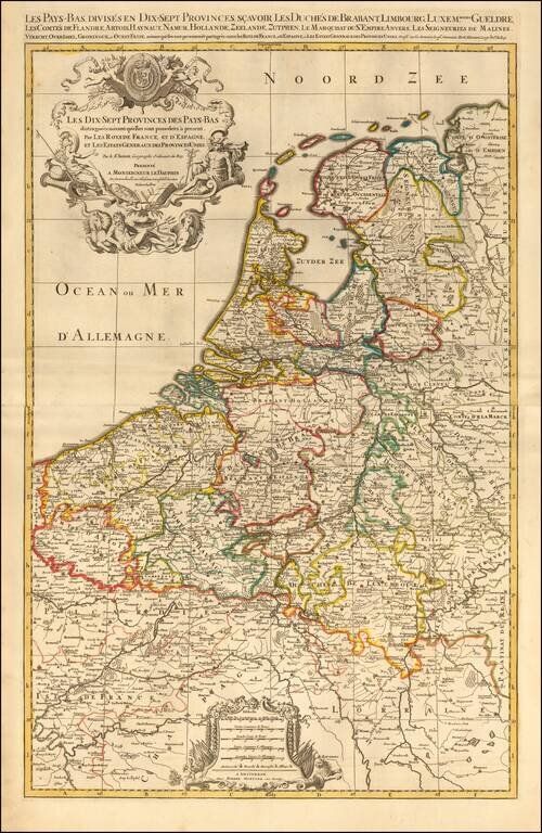
Map of the Seventeen Provinces of the Low Countries (Netherlands, Belgium, and Luxembourg), published in Paris, circa 1700. Includes two additional sheets with an alphabetical index of town names and villages and a Table of the Seventeen Provinces of...
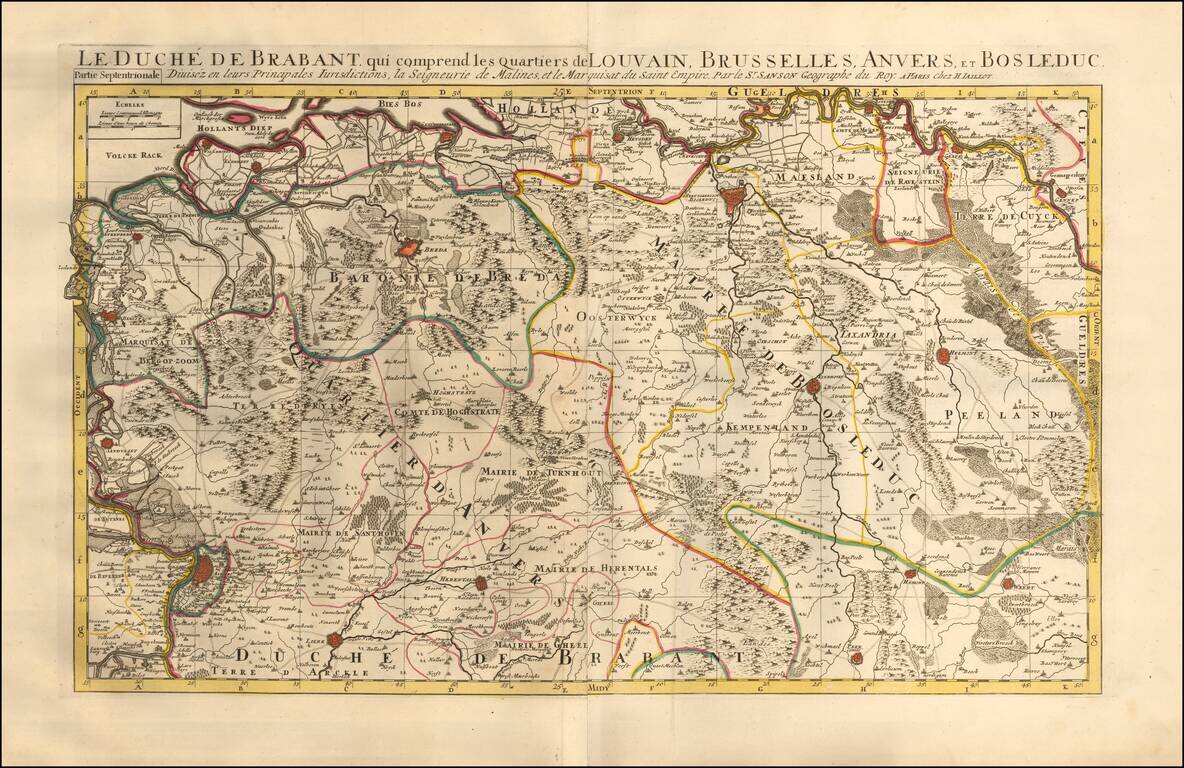
Map of the Duchy of Brabant which includes the districts of Leuven, Brussels, Antwerp, and Bosleduc. Includes 2 sheets with 4 city plans and/or views of the areas within northern and southern Brabant. Also includes an alphabetical table of towns and...
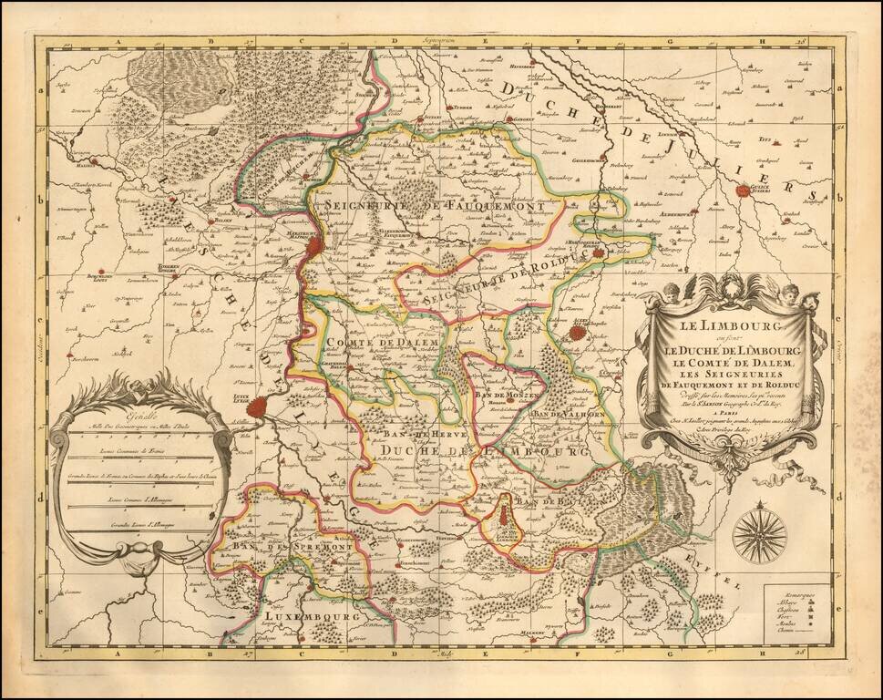
A fine and detailed map of Limburg and Dalem in the southern Netherlands. The map includes a separate sheet with an alphabetical table of towns and villages within Limburg. Based on the work of Nicholas Sanson, the map highlights the counties and...
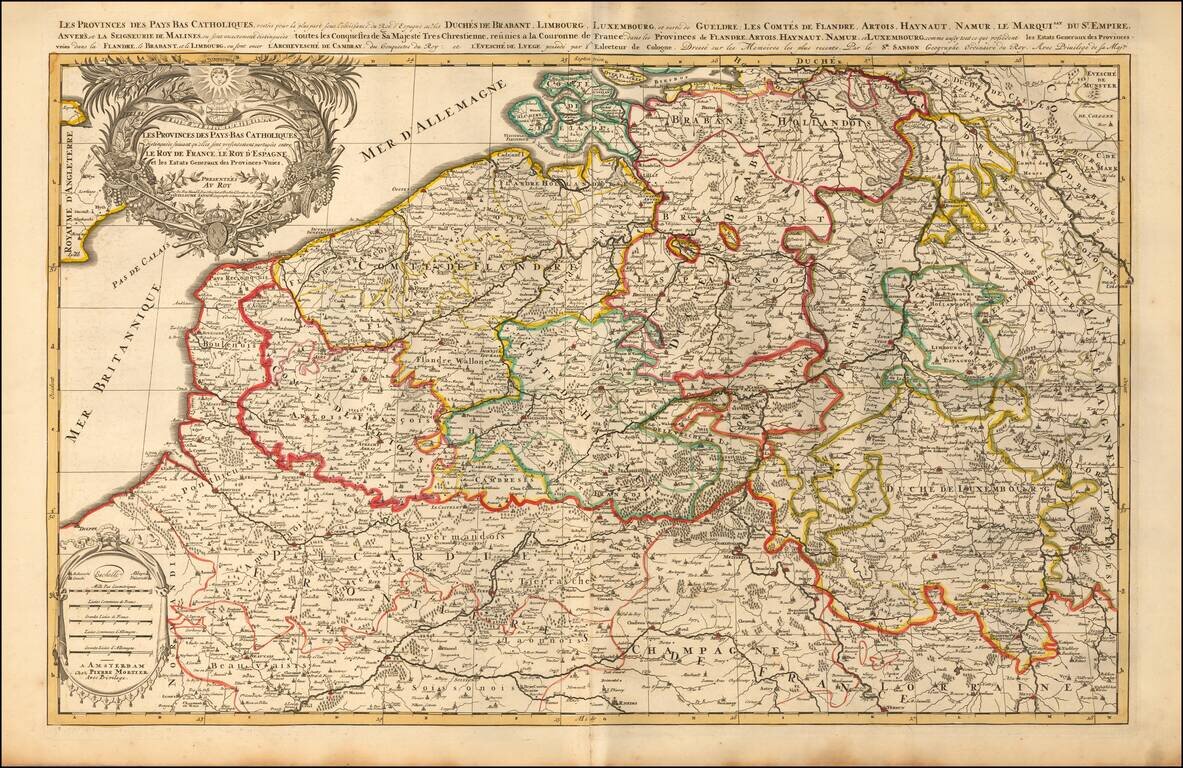
A finely detailed map of the Cathlolic Low Countries, published in Amsterdam, circa 1700. The map illustrates the main provinces of the Catholic Low Countries, including Brabant, Limburg, Luxembourg, Gueldre, Flandres, Artois, Hainaut, Namur,...
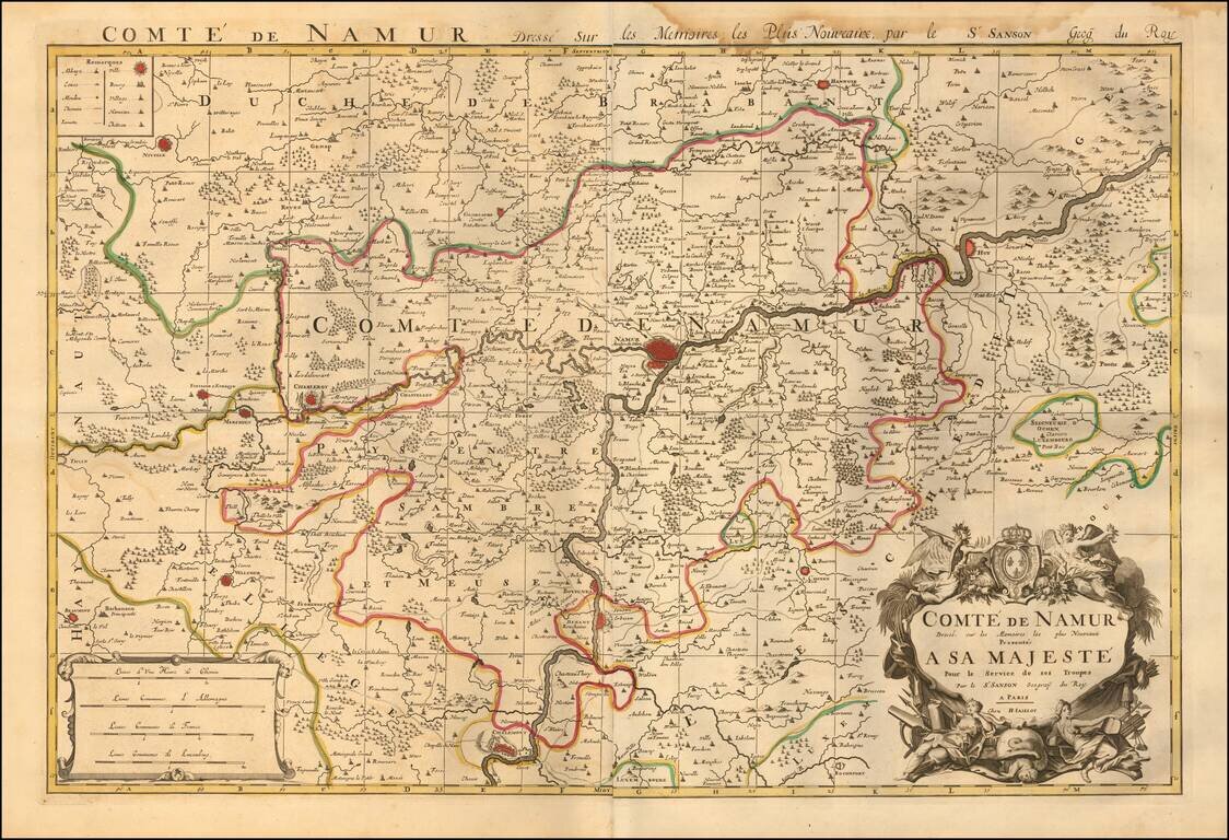
Map of the County of Namur, published in Paris, circa 1700. A fine and detailed map of the region around the city of Namur, from Jaillot’s “Nouvelle introduction a le geographie....” The map is embellished with a beautifully engraved title and...
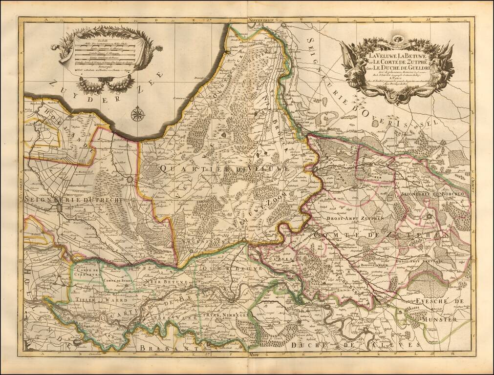
A beautifully detailed map of Utrecht, Veluwe, Zutphen, Holland, and Neder-Betuw published in Paris. The map outlines in color the towns and municipalities of Utrecht, Veluwe, Zutphen, Neder-Betuwe, etc., and shows relief pictorially. Features lakes,...
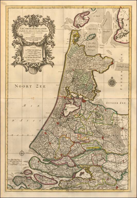
A finely detailed map of Holland published in Amsterdam, circa 1700. The map extends from Amsterdam in the south to Texel in the north, outlining key municipalities and cities across the region, including Goeree-Overflakkee, Voorne-Putten, Utrecht,...
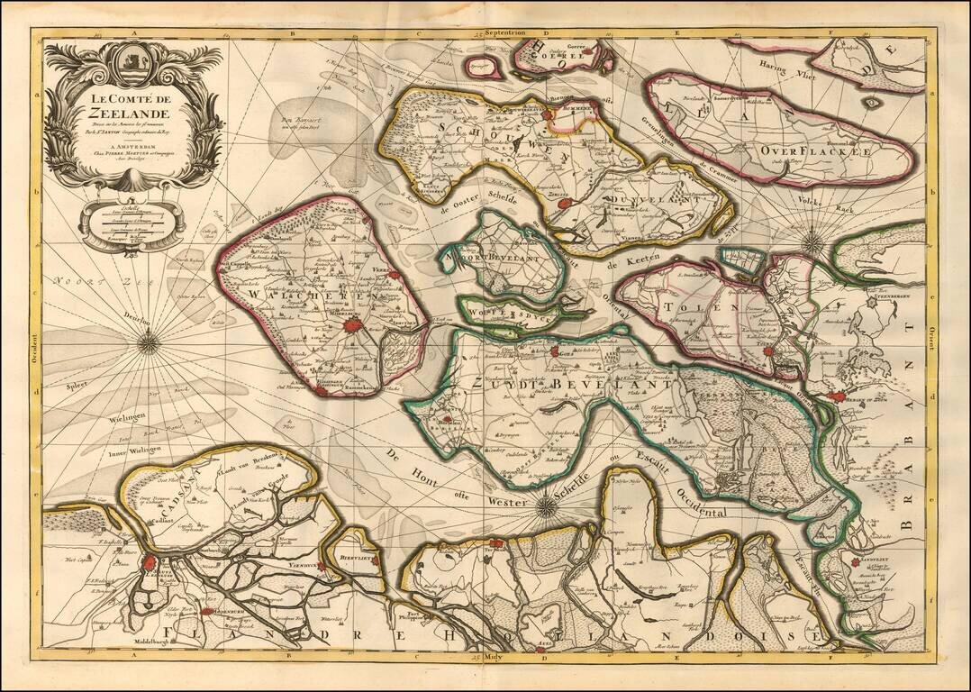
A finely detailed map of Zeeland, published in Amsterdam, circa 1700. The map outlines the islands and municipalities of Walcheren, Schouwen-Duiveland, Noord-Beveland, Wolfersdyck, Zuid-Beveland, Goeree-Overflakkee, Tholen, Cadzand, etc. Main cities...