
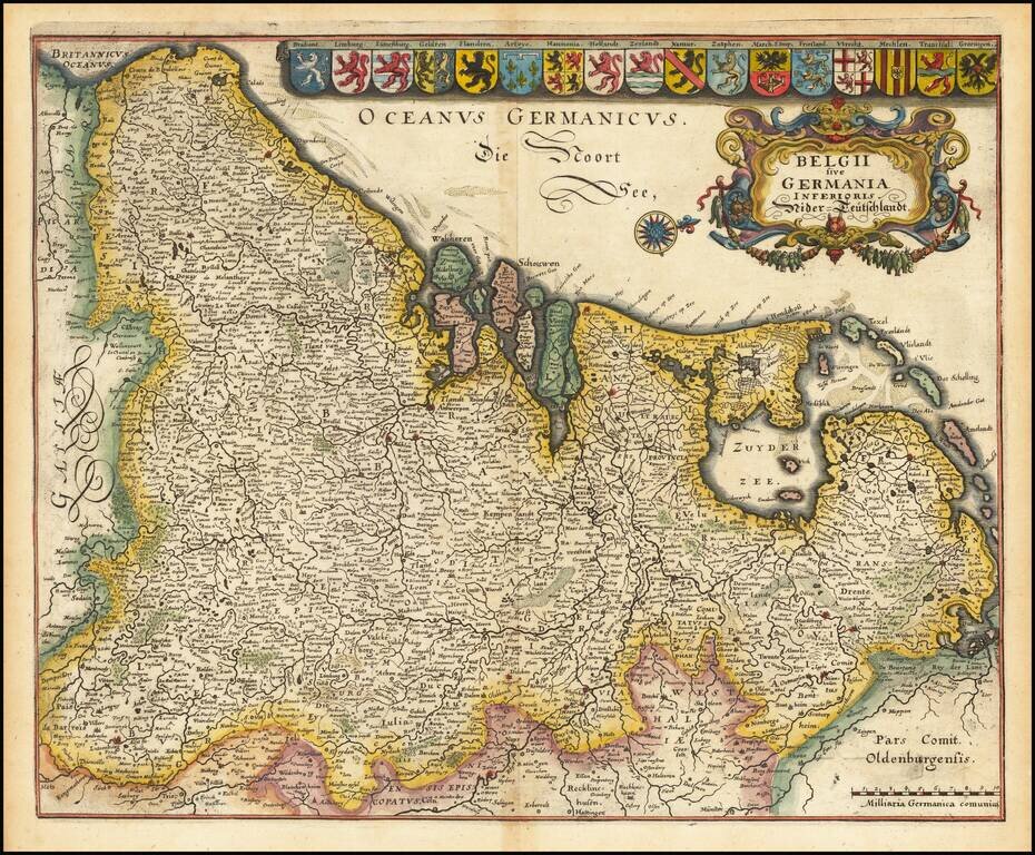
Gorgeous full color example of Merian's map of the Low Countries. Includes an ornate cartouche, compass rose and 17 coats of arms.
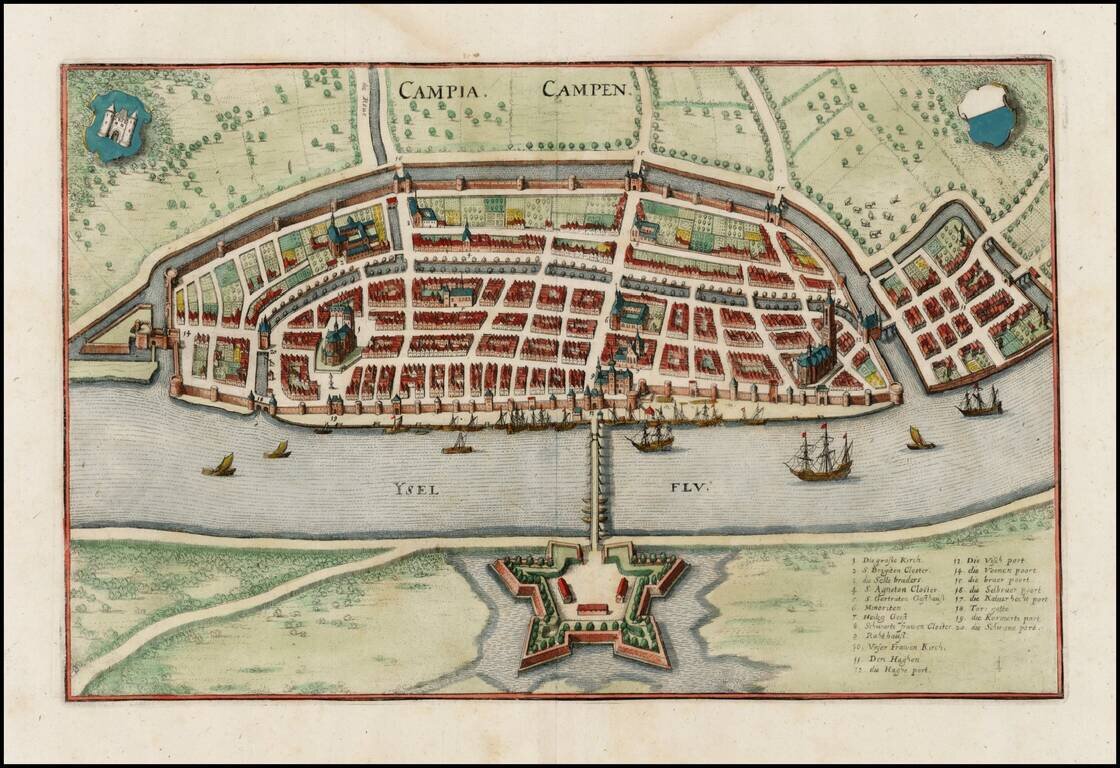
Striking view of Kampen on the Ysel River, with 2 coats of arms. Shows town plan, fortified walls, bridge, canals, etc.
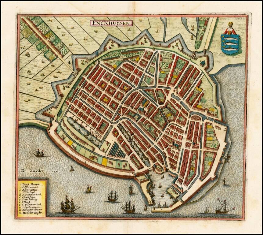
Detailed view of the city of Enckhuysen, from Merian's Neuwe Archontologica Cosmica . . ., published in 1638. Shows town plan, buildings, churches, bridges, fortified walls of the city, etc. Large coat of arms, ships in the harbor and a barge, with...
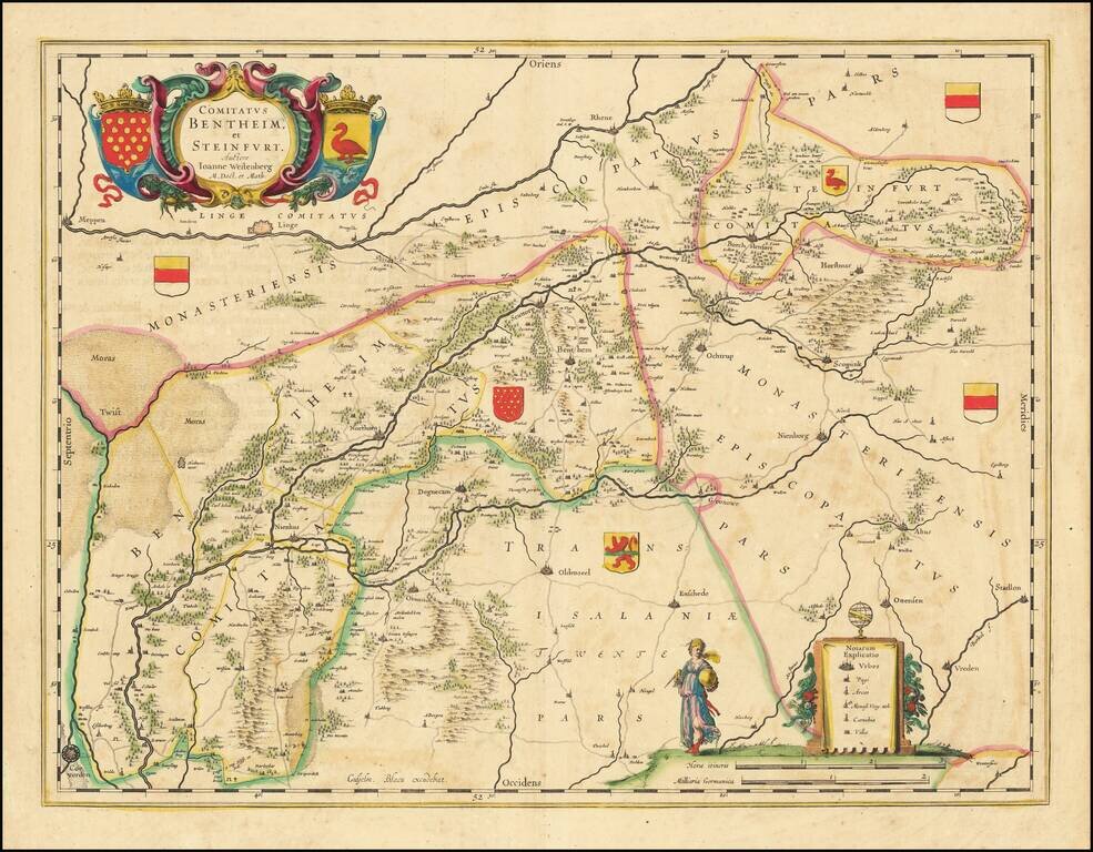
Gorgeous regional map of a portion of the Netherlands. The map shows Meppen, Linge, Rhene, Borchstenfort, Scopink, Nienborg, Ochtrup, Horstmar, Seuttorp, Benthem, Northorn, Degnecam, Oldenzeel, Enschede, Ottensen, Stadlon, Vreden, Otmarsch, Nienhus,...
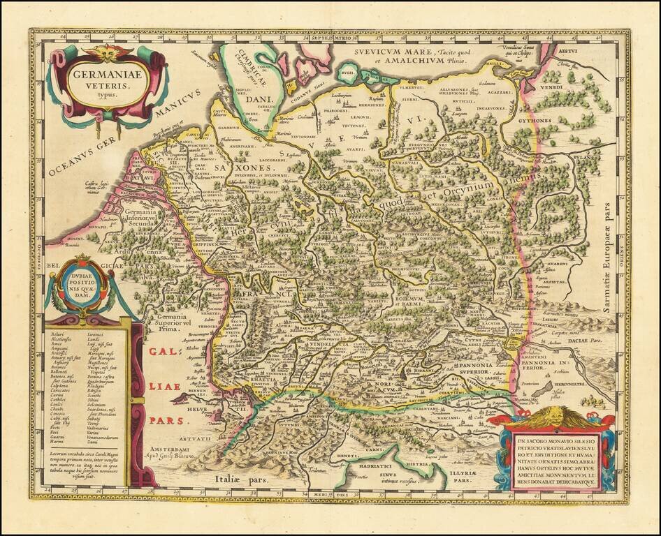
A Plethora of Anicent Place Names Striking example Blaeu's map of the Ancient German Empire in Northern Europe, based upon an earlier map by Ortelius. Extends from the Adriatic (Hadriatici Sinus) to the Baltic (Suevicum Mare) and the Vistula and...
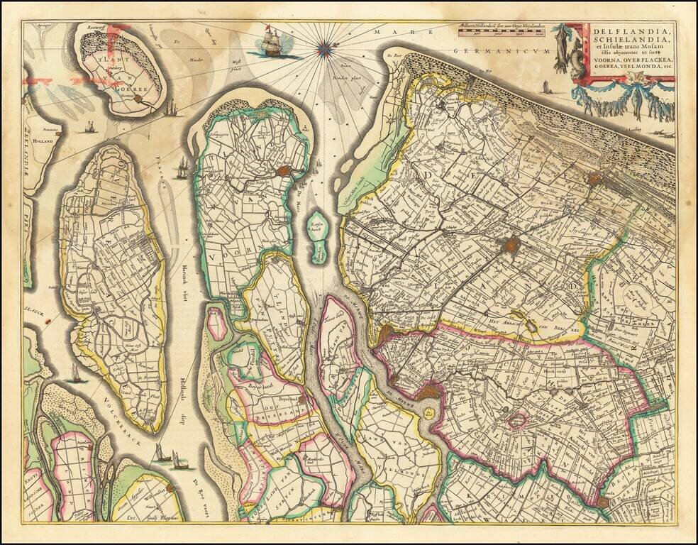
Nice old color example of Blaeu's regional map of Southern Holland. The map shows the estuary of the River Maas and extends from 's-Gravenhage to Gouda in the north and from Ouddorp to Steenbergen in the south. Cities, such as Rotterdam, Delft, and...
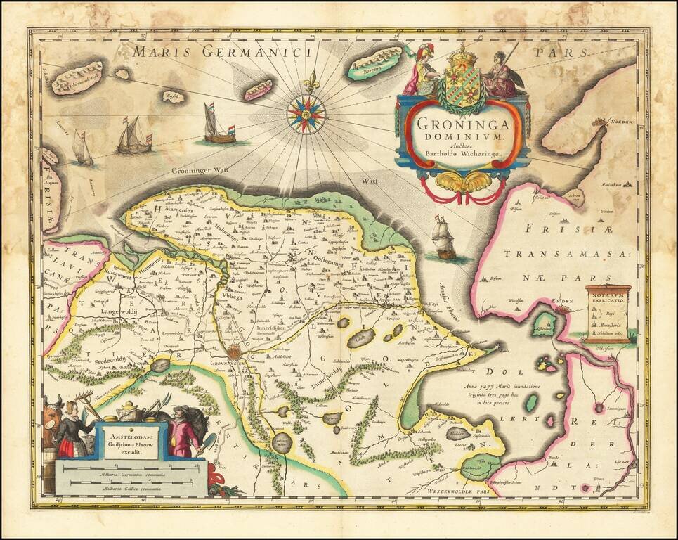
Old color example of Blaeu's map of Groningen. Includes two large cartouches, coat of arms, four sailing ships, compass rose and rhumb lines.
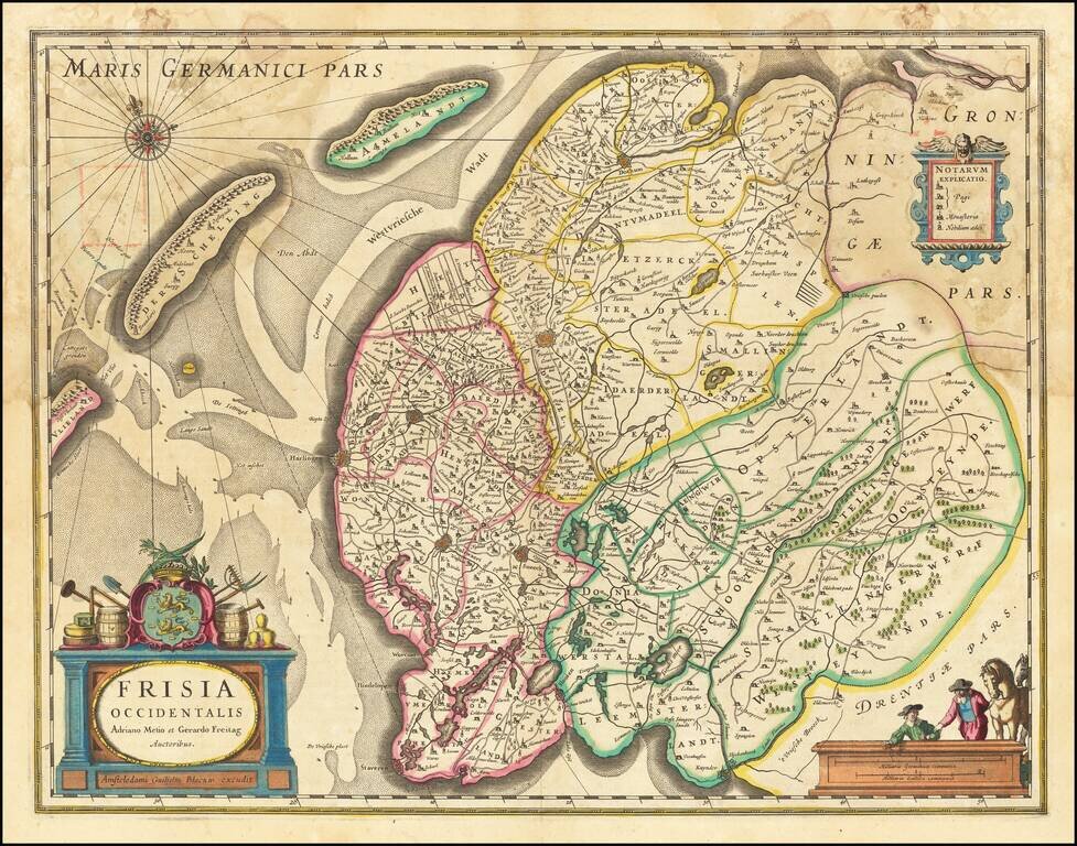
Blaeu's map of the region extending from Kuynder and Staveren in the south to Dockum and Oosdon in the north. Three cartouches, coat of arms, compass rose and rhumb lines.
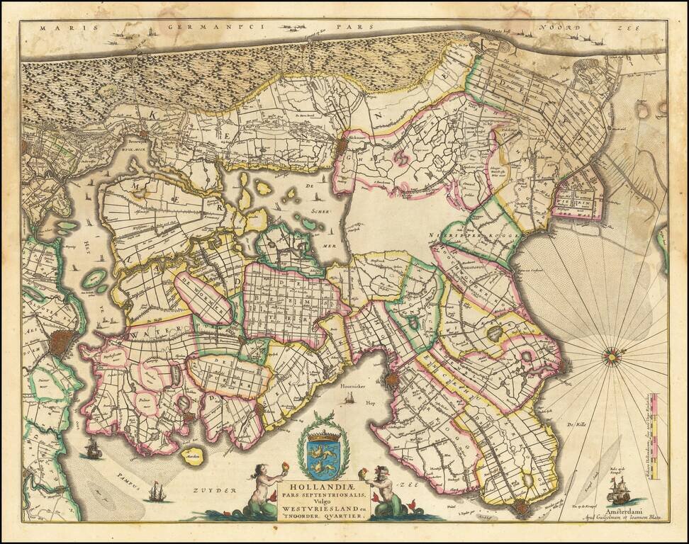
Detailed map of the area showing Amsterdam in the South and extending north to Enkhuizen and Medemblik in North Holland. The map shows west at the top.
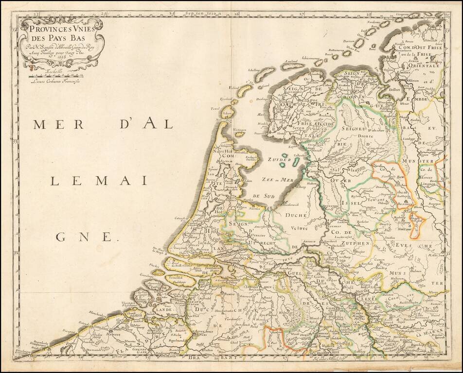
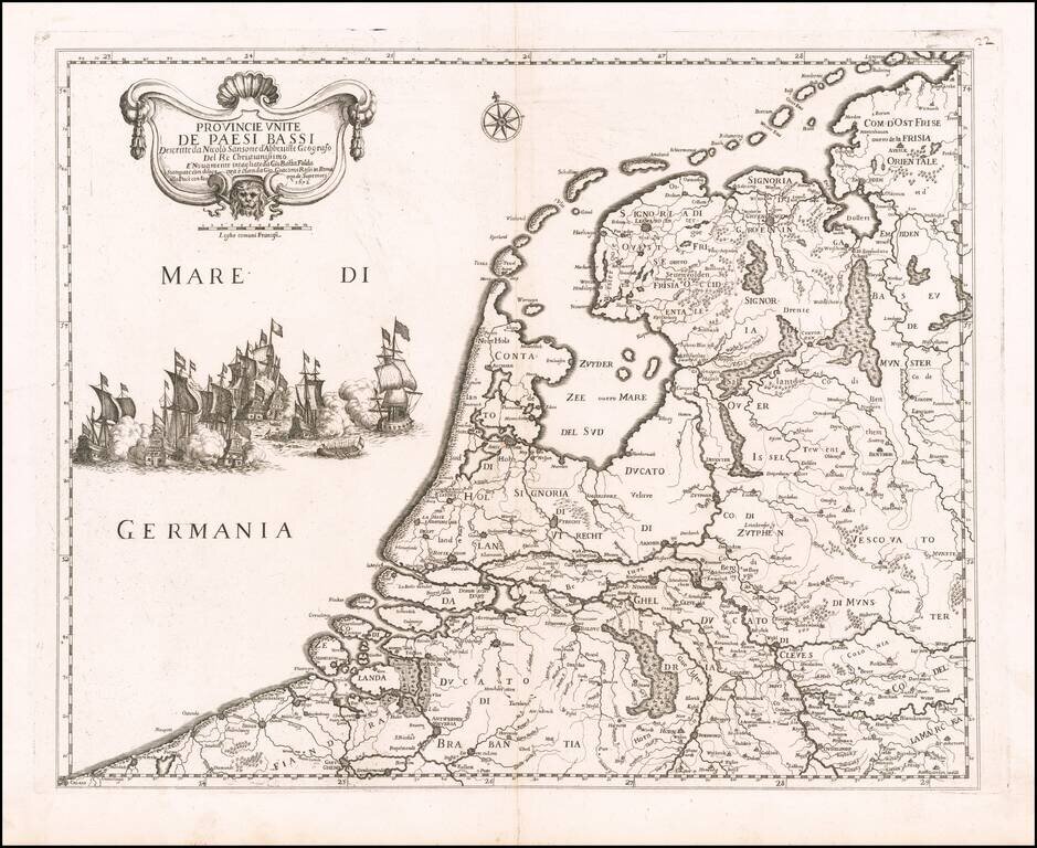
Nicholas Sanson's 1648 double-page engraved map of the Netherlands.
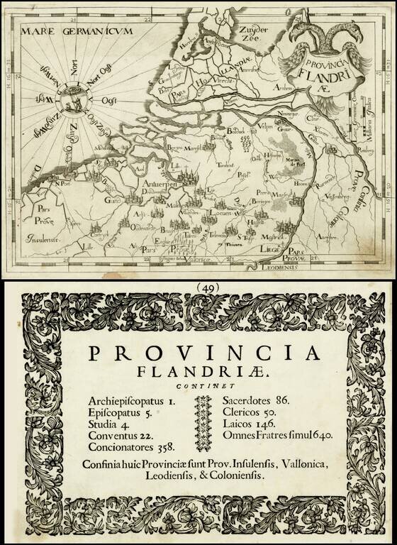
Rare map of the "Province of Flanders" by Johannes A. Montecalerio, published in Chorographica Descriptio Provinciaru & Conventum… in Milan. The engraving style is bold and unique, not at all similar to contemporary cartographers. There were...

Minor toning from a previous framing. Detailed plan of the Den Haag, published by Johannes Blaeu.
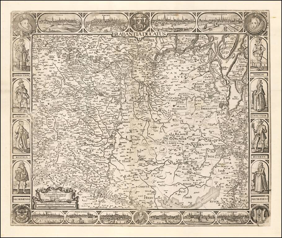
A Rare Late State! Rare map of the Duchy of Brabant, published by Peter Verbiest in Amsterdam. The map is oriented with west at the top and includes City Views of Leuven, Brussels, Antwerp, s'Hertogenbosch, Mechelen, Breda, Helmond, Lier, Bergen op...
Decorative map of the Low Countries, published by Rossi in his Mercurio geografico overo guida geografica in tutte le parti del mondo conforme le tavole geografiche del Sansone Baudrand e Cantelli. The map is colored by regions and shows towns,...
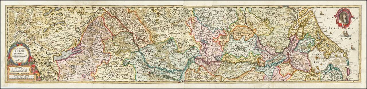
Rare separately published map of the Rhine River, engraved by Verbiest. Originally printed in two sections, this example has been joined at an early date. As with all Verbiest maps, the map is extremely rare.
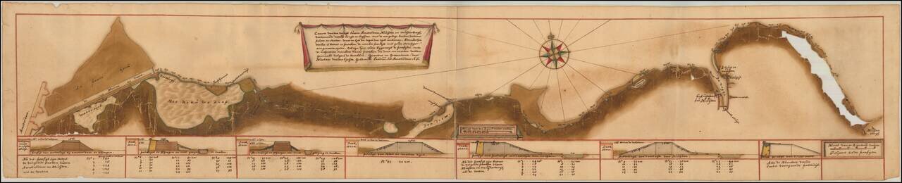
An Amsterdam Canal Map Drawn by Nicolaas van der Heyden. Finely executed gold heightened manuscript map of the Nieuwvaart Canal in Amsterdam, drawn by Amsterdam's Inspector General of Dikes and Canals, Nicolaas van der Heyden in 1676. The map extends...