
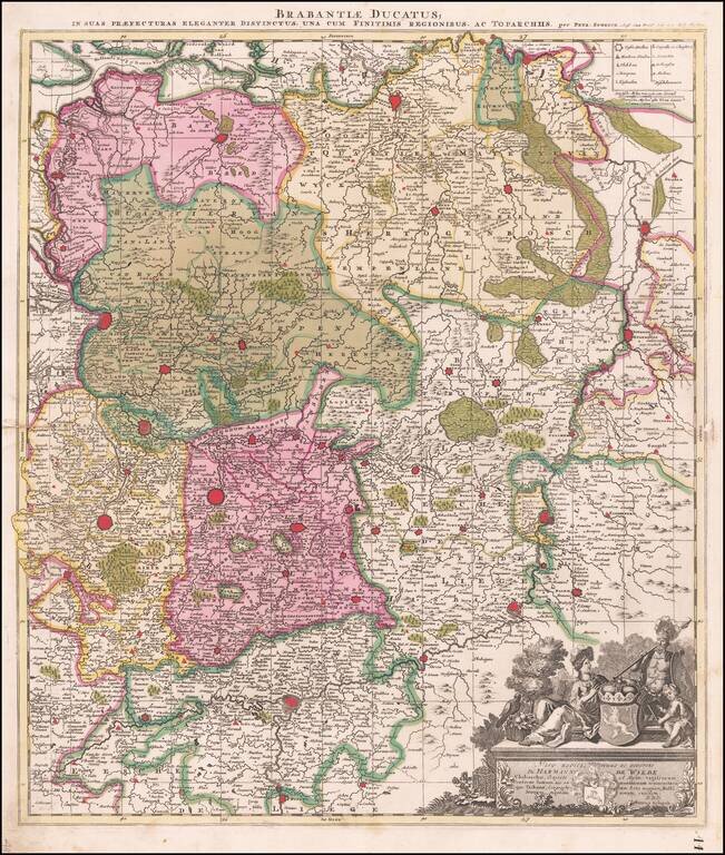
Striking map of the northern Duchy of Brabant and neighboring regions, published by Peter Schenk. The map is centered on Louvain and Tienen, with Brussels, Antwerp, Namur, Liege, Maastricht and Breda among the larger cities on the map.
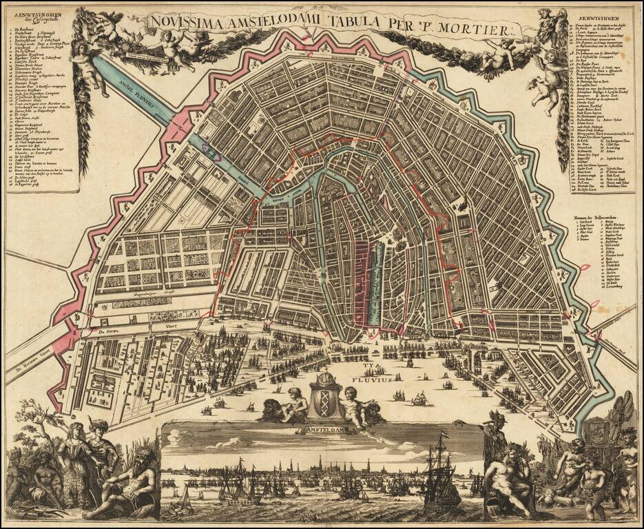
Rare and decorative map, showing allegorical representations of the continents in the lower corners. The panoramic view at the bottom depicts the IJ River, filled with sailing ships, based upon Jochem Bormeester's view of 1685. The plan shows...
![[Southern Netherlands]](/map/small/63488.jpg)
Detailed map of the Southern part of Holland, published in Amsterdam circa 1700. This is the lower half of a 2 sheet map of Holland.
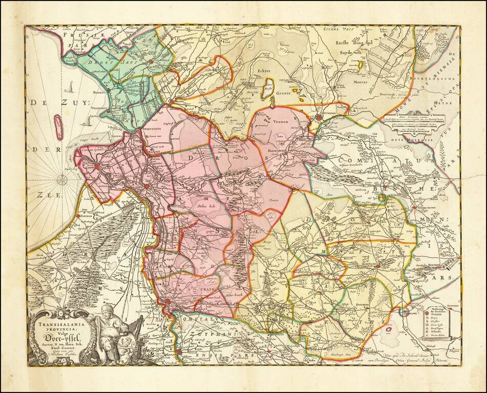
Nice map of Overijssel, published in Amsterdam by Visscher. Major cities include Deventer, Kamen, Zwolle, Almelo, Hengelo and Enschede.
Highly detailed map shows the land development in Gelderland, Holland, near the Zuyder Zee. The map shows Amsterdam, Gouda, Schoonhoven, Buren, Wageningen, Arnhem, Sevener, Doesburg, Zutphen and the Yssel River, centered on Amersfoort, and also...

Detailed map of the 17 provinces of the Low Countries. Includes a decorative cartouche and 17 coats of arms.
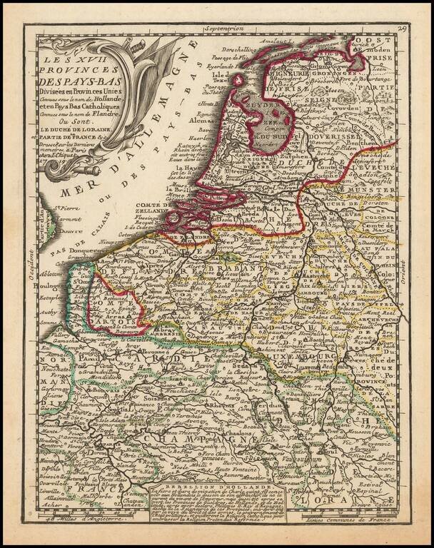
Detailed map of the 17 provinces with a key identifying regions. Includes and decorative cartouche and text on the Dutch Rebellion against Spain after the death of Charles V, and their rejection of the Catholic Religion in favor of the Reformed...
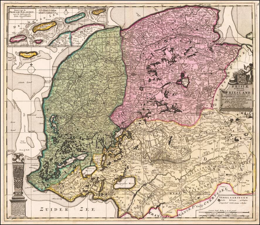
Antique Map of Friesland, in the Netherlands Fine old color example of this rare edition of Schenk's map of the Friesland, on double thick paper. Detailed map of Friesland, Groningen and Drenthe, the northeast provinces of the Netherlands, with...
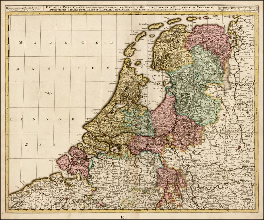
Scarce and highly detailed map of the Low Countries, published by Valk. The map locates towns, roads, rivers, lakes, islands, etc. Finely engraved.
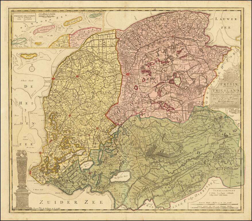
Antique Map of Friesland, in the Netherlands Fine old color example of this rare Halma map of Friesland. Detailed map of Friesland, Groningen and Drenthe, the northeast provinces of the Netherlands, with armorial cartouche, scale of miles, vignette...
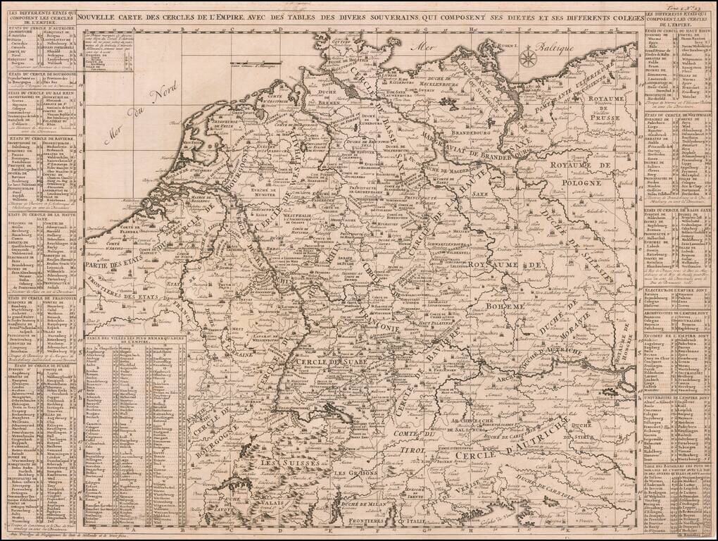
A very detailed map of the German Empire with a list of it's important cities and nobility in tables at the sides. This handsome copper engraved map includes today's Poland, Germany, Switzerland, Austria, Holland, Belgium and Luxembourg.
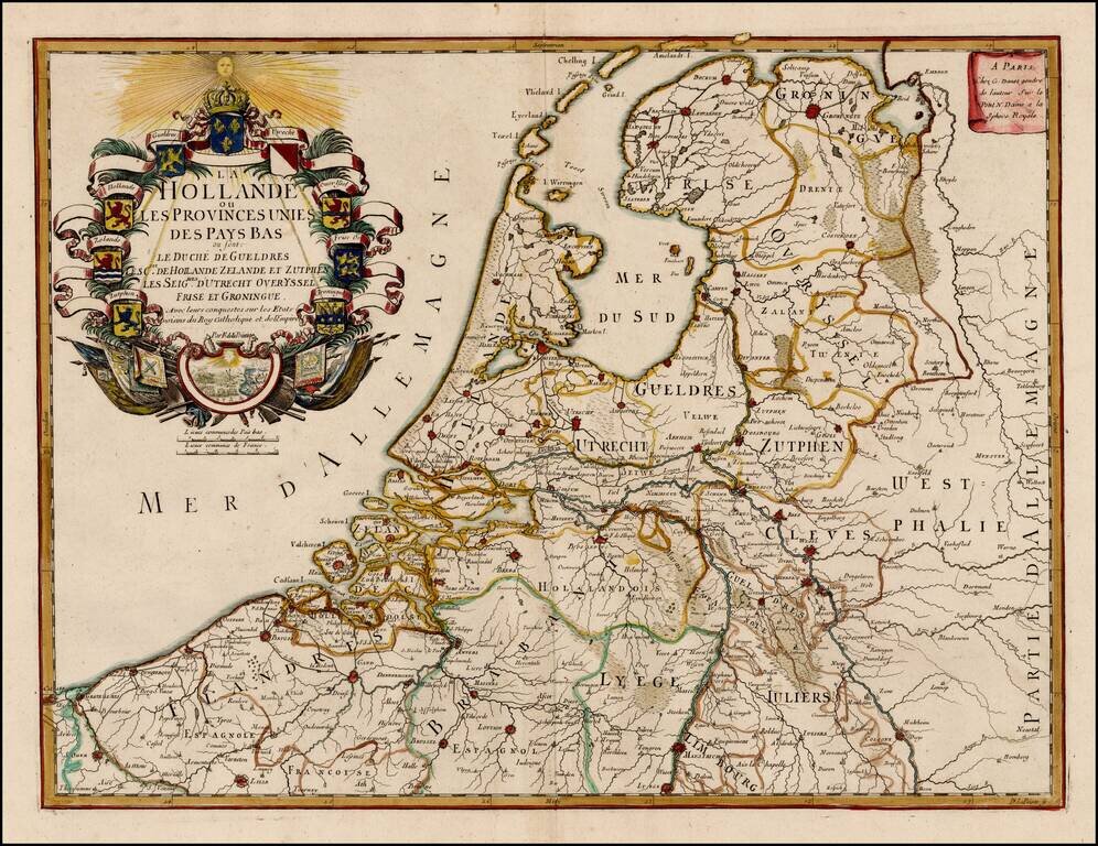
Scarce map of the 7 Provinces published in Paris by Danet. Includes 7 coats of arms in the title cartouche.
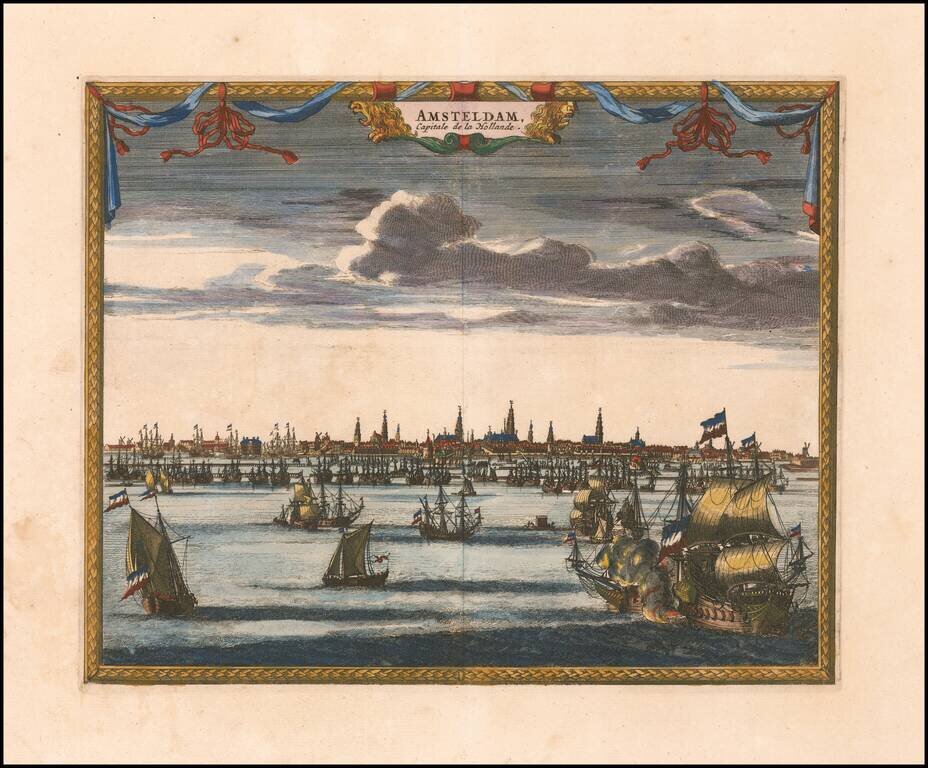
Attractive and uncommon panorama of Amsterdam, which appeared in Van der Aa's Galerie Agreeable du Monde.
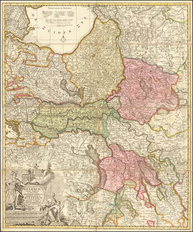
Detailed map of the Duchy of Gelderland, Zutphen, and part of northern Netherlands, published in Amsterdam by Ottens. Includes an elaborate cartouche.
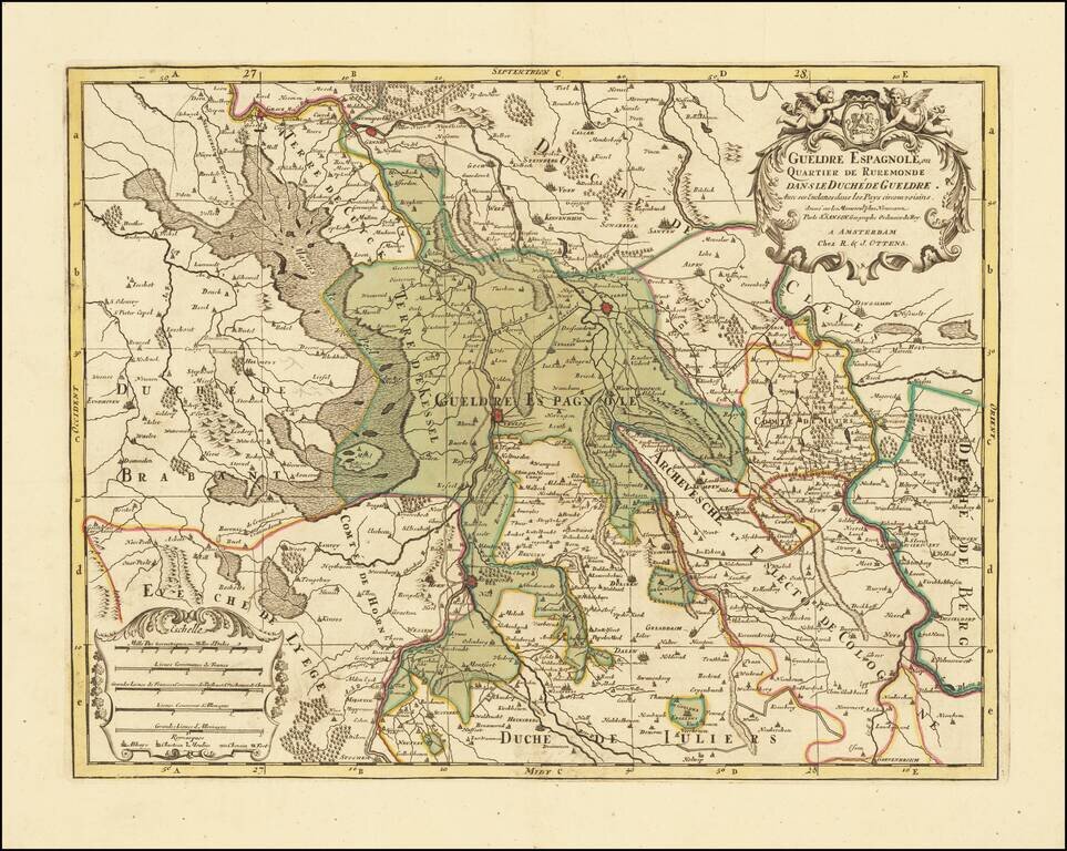
Attractive engraving of Gelderland with the towns of Roermond and Venlo at center. The map is filled with tiny villages, towns, lakes and rivers. Adorned by a decorative strapwork title cartouche and five distance scales. The county of Gelderland,...
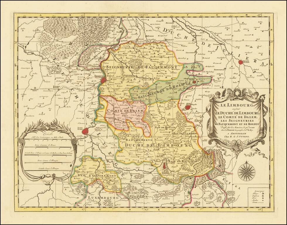
A fine and detailed map of Limburg and Dalem in the southern Netherlands. The map includes a separate sheet with an alphabetical table of towns and villages within Limburg. Based on the work of Nicholas Sanson, the map highlights the counties and...