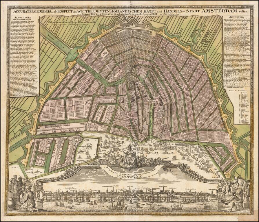
Nice example of Homann's map of Amsterdam, along with a striking birds-eye view of the city. Marvelous panoramic view, flanked by scenes of commerce. Amsterdam is shown after its period of explosive growth during the late 16th and 17th centuries, which...
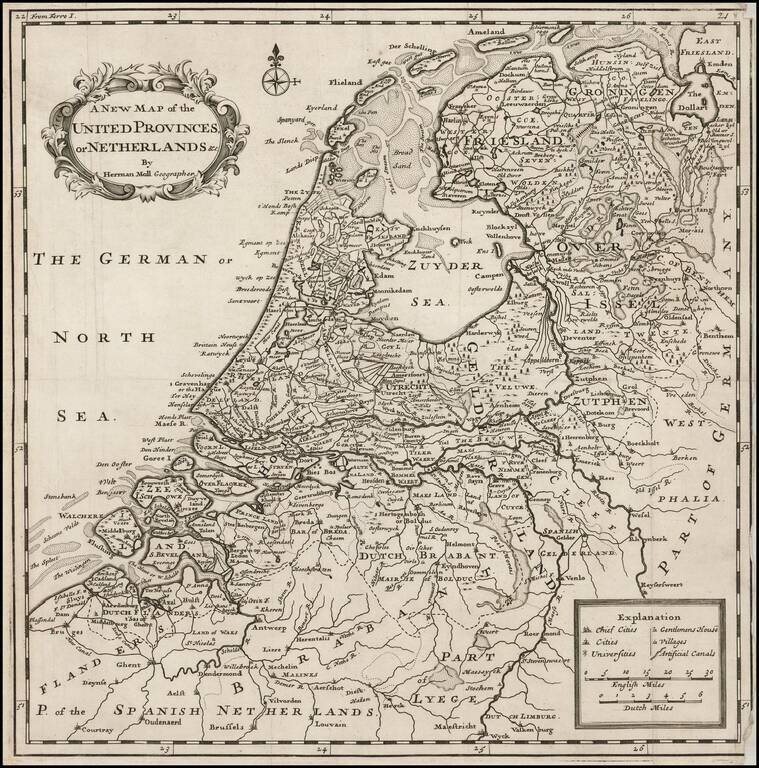
Scarce map of the Netherlands, published in London by Herman Moll. Includes a large inset map of Arx Britannica, a Fortress built by the Roman Emperor Caligula, at the mouth of the Rhine River, which disappeared from view at the end of the 16th Century...
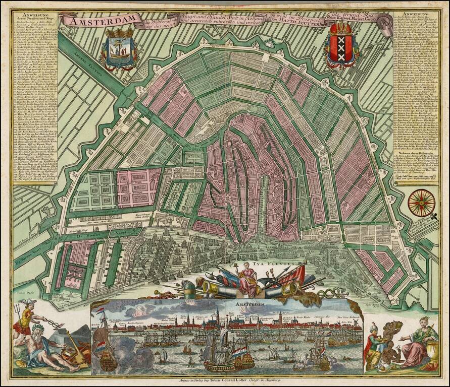
Nice full color example of Seutter's decorative and highly detailed plan of Amsterdam, with a striking view of the City and allegorical embellishments below. Includes 2 coats of arms and a key naming over 300 places on the map and view.
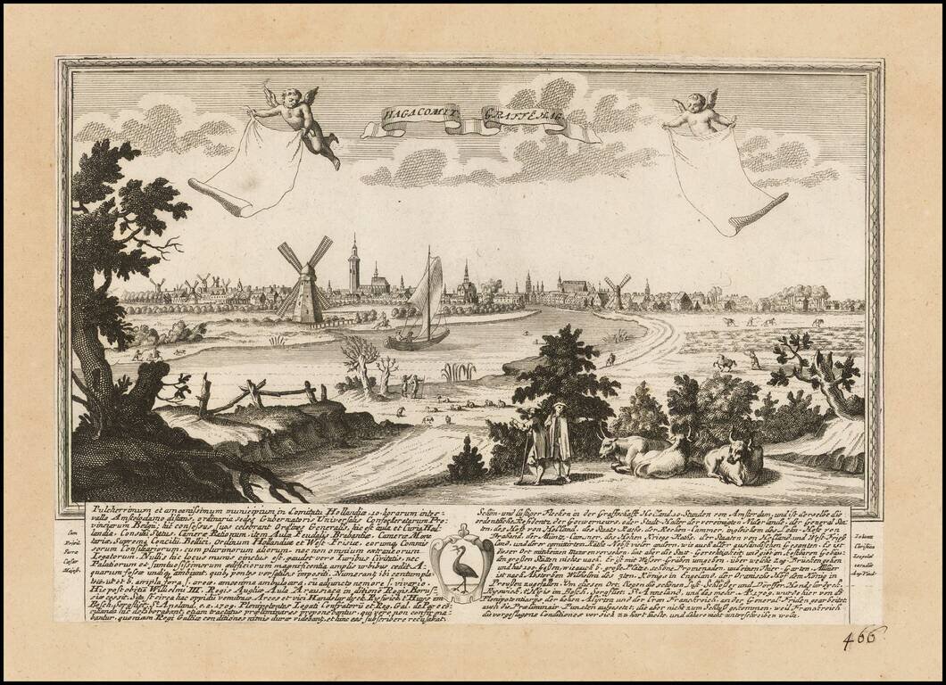
Rare view of Den Haag, published by J.F. Leopold, in Augsburg, in 1730. The view includes a coat of arms and extensive description of the city in Latin and German. This is the first example we have offered in over 20 years.
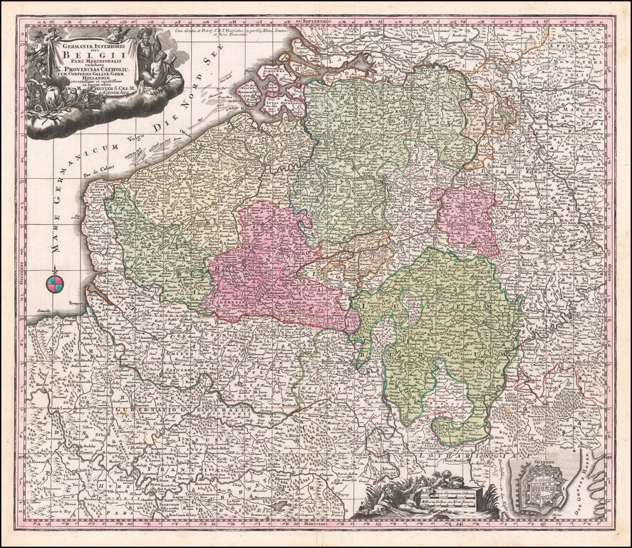
Decorative regional map of the Low Countries, published by Seutter.
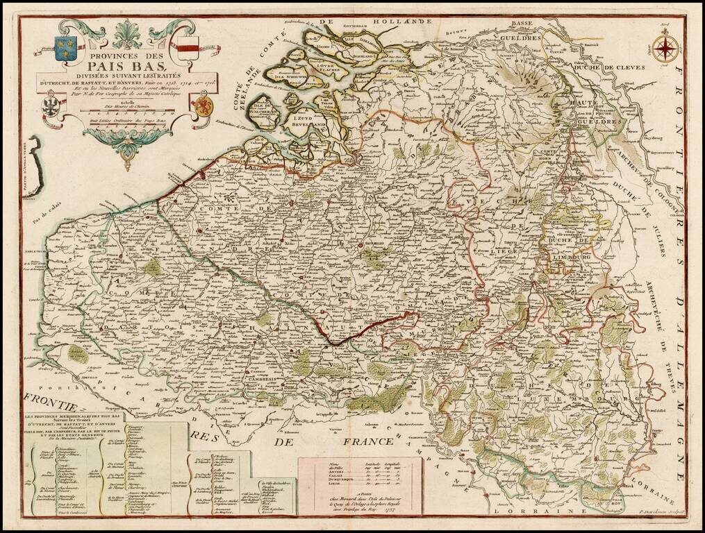
Scarce Benard edition of this detailed map of the Low Countries, from Zeland and Brabant to Luxembourg and Artois. The map includes the coats of arms of France, Austria, Brandenburg and the States General.
![Kaart van de Beneeden rivier de Maas en de Merwede van de Noord Zee tot Hardinksveld [Rotterdam Section of Maas River Map]](/map/small/25266.jpg)
Detailed section of Melchior Bolsta's 6-sheet map of the Meuse (Maas) River, showing the sections of the river which include Rotterdam and Delfshaven, along with Ysselmonde, Charlois, Byerland, and Heynoord. Bolstra's map is of the highest historical...
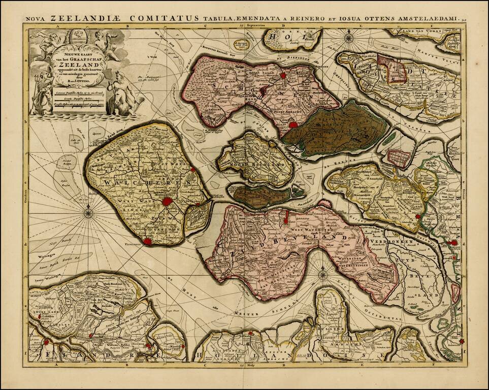
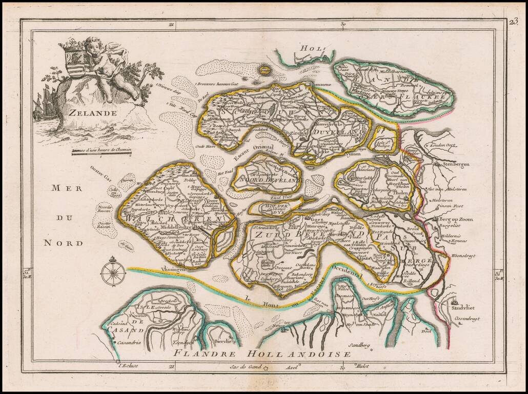
Rare map of the Province of Zeeland, with its many islands and peninsulas. Major cities, small villages, and some of the natural features are named. A nice old color example.
Striking map of Holland, based upon De L'Ise's map. Includes a decorative cartouche and excellent geographical detail. Albrizzi's maps are scarce and beautifully engraved.
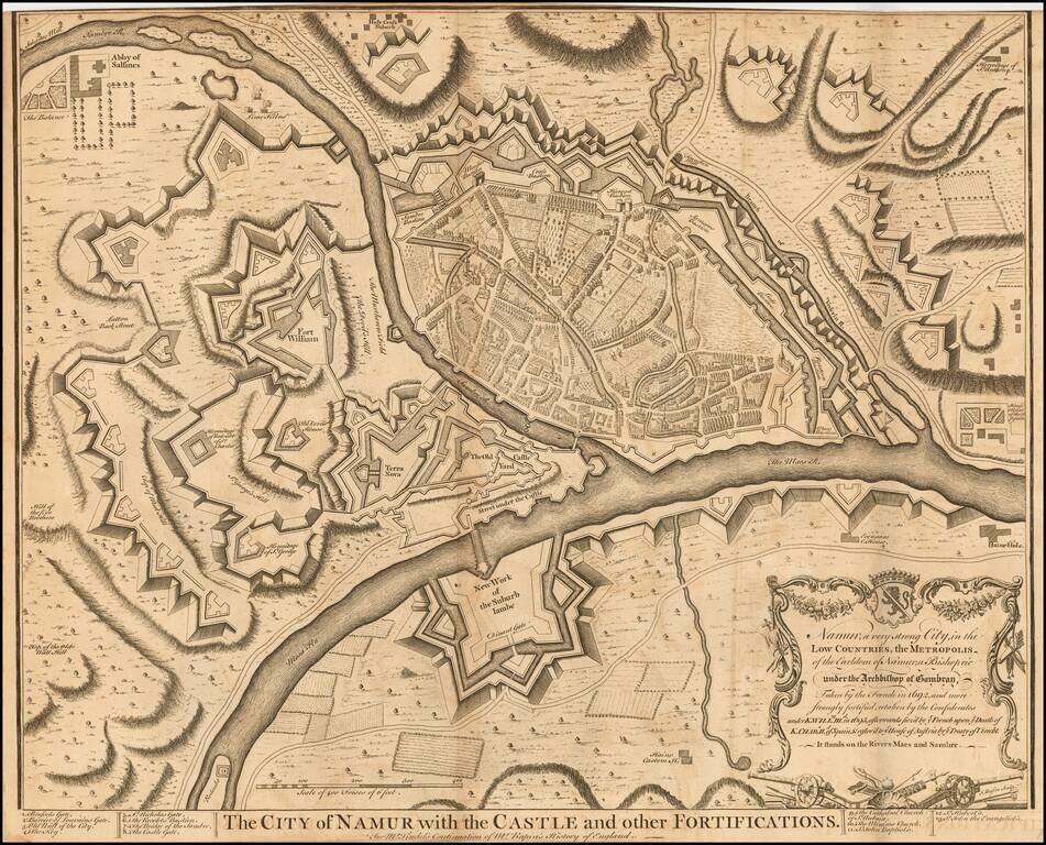
Striking plan of Namur and the Maes and Sambre Rivers, showing the town and fortifications.
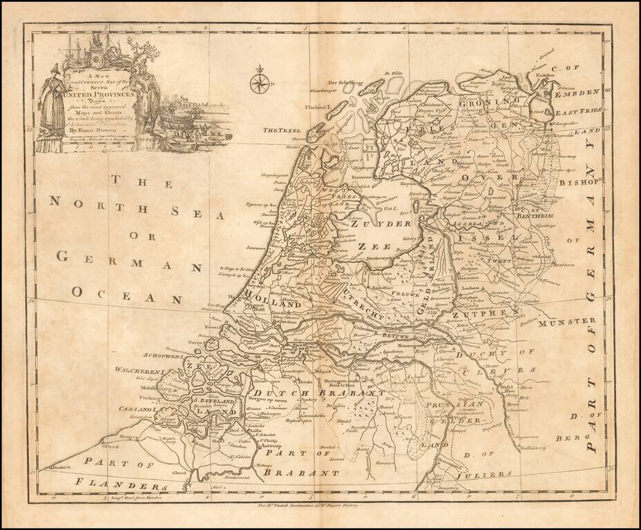
Emanuel Bowen's map of the Seven United Provinces, published in London circa 1744.
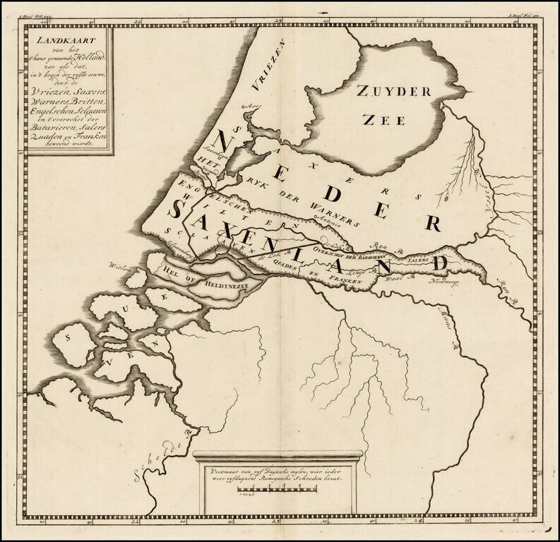
Rare ancient map of the Low Countries, with reference to the various tribes of early Europeans who came through the region. The map appeared in a 9 map atlas published in 1745 by Pieter de Hondt in Den Haag, entitled Atlas van het aloude Holland, En...
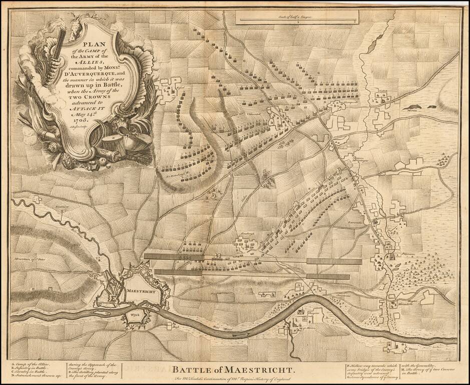
Detailed plan the Battle of Maastricht (1703), including fortifications, town plan, roads, farms, rivers, and a decorative cartouche. From Tindal's Continuation of Rapin's History.