
A fine early map of the Deventer region, which appeared in Petrus Kaerius's (Peter Van der Keere) Germaniae Inferior id est, XVII Provinciarum ejus novae et exactae Tabulae Geographicae, first published in Amsterdam in 1617. Van der Keere's atlas was...
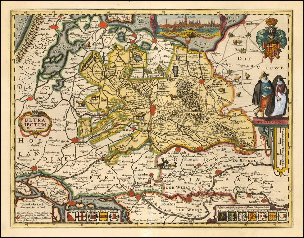
A fine early map of the Utrecht region, which appeared in Petrus Kaerius's (Peter Van der Keere) Germaniae Inferior id est, XVII Provinciarum ejus novae et exactae Tabulae Geographicae, first published in Amsterdam in 1617. Van der Keere's atlas was...
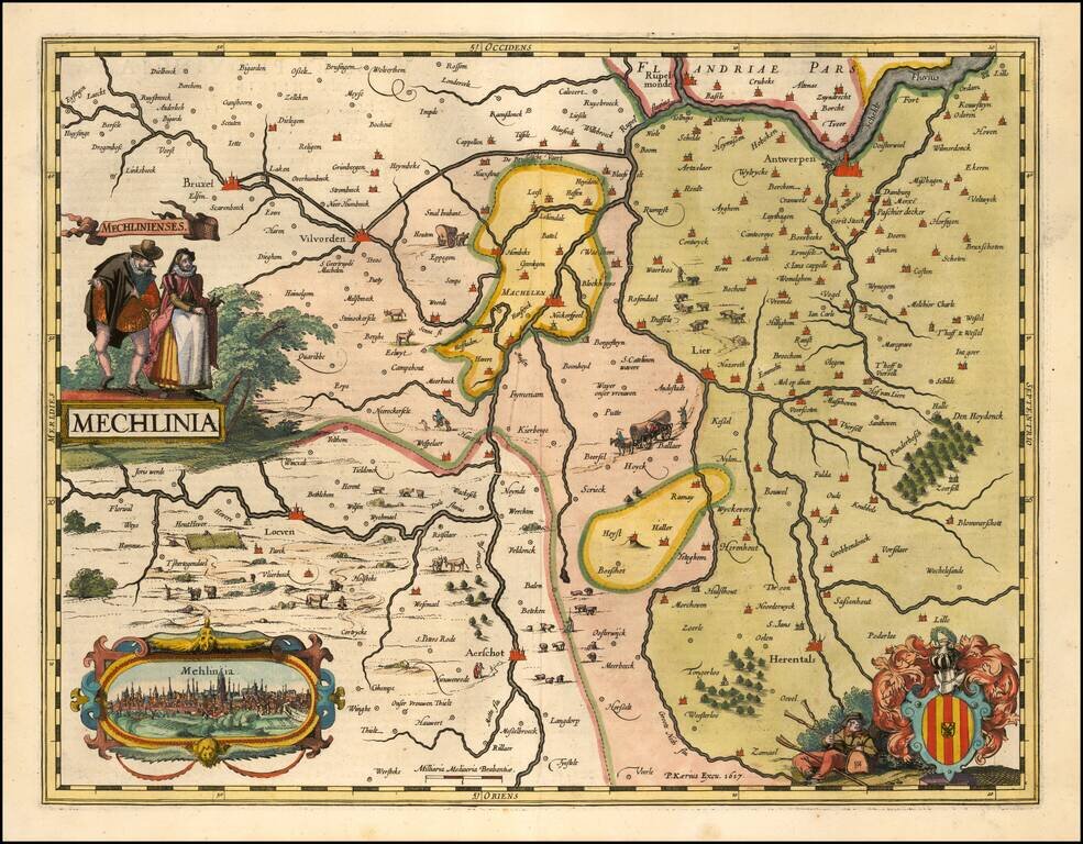
A fine early map of the the Mechelen region, which appeared in Petrus Kaerius's (Peter Van der Keere) Germaniae Inferior id est, XVII Provinciarum ejus novae et exactae Tabulae Geographicae, first published in Amsterdam in 1617. Van der Keere's atlas...
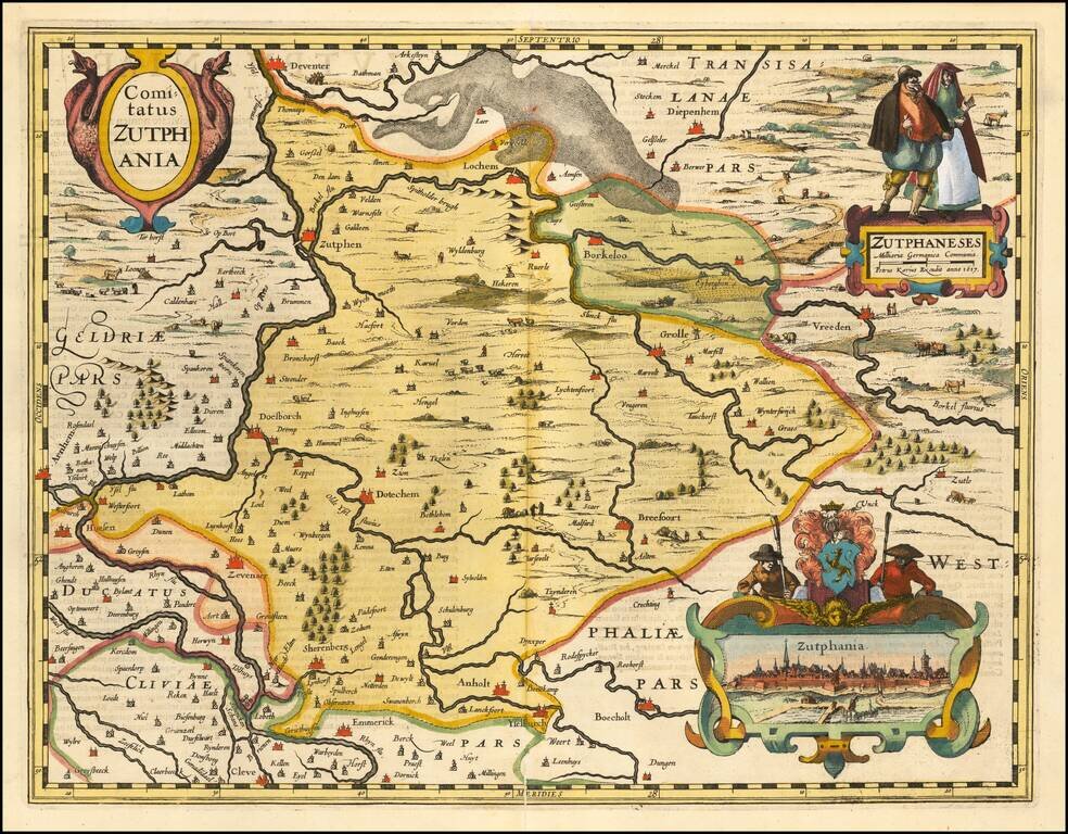
A fine early map of the part of Gelderland, in the region then controlled by the Counts of Zuthpen, which appeared in Petrus Kaerius's (Peter Van der Keere) Germaniae Inferior id est, XVII Provinciarum ejus novae et exactae Tabulae Geographicae, first...
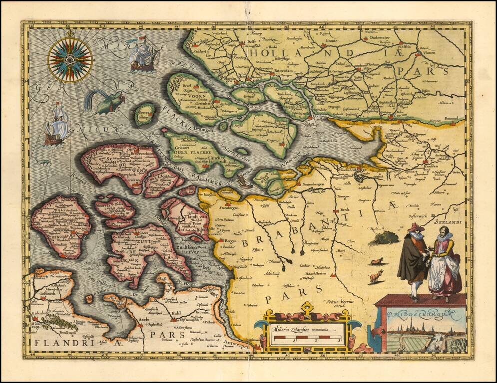
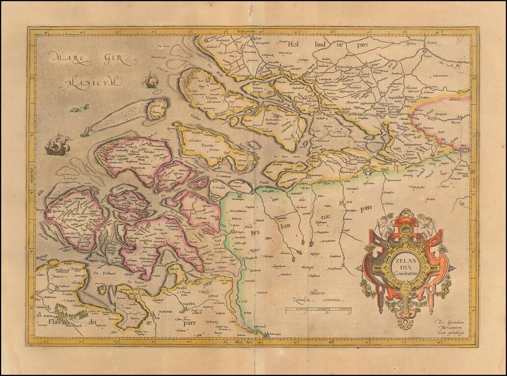
A fine early map of Middelburg which appeared in Petrus Kaerius's (Peter Van der Keere) Germaniae Inferior id est, XVII Provinciarum ejus novae et exactae Tabulae Geographicae, first published in Amsterdam in 1617. Van der Keere's atlas was the first...
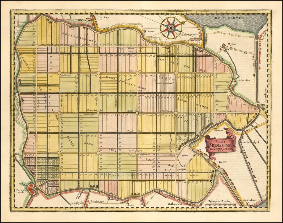
The Oldest Area in the Netherlands Reclaimed from the Sea. Fine map of the polder Beemster in Noord Holland, including the towns of Purmerend, De Ryp, Oudendijk, etc. The map appeared in the first separately issued atlas of the Low Countries which...
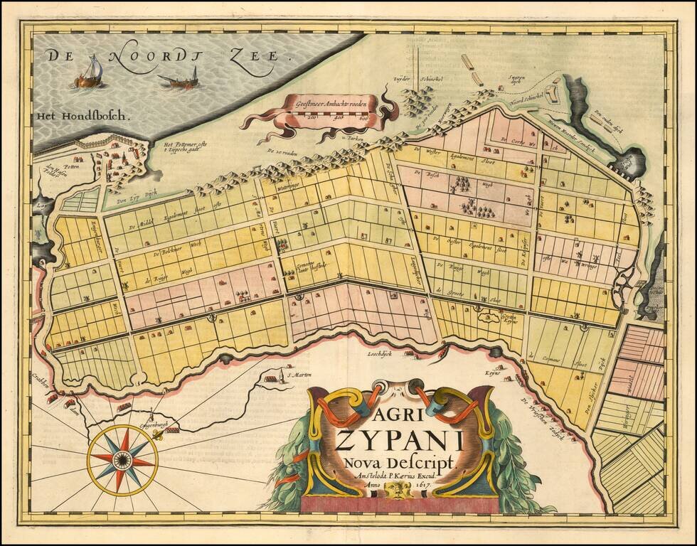
A fine early map of the Zijpe region of North Holland, which appeared in Petrus Kaerius's (Peter Van der Keere) Germaniae Inferior id est, XVII Provinciarum ejus novae et exactae Tabulae Geographicae, first published in Amsterdam in 1617. Van der...
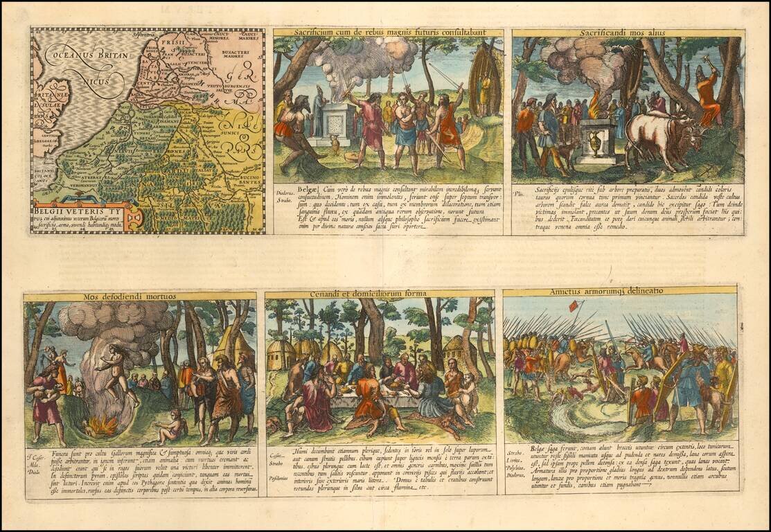
Daily Lives of Ancient Celts Nice example of the Peter van der Keere (Petrus Kaerius) map of the Low Countries in Ancient Times. The map is augmented with scenes showing the daily lives of ancient Belgian Celtic Tribes. The additional images show...
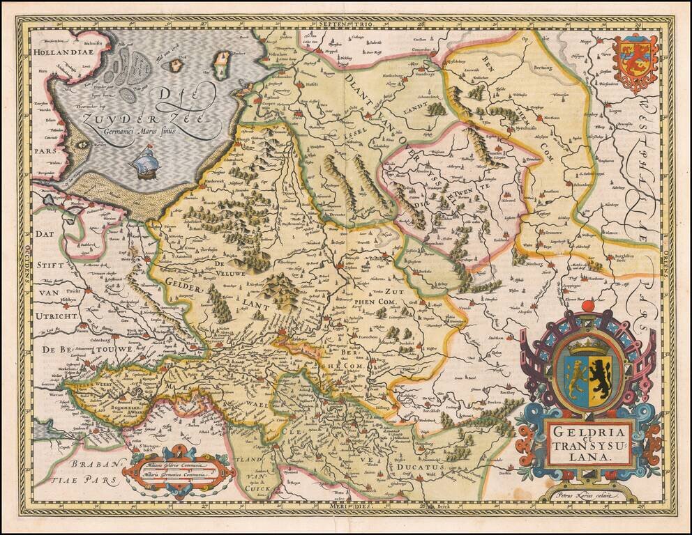
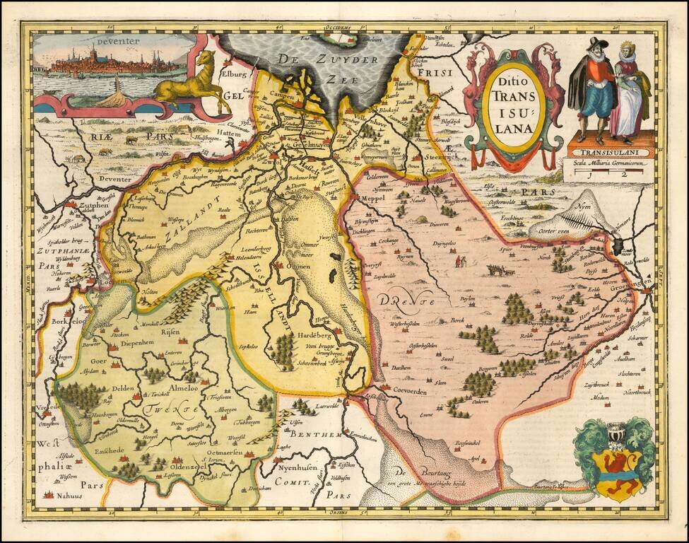
A fine early map of the Gelderland, Overijssel and adjoining regions, which appeared in Petrus Kaerius's (Peter Van der Keere) Germaniae Inferior id est, XVII Provinciarum ejus novae et exactae Tabulae Geographicae, first published in Amsterdam in...
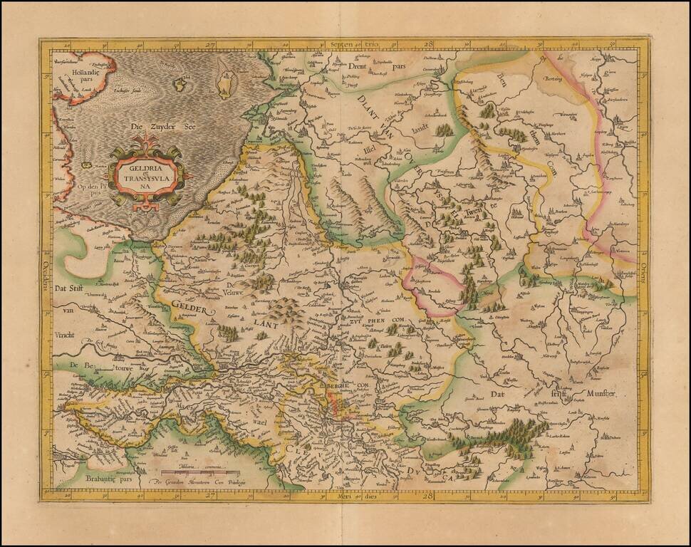
Nice old color example of Mercator's detailed regional map of the Central Netherlands, from Mercator's Atlas Sive Cosmographia.
Rare map of the Holy Roman Empire, published in Paris by Jean Le Clerc. Le Clerc's map is based upon Willem Janszoon Blaeu's map of the same title, first issued in 1606, which includes town views across the top.
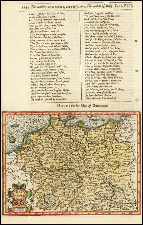
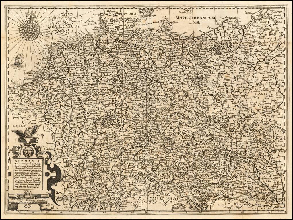
Decorative map of the German Empire, from the Low Countries to Prussia, Poland, Hungary, Austria and Switzerland. Decorative cartouche, sailing ship and coat of arms. From the 1625-26 edition of Purchas His Pilgrims, one of the seminal early 17th...
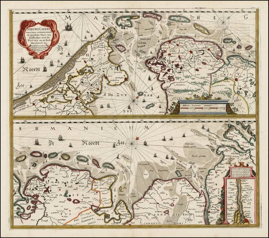
Nice example of Henricus Hondius' map of the Wadden Sea in two horizontal sections, published in Amsterdam. Interesting map of the major shipping routes between the Amsterdam and Hamburg in the Southern part of the North Sea. The map was first issued...
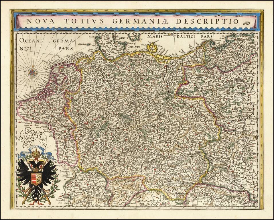
No Text on Verso! Rare edition of Blaeu's map of the German Empire, lacking text on the verso. The map includes the Netherlands, Germany, Switzerland, Austria, Bohemia, Moravia and Poland. This map is scarce, more so without text on the verso.
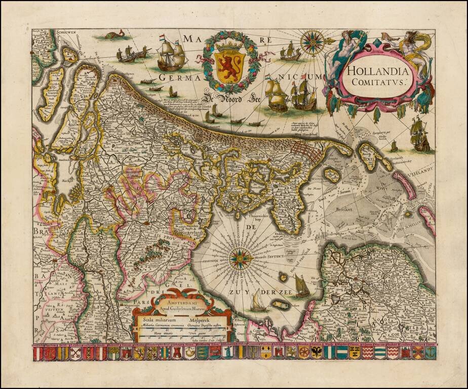
Striking example of Blaeu's rare early map of Holland, oriented with west at the top. The title cartouche is flanked by two sea gods, with 32 coats of arms of the major cities of the Netherlands along the bottom. The present map is known in 4 states,...