

Striking map of the German Empire, including the Low Countries, Switzerland, Austria, and part of the Balkans prepared by Johan Baptiste Vrients for the very late editions of Ortelius' Theatrum Orbis Terrarum, the first modern atlas of the world. The...

Nice example of Blaeu's map of Rugia, including large decorative cartouche, compass rose, sailing ships, sea monster and 30 coats of arms.

This is an unusual thematic chart shows the traveling distances from various European cities in a style that is still used today. Several similar charts were made during this time, but this one gives a very large number of combinations, some nearly...

Rare edition of Cloppenburg's map of the Holy Roman Empire.
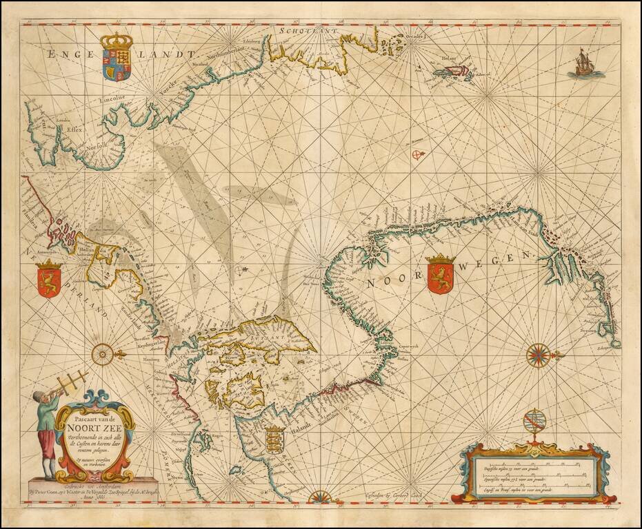
Nice example of Goos' Sea Chart of the Noort Zee, extending from the Mouth of the Thames and the English Channel and Calais and Dunkirk to Stetin and Christianopolen on the Baltic and Dronten and Schogen in Norway. The chart is oriented with north at...
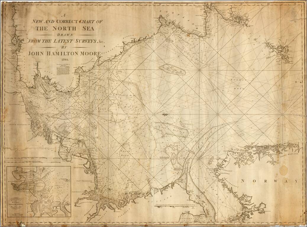
Exceedingly rare early commercial Sea Chart of the North Sea by John Hamilton Moore, published in London. Moore was one of the earliest blue back chart publishers working in London. The present chart is apparently the second edition, after an edition...
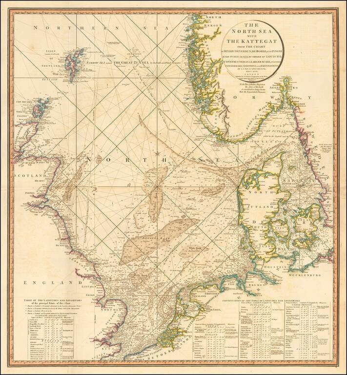
Striking and highly detailed sea chart of the North Sea from the Straits of Dover to the Shetlands and North Bergen in Norway, and east through the Kattegat to Copenhagen. Highly detailed sea chart, with extensive tables and annotations. Shows...
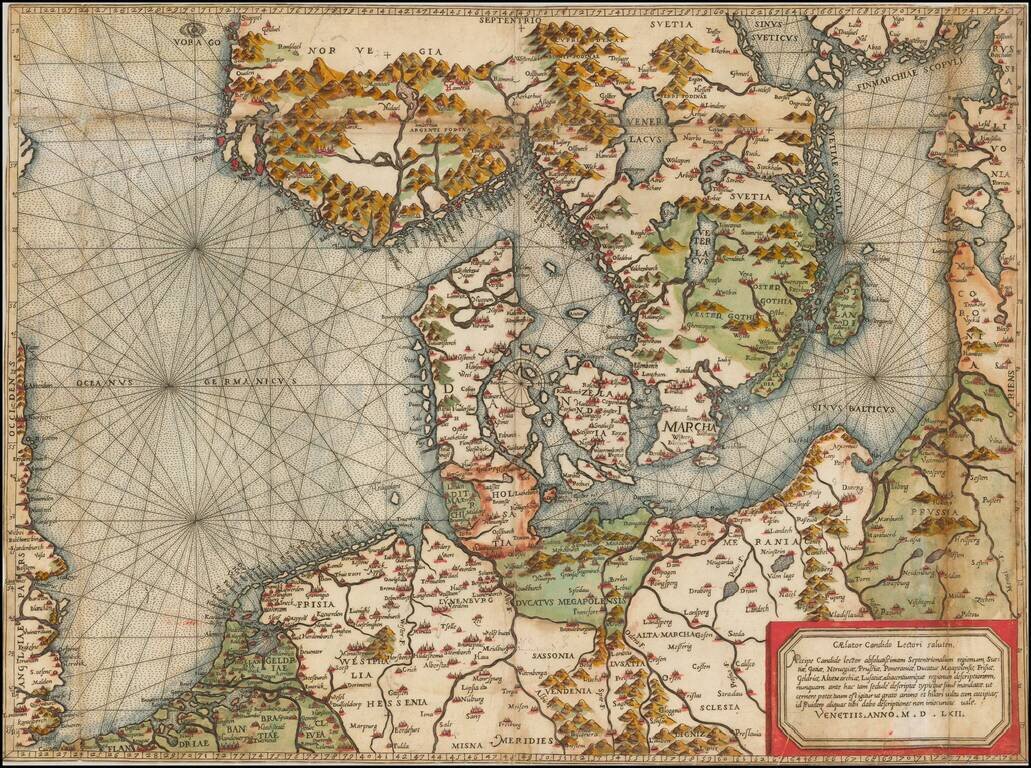
"Beyond all comparison the best map of the Southern Baltic and the North Sea." (A.E. Nordenskold) Extraordinary old color example of this rare Lafreri School Map of Scandinavia, the Baltic and contiguous parts of Poland, Germany, the Low Countries...
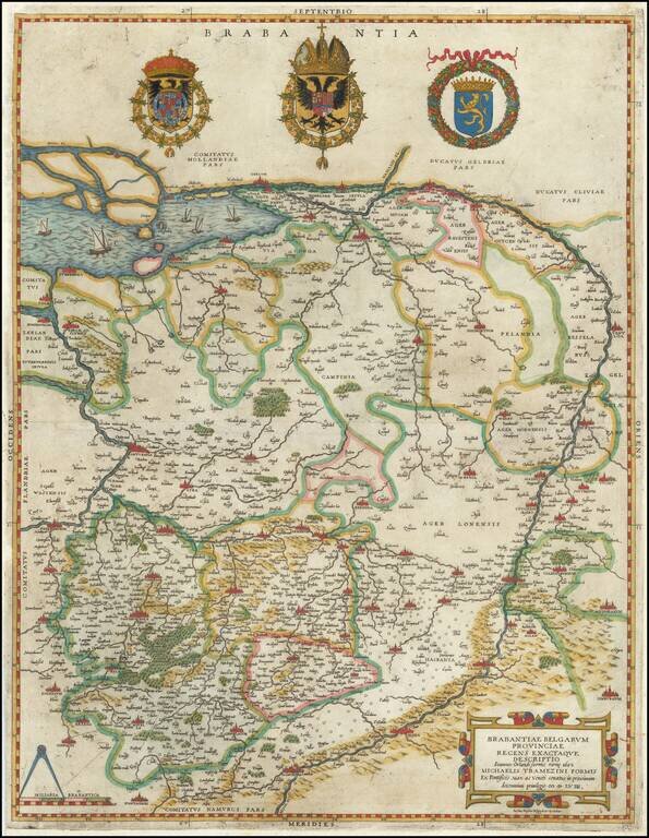
Extremely rare example of the first Lafreri School edition of Jacob van Deventer's groundbreaking survey of Brabant, the earliest surviving example of a map based upon a modern trigonometric survey. The present map represents the synergy of fine art...
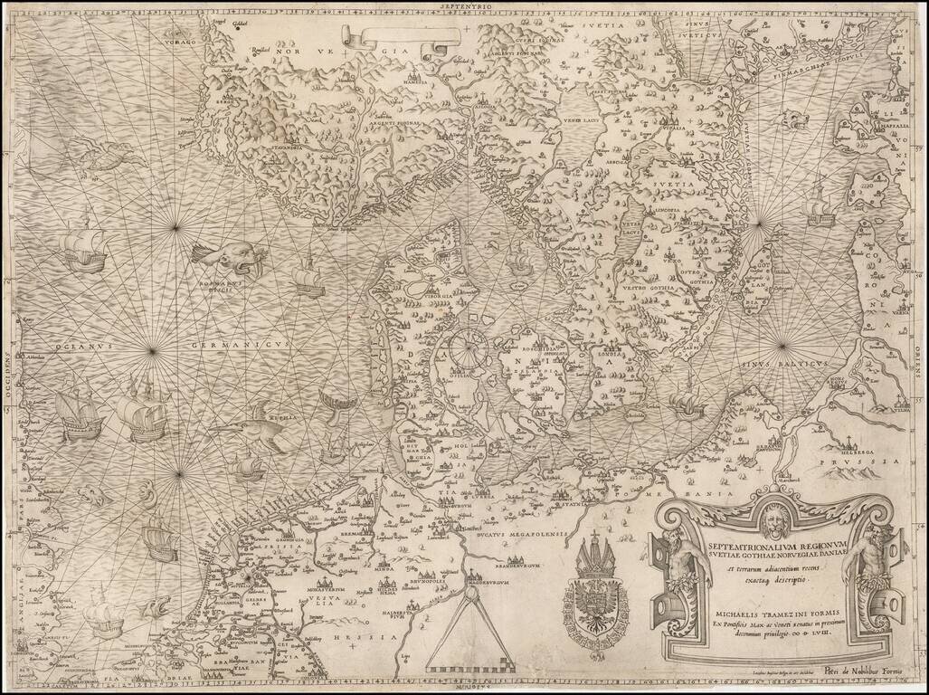
The most important modern map of Scandinavia and the Baltic Regions published in the mid-16th century. Rare and highly important early map of Scandinavia, the Baltic Sea and the North Sea by Michael Tramezini, based upon Cornelis Anthoniszoon's lost...
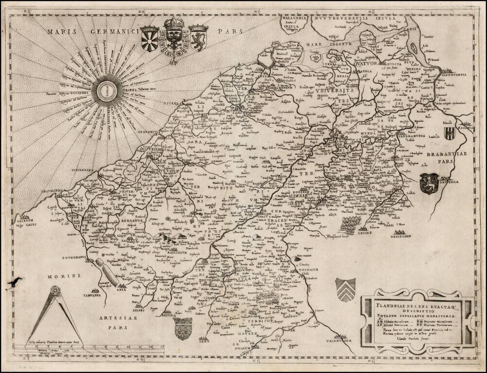
Nice example of Claudio Duchetti's map of northwestern Belgium and the southwestern part of the Netherlands. Duchetti's map is based upon Jacobus Bossius's map of the same title, published in Venice in 1555, by Michaelis Tramezini. The Bossius's map...
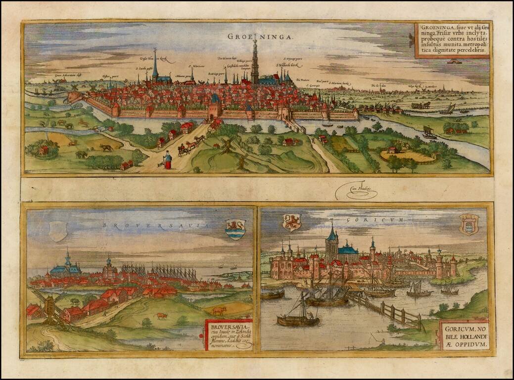
Decorative early views of Groeningen, Gork and Brovershaven. Bird's-eye view of the 3 towns with details of surrounding fields, farms and structures. From Braun & Hogenberg's Civitatus Orbis Terrarum, the most important book of town plans and...
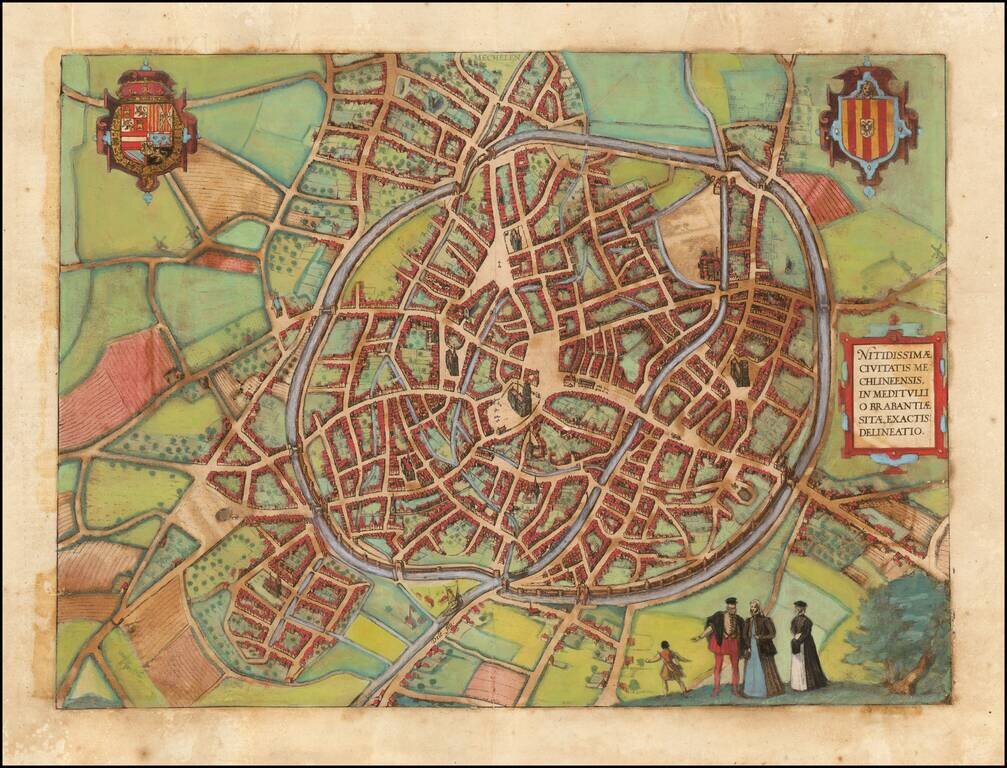
Decorative early views of Mechelen in Brabant. From Braun & Hogenberg's Civitatus Orbis Terrarum, the most important book of town plans and views published in the 16th century.
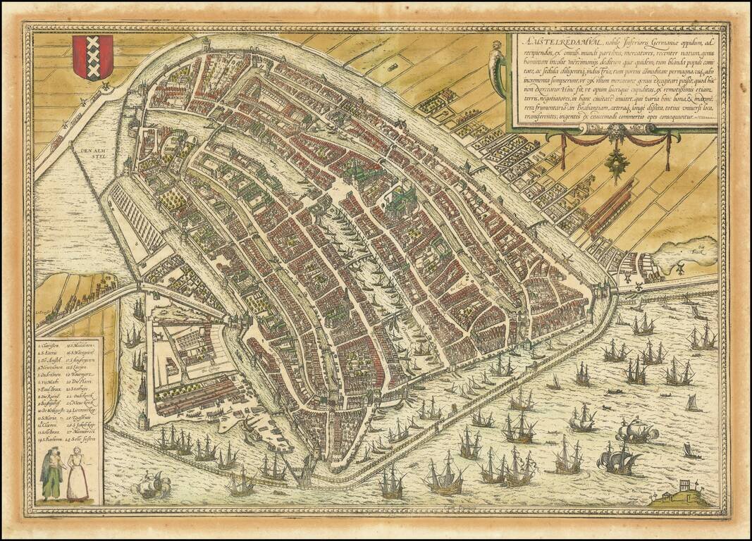
This is a finely colored example of Braun & Hogenberg's first view of Amsterdam, from Part I of their Civitates Orbis Terrarum, first published in Cologne in 1572. Braun & Hogenberg's view is based upon a plan of Amsterdam by Cornelis...
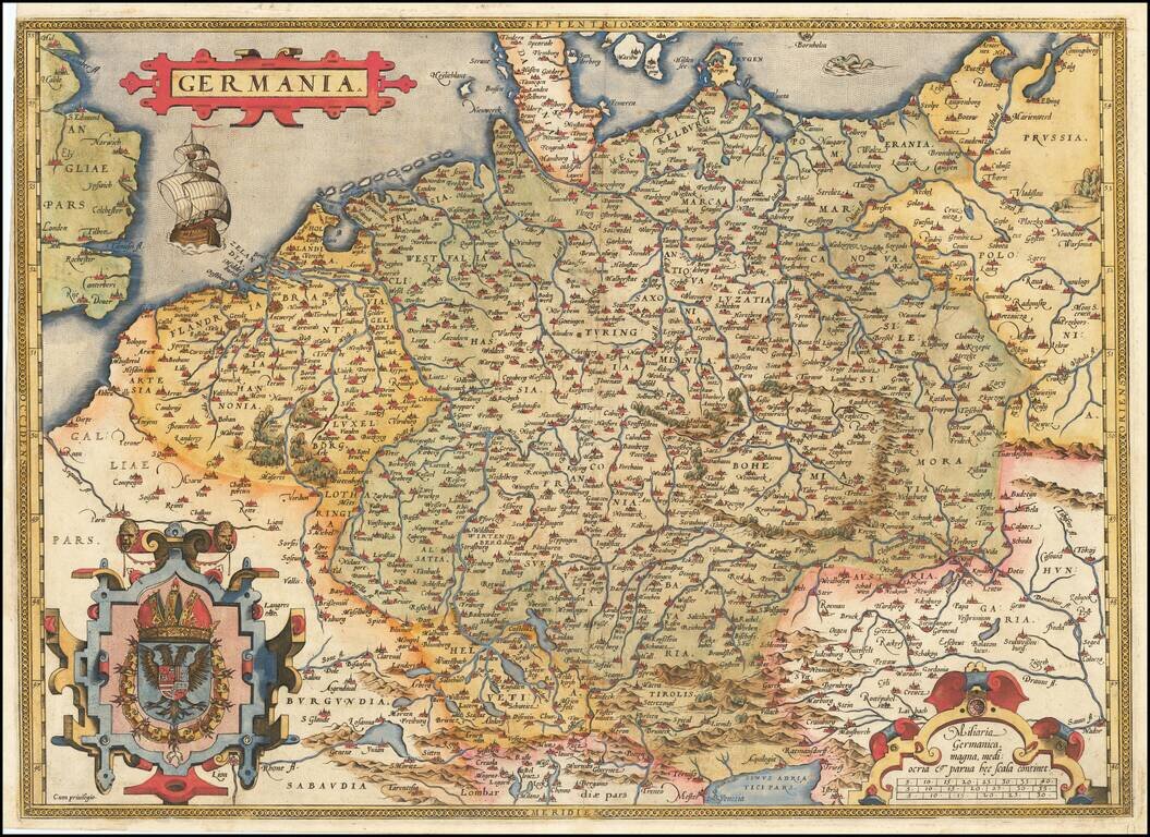
Fine old example of Ortelius' map of the German Empire, from his Theatrum Orbis Terrarum, the first modern atlas of the world. The map extends from The English Channel to the Baltic, the Vistula and Poland in the northeast, Budapest, Venice and the...
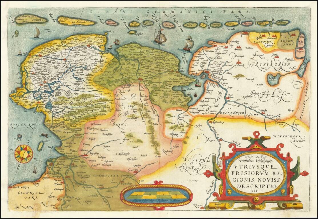
A nice old color example of Ortelius' map of Friesland, including a larger compass rose, sailing ships and an elaborate cartouche. The map appeared in Ortelius' Theatrum Orbis Terrarum, the first modern Atlas, first issued in 1584.