Map size in jpg-format: 3.40821MiB
Click to open in high resolution (open in new tab).
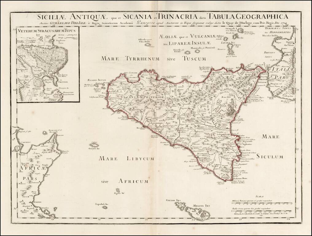
Scarce map of Ancient Sicily, with a large inset of Syracuse, originally published by Guillaume De L'Isle in 1714.
Detailed map of ancient Sicily, showing roads, mountains, rivers, towns, harbors, smaller islands, etc. Extends south to Malta.
Shows Mount Aetna in the midst of a Volcanic eruption.
Philippe Buache (1700-1773) was one of the most famous French geographers of the eighteenth century. Buache was married to the daughter of the eminent Guillaume Delisle and worked with his father-in-law, carrying on the business after Guillaume died. Buache gained the title geographe du roi in 1729 and was elected to the Academie des Sciences in the same year. Buache was a pioneering theoretical geographer, especially as regards contour lines and watersheds. He is best known for his works such as Considérations géographiques et physiques sur les découvertes nouvelles dans la grande mer (Paris, 1754).
If you are a student, write to us in telegram: @antiquemaps and indicate what material you need and for what work you need a map in high detail. We are ready to provide material on special terms. For students only!


