Map size in jpg-format: 65.3281MiB
Click to open in high resolution (open in new tab).
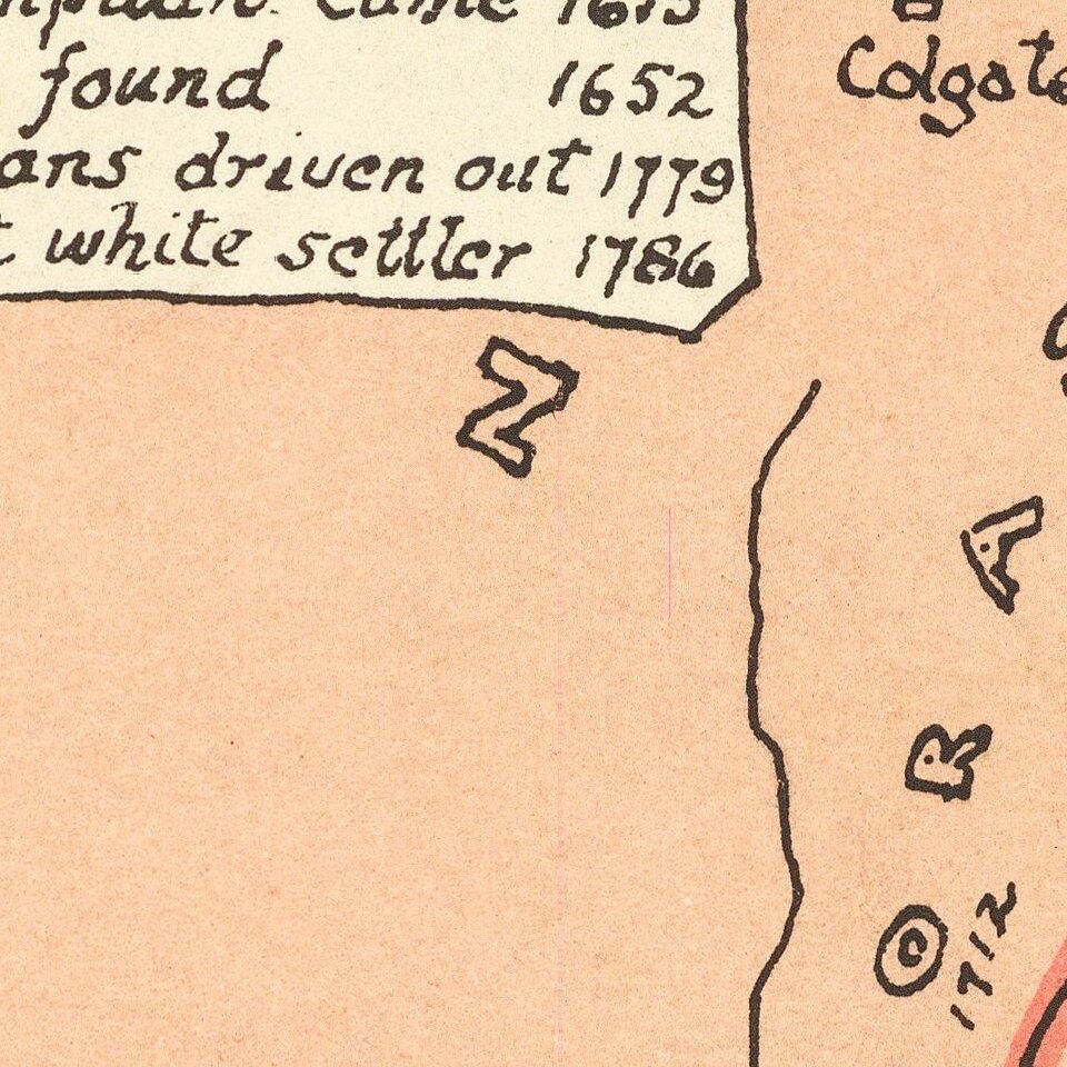
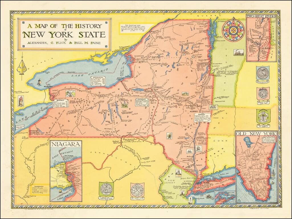
EArly pictorial map of New York State, published by R.R. Bowker in New York.
The map provides a history of the state, covering a period of 400 years, including:
Includes insets of "Old New York", "Niagara" and "Two Great Rivers." Decorated by five coats of arms and an attractive compass rose.
Created by Alexander Flick and Paul Paine.
If you are a student, write to us in telegram: @antiquemaps and indicate what material you need and for what work you need a map in high detail. We are ready to provide material on special terms. For students only!

![[Site of A Presidential Assassination] Plan of the Pan American Exposition to be held at Buffalo, New York (May 1 - Nov. 1, 1901)](/map/small/69181.jpg)