Map size in jpg-format: 103.993MiB
Click to open in high resolution (open in new tab).
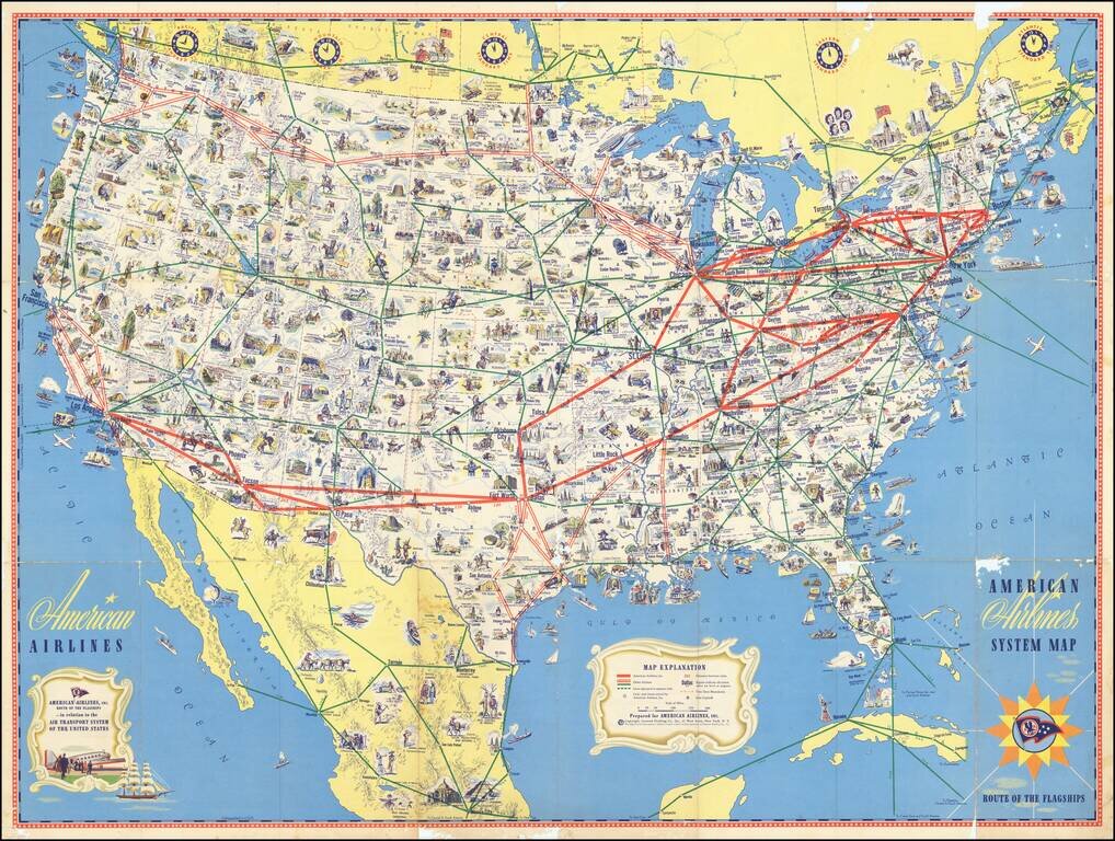
Richly illustrate pictorial map highlighting the flagship routes of American Airlines.
The American Airlines system is shown "in relation to the Air Transport System of the United States", with other airlines marked in green, but identified. The map also includes seasonal routes to Yellowstone National Park in green dashed lines and other airlines are indicated by 3-letter abbreviations.
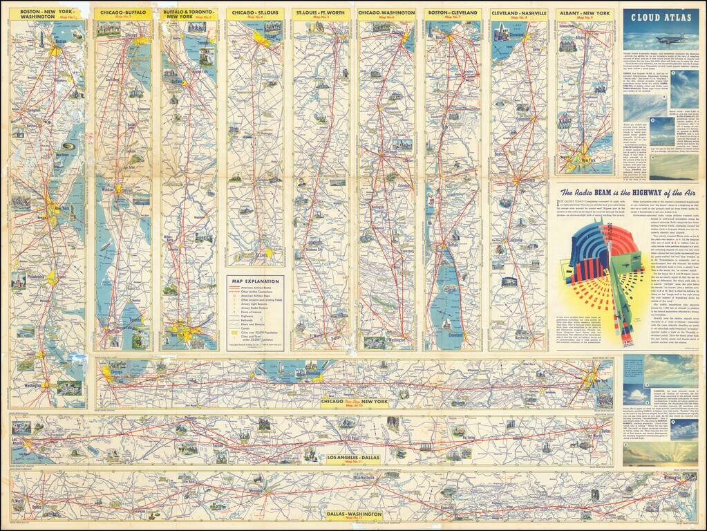
The verso includes 12 strip maps of American Airlines flagship routes in greater detail, along with a "Cloud atlas," and a fascinating illustration of "The Radio beam is the highway of the air."
If you are a student, write to us in telegram: @antiquemaps and indicate what material you need and for what work you need a map in high detail. We are ready to provide material on special terms. For students only!

![[Signed Political Satire Artwork] Vietnam ... Vietnam ... Vietnam ...](/map/small/68726.jpg)
