logo

1720. Pas kaart Van de Caribes Tusschen I. Barbados en I S. Martin . . . (St. Barts, Nevis, St. Kitts, Monserrat, St. Martin, Barbados, Antigua, Barbuda, St. Lucia, St. Vincent, Martinique, Dominica, Guadalupe, etc).

  • Pas kaart Van de Caribes Tusschen I. Barbados en I S. Martin . . . (St. Barts, Nevis, St. Kitts, Monserrat, St. Martin, Barbados, Antigua, Barbuda, St. Lucia, St. Vincent, Martinique, Dominica, Guadalupe, etc).

Pas kaart Van de Caribes Tusschen I. Barbados en I S. Martin . . . (St. Barts, Nevis, St. Kitts, Monserrat, St. Martin, Barbados, Antigua, Barbuda, St. Lucia, St. Vincent, Martinique, Dominica, Guadalupe, etc). information:

Year of creation: 
Resolution size (pixels): 
 4812x4270 px
Disk Size: 
 4.64393MiB
Number of pages: 
 1
Place: 
 Amsterdam
Author: 

Print information. Print size (Width x height in inches):
Printing at 72 dpi 
  66.83 х 59.31
Printing at 150 dpi 
 32.08 х 28.47
Printing at 300 dpi 
 16.04 х 14.23

An example of detailing the file of this map of in a printable high-resolution:

Click to open in high resolution (open in new tab).
Attention! this is just the central piece (central area 960x960 px) of the map file!
This is an example, so that you can see and study the level of detail of a given map. The entire Map will be fully available after payment!

Pas kaart Van de Caribes Tusschen I. Barbados en I S. Martin . . . (St. Barts, Nevis, St. Kitts, Monserrat, St. Martin, Barbados, Antigua, Barbuda, St. Lucia, St. Vincent, Martinique, Dominica, Guadalupe, etc).

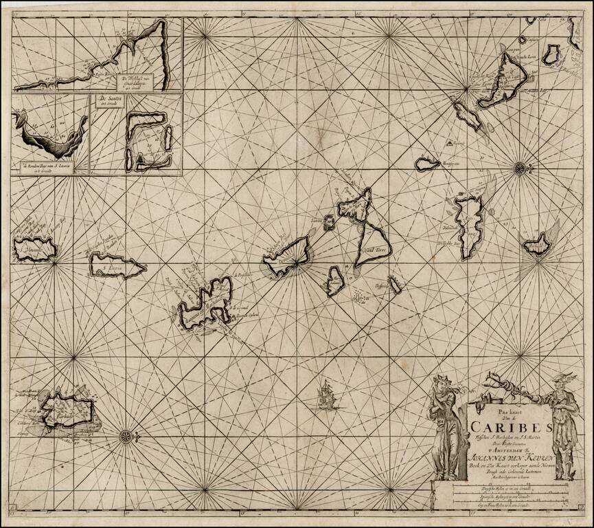
Nice example of Van Keulen's sea chart of the Lesser Antilles, from De Nieuwe Groote Lichtende Zee-Fakkel, Part IV.

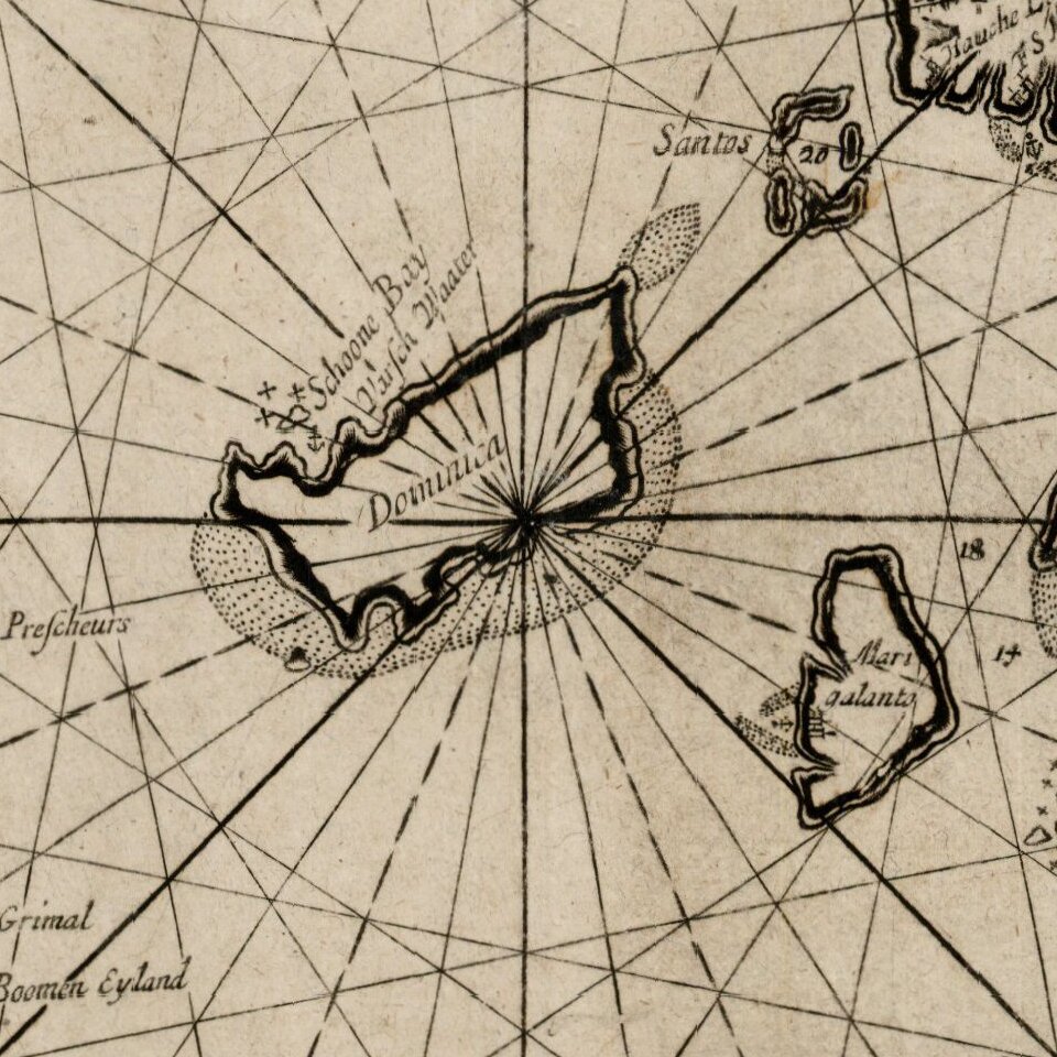
A very attractive Dutch sea chart, with north at the top, extending from the southern part of St. Martin in the north to St. Vincent in the south. Other islands St. Barts, Nevis, St. Kitts, Monserrat, St. Martin, Barbados, Antigua, Barbuda, St. Lucia, St. Vincent, Martinique, Dominica, Guadalupe.

The three insets at upper left provide details of harbors on the islands of St. Lucia, Guadeloupe, and the Les Saintes archipelago.

Includes towns, anchorages, soundings, ports, etc. The Van Keulen family dominated the chart making business in Holland from the 1680s until the middle of the 19th Century.


Special conditions for students!

If you are a student, write to us in telegram: @antiquemaps and indicate what material you need and for what work you need a map in high detail. We are ready to provide material on special terms. For students only!

Item information:

Year of creation:
Size:
4812x4270 px
Disk:
4.64393MiB
Number of pages:
1
Place:
Amsterdam
Author:
Johannes Van Keulen.
$14.99

Related item