
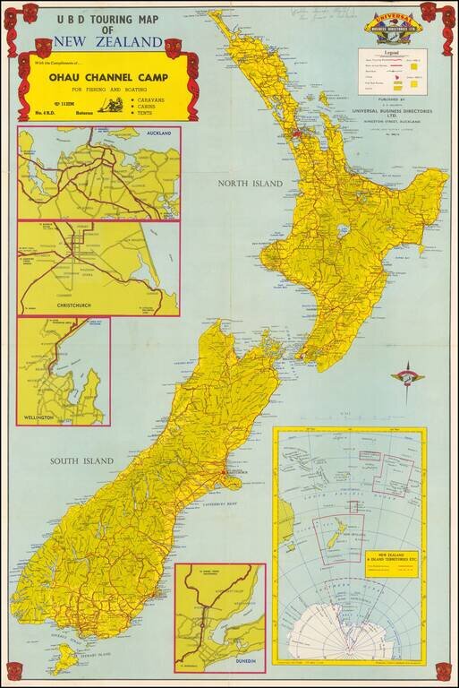
Decorative touring map of New Zealand, embellished with Mauri Warrior masks. Shows the main touring routes, railways, city bus routes, parks, etc. Large inset maps of Auckand, Dunedin, Christchurch and Wellington. On the verso, there are smaller maps...
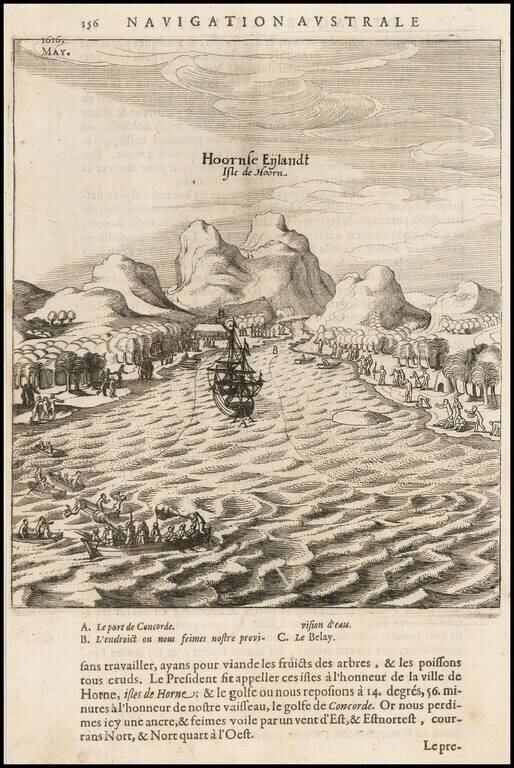
Scarce map of the bay and coast of the South Seas island of Futuna (Hoorn), from the voyage of Le Maire and Schouten. The bay shown was named after the ship Eendrachts (Unity Bay). Willem Cornelisz Schouten (1567-1625) was a navigator for the Dutch...
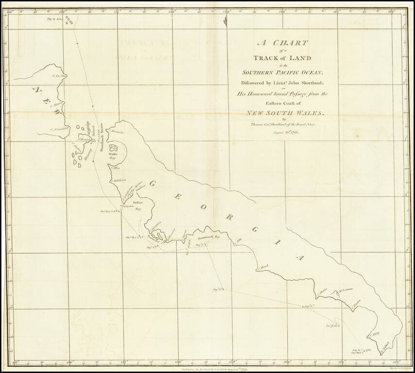
Detailed map of South Georgia, showing the tracks of Lieutenant John Shortland. John Shortland (1739–1803) entered the Royal Navy in 1755 as a midshipman and served under Admiral Boscawen off Newfoundland, under Admiral Byng off Minorca and under...
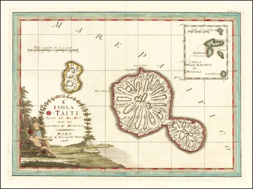
Decorative map of the island of Tahiti, published in Rome by Cassini, with a large inset map of the Marquesas Islands. Cassini's map celebrates the visit to Tahiti by Captain James Cook, during Cook's scientific mission to observe the transit of the...
![[Tonga Islands] Le Isole De Gli Amici Delineate Suller ulitime Osservazioni de Cap. Cook . . . 1798](/map/small/64141.jpg)
Decorative map of the island of the Friendly Islands (Tonga), published in Rome by Cassini, with a large inset map of the Marquesas Islands. Cassini's map illustrates Captain James Cook's visits to the islands in 1773, 1774, and 1777, with each visit...
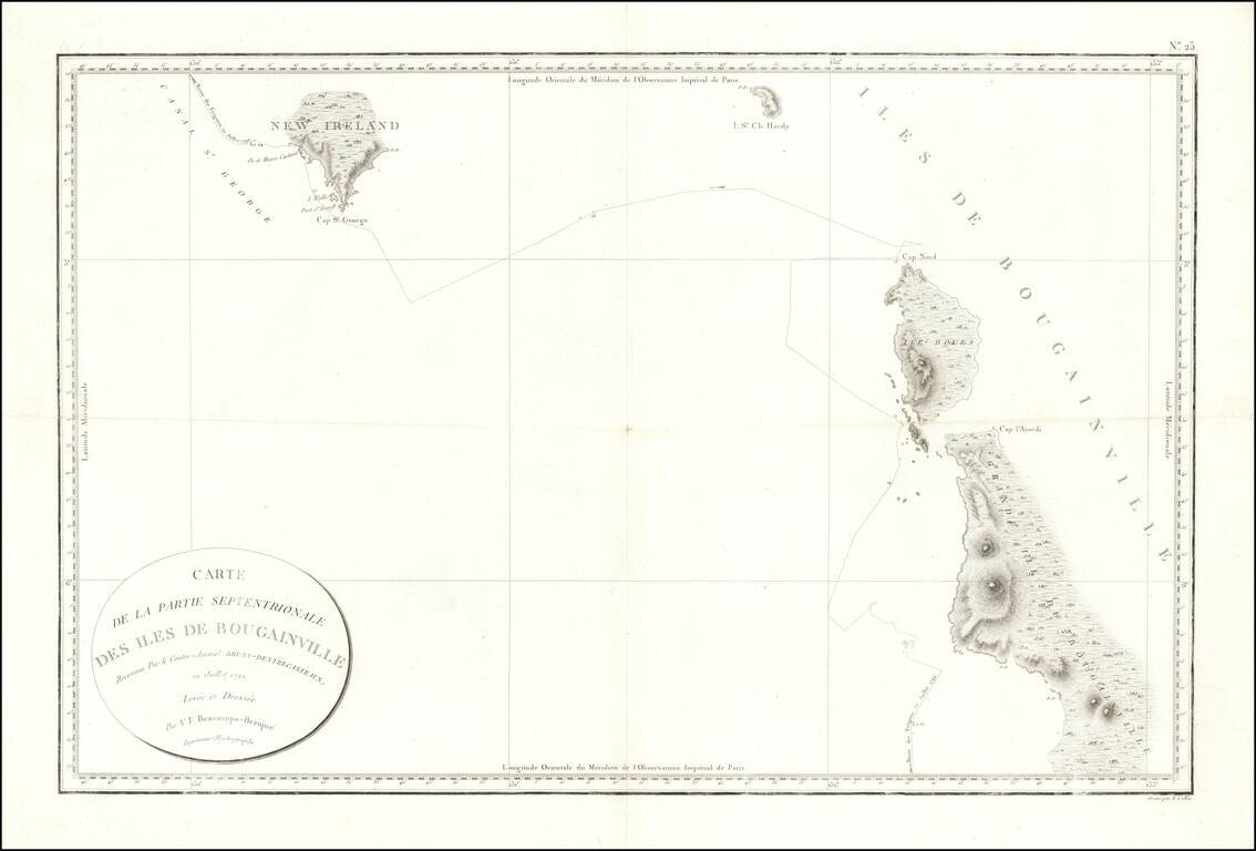
Fine early sea chart showin New Ireland and the Bougainville Islands. This chart spans from the southern tip of Latangai Island (here called New Ireland) to the northwest coastline of Bougainville Island. Bruni d'Entrecasteaux's route is traced and...
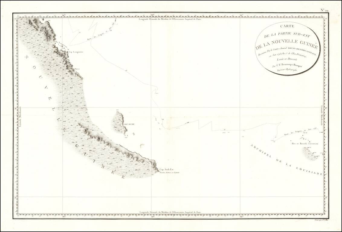
Papua New Guinea The chart appeared in Atlas du voyage de Bruny-Dentrecasteaux, contre-amiral de France, commandant les fregates la Recherche et l'Esperance, fait par ordre du gouvernement en 1791, 1792 et 1793 : publie par ordre de sa majeste...
One of the earliest obtainable maps of Tonga. Rear Admiral Jules Sébastien César Dumont d'Urville (1790-1842) was a French explorer and naval officer, who explored the south and western Pacific, Australia, New Zealand, and Antarctica. Dumont...
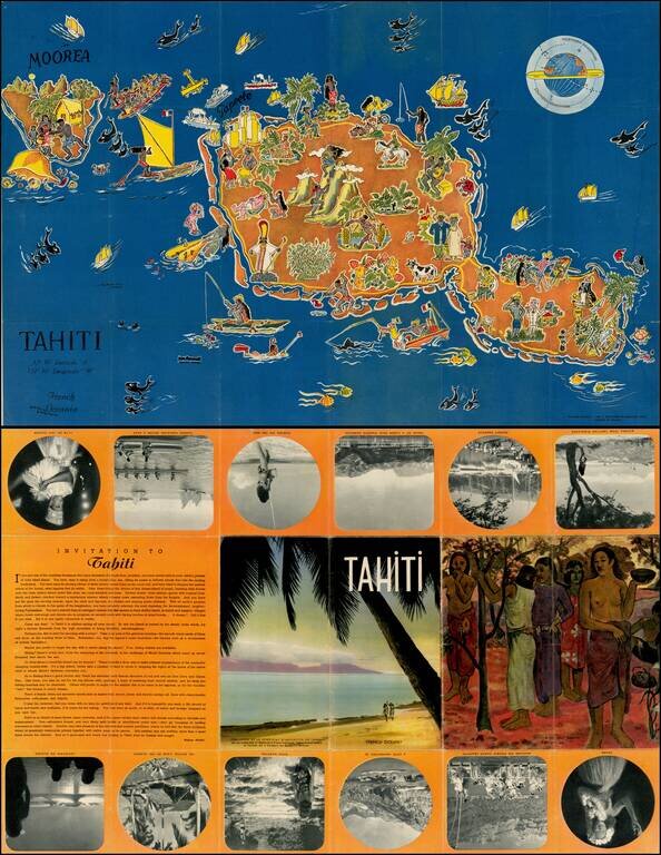
Decorative pictorial map of Tahiti, drawn by Jean Rousaute for Le Syndicat d'Initiative de Tahiti in Paris. The map shows a colorful look at the peoples, wildlife, and tourists found around Tahiti.
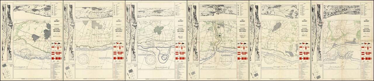
A Complete Set of TOP SECRET Landing Maps For Okinawa Produced in the Lead Up to the Invasion. Six color-printed sheets (of six, i.e., complete), showing all of the American landing beaches on Okinawa. Each sheet is composed of ten frames: the...
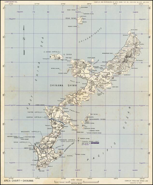
This is a military chart showing Okinawa in detail, with a particular focus on the military installations of the island. The map depicts the island in full, along with some nearby islands including Ie Shima and Iheya Shima, some of which would also see...
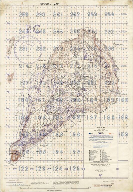
"SECRET" Situation Map of Iwo Jima Detailing the Minutiae of the Japanese Defense of the Island. A rare "Secret" situation map of Iwo Jima prepared in anticipation of the 19 February 1945 U.S. invasion of the island. The map shows the landing zones on...
![(Second World War - Iwo Jima) Beach Diagram Southwestern Beaches, Iwo Jima Information Taken from Aerial Photographs of 4 July 1944... [with] Becah Diagram Southeastern Beaches, Iwo Jima Beach Information taken from Aerial Photographs of 4 July 1944...](/map/small/62967.jpg)
"SECRET" Beach Diagrams used for Planning and Executing the American Landings on Iwo Jima. Two very rare color-printed views of the southern beaches of Iwo Jima, the southwestern section of which served as a potential landing area for the U.S. Marine...
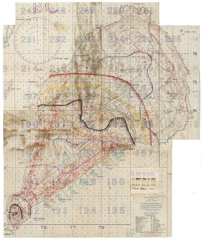
Secret Enemy Installation Map of Iwo Jima prepared for the American invasion, heavily annotated to show the progress of the battle. A rare “Secret” map of Iwo Jima, issued little more than a week before February 19, 1945 U.S. invasion. The map...