
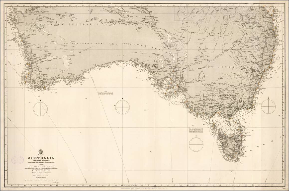
Fine rare format chart of the Southern part of Australia, published by the British Admiralty. Includes Brisbane, Syndey, Melbourne, Adelaide, Perth, and Tasmania.
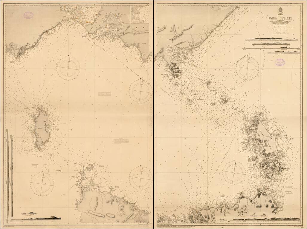
Fine two sheet chart of the Bass Straits published by the British Admiralty. The chart is based on the original surveys of John Lort Stokes and was periodically updated by the Admiralty over the next 40 years. John Lort Stokes (1811-1885) joined the...
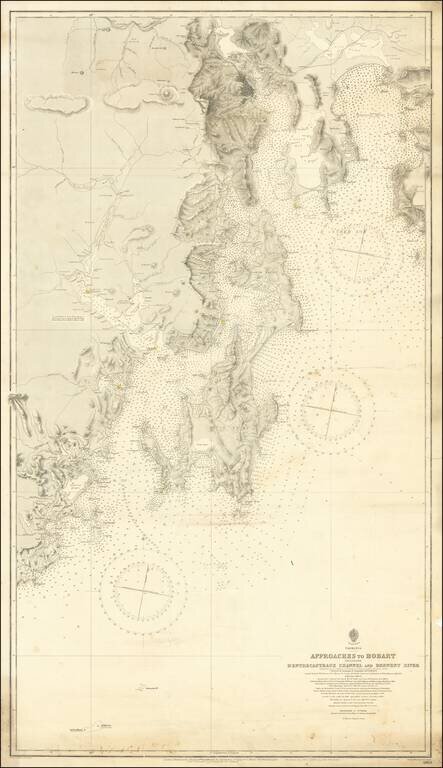
Detailed sea chart of the approaches to Hobart, first published by the British Admiralty in 1889. The present example is corrected to 1912 and presents a highly detailed look at the Tasmanian Coastlilne between Recherche Bay and the Tasman Peninsula,...
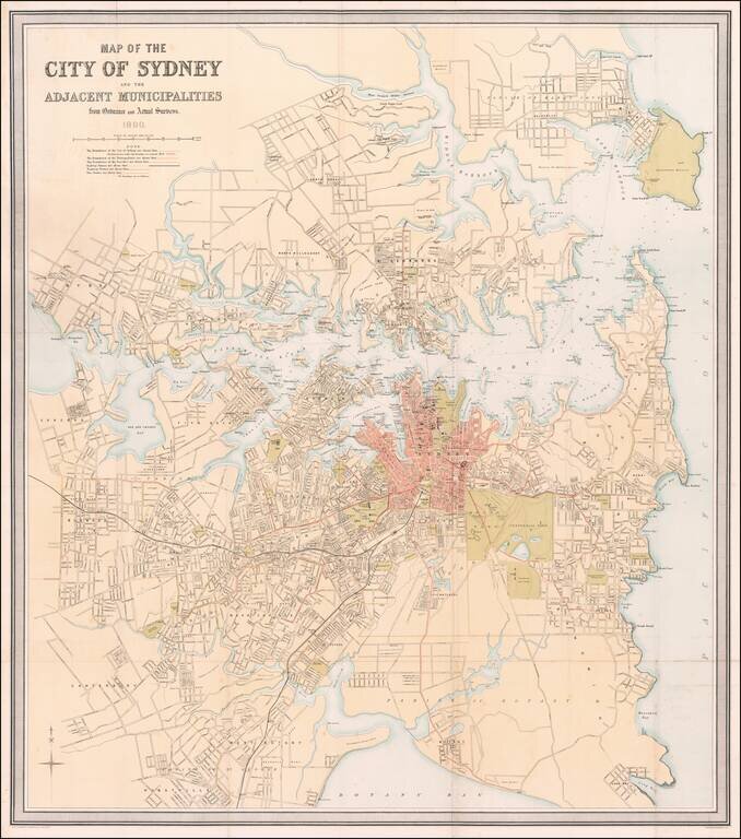
Striking, Detailed Map of Sydney at the Turn of the Twentieth Century Fine large-format map of Sydney and its environs printed and published by John Scott & Co. in Sydney. This map captures Sydney at a vibrant moment in its development....
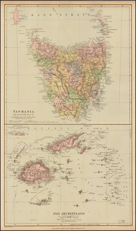
Fine and highly detailed map of Fiji and Tasmania, from Stanford's London Atlas. The map is meticulously colored by counties and shows fine detail throughout.
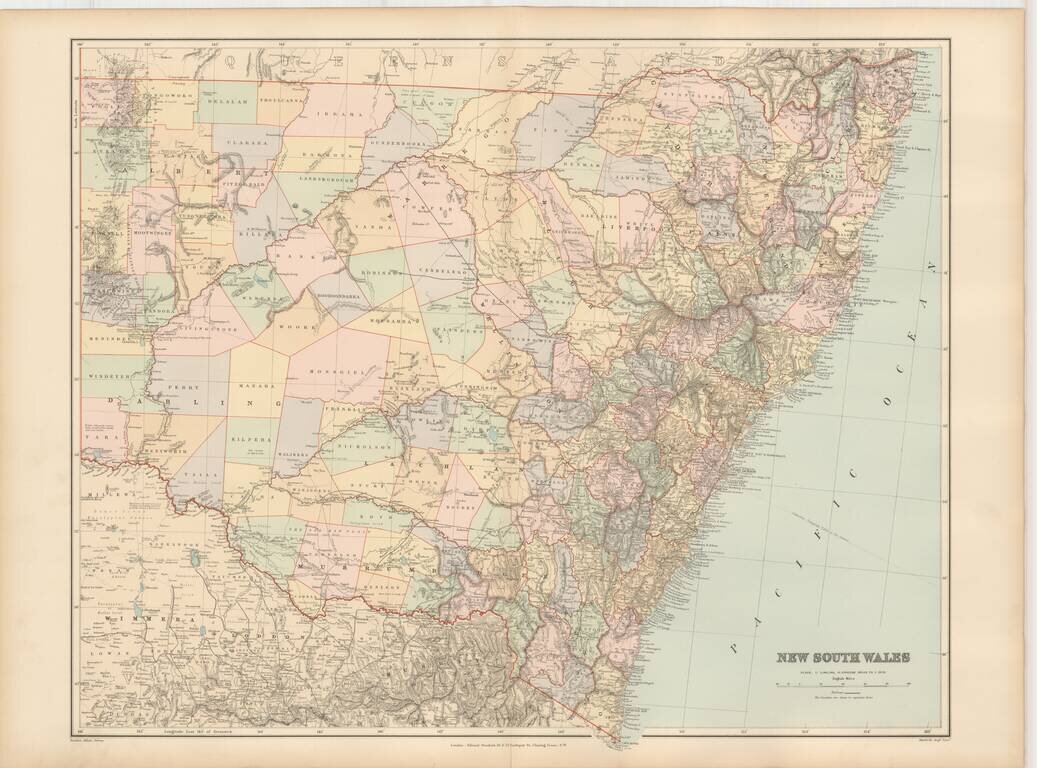
Fine and highly detailed map of New South Wales, from Stanford's London Atlas.
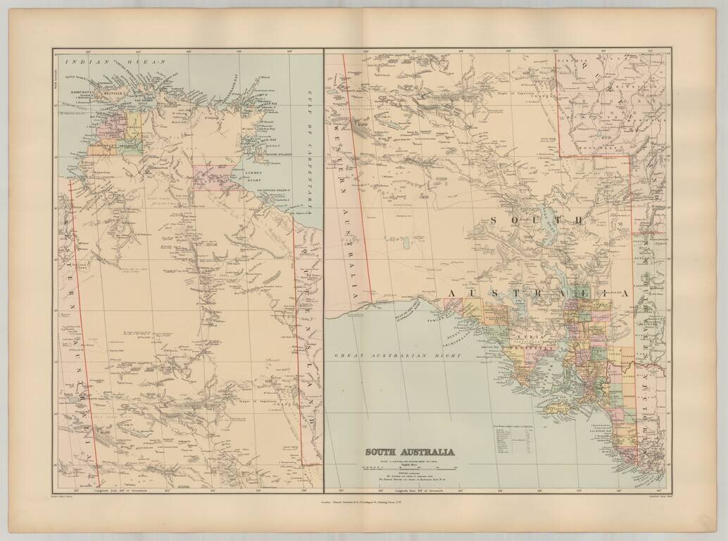
Fine and highly detailed pair of maps of South Australia, from Stanford's London Atlas.
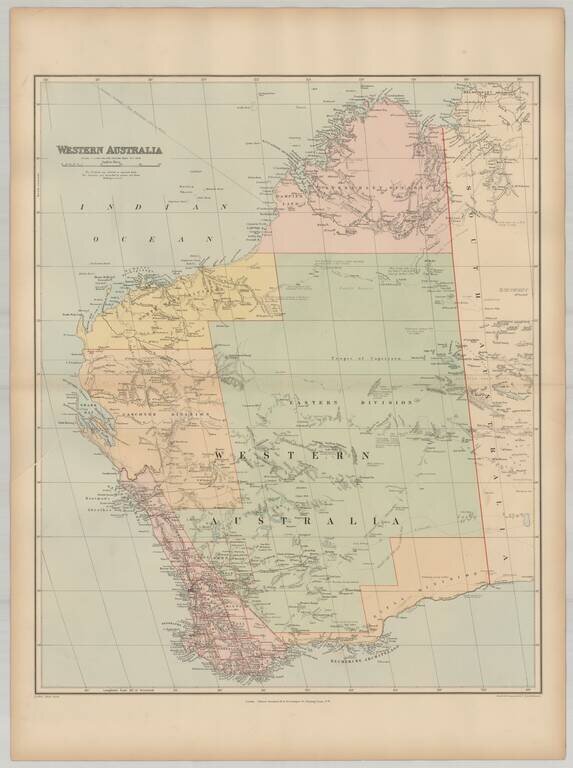
Fine and highly detailed map of Western Australia, from Stanford's London Atlas.
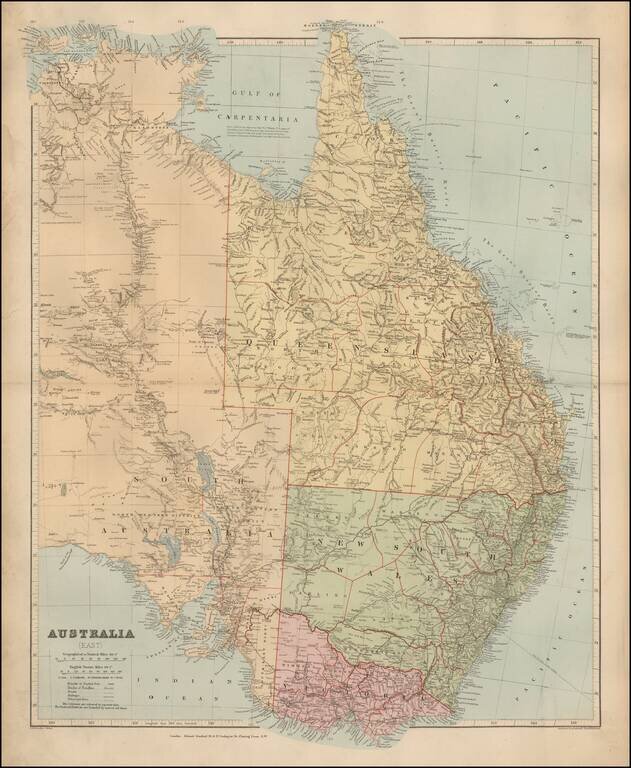
Fine and highly detailed map of Eastern Australia, from Stanford's London Atlas.
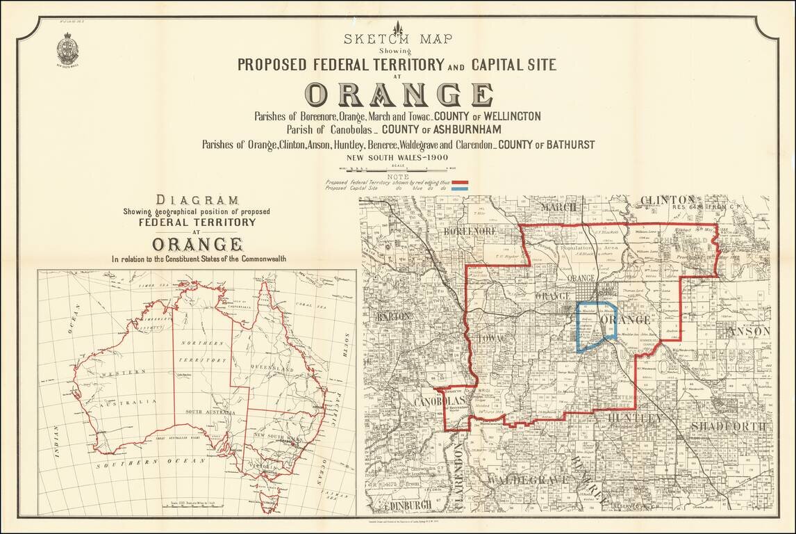
Rare map of a portion of New South Wales, illustrating the proposal to locate the capital of Australia in the City of Orange, New South Wales. At the end of the 19th Century, Sydney and Melbourne were in the midst of a fight regardin the location of...
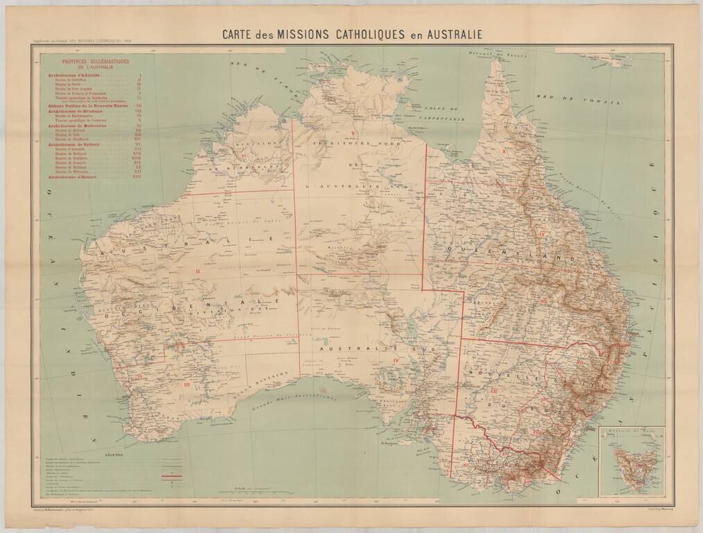
Rare map showing the Catholic Missions in Australia, published as a supplement to the Journal Les Missions Catholiques in Paris. The map provides a marvelously detailed look at the Catholic Missions throughout the Austrlian Continent.
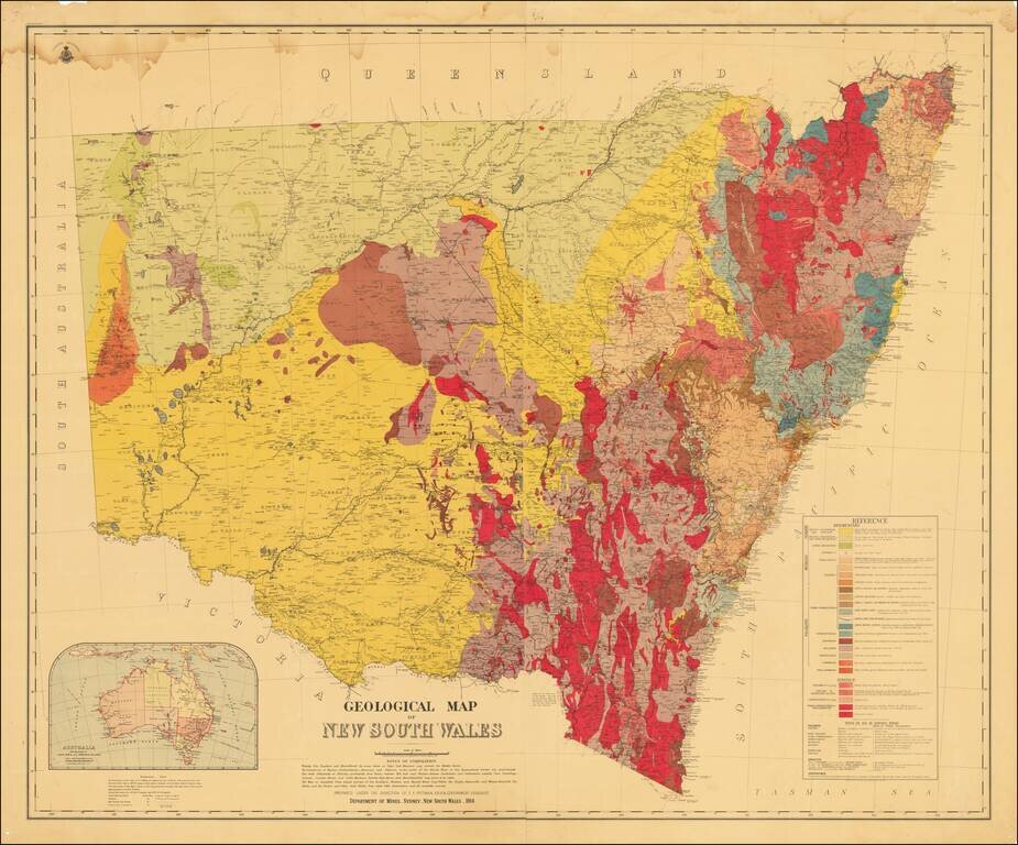
Detailed color-printed two-sheet geological map of New South Wales, published by the Department of Mines, Sydney, New South Wales, in 1914. The map was prepared under the direction of E.F. Pittman, A.R.S.M., a government geologist. The map contains a...
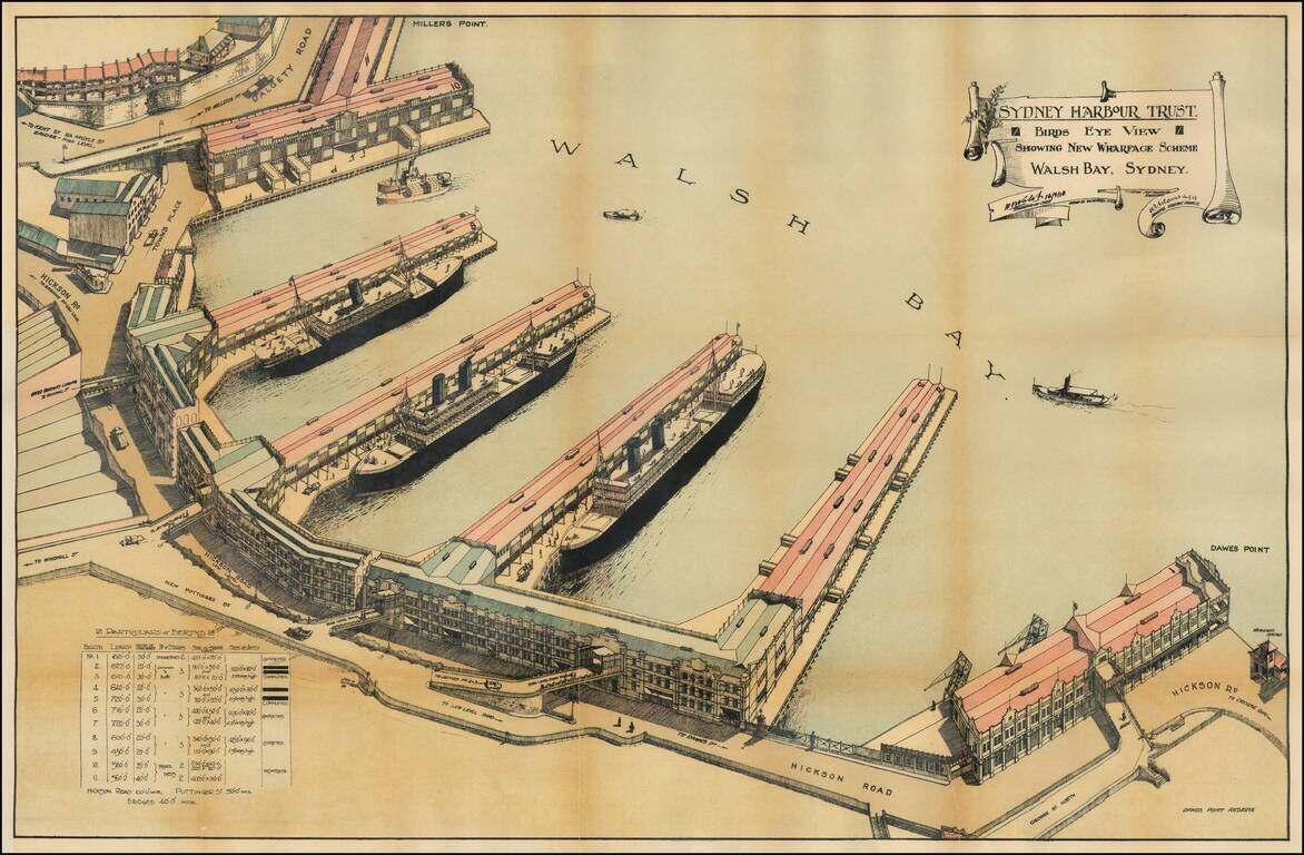
Detailed Plan of the Walsh Bay area of Sydney Harbor, published by the Syndey Harbour Trust. The Wharf at Walsh Bay was constructed between 1912 and 1921, making this one of the earliest obtainable views of the Wharf. Sydney Harbour Trust The Sydney...
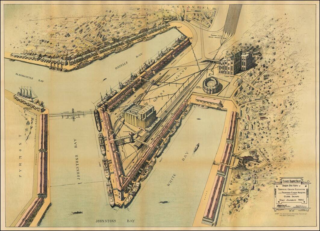
Detailed Plan of the Walsh Bay area of Sydney Harbor, published by the Syndey Harbour Trust. Detailed plan of the area around Glebe Island, illustrating plans for the improvement of the facilities on the water front at Johnston's Bay, Rozelle Bay and...
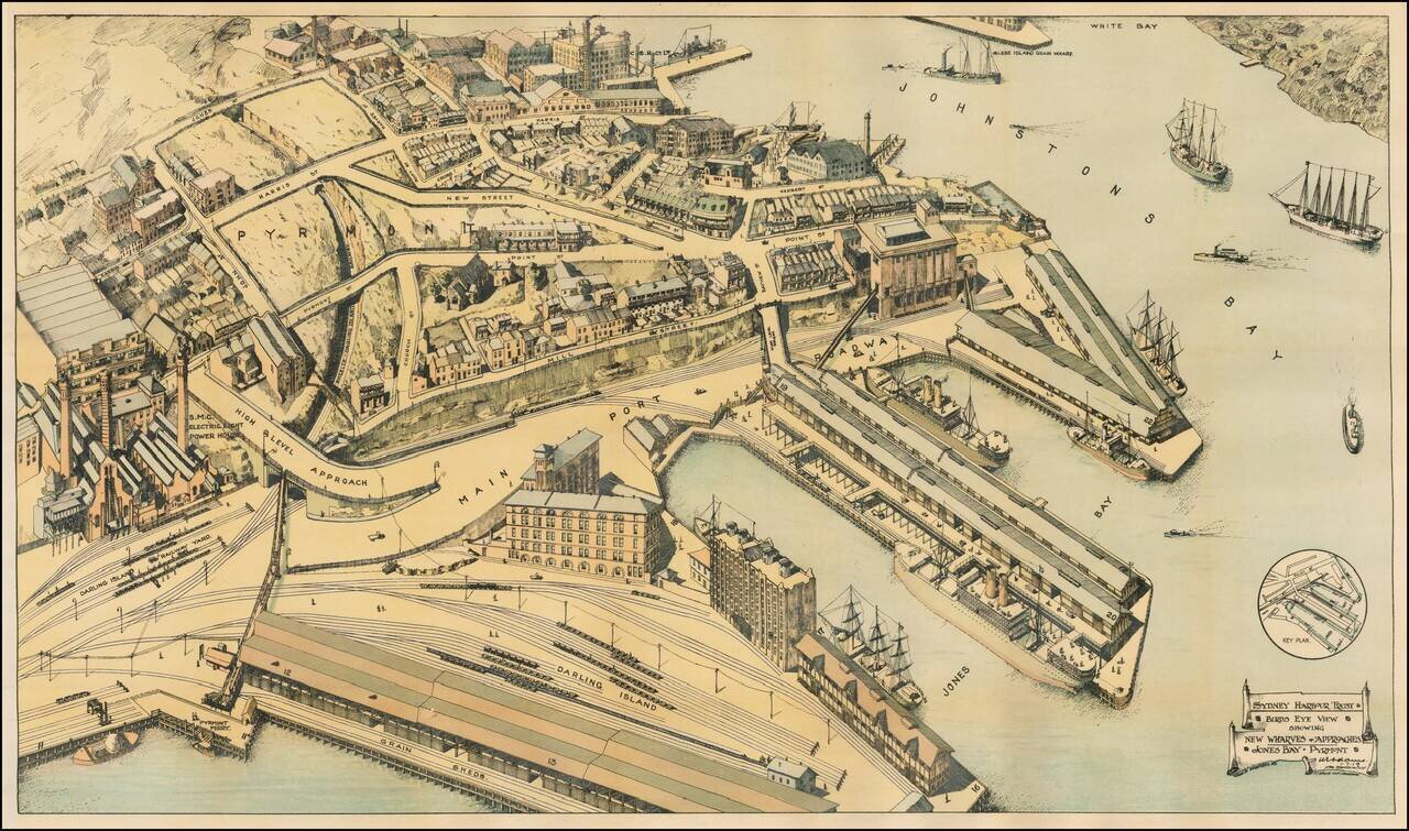
Detailed Plan of The Jones Bay, Pyrmont Harbor and Johnstons Bay area of Sydney Harbor, published by the Syndey Harbour Trust. Sydney Harbour Trust The Sydney Harbour Trust was formed by the New South Wales Parliament in 1900 to oversee for the...
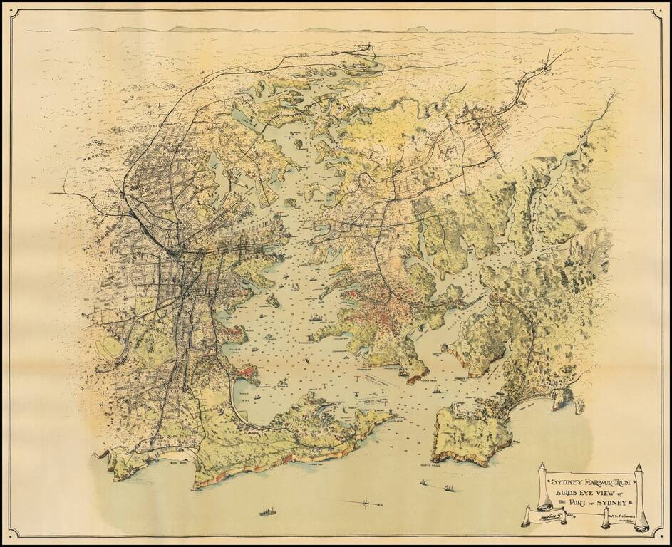
Fine overview of Sydney Harbor and environs, published for the Sydney Harbour Trust. An exceptional caricature style overview of the Harbor, illustrating existing and proposed changes to improve the harbor. Sydney Harbour Trust The Sydney Harbour...