
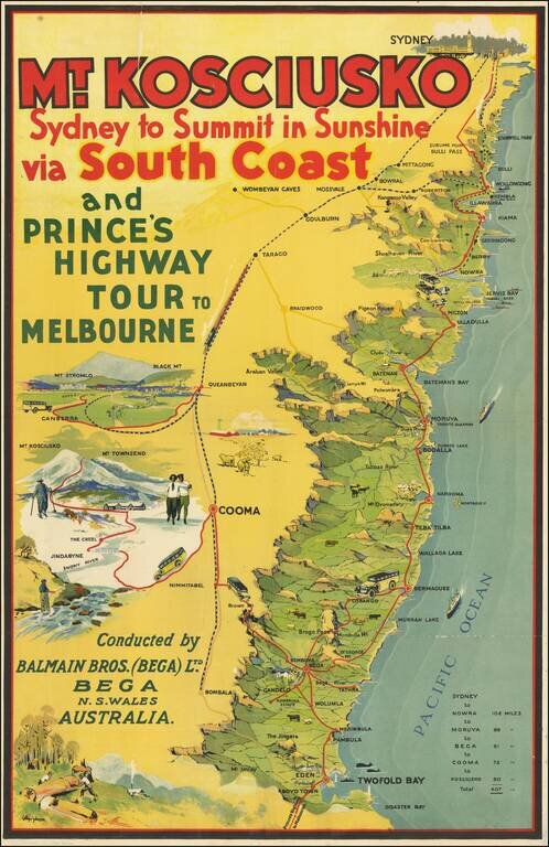
Rare travel poster of the area between Sydney and Twofold Bay, promoting the Balmain Bros. (Bega) Ltd., with the publication mark of J.H. Enemark Ltd., Litho. Sydney at the bottom left. The map illustrates a coastal motor route between Sydney and...
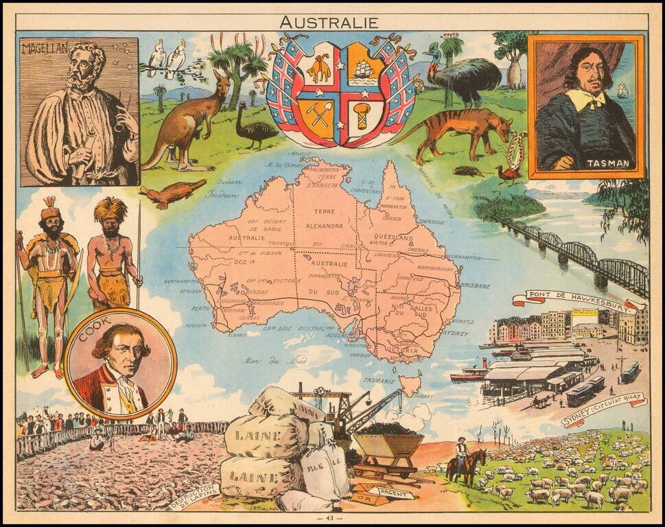
Decorative pictorial map of Australia, published by Children's book artist JP Pinchon.
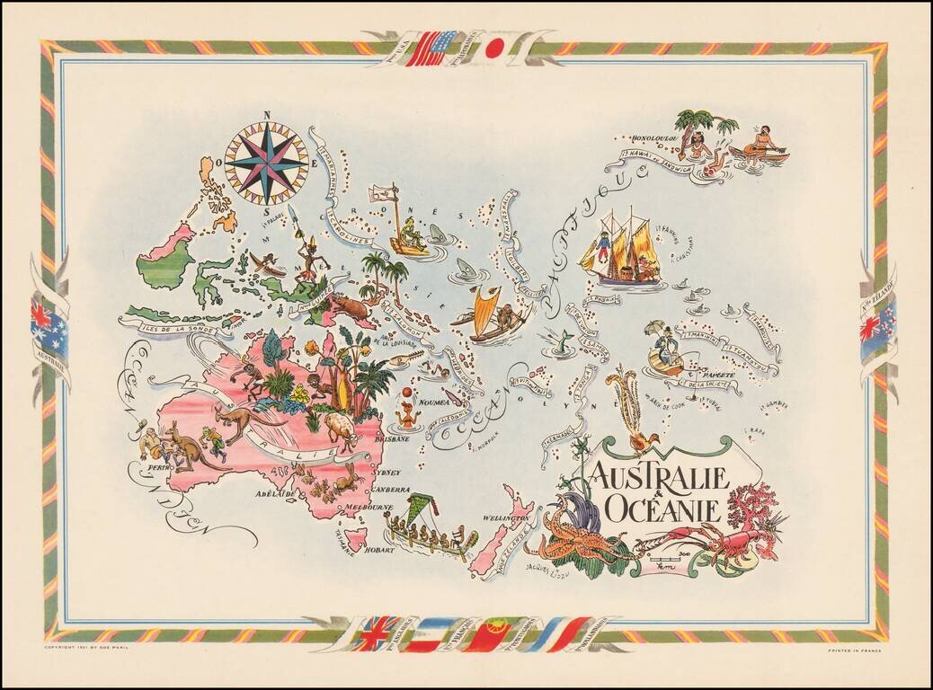
Decorative map of Australia, the Philippines, New Guinea, New Zealand and the South Pacific, published by Jacques Lizou. Lizou published a number of maps in this style in 1951, including maps of the French provinces, etc.
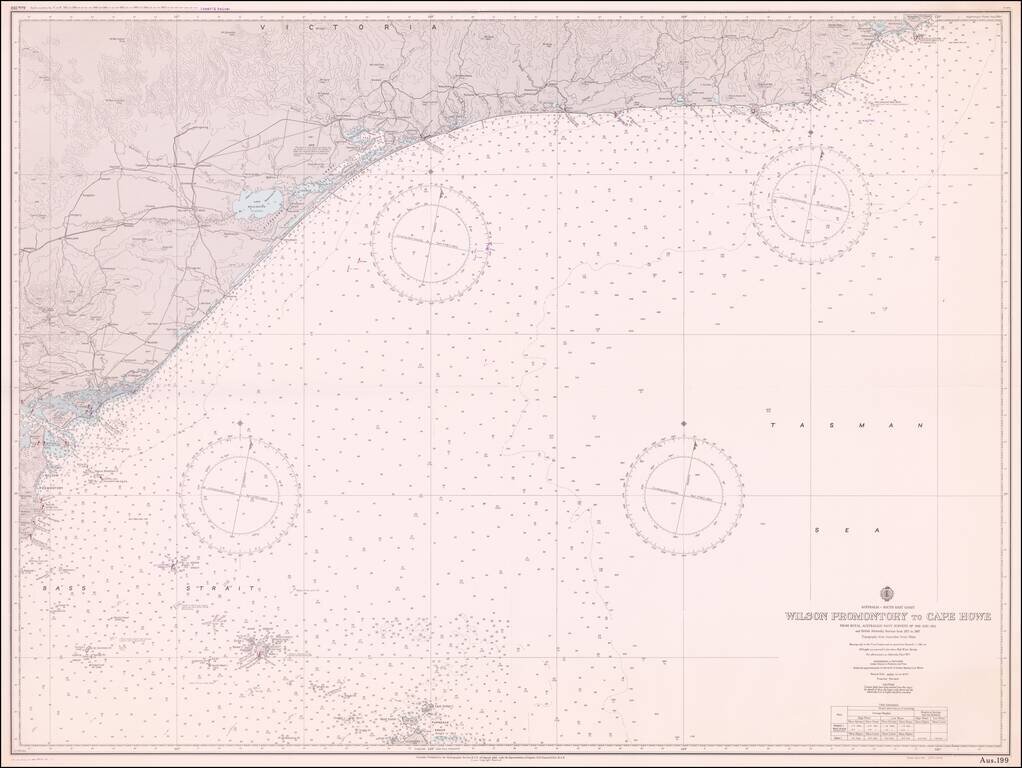
Fine sea chart extending from Cape Howe Marine National Park to Wilson Promontory, prepared for the Royal Australian Navy.
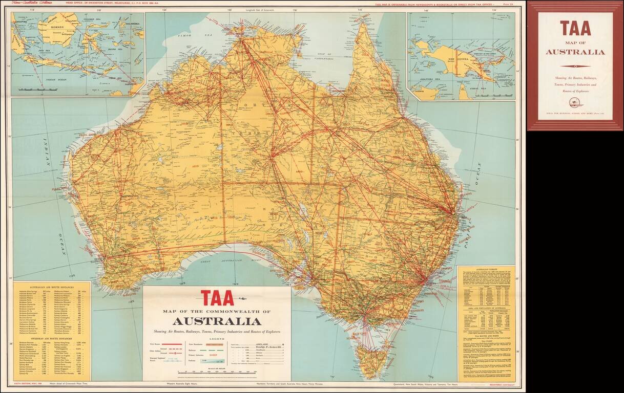
Scarce Trans Australia Airlines map of the continent of Australia, highlighting the air routes of TAA wihtin and beyond Australia. A key at the bottom left shows approximatetly 50 domestic and approximately 30 overseas air routes (including...
![[The Spanish fleet in the Ladrone Islands]](/map/small/48713.jpg)
Antique engraving of the Spanish fleet interacting with Polynesian outriggers and sailing vessels in the vicinity of Guam. The engraving was page 475 from Newe Welt und Americanische Historien by Johann Ludwig Gottfried, published by Mattaeus Merian,...
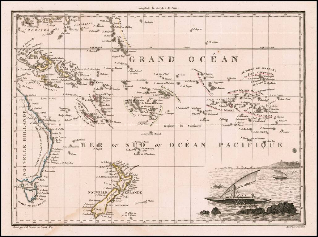
Decorative antique engraved map of the Eastern Pacific, from the Carolines, Eastern Australia, and Tasmania to the Marquesas, including all of New Zealand. Malte Brun's maps were extremely well researched, utilizing the most up to date information....
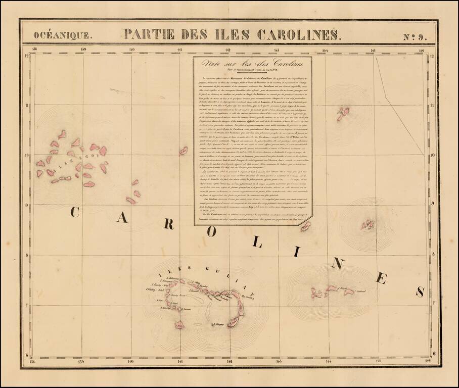
Highly detailed map of a portion of the Carolines, including Iles Guliay and Iles Egoy. Large text note included. Nice detail, especially for the period.
![[Micronesia- Marianas - Marshall Islands - Gilbert Islands] Carte de l'Archipel des Iles Carolines](/map/small/69190.jpg)
Large detailed map of the archipelago of the Caroline Islands located in Micronesia, engraved by Ambroise Tardieu and included in the official account of the Commander Duperrey during the expedition of the corvette La Coquille . The map also covers...
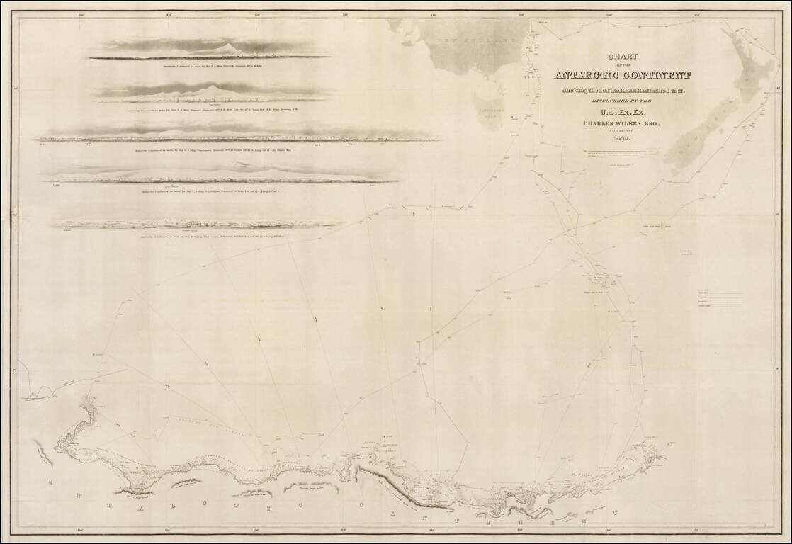
A good example of the Wilkes map of the Antarctic Regions, which accompanied the official account of Wilkes Expedition. The map includes the tracks of Wilkes' expedition, 5 profile views and an outline map of New Zealand and the Southern Tip of...
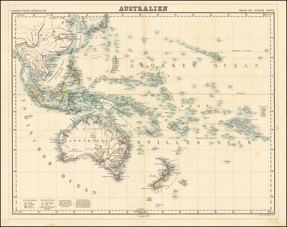
Nice example of Kiepert's fine early map of Australasia, published in 1869. The map extends from the Philippines and the China Sea to New Zealand, Hawaii, the Marquesas and the Society Islands.
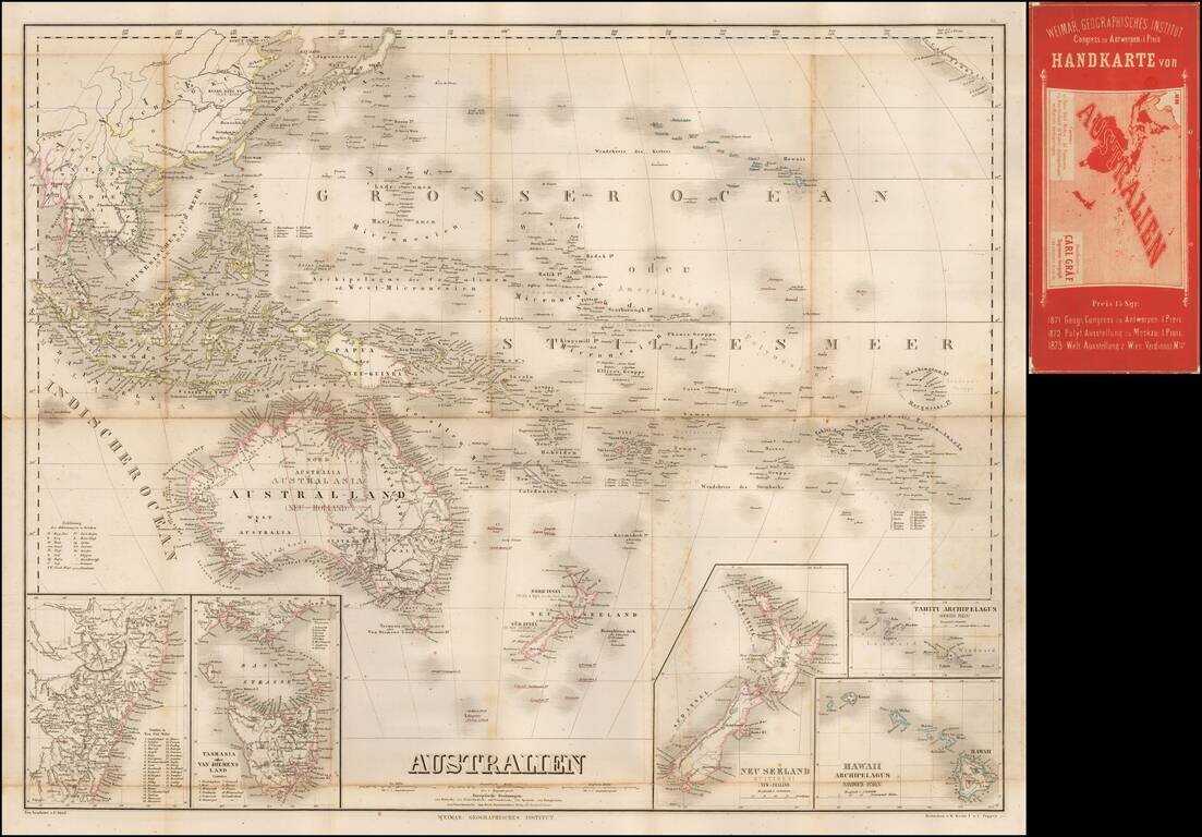
Separately published map of Oceana, bearing the imprint of Carl Graf. Includes inset maps of Hawaii, New Zealand, Oceana, Tahiti, Van Diemens Land and New South Wales.
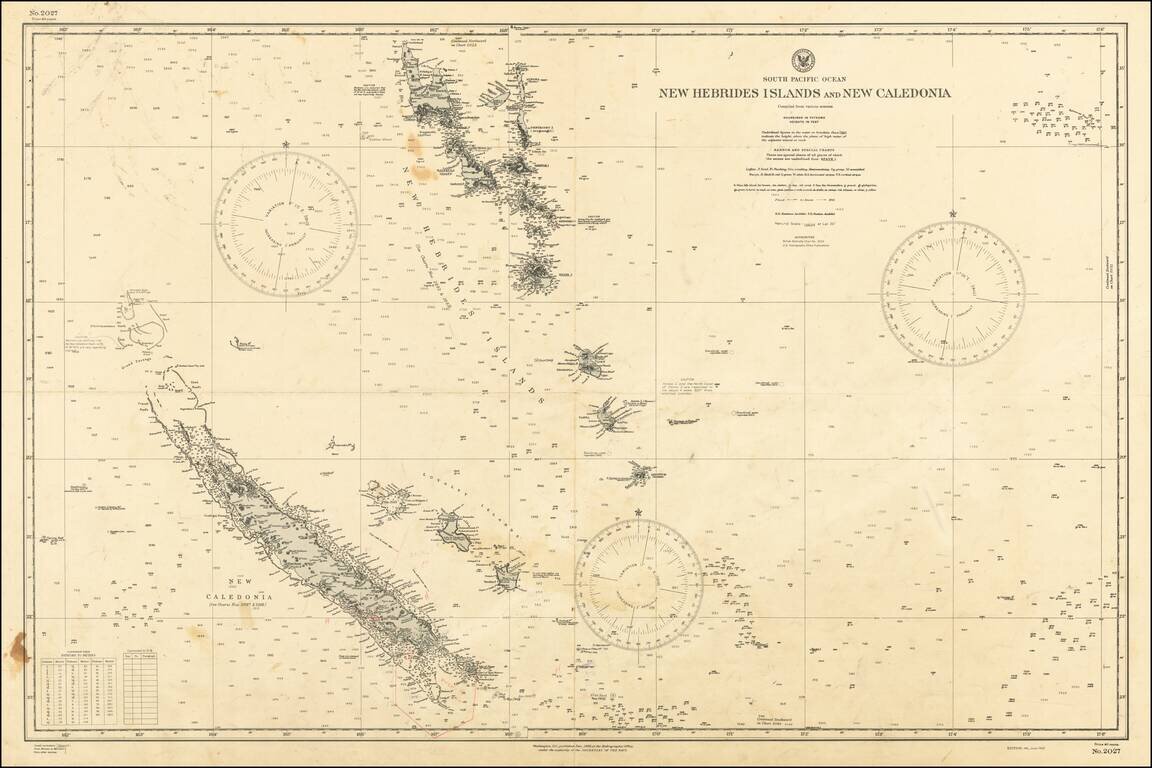
World War II chart of the New Hebrides Islands and New Caledonia, published by the U.S. Secretary of the Navy on the 4th of June 1943. The chart was originally published in December 1902, this is an updated version.
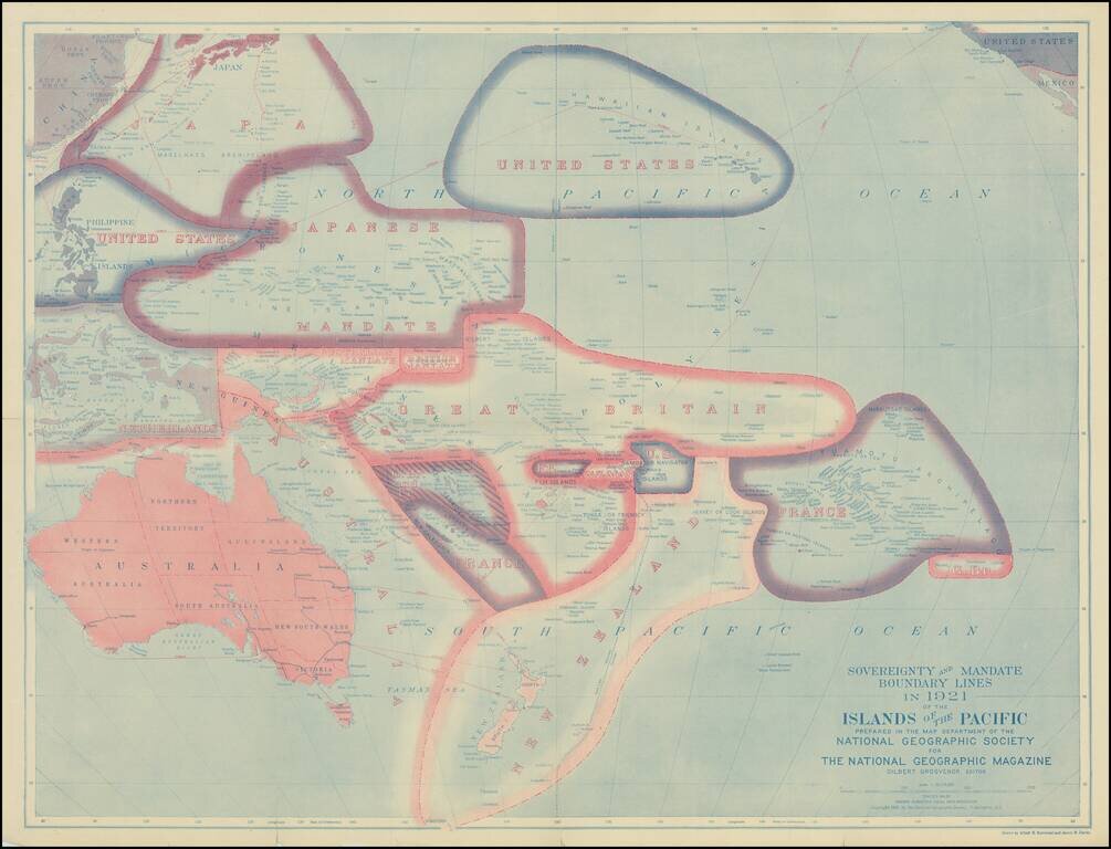
Fine map of the Pacific Ocean subsequent to the settlements agreed on territorial claims at the Peace Treaties after World War I. The best contemporary Pacific map of its era with the Island groups reflecting the loss of the German possessions of...
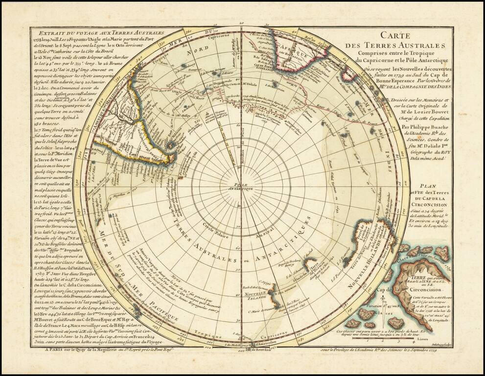
Rare First State / Overview of South Polar Exploration and Conjecture in the First Half of the 18th Century! Remarkable map of the Southern Hemisphere, the foundational map the work of noted French mapmaker Philippe Buache. This map is Buache's...
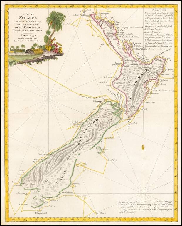
The First Decorative Map of New Zealand -- Drawn From Cook's Official Account Nice hand-colored example of Zatta's map of New Zealand, one of the most decorative and highly sought after editions of Cook's mapping of New Zealand and one of the largest...