Map size in jpg-format: 8.23822MiB
Click to open in high resolution (open in new tab).
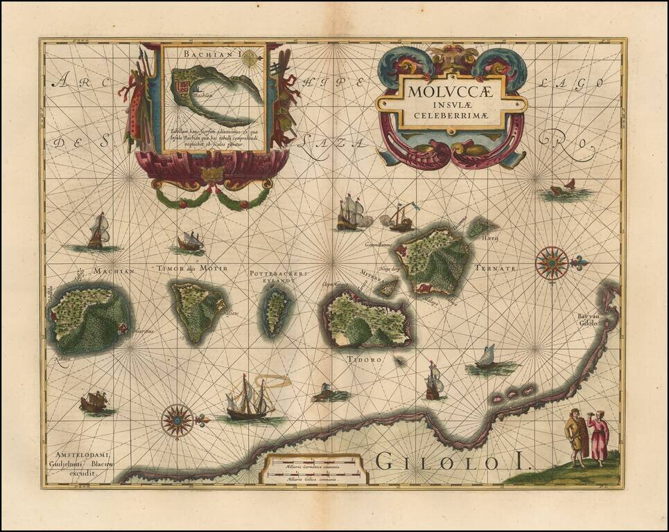
Finely colored example of Blaeu's important and highly decorative map of the Spice Islands.
Wonderful, highly decorative cartouche, which many collectors will recognize as the thematic logo for the Miami International Map Fair. The map features a large inset of the Island of Bachian (Batjan) in an elaborate frame as well as a Moluccan couple in the lower right corner in Europeanized native dress. This is indicative of the area's commercial importance.
Blaeu has filled the seas with both European and local ships, two of which are engaged in battle. Sea monsters and decorative compass roses are also shown.
Willem Janszoon Blaeu (1571-1638) was a prominent Dutch geographer and publisher. Born the son of a herring merchant, Blaeu chose not fish but mathematics and astronomy for his focus. He studied with the famous Danish astronomer Tycho Brahe, with whom he honed his instrument and globe making skills. Blaeu set up shop in Amsterdam, where he sold instruments and globes, published maps, and edited the works of intellectuals like Descartes and Hugo Grotius. In 1635, he released his atlas, Theatrum Orbis Terrarum, sive, Atlas novus.
Willem died in 1638. He had two sons, Cornelis (1610-1648) and Joan (1596-1673). Joan trained as a lawyer, but joined his father’s business rather than practice. After his father’s death, the brothers took over their father’s shop and Joan took on his work as hydrographer to the Dutch East India Company. Later in life, Joan would modify and greatly expand his father’s Atlas novus, eventually releasing his masterpiece, the Atlas maior, between 1662 and 1672.
If you are a student, write to us in telegram: @antiquemaps and indicate what material you need and for what work you need a map in high detail. We are ready to provide material on special terms. For students only!

![[Sunda and Lilliput, etc. from Gulliver's Travels]](/map/small/54927.jpg)
