Map size in jpg-format: 23.4872MiB
Click to open in high resolution (open in new tab).
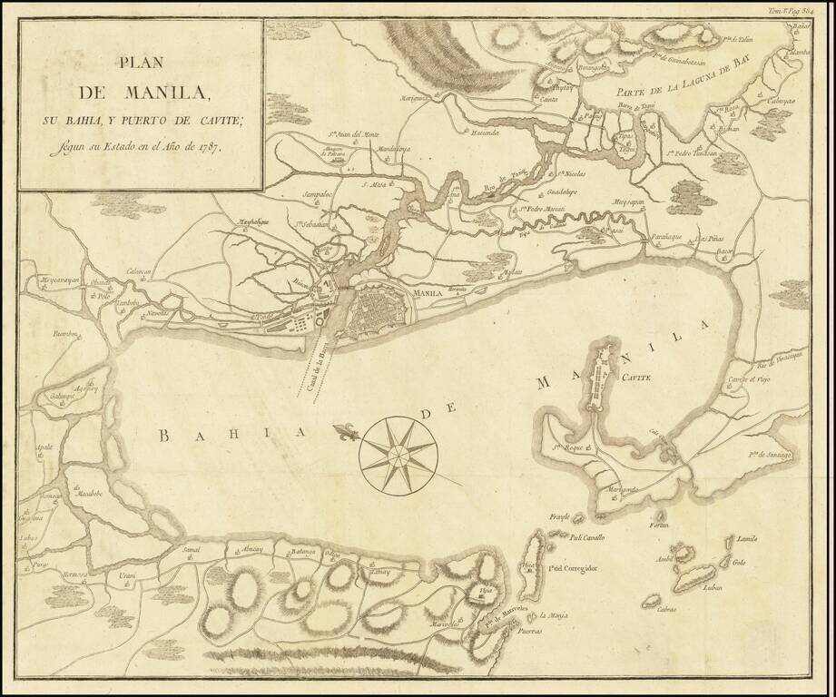
The Duque de Almodovar's Map of Manila Bay
Rare large map of the Bay of Manila, by the Duque de Almodovar, published in Manila.
The map is based upon the cartography of Father Pedro Murillo Velarde's Carta Hydrographica y Chorographica de las Islas Filipinas, published in Madrid in 1734.
The map appeared in volume 5 of Historia politica de los establecimientos ultramarinos de la nacionales Europeas, published in Madrid in 1790.
Rarity
The map is rare on the market. This is the first time we have seen the map.
If you are a student, write to us in telegram: @antiquemaps and indicate what material you need and for what work you need a map in high detail. We are ready to provide material on special terms. For students only!
![[Martin Behaim Globe / Book] Pars Globi terrestris Ao. 1492 a Martino Behaim Equite Lusitano Norimbergae confecti Delineavit Christoph. Theoph de Murr 1778 (bound with:) Diplomatische Geschichte des Portugesischen berühmten Ritters Martin Behaims](/map/small/68828.jpg)
![Il Disegno Della Terza Parte Dell' Asia [Gastaldi's Wall Map of SE Asia with extra panels!]](/map/small/30554hbp.jpg)
![Chinae, olim Sinarum regionis nova descriptio. auctore Ludouico Georgio. [English Edition!]](/map/small/71123.jpg)