
![明初的疆域形势 [Early Ming Borderland Situation]](/map/small/36675.jpg)
Remarkable Series of Taiwanese Classroom Hanging Maps Covering the Modern History of China Striking series of maps, The Modern History of China Hanging Map Series [中國近代史挂圖], published in the 1960s in Taipei. The colorful and...
![八年抗战之经过 [The Experience of the Eight-Year War of Resistance]](/map/small/36700.jpg)
Remarkable Series of Taiwanese Classroom Hanging Maps Covering the Modern History of China Striking series of maps, The Modern History of China Hanging Map Series [中國近代史挂圖], published in the 1960s in Taipei. The colorful and...
![南明之抵抗 [The Southern Ming Resistance]](/map/small/36695.jpg)
Remarkable Series of Taiwanese Classroom Hanging Maps Covering the Modern History of China Striking series of maps, The Modern History of China Hanging Map Series [中國近代史挂圖], published in the 1960s in Taipei. The colorful and...
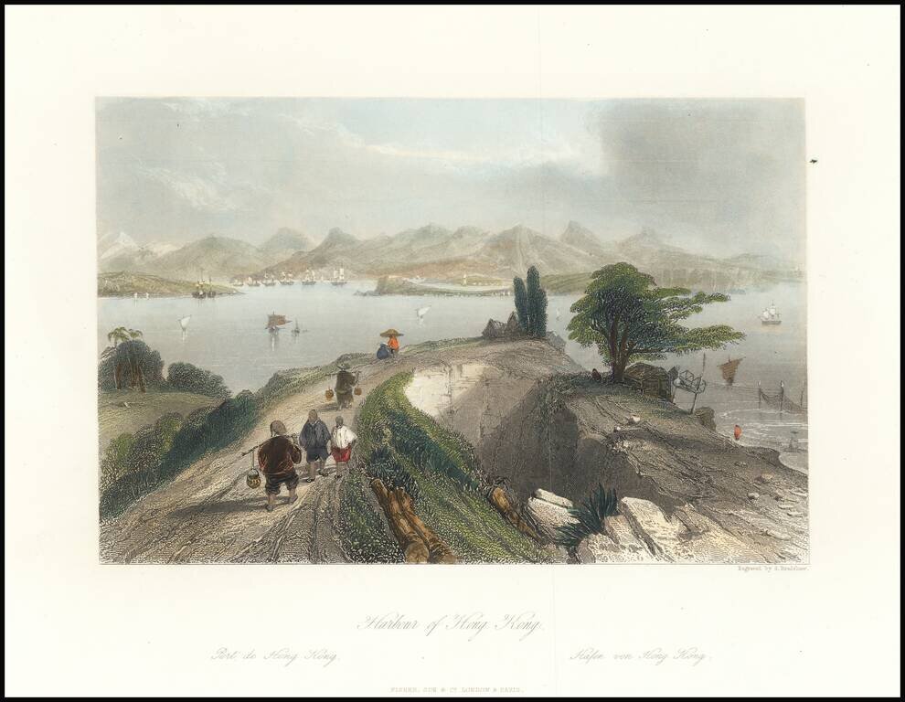
This is an attractive antique view of Hong Kong harbour, drawn by an Englishman in the first half of the 19th century. The view shows the harbour in the distance, framed by tall mountains. In the foreground, merchants and peasants dressed in...
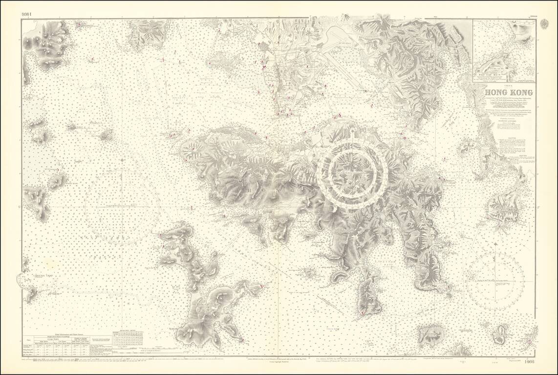
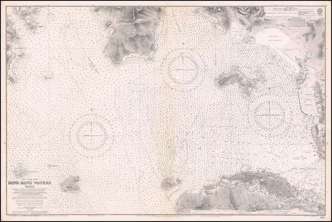
An Exceptional Post-World War II Chart of Hong Kong and Environs -- The First British survey of Hong Kong Harbor, updated to 1953 / 1964 Remarkably detailed British Admiralty Sea Chart of Hong Kong, first published in 1843, based upon the surveys of...
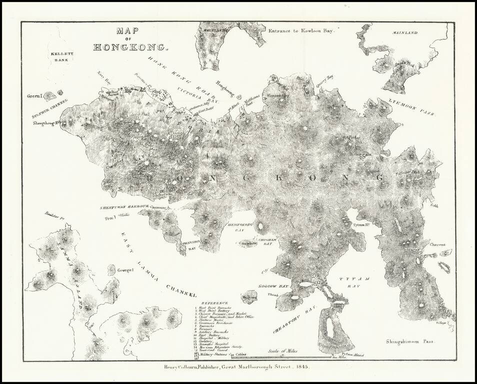
Very early lithographed map focusing specifically on Hong Kong, published in London in 1845. The map is one of the earliest obtainable mappings of Hong Kong after it was ceded to Great Britain in the Treaty of Nanking in 1842. The map derives in large...
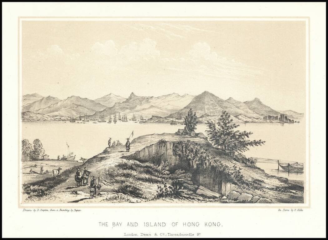
Fine early lithographic view of Hong Kong, "Drawn by B. Clayton from painting by Piqua."
Western Approaches To Hong Kong Harbor A large-scale and detailed sea chart of the western approaches to Hong Kong Harbor, issued by the British Admiralty, including all of Victoria (Central), western Kowloon and extending westwards to Lantau...
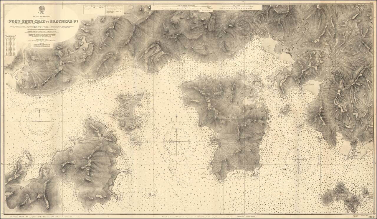
Impressive Chart of Park Island, Tsing Yi, and western Hong Kong Harbor. A very detailed chart of the section of water west of Hong Kong Harbor. The chart was first published in 1908, based on the surveys of Commander C.E. Monro of H.M.S. Rambler,...
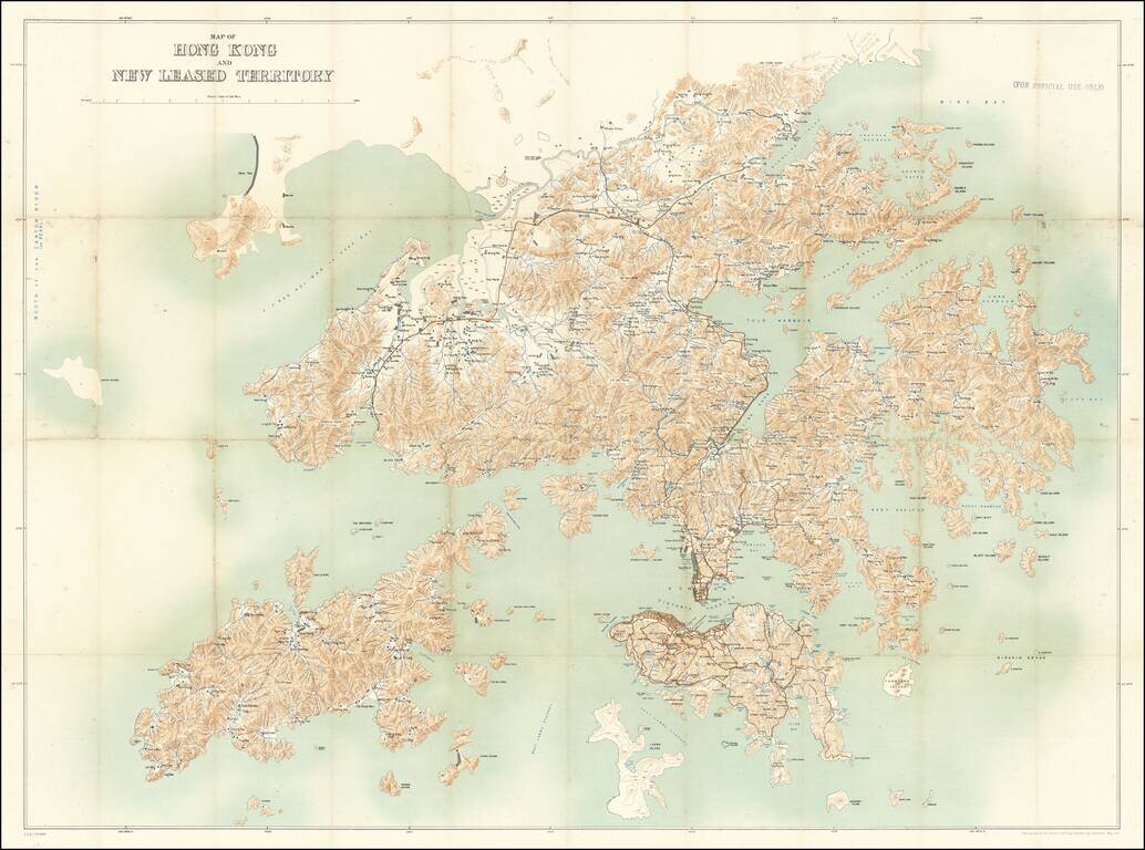
For Official Use Only. A Large Map of Hong Kong During the 1911 Revolution. Large antique map of Hong Kong Island and the region north to the Sham Chun River. The map was prepared by the Royal School of Military Engineering in concert with the...
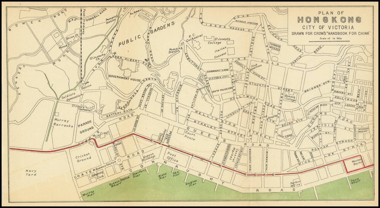
Nice antique map of Victoria, Hong Kong, published by Carl Crow in Shanghai, circa 1917. The map covers what is now central Hong Kong, from the harbor south to Government House and Robinson Road. All the major roads, and some of the major public...

Western Approaches To Hong Kong Harbor (Red Lined By An Early Harbor Planner) A large-scale and detailed sea chart of the western approaches to Hong Kong Harbor, issued by the British Admiralty, including all of Victoria (Central), western Kowloon...
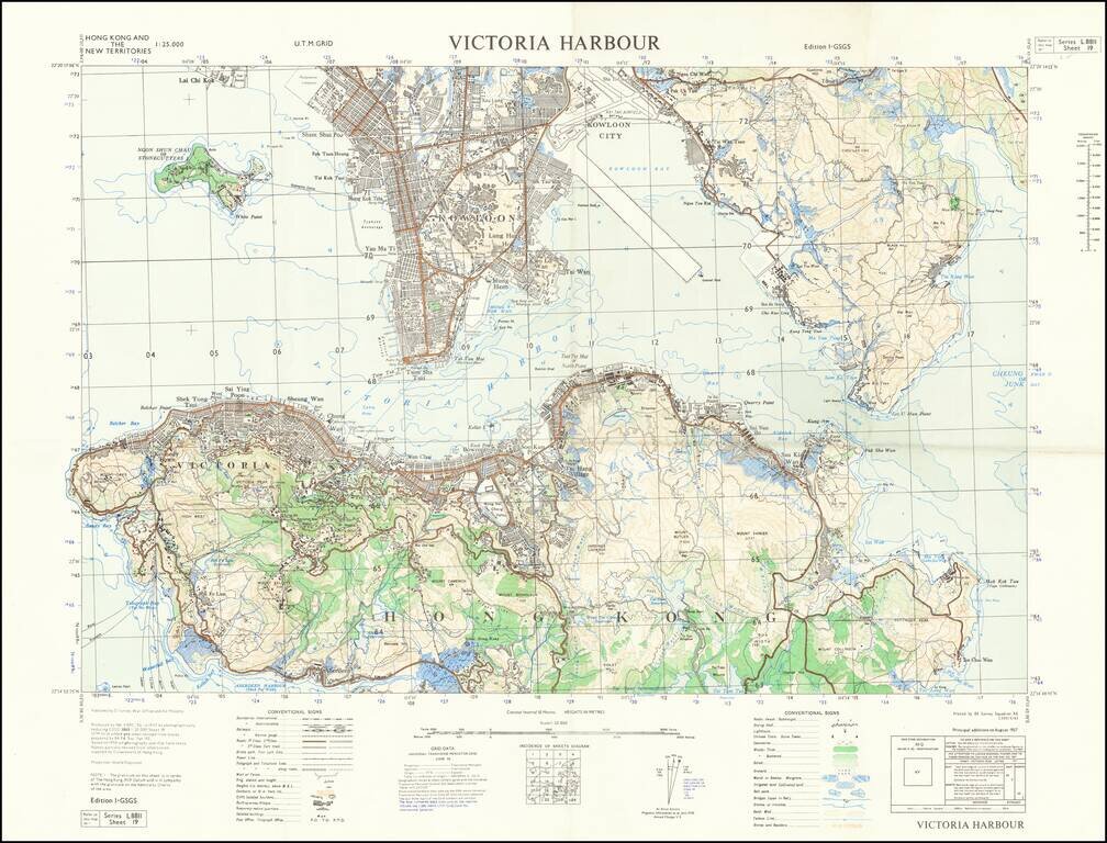
Detailed map of Victoria Harbour produced by D Survey, War Office and Air Ministry in 1957. There is a diversity of information communicated by the map including built-up areas, villages, "temporary native quarters", and isolated buildings in some...
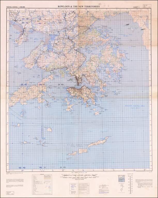
Detailed War Office and Air Ministry Two-Sheet Chart of Hong Kong. Detailed British military mapping of Hong Kong, published in two sheets (here joined as one), in 1958. The sheets are labeled first editions and have as their sources RAF Air Survey...
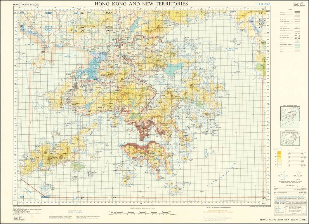
Scarce United Kingdom Ministry of Defence map of Hong Kong and New Territories. Published by the MOD in 1970 based on surveys from 1957 and 1968-69. Built-up areas, "squatter areas", areas under construction, topography, roads and tunnels, railroads,...
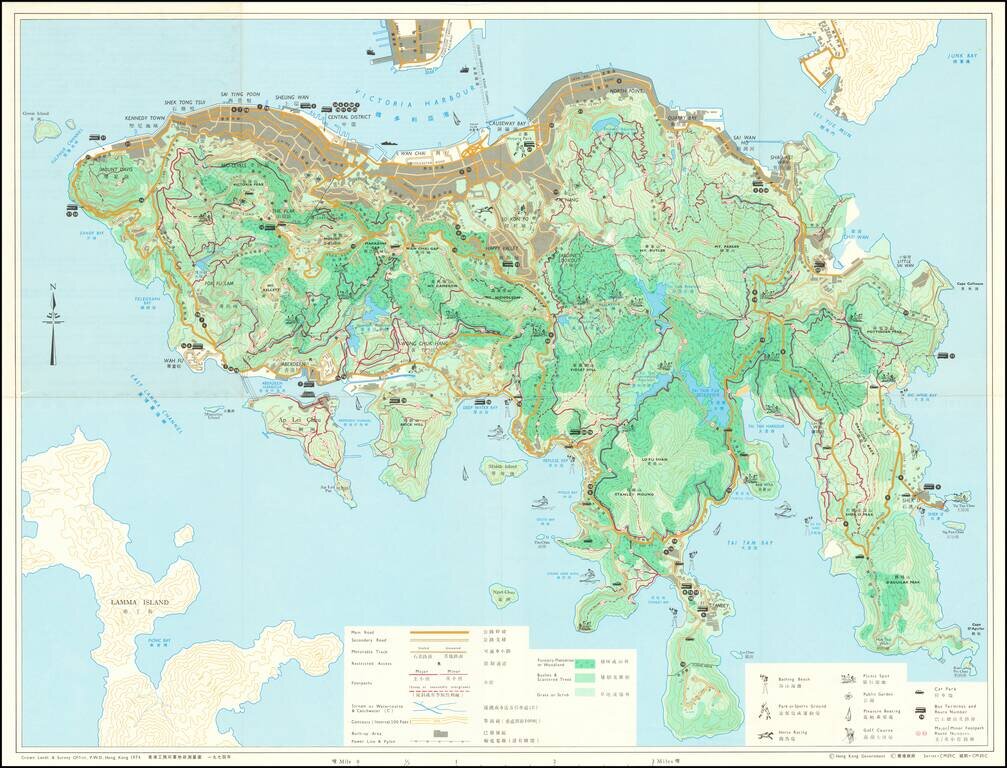
Detailed bi-lingual folding map of Hong Kong Island, with inset maps of The Peak Area, Aberdeen Reservoir Area, and Tai Tam Reservoir Area. The map uses small illustrations to show Bathing Beaches, Park or Sports Ground, Picnic Spots, Public Gardens,...