
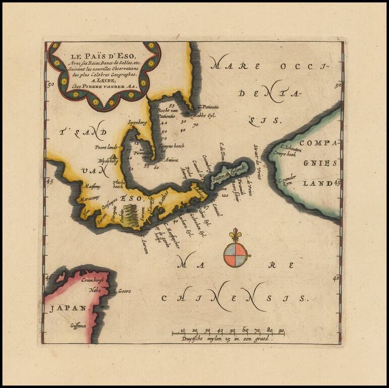
Rare map of the Land of Eso (Hokkaido), which appeared in Vander Aa's Galerie Agreable du Monde. The map illustrates the northern tip of Japan, Hokkaido and the neighboring Compagnie's Land.
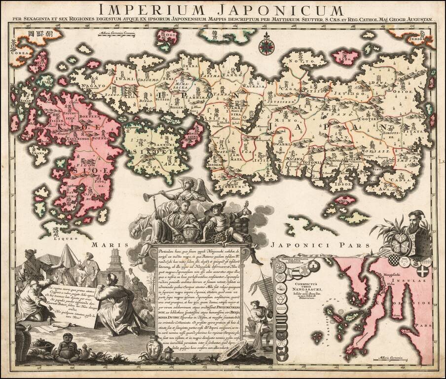
Nice example of Matthaus Seutter's edition of Adrien Reland's seminal map of Japan. Adrien Reland's map of Japan is the first map to use Sino-Japanese characters on a European printed map and represents a radical departure from prior European maps of...
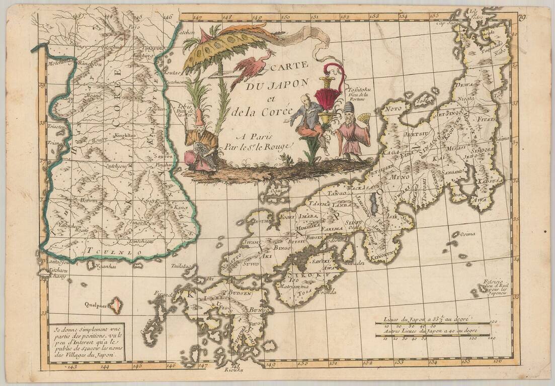
Scarce map of Japan and Korea, from Le Rouge's Atlas Nouvel Portatif . . . , first issued in Paris in 1748. Japan is divided into its provinces, with mountains, lakes and rivers named. Korea includes major cities, lakes, rivers and mountains....
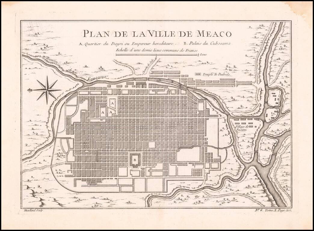
Detailed plan of Kyoto, from Bellin's Petit Atlas Maritime. The five volume work covered all the known areas of the world and is considered to be one of the finest and well produced marine atlases during the period. This map show the city of Kyoto...
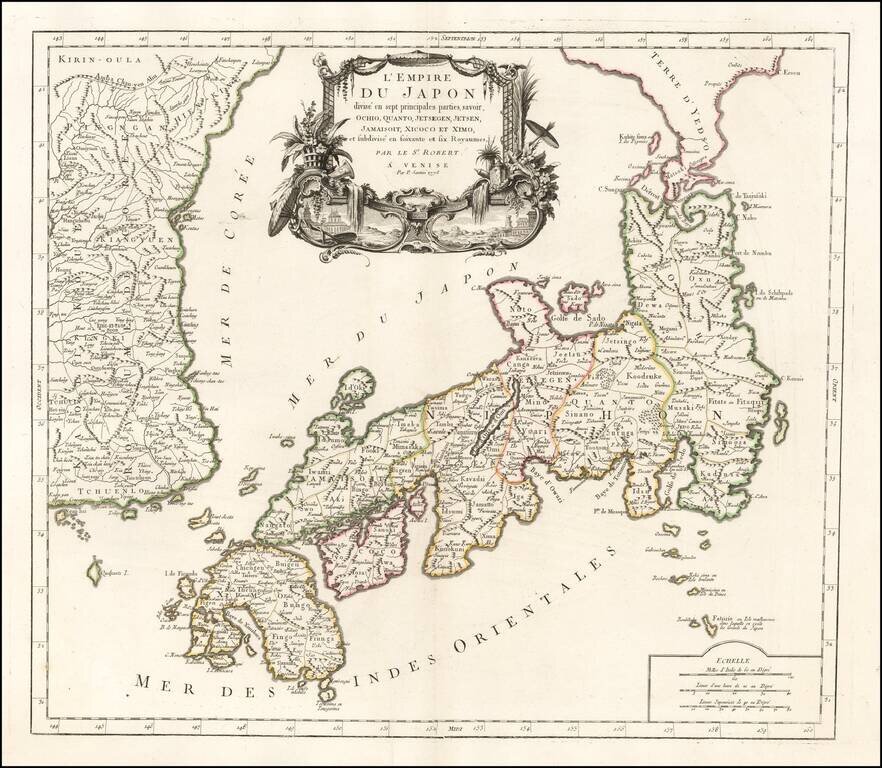
Fine early map of Japan and Korea published in Venice by Francois Santini. The sea between Japan and Korea is prominently labeled Mer de Coree. The map is one of the best large format maps of Japan and Korea to appear in a commercial atlas. One of...
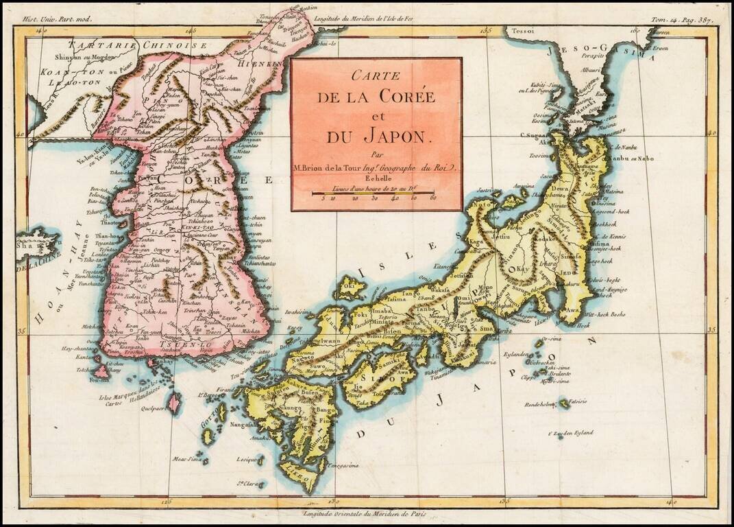
Excellent map of Japan and Korea, showing the towns, rivers, mountains, islands and other major features of each. Based upon the D'Anville model, according to Lutz Walter, who was unable to identify the source of the work from which this map came.
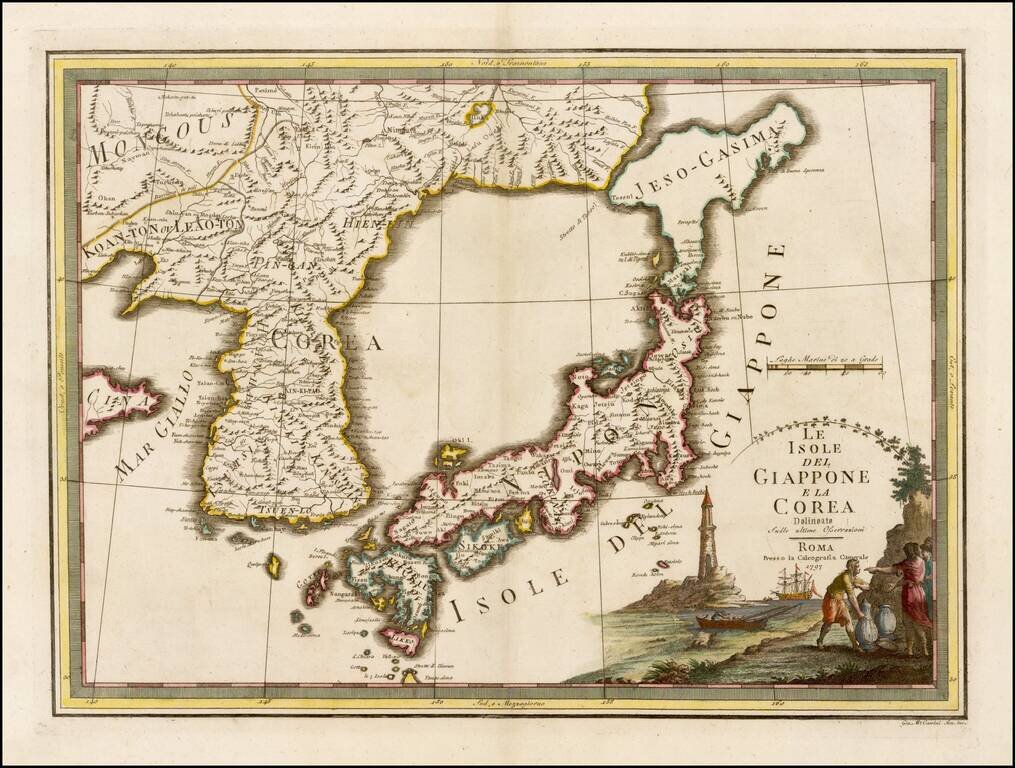
Fascinating early map of Korea and Japan, from Nuovo Atlante Geografico Universale. published by Cassini, in Rome. It has a very unusual, almost triangular, representation of 'Jeso-Gasima', the semi-mythical island to the north of Japan. The title is...
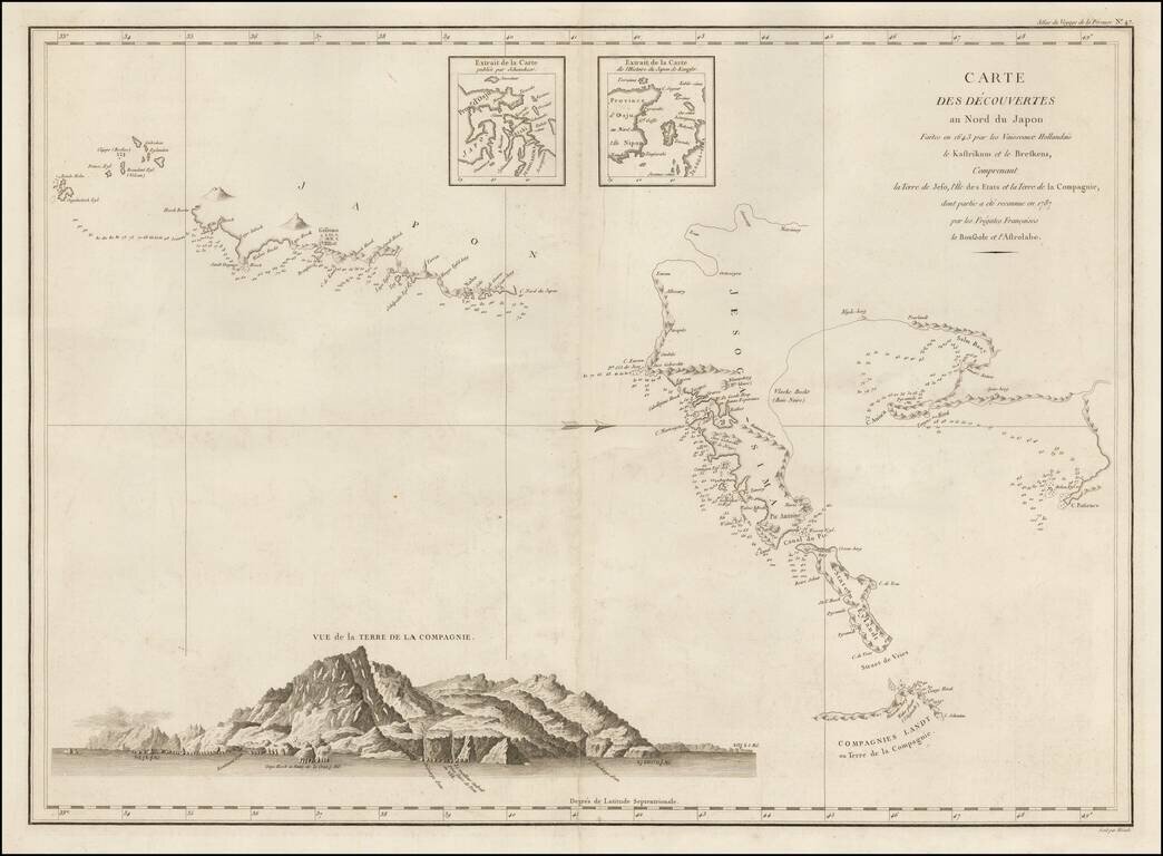
Important Chart of Northern Japan Illustrating Early Dutch Discoveries as Recorded by the Lost La Perouse Expedition Oriented with west at the top, this chart shows the discoveries made by the Dutch ships Kastrikum ( Castricum) and Breskens in 1643...
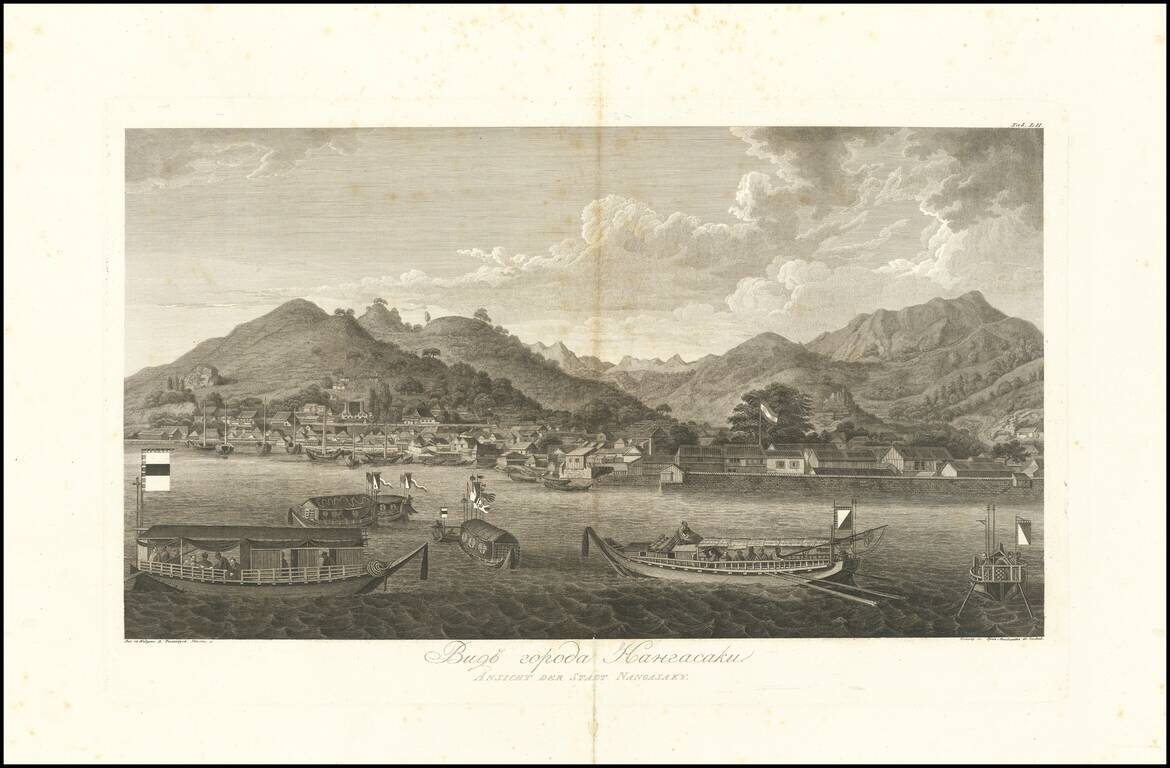
Magnificent View of Nagasaki From the Original Russian Edition of Krusenstern's Important Atlas Fine example of this skillfully-engraved view of Nagaski, based upon drawings taken by Wilhelm Gottlieb Tilesius in 1804-5, which appeared in the atlas to...
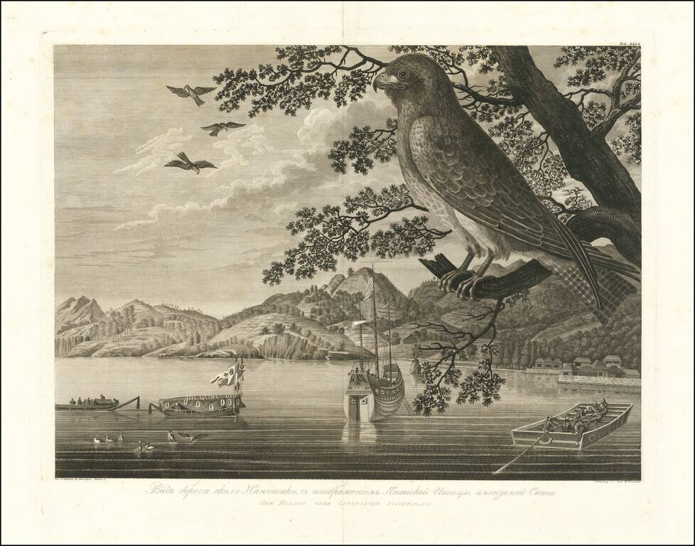
Magnificent View of Nagasaki Coast and an Osprey From the Original Russian Edition of Krusenstern's Important Atlas Fine example of this skillfully-engraved view of Nagaski coastline and an Osprey, based upon drawings taken by Wilhelm Gottlieb...
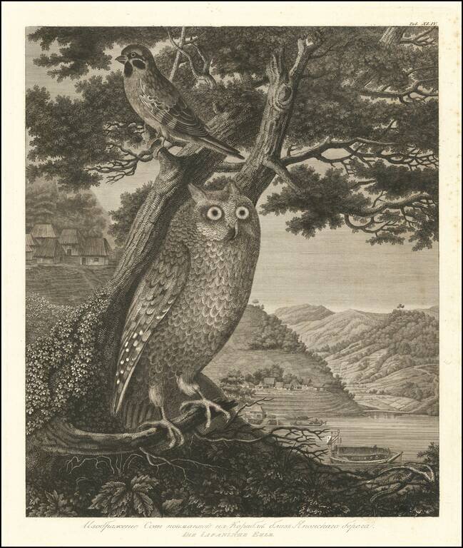
Magnificent Natural History Engraving of an Owl and Sparrow on the Japanese Coast. Fine example of this skillfully-engraved image of an owl and sparrow set against the backdrop of the Japanese coastline. The engraving is based upon drawings taken by...
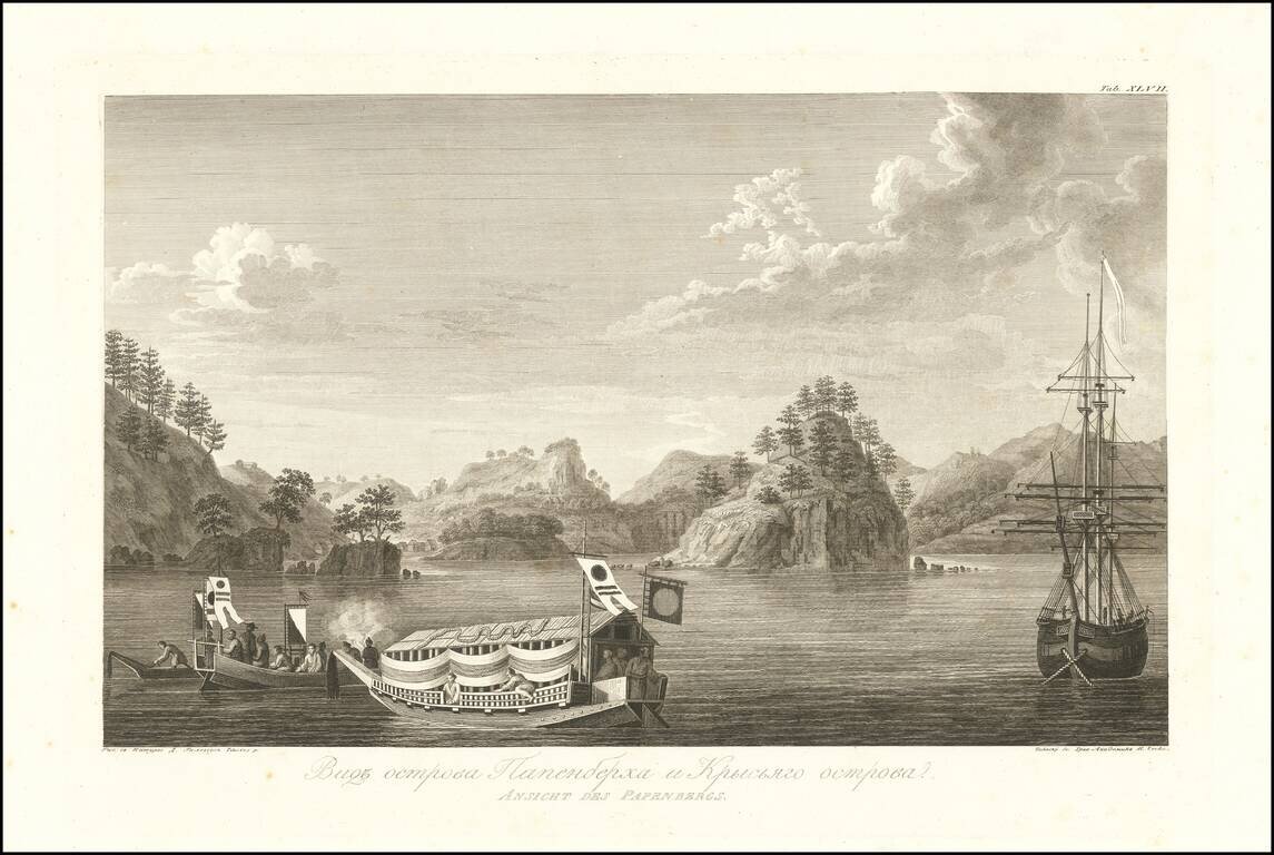
Beautiful View of Papenberg Island and Nearby Coastlines, from the Original Russian Edition of Krusenstern's Important Atlas Fine example of this skillfully-engraved view of Papenberg Island on Russia's Pacific Coast, based upon drawings taken by...
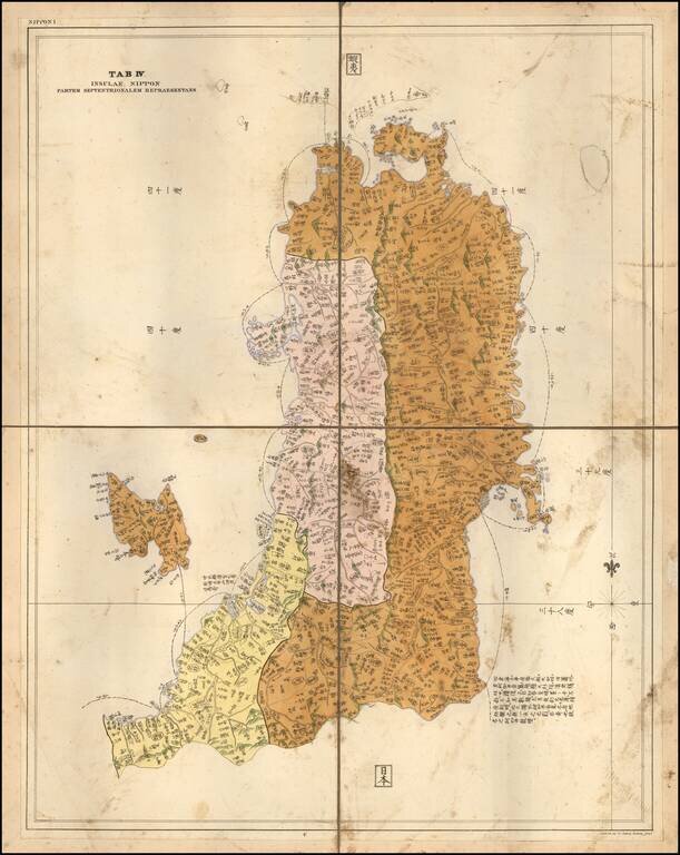
Rare Separately Published Example of the Map of Part of Honshu, by German physician and traveler Philipp Franz von Siebold. Fine map of the most northern part of Honshu, including Fukushima, the island of Sado island. One of the few large scale maps,...
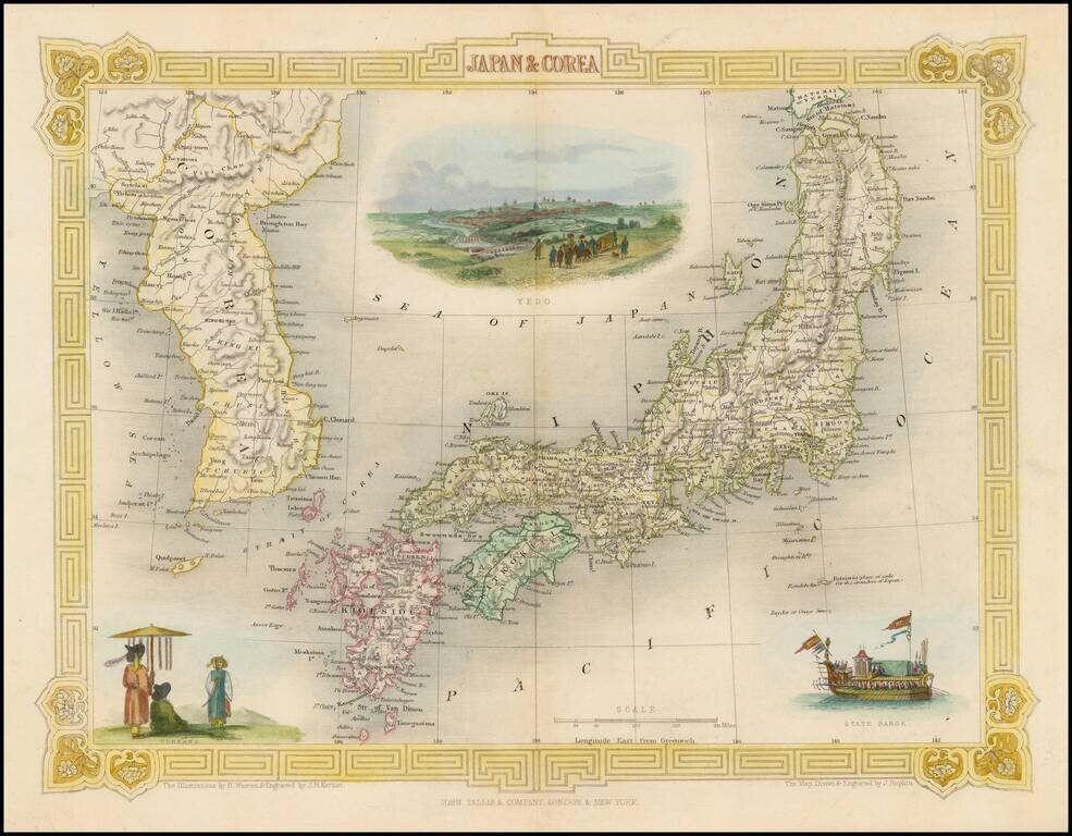
Striking full color map of this decorative map of Japan and Korea, with vignettes of Yedo, a State Barge and Coreans. Engraved for R. Montgomery Martin's Illustrated Atlas. Tallis was one of the last great decorative map makers. His maps are prized...
![(Commodore Perry's Arrival in Edo Bay.) [Foreign Ship | Defence on Land and Sea] [lkokusen | Kairiku okatame]](/map/small/55558.jpg)
Commodore Perry's Fleet Arrives in Edo Bay. A large double-page two-sheet kawaraban with a fold along the left edge. The upper section of this image is a list of the officials responsible for coastal defense. The lower right side shows an American...
![[Concerning the Revised Locations of the Officials Assigned to Coastal Defence] [Kaisei kairiku okatame basho ni tsuki]](/map/small/55559.jpg)
Large double-page two-sheet kawaraban illustrating coastal defense against foreign navies. Published in the wake of Commodore Perry's arrival in Japan. The upper section of the kawaraban lists the officials assigned to coastal defense duty. The...