
![支那全圖 Shina zenzu [Comprehensive Map of China]](/map/small/65521.jpg)
Rare Imperial Japanese Army Map of China Finely executed large map of China and Korea published in Tokyo just before the outbreak of the Sino-Japanese War. The map was issued by the Imperial Japanese Army General Staff Office (Sanbō-honbu). The map...
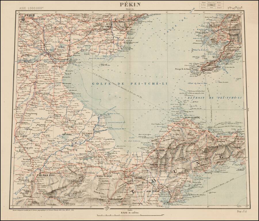
Rare map of the area near Bejing, from a 9 sheet map published by Dessine, for the Geographical Service of the French Army (Service Geographique de l'Armee). The map is discussed at length in the journal of the Eighth Annual Geographical Conference,...
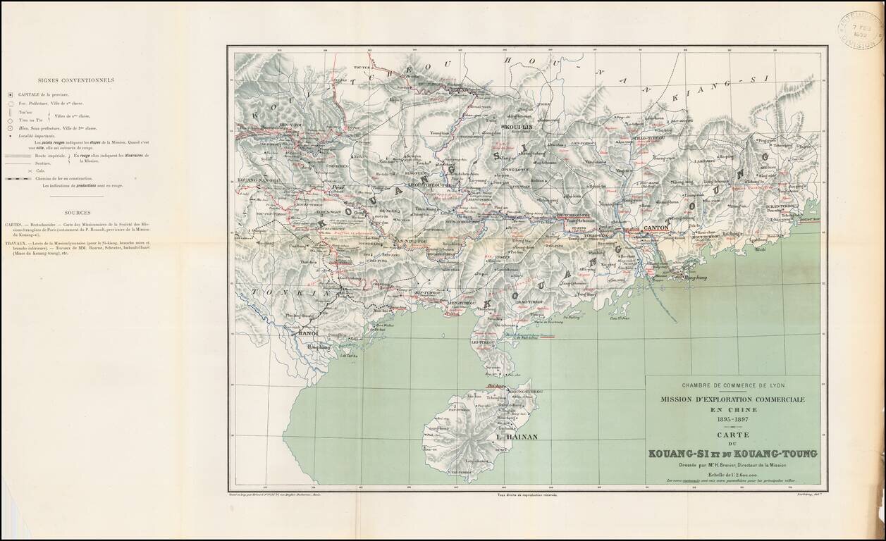
Rare regional map of eastern China, published by the Lyon (France) Chamber of Commerce in connection with its attempts to expand trade with China. The map is one of at least 3 maps in a set prepared by Erhard Freres in Paris, published in conjunction...
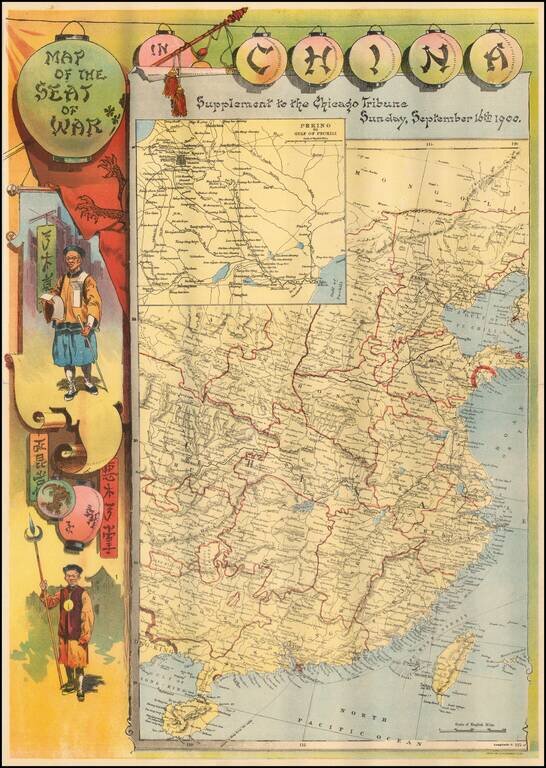
Rare separately published map of the Theater of War in China, published by the Chicago Tribune. The image includes Chinese figures in border to left, and an inset map of Peking region to the Gulf of Pechili, and political map of eastern China. The...
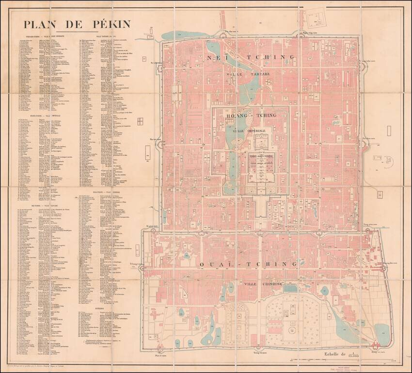
Large French Map of Beijing, Sold by A French Bookseller in Beijing. Lithographed folding map of Beijing published by the French Service Geographique de l'Armee at the beginning of the 20th century. The map includes a massive key with 384 points of...
![[Rare Set of Boxer Rebellion Maps] Boxer-Aufstand in China. Karte der weiteren Umgebungen von Peking und Tientsin von F. von Richthofen . . . [with] Provinz Tschi-Li, Tientstin und Peking mit Umgebung von Dr. O.F. von Mollendorf . . . [and] Nordostli](/map/small/65681.jpg)
Mapping The Boxer Rebellion Rare set of maps illustrating the theater of war during the Boxer Rebellion, issued in Berlin by Dietrich Reimer. Published in the second year of the Boxer Rebellion (1899-1901), the maps would seem to have been published...
![[Map of Western Shangdong Province]](/map/small/60891.jpg)
Boxer Rebellion-Era Map of Shangdong Province. Highly detailed map of part of Shandong Province by the Kartographische Abtheilung der Konigl. Preuss. Landes-Aufnahme. The map was prepared in Germany to highlight German interests in China, as the Boxer...
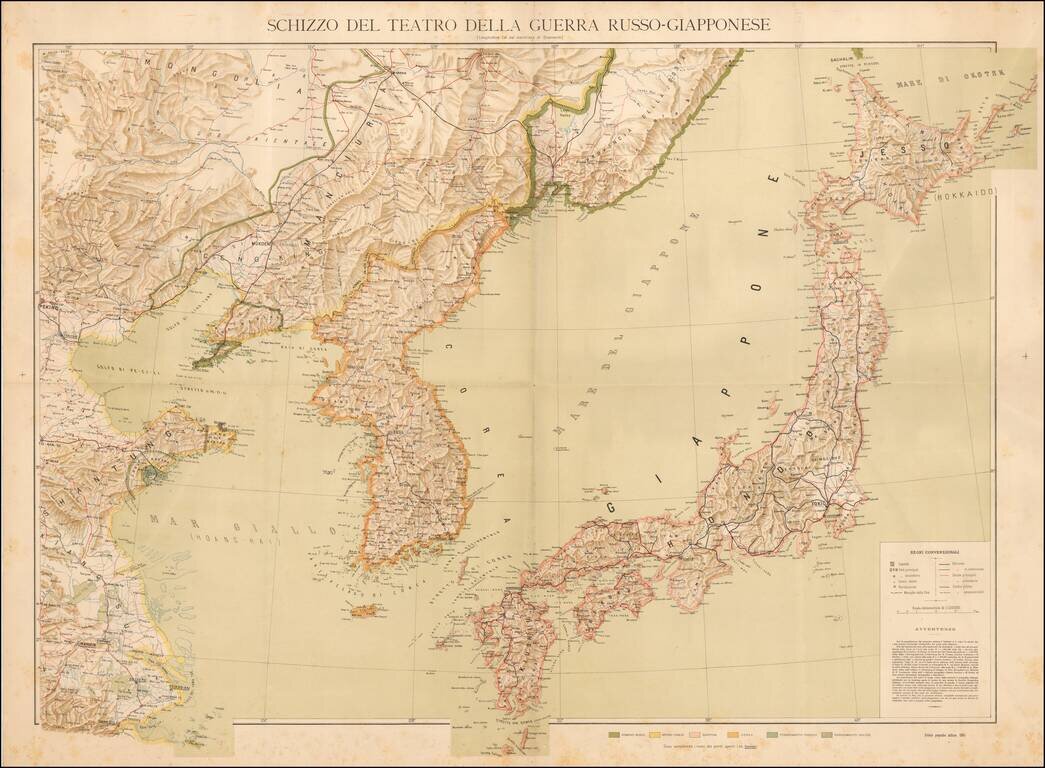
Separately published Italian map of the Theater of the Russo-Japanese War, published in 1904. The map is color coded to show: Russian Domain Imperial Chinese Japan Korea German Possessions English Possessions Additional details include...
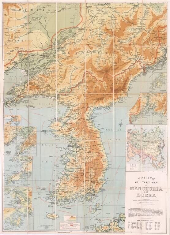
Russo-Japanese War Map of Manchuria and Korea. Detailed color-lithographed folding map of Korea and Manchuria, published in London for coverage fo the Russo-Japanese War. The Russo-Japanese War was fought during 1904–1905 between the Russian Empire...
![[Gansu & Ningxia] Kansu](/map/small/61498.jpg)
Fine regional map of Gansu & Ningxia, from the Atlas of the Chinese Empire; Prepared by Mr. Edward Stanford for the China Inland Mission. The work was published by Morgan & Scott, Ltd., London. Lanchowfu (Lanzhou), the Great Wall of China,...
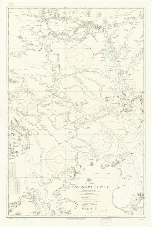
Detailed chart of the Pearl River (Zhujiang) Delta, published by the U.S. Navy Hydrographical Office based on a British Admiralty Chart published in 1909 and here updated to 1930s. The map provides significant detail of the area between Canton...
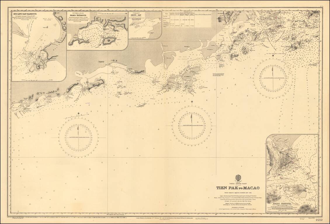
Scarce map of the the region from Macau to the west, published by the Hydrgraphic Office of the British Admiralty. Shows the South China Sea from Dianbai to Macau, centered on Hailing Island (then St. John Island). Includes insets of Macau Harbor,...
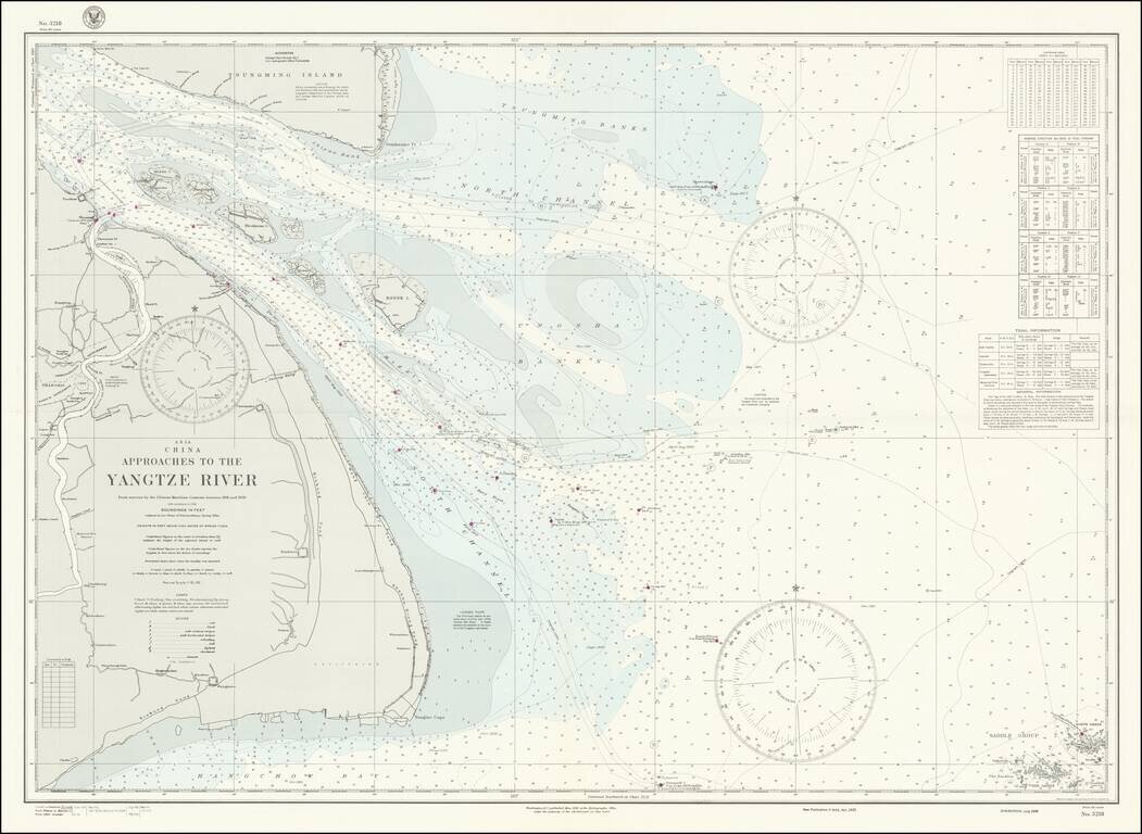
World War II-era hydrographical chart of the entrance to the Yangtze River and the Shanghai Region. Shanghai is shown at the left of the map, with details such as the railroads and their stations, the International Settlements, and local hamlets and...
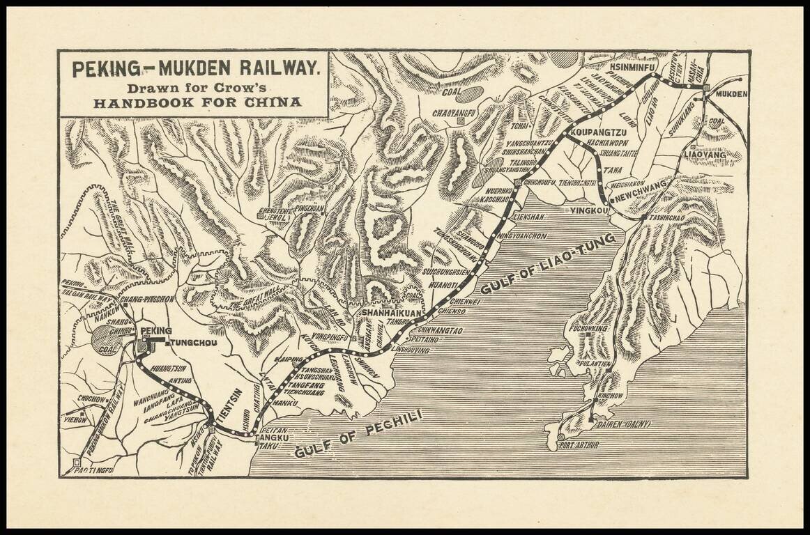
Small map covering northeastern China from Beijing to Shenyang (Mukden), covering the extent of the Peking-Mukden Railway. The so-called Jingha Railway first reached Mukden in 1912. The route was known as the Peking-Mukden Railway from 1907 to 1928,...
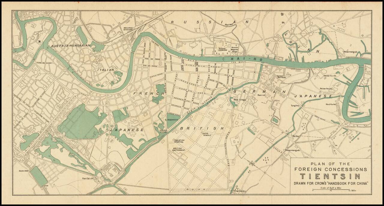
Attractive color-printed plan of the foreign concession area of Shanghai, published for Carl Crow's handbook on China in the early 1920s. As the map shows the Austria-Hungarian section, it probably predates the end of World War I and the fall of the...
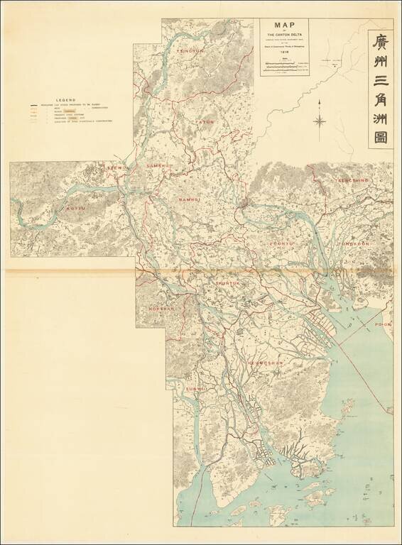
Controlling the Rivers Feeding the Canton Delta and Zhujiang Estuary Large detailed bilingual wall map tracking the course of the Canton Delta, and the Xi River and Bei River, Zhujiang River and Estuary and the area around Guangzhou and Foshan. The...