
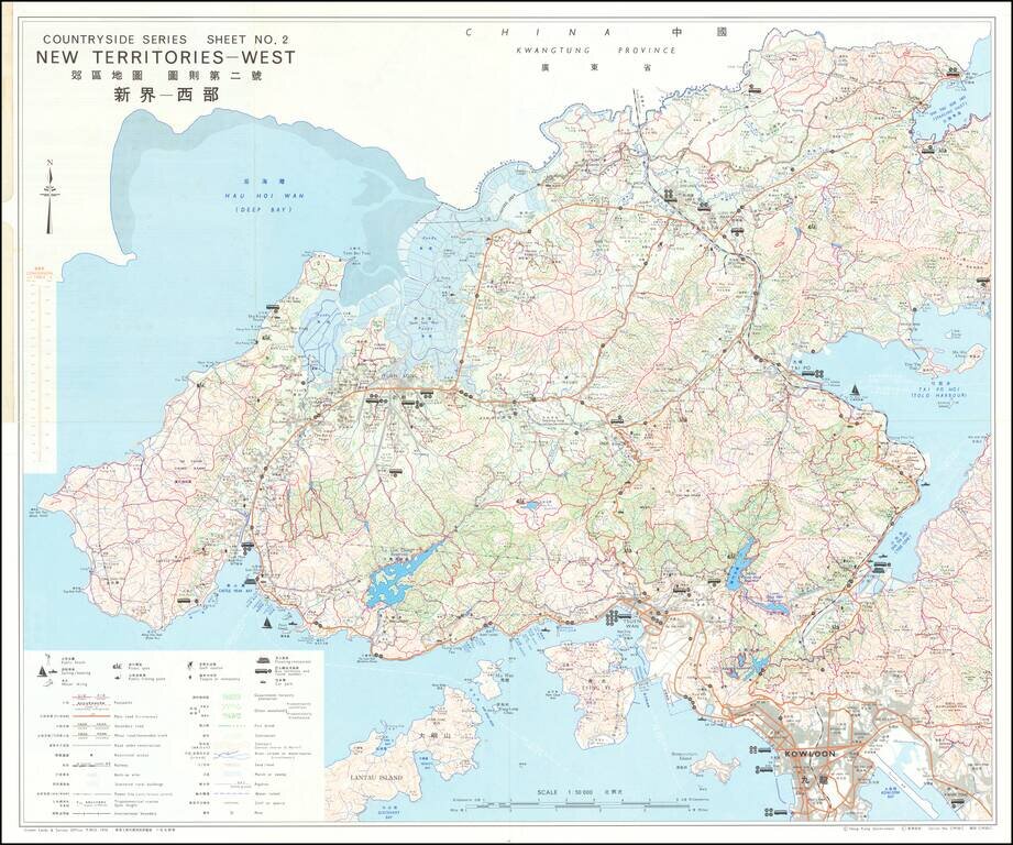
Detailed bi-lingual folding map of Hong Kong New Territories showing Kowloon, etc. The map uses small illustrations to show Bathing Beaches, Park or Sports Ground, Picnic Spots, Public Gardens, Horse Racing, Pleasure Boating, Golf Courses, etc.
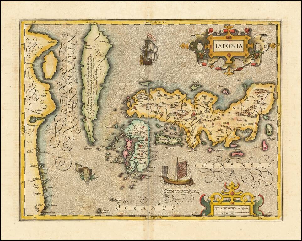
One of the Earliest Obtainable Maps of Japan and Korea The Metellus map of Japan and Korea is the earliest obtainable printed map of the region, after the Teixeira / Ortelius map. The landmark Ortelius prototype was derived from the Portuguese...
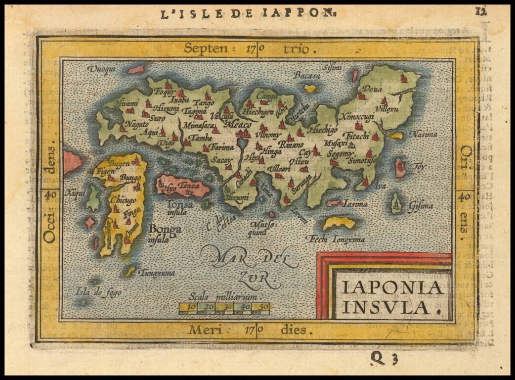
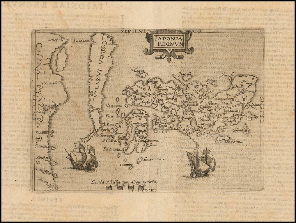
Nice full color example of Ortelius' miniature map of Japan, from the first edition of Ortelius Epitome published by Giovanni Battista Vrients. One of the earliest obtainable separate maps of Japan. J.B. Vrients purchased the rights and plates for...
Fine full example of Hondius' map of Japan & Korea. One of the finest early Dutch maps of the region, first published in 1606 as one of the 37 new maps engraved for Jodocus Hondius' expanded Dutch edition of the Mercator Atlas. The map is based...
![Iaponiae Nova Descriptio [Korea as an island]](/map/small/56910.jpg)
Jansson’s Early Map of Japan, Showing Korea as an Island Fine example of one of the earliest European atlas maps of Japan, which also shows Korea as an island. The Jansson Japan is a delicate and skilled reworking of the Mercator-Hondius atlas map...
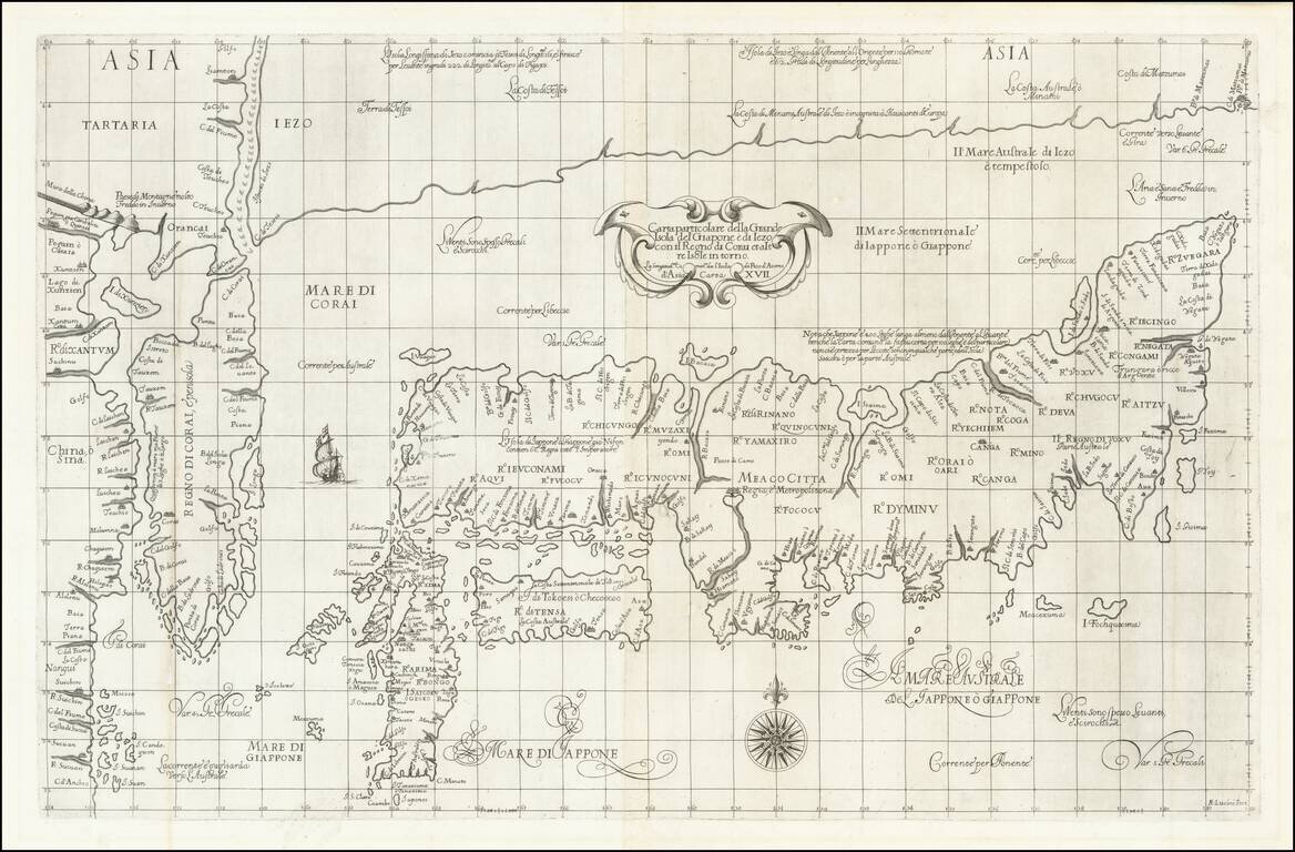
The Map of Japan Based Upon The Jesuit Maps of Inacio Moreira and Christopher Blancus Fine example of the first state of Robert Dudley's rare map of Japan, first published in 1646. This is one of the two maps of Japan created by Dudley for his Dell'...
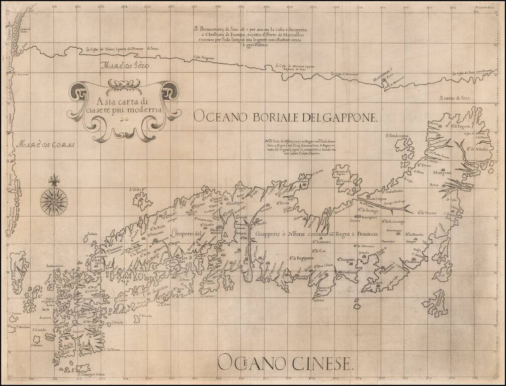
Robert Dudley's Monumental Map of Japan and Korea. The Most Important Map of the "Sea of Korea." Fine example of the first state of Robert Dudley's rare map of Japan and Korea, first published in 1646. This is the larger of two maps of Japan created...
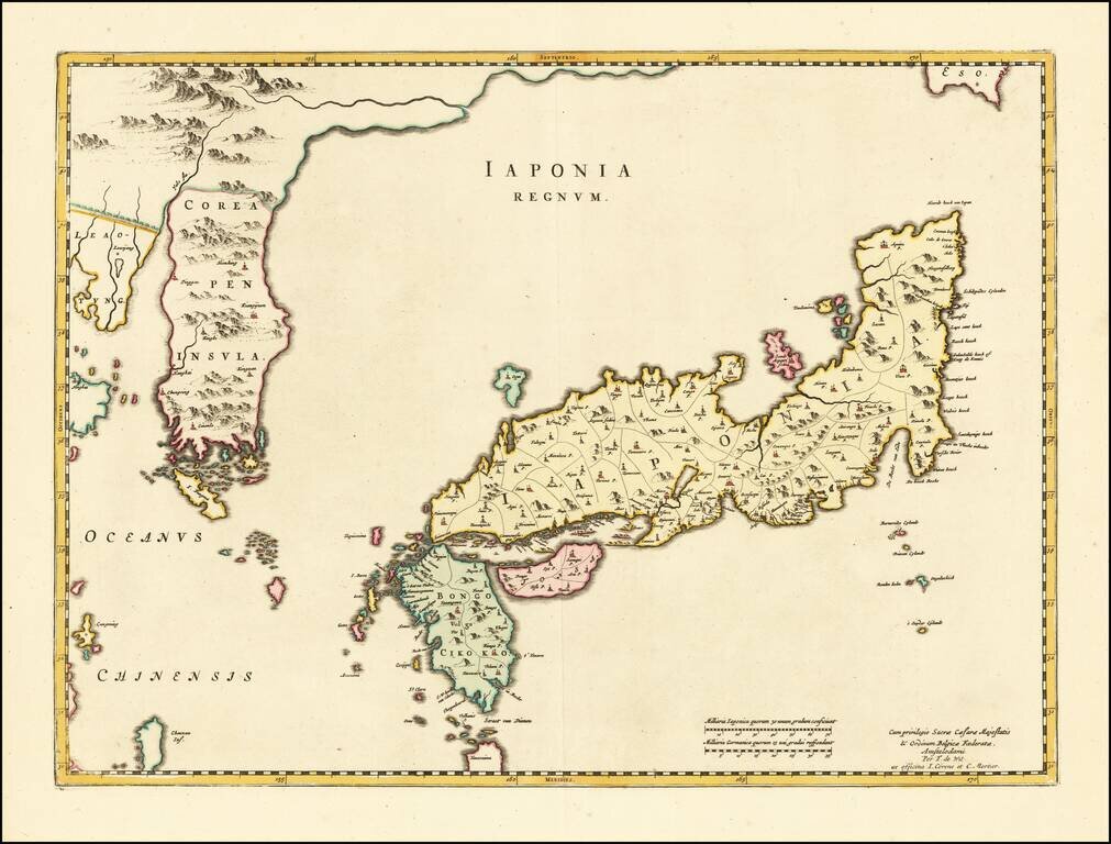
Striking Blaeu Map of Japan, Showing Korea as a Peninsula Fine, old-color example of Joan Blaeu's map of Japan and Korea from his renowned Atlas Sinensis. While titled as a map of Japan, perhaps the single most noteworthy feature of this map is that...
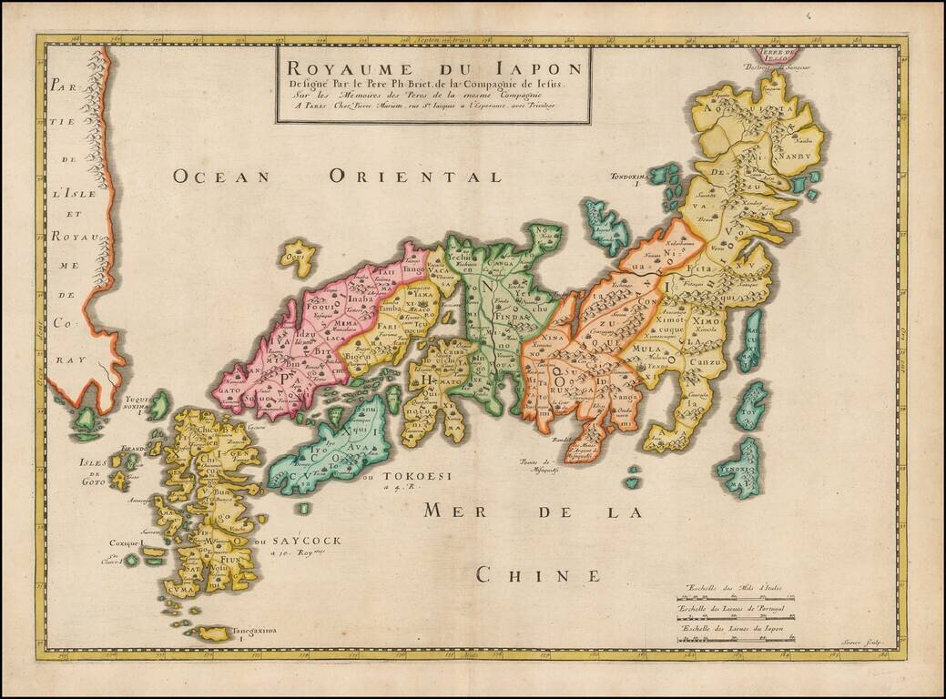
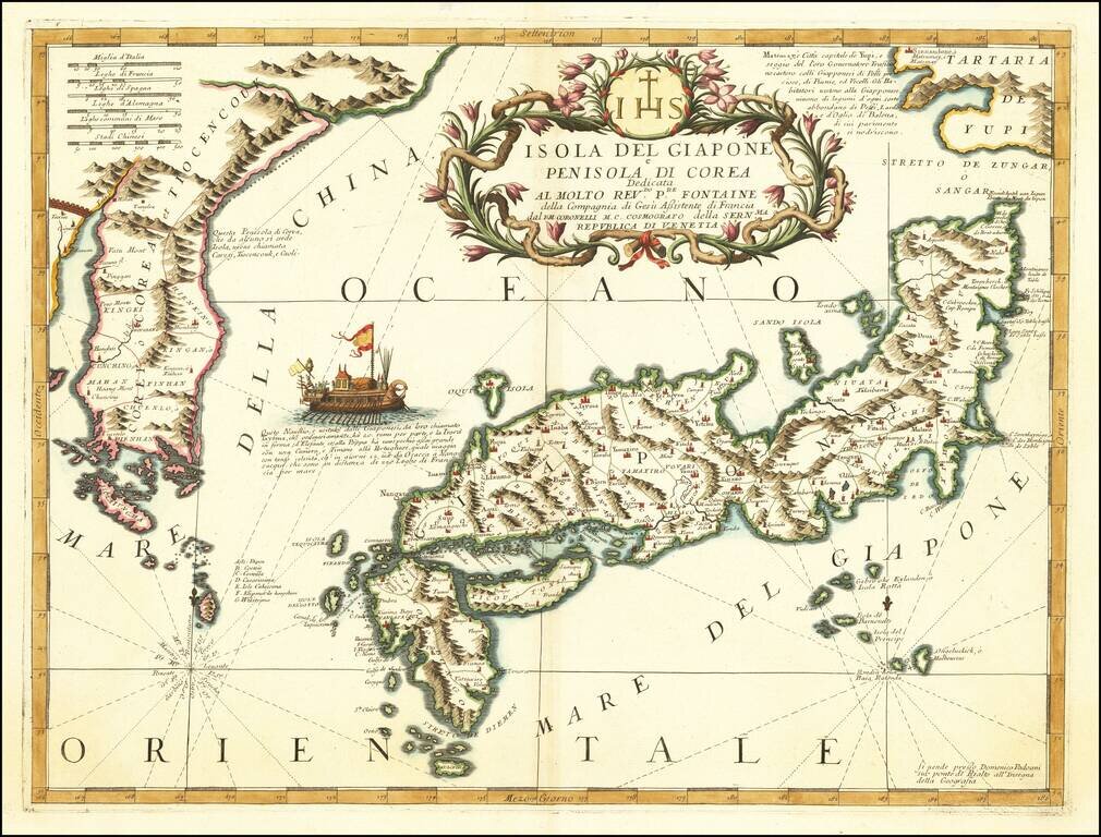
Striking early map of Japan and Korea. Briet's map follows the Blancus/Moreira model, and looks very similar to the Christophoros Blancus unpublished map of 1617. The map shows a well-shaped Japan with named provinces, and major cities including Tokyo...
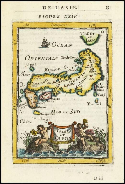
Decorative miniature map of Japan, from the first edition of Mallet's monumental work. Includes decorative cartouche, sailing ships and an early interesting projection of Japan.
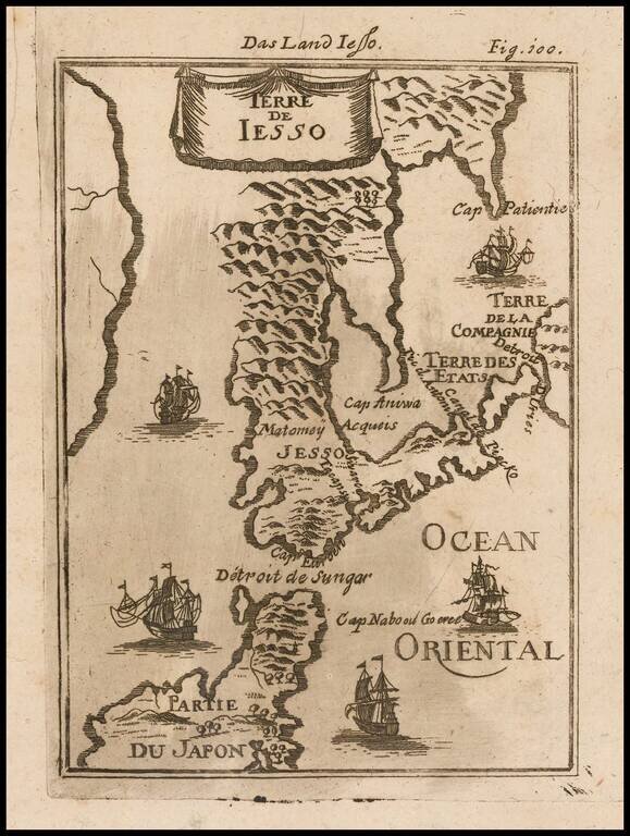
Decorative miniature map of the Land of Eso (Hokkaido) and the north part of Japan, from the first German edition of Mallet's monumental work. Includes sailing ships.
Rare early map of Japan and Korea, which includes some fascinating mythical information. Hokkaido is shown as being connected to Korea. Nice example of this scarce map.
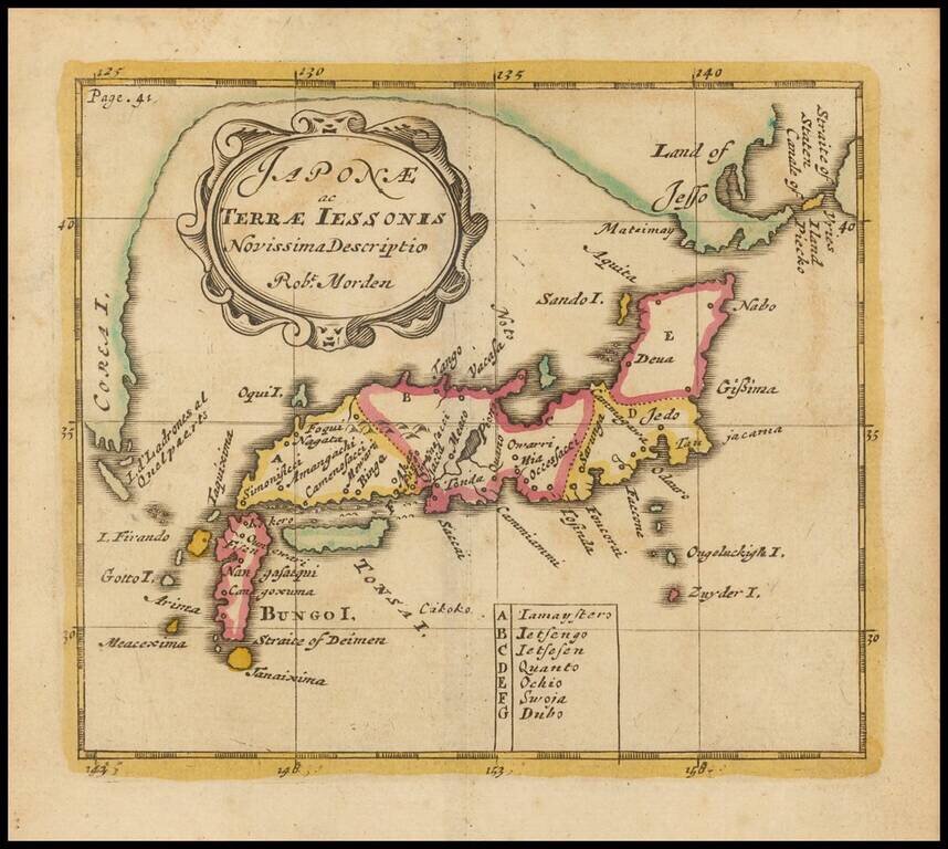
Nice example of Coronelli's important map of Japan and Korea, published in Venice. Ezo named 'Tartari de Yupi'. In the sea between Japan and Korea is a vignette of a boat described as a Japanese vessel capable of crossing the 220 French miles between...
![[Japan and Island of Korea] William Adams Reystogt na Oost-Indien; Avontuurlyle door de Straat Magellaan in't Keyzerryk van Iapan Voleyndigd](/map/small/69763.jpg)
Fine example of this decorative map of Japan and Corai Insula (Korea). The map was used to illustrate the Dutch translations of the account of the voyage of William Adams to Japan in 1600. The cartouche depicts Adams' reception at the Court of the...
![Les Isles Philippines Molucques et de La Sonde [Japan inset]](/map/small/51609.jpg)
Detailed map of part of Southeast Asia and the Philippines, with a large inset of Japan.
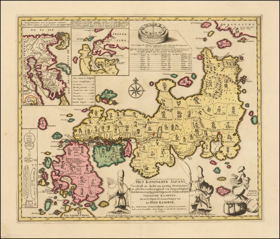
Fine old color example of Kaempfer's scarce map of Japan, which appeared in the 1729 Dutch edition of Kaempfer's History of Japan. The map was prepared by Johann Caspar Scheuchzer from the maps brought back from Japan by Kaempfer. The decorative...