Map size in jpg-format: 9.36625MiB
Click to open in high resolution (open in new tab).
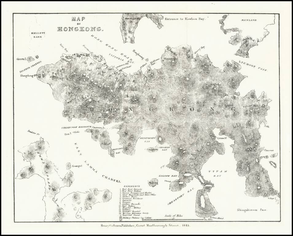
Very early lithographed map focusing specifically on Hong Kong, published in London in 1845.
The map is one of the earliest obtainable mappings of Hong Kong after it was ceded to Great Britain in the Treaty of Nanking in 1842. The map derives in large part from Belcher's famous 1841 survey.
The map provides a very early look at Hong Kong, with emphasis on its topographical features. Only a few buildings are shown in Victoria. The map includes a key locating 18 strategic points of interest, including:
This is one of the earliest separate maps of Hong Kong obtainable to a collector.
If you are a student, write to us in telegram: @antiquemaps and indicate what material you need and for what work you need a map in high detail. We are ready to provide material on special terms. For students only!

![[ Hong Kong / Macao / Canton ] Iunnan, Queicheu, Quangsi et Quantun, Provinciae Regni Sinensi Praefecturae dictae](/map/small/55800.jpg)