
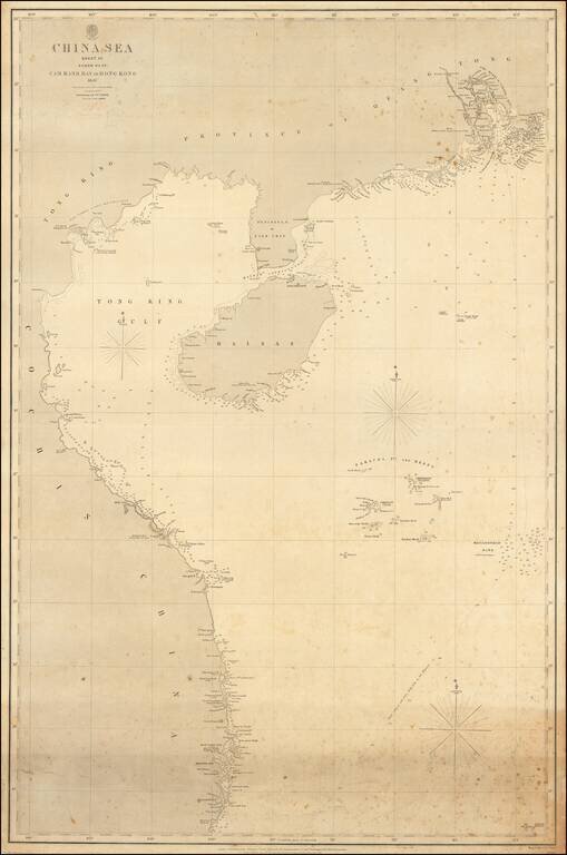
The authoritative sea chart of the southwestern coasts of China and northern Vietnam showing the main shipping route into Hong Kong during the era of the Second Opium War. This important work was part of a series of charts of the South China Sea first...
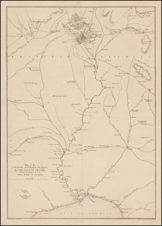
Detailed map of the area around Beijing, showing roads, rivers, towns, etc. 'The Weekly Dispatch' newspaper between the years 1856 and 1862 included in each edition a map of a part of the world. During this period a total of 118 maps were issued. The...
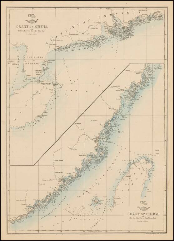
Fine pair of charts of the Chinese coast on one sheet. 'The Weekly Dispatch' newspaper between the years 1856 and 1862 included in each edition a map of a part of the world. During this period a total of 118 maps were issued. The maps bear the...
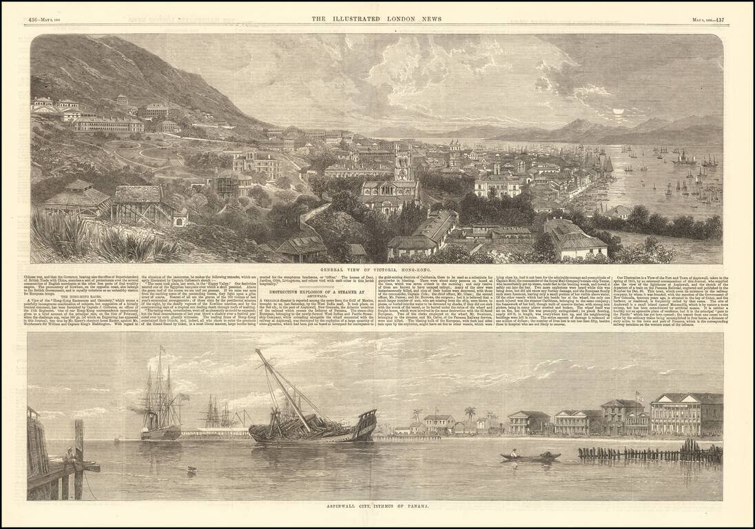
Fine early view of Victoria, Hong Kong, published by the Illustrated London News. The short article below notes that the view illustrates the Race Course and Cemetary, based upon an image furnished by Captain J. Colborne, an officer of the 11th...
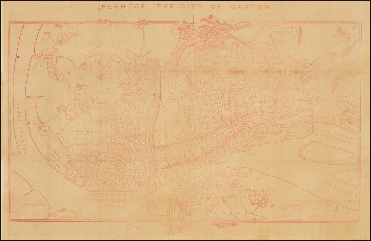
Rare Early Copy of Daniel Vrooman's Monumental Manuscript Map of Canton, China. Interesting early plan of Canton, based upon Daniel Vrooman's manuscript map of Canton. Vrooman's manuscript plan offered a little-seen view of Canton on the eve of the...
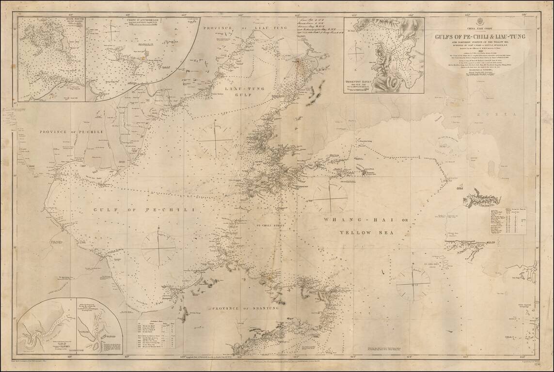
Detailed sea chart of the Coast of Northerneastern China and part of Korea, published by the British Admiralty. The map extends from the Shantung Province and Pechili Province in the west, including the river extending from Tianjin to Beijing in the...
![(China) Карта Чжилійской Губерніи No. 1 [Map of the Zhili Province No. 1]](/map/small/58914.jpg)
Russia Explores the Possibility of Invading China. Fascinating Russian-language lithographed map of Zhili Province (the home of Beijing), with inset maps of Beijing, Tongzhou, Kalanga, and Tianjin. The map was produced in 1871, when there was a very...
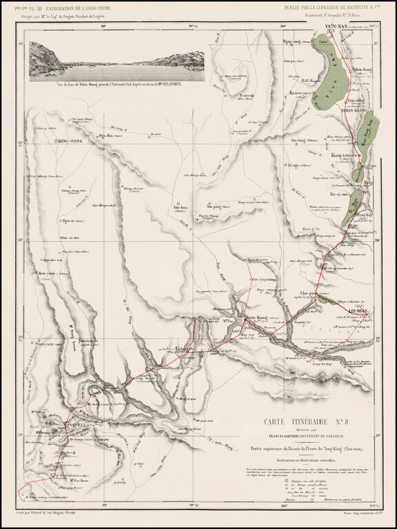
Detailed map of the route from Yun-nan to Poi Eul and southward, from l'Exploration de l'Indo-Chine, dirigée par Doudart de Lagrée. Highly detailed route map, with vignette of Tchin-Kiang.
![[Shanghai, Hangzhou, Ningbo, Suzhou] Carte du Tche-kiang dressee ar les Missionaires sous la direction de Mgr Guierry de la Congregation de St. Lazare Vicaire Apostque du Tach-Kiang](/map/small/64426.jpg)
Rare Missionary map of China, showing the region from Shanghai in the north to Ningde. The map illustrates the province of Tche-kiang. As noted by the text which accompanied the map, it was drawn up by the missionaries working in province, under the...
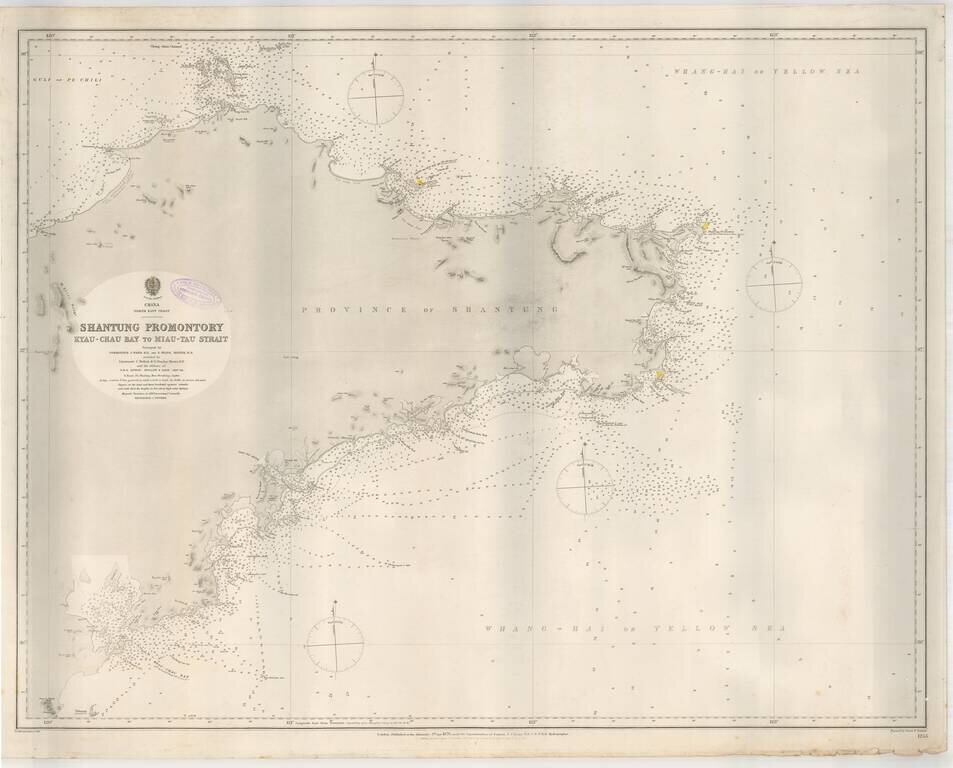
Highly detailed sea chart of the Shantung (Shandong) Province, published by the British Admiralty. The chart provides a highly detailed treatment of the region, from Kyau-Chau Bay (Jiaozhuo Bay) and the Qingdao area to Miaodoa Strait in the North and...
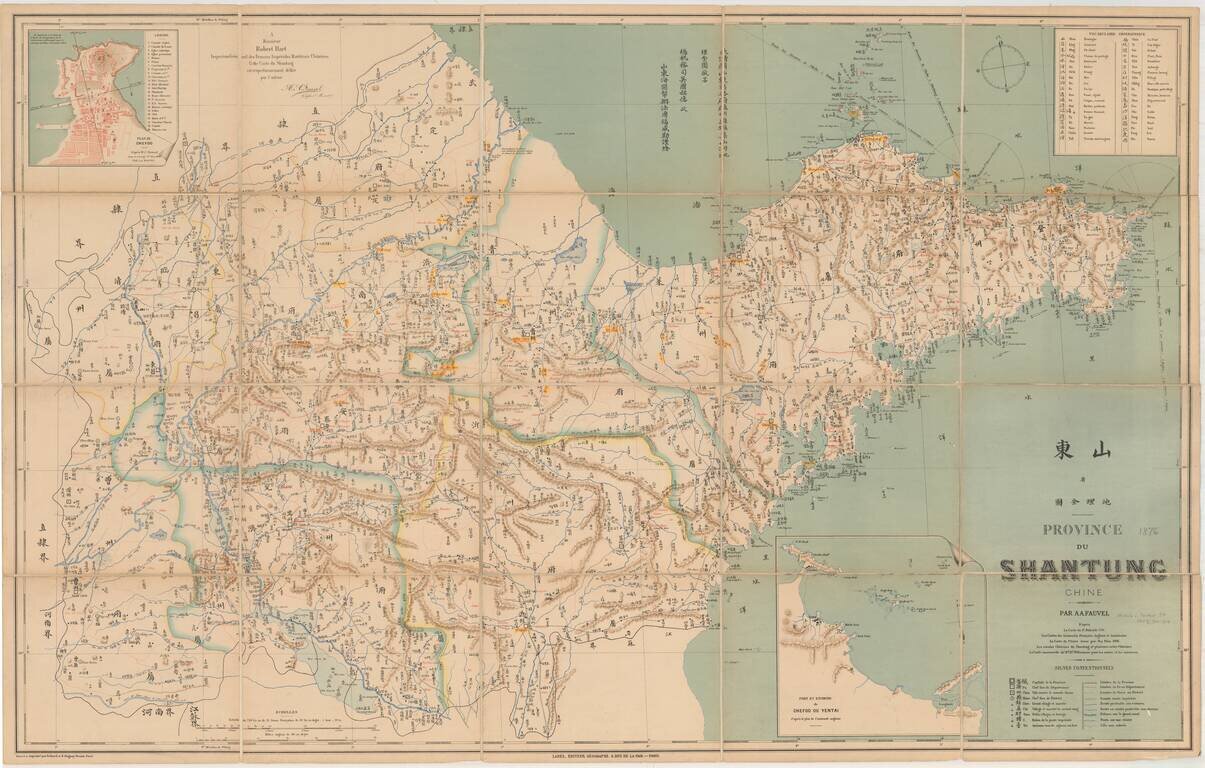
Detailed map of the Shandong Province, printed in Chinese and French. The map shows rivers and mountains and natural resources, and includes a Geographical Vocabulary table at the top left, showing Chinese symbols and translations and a table at the...
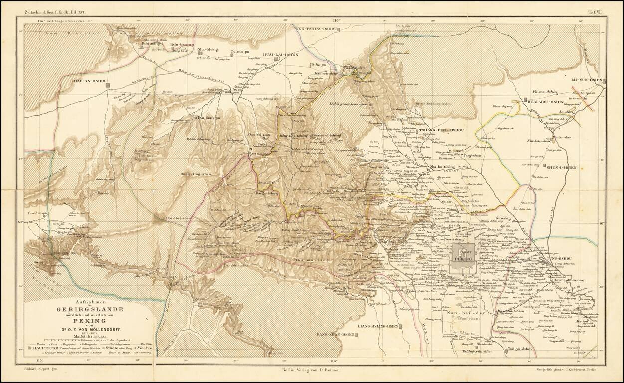
Fine map illustrating the area north and west of Beijing, as explored by Dr. O.F. von Mollendorff. Paul Georg von Mollendorff Paul Georg von Möllendorff (1847 – 1901) was a German linguist and diplomat. Möllendorff is mostly known for his service...
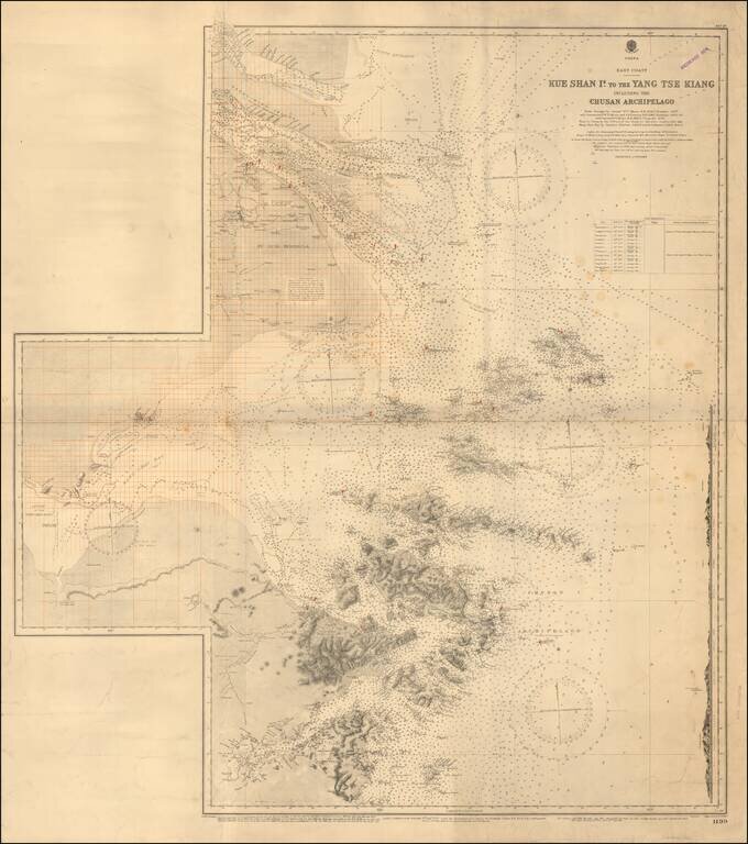
Redlined For Contemporary Use Detailed sea chart of the mouth of the Yangtze River in the north to the Zhousan Island, published by the British Admiralty. The chart includes thousands of soundings, islands, sailing directions and lighthouses,...
Detailed British Admiralty sea chart of China, extending from Hong Kong and the Lena Islands in the south to Hie Che Chin Bay in the north. Victoria is named on Hong Kong. The map includes extensive soundings and other sailing information. Includes...
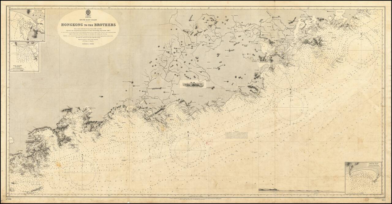
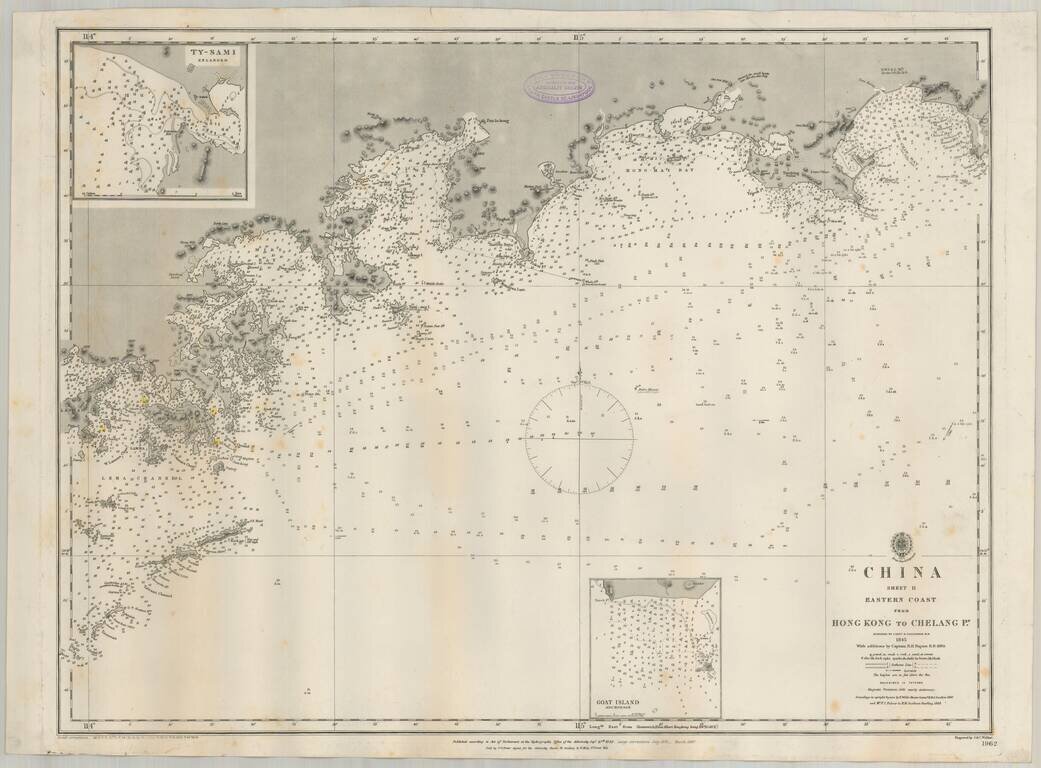
19th Century British Navigational Chart Scarce early sea chart of the coast of China, from Hong Kong and Lantao to Nan'ao Island and Dongshan. Engraved chart, including tidal information, compass roses, soundings, seabed notations, currents,...
![[China] 古今地舆全圖 / Full Modern and Ancient Map](/map/small/62437kb.jpg)
A Rare and Important Discovery -- The First Map of China Published For Commercial Use and Sale Mingjie Liu's (刘明杰) (1857 - 1911) important 1892 (Guangxu 18) Qing Era xylographic (woodcut) map of China is the earliest known example of what is...