
![[China Sea / Luzon / Hong Kong / Canton / Formosa] Bogt Toncqin](/map/small/64690.jpg)
Manuscript Sea Chart of the Coasts of China, Luzon and Vietnam Drawn by the Chief Mapmaker of the Dutch East India Company in Batavia (Jakarta) Striking and unique survival in the hand of Gerrit de Haan, the chief mapmaker of the Dutch East India...
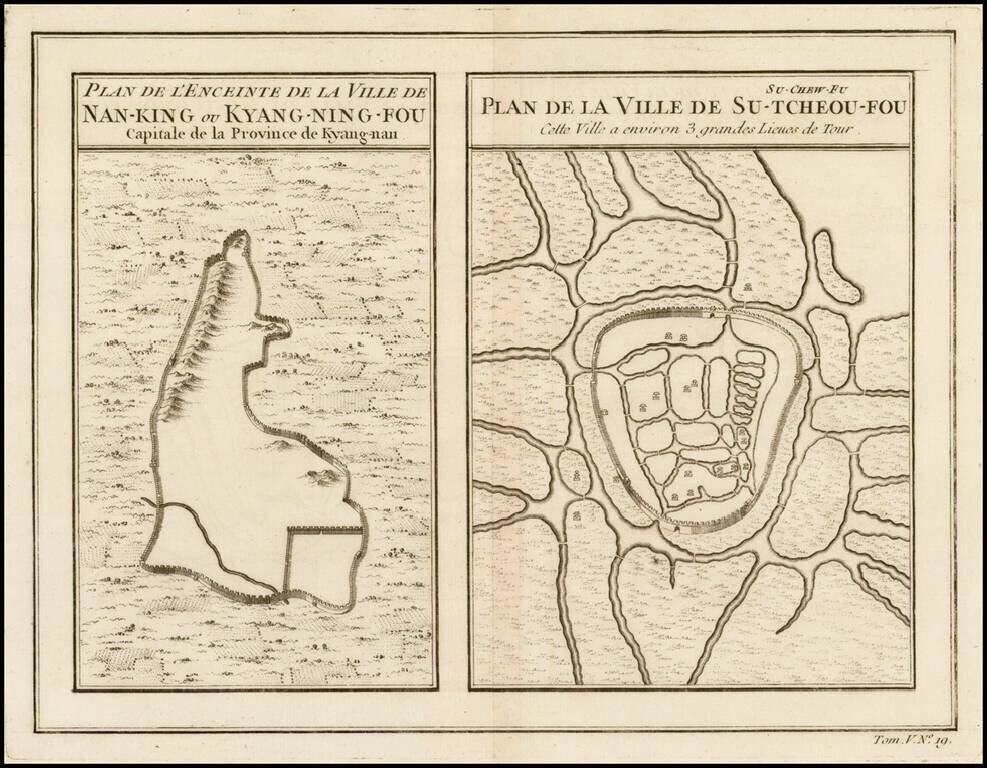
Two maps on a single sheet, depicting major Chinese cities. The plan on the left shows Nanking and its fortifications. The plan on the right shows Su-Tcheou-Fou or Su-Chew-Fu.
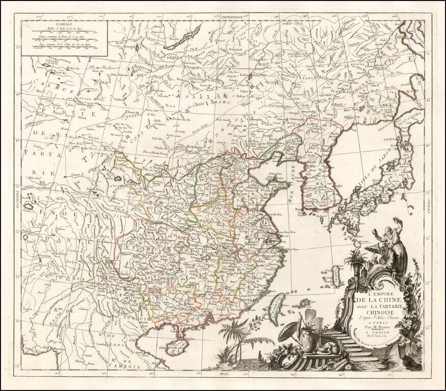
Detailed map of China, Korea and the Islands of Japan, showing the Provinces, towns, mountains, rivers, lakes, islands, published in Paris by Jean Lattre. The map is drawn from D'Anville's atlas of China, the first modern atlas of China and a work...
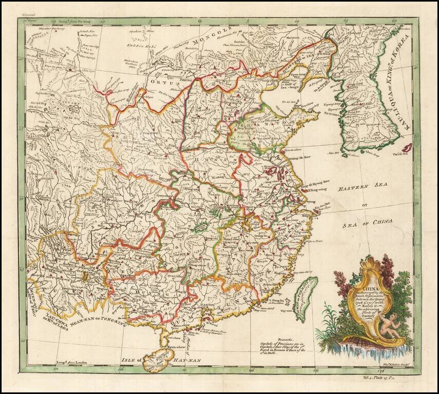
Based on a Jesuit Map of China Finely executed map of China and Korea, originally drawn from Jesuit Sources. The Qing Emperor Kangxi commissioned a ground of Jesuit surveyors to map China from 1708 to 1716. The resulting maps were published as the...
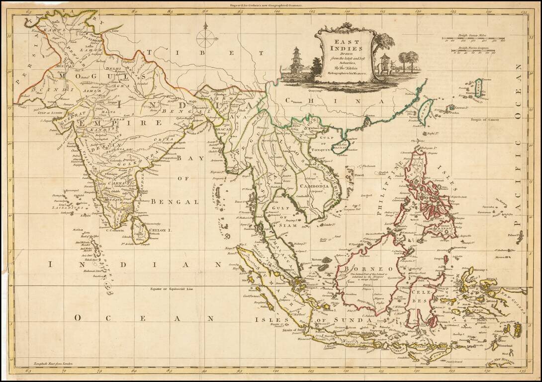
Decorative map of China, Korea, Southeast Asia, the Philippines, and India, published in Guthrie's New Geographical Grammar.
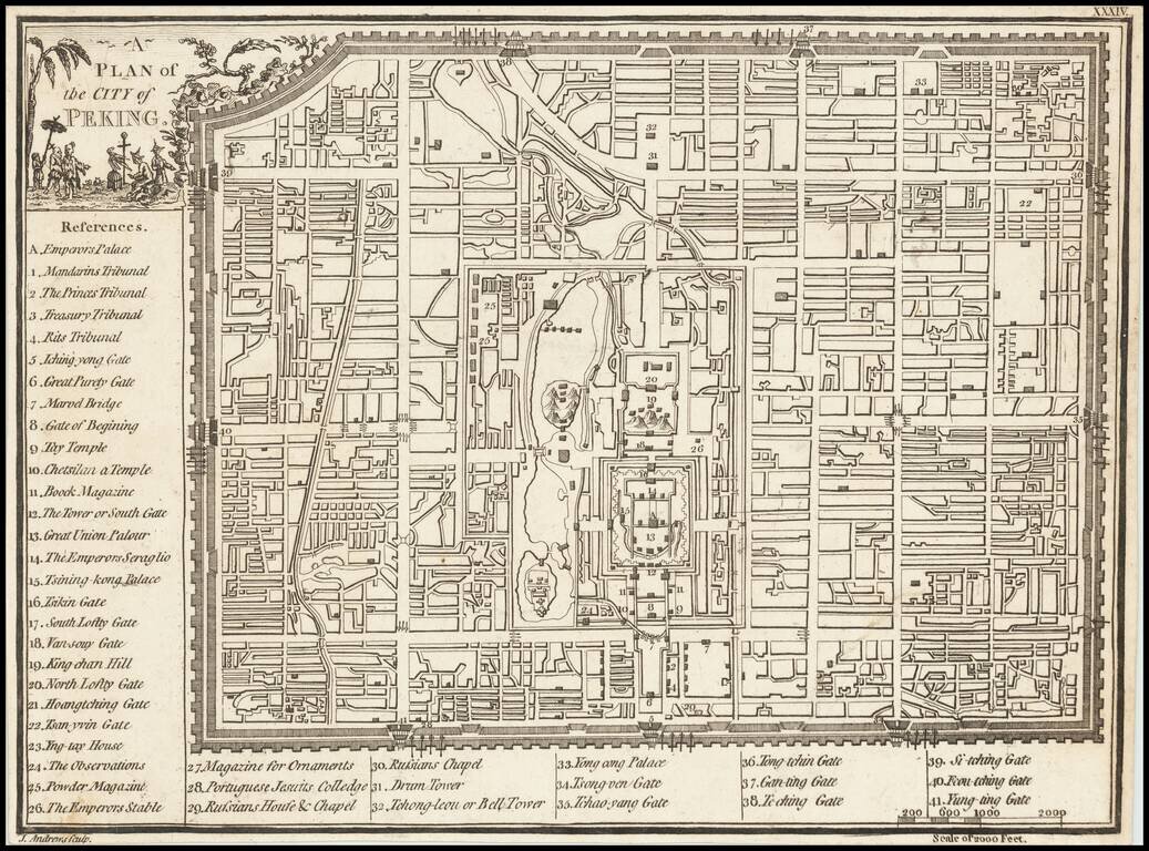
Scarce plan of the City of Beijing, published in London by John Andrews.
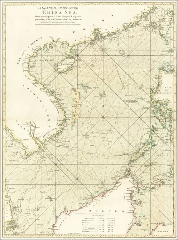
Stunning Original Hand-Color. Rare English sea chart of the South China Sea, published in London by Robert Sayer for an early edition of his The Oriental pilot, or, A select collection of charts and plans ... for the navigation of the country trade in...
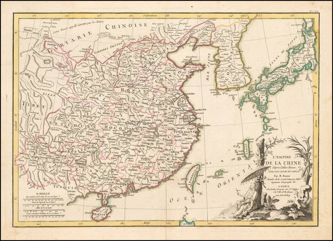
Fine large format map of China, based in part on information derived from Bonne's Atlas of China. The map shows all of China, with outline color for the provinces, and a decorative thematic cartouche.
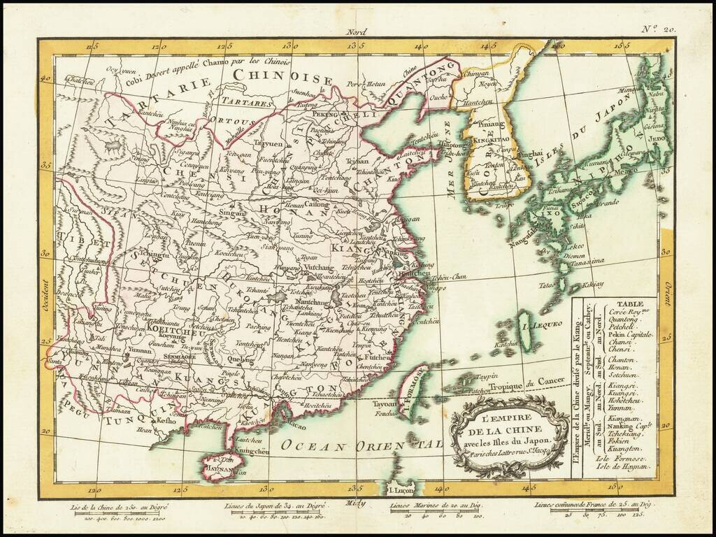
Detailed map of China, Korea and the Islands of Japan, showing the Provinces, towns, mountains, rivers, lakes, islands, published in Paris by Jean Lattre. The map is drawn from D'Anville's atlas of China, the first modern atlas of China and a work...
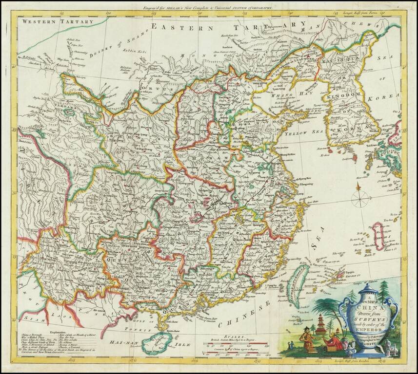
Attractive engraved map of China, produced by Thomas Kitchin for George Henry Millar's New Complete & Universal System of Geography. The map was published in London circa 1782. The cartouche is particularly attractive on this map, featuring a...
![La Tartaria Chinese . . . 1784 [show Corea]](/map/small/44378.jpg)
Decorative map, showing the region from Korea and Tartary to Northern China. Corea is spelled with a "C." Decorative cartouche. The map was issued in Zatta's Atlante Novissimo, a monumental 4 volume work and one of the last great decorative atlases.
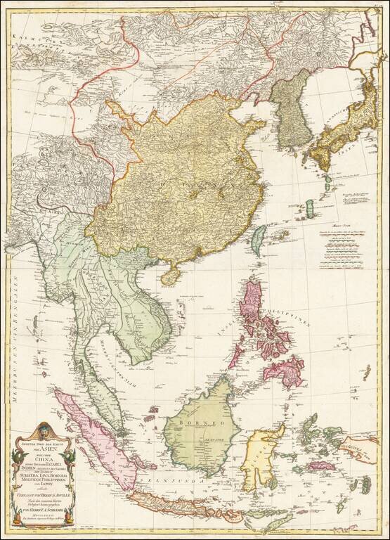
Detailed map of East Asia, extending from China and Korea to Java, published in Vienna in 1786. The map is centered on the Philippine Islands and provides a nice detailed overview of the region.
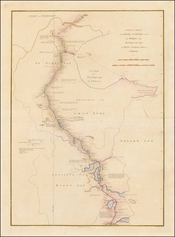
Detailed map showing the route taken from Zhe-Hol in Tartary to Beijing and then on to Hang-Tchoo Foo, from Staunton's An Authentic Account of an Embassy from the King of Great Britain to the Emperor of China. The map details George Macartney's...
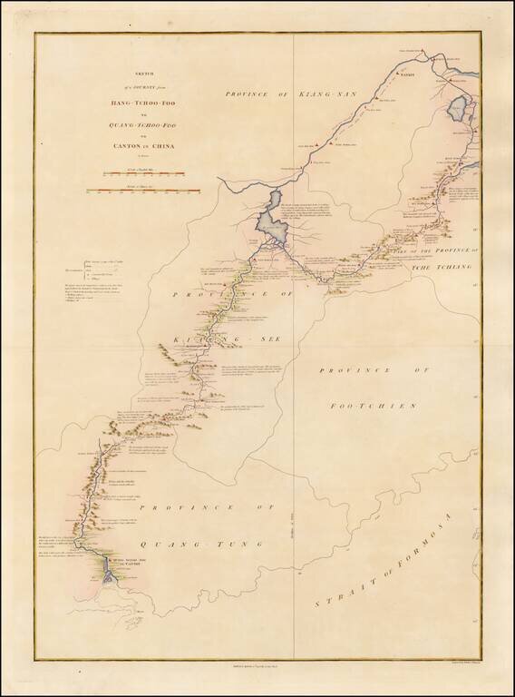
Detailed map showing the route taken from Hang-Tchoo Foo to Quang-Tchoo-Foo (Canton), from Staunton's An Authentic Account of an Embassy from the King of Great Britain to the Emperor of China. The map details Geroge Macartney's Embassy to China, the...
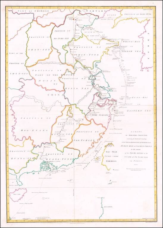
Detailed chart of the coast of China from Staunton's An Authentic Account of an Embassy from the King of Great Britain to the Emperor of China, showing the tracks of the vessels carrying the Earl of Macartney's Embassy along the coast of China with a...
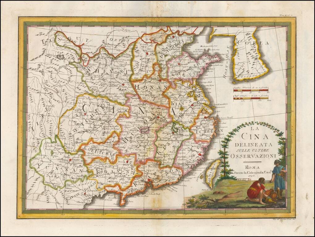
Nice example of Giovanni Maria Cassini's decorative map of China and Korea. The map includes a fine decorative vignette, being one of the last great decorative maps of the region.