
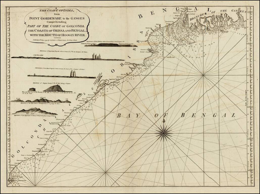
Detailed sea chart of the coast of India, from the mouths of the Ganges Rivers in the northeast to Point Gordeware in the south west. Includes numerous sailing channels and soundings, along with smaller islands and several profile views. One of the...
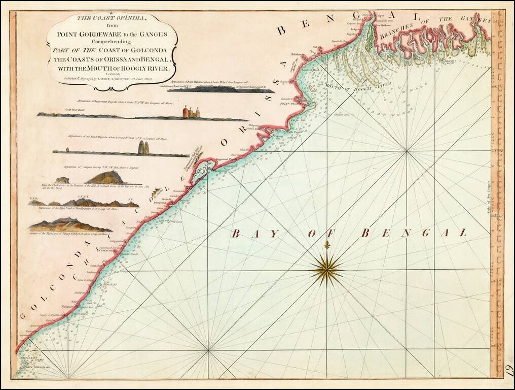
Detailed sea chart of the coast of India, from the mouths of the Ganges Rivers in the northeast to Point Gordeware in the south west. Includes numerous sailing channels and soundings, along with smaller islands and several profile views. One of the...
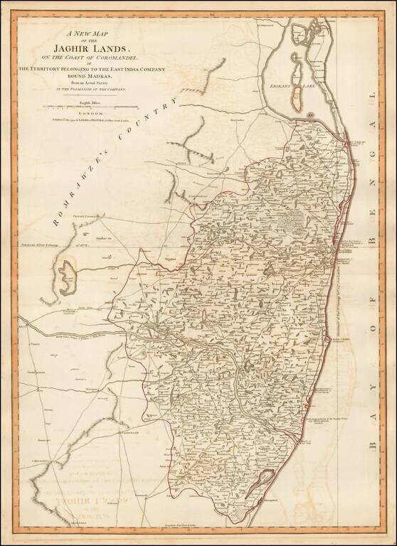
Detailed map of the coastal region of India centered on Madras and Fort St. George (Chennai), extending north to Erikans Lake (Pulicat Lake) and south to Cheeyer Tank and Allumparva (Cheyyur), one of a series of maps of India prepared by James Rennell...
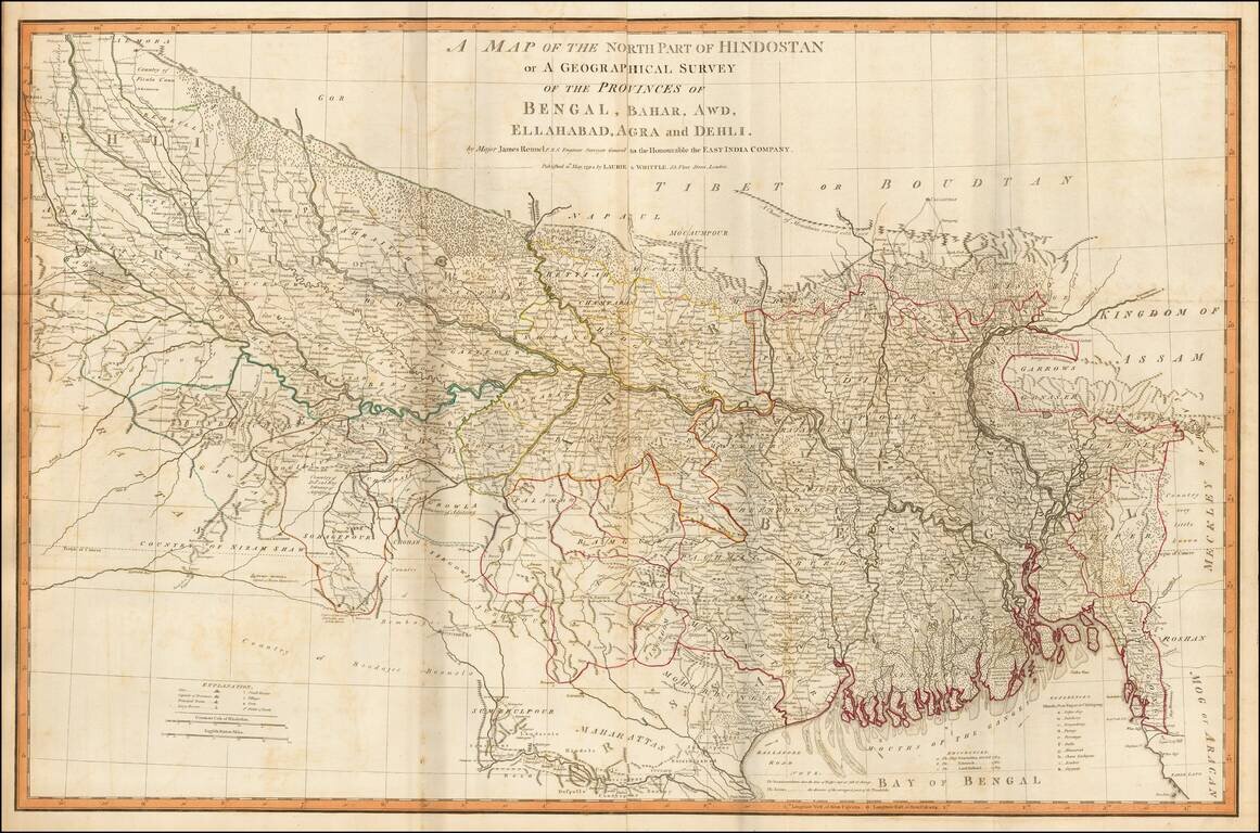
Fine example of James Rennell's highly detailed map of northern India, based upon his survey work while Surveyor General of the East Indian Company. The map is exceptionally detailed and includes roads, towns, mountains, rivers and a host of other...
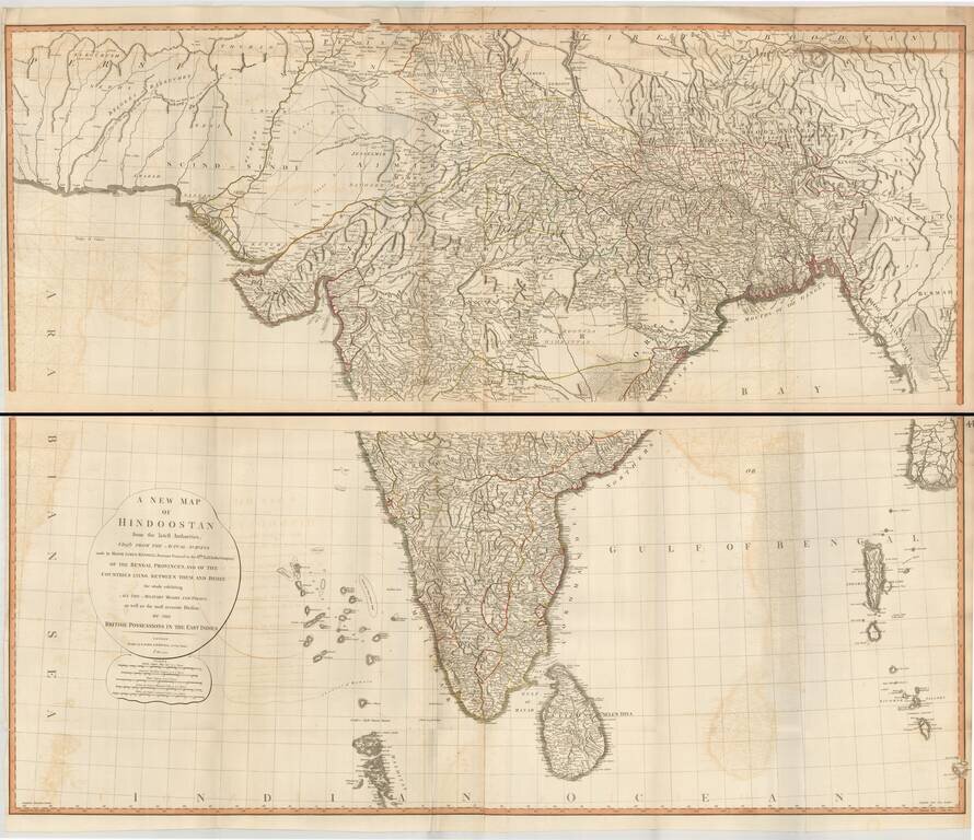
Superb large format map of India and Sri Lanka, based on the surveys of James Rennell, and published by Laurie & Whittle. The map is exceptionally detailed and includes roads, towns, mountains, rivers and a host of other details. It was one of the...
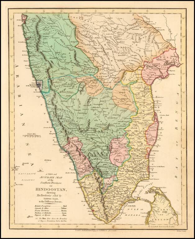
Delightful regional map of the Southern part of India and Ceylon, with nice details. Robert Wilkinson was active in London as a cartographic publisher from 1785 to 1825. He produced a number of nice works, including a General Atlas and a re-issuance...
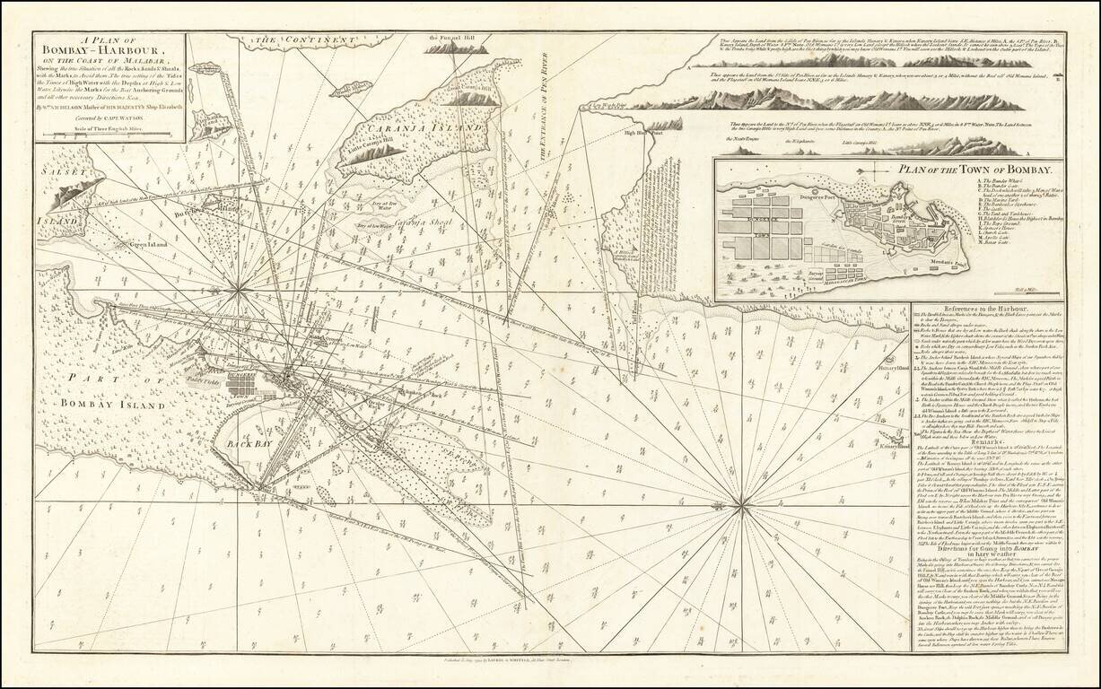
The First Modern Chart of Mumbai (Bombay) Harbor Fine example of the second edition of William Nichelson's charting of Bombay Harbor, published in 1794 by Laurie & Whittle. The second edition notes that it is "Correct by Capt. Watson". The map...
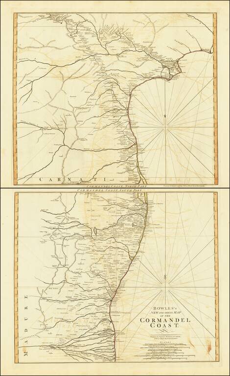
Beautiful set of maps featuring the Coromandel Coast of southeast India from Narsapur south to Nagapattinam. Important cities, rivers, mountains and lakes noted.
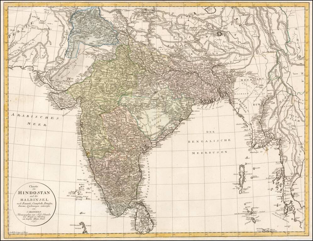
Rare late 18th Century map of India and environs, extending to Kandahar and Kabul in the west and Siam and Malaca in the east. Includes Sri Lanka and the northern part of the Maldives. A highly detailed map, which credits the prior work of James...
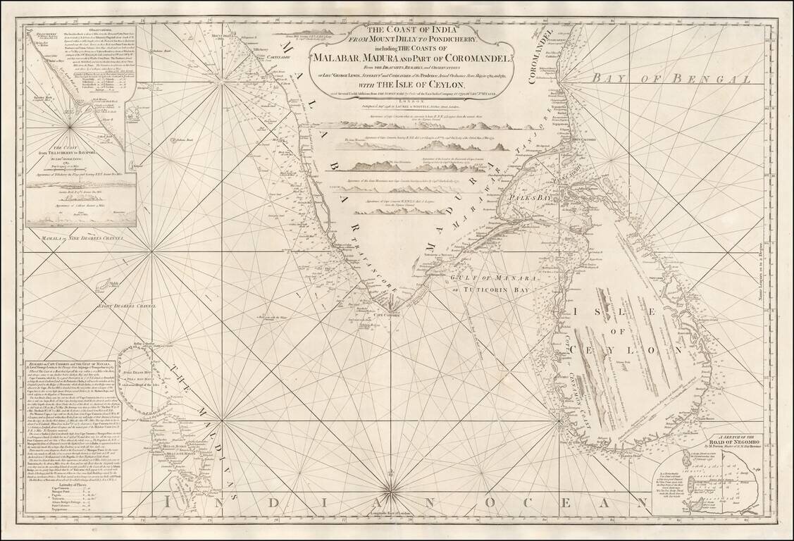
A Rare English Sea Chart of Ceylon and Southern India Fine East India Company Sea Chart, covering the southern part of India and the island of Ceylon (Sri Lanka), published in London by Laurie & Whittle. The chart was published separately and in...
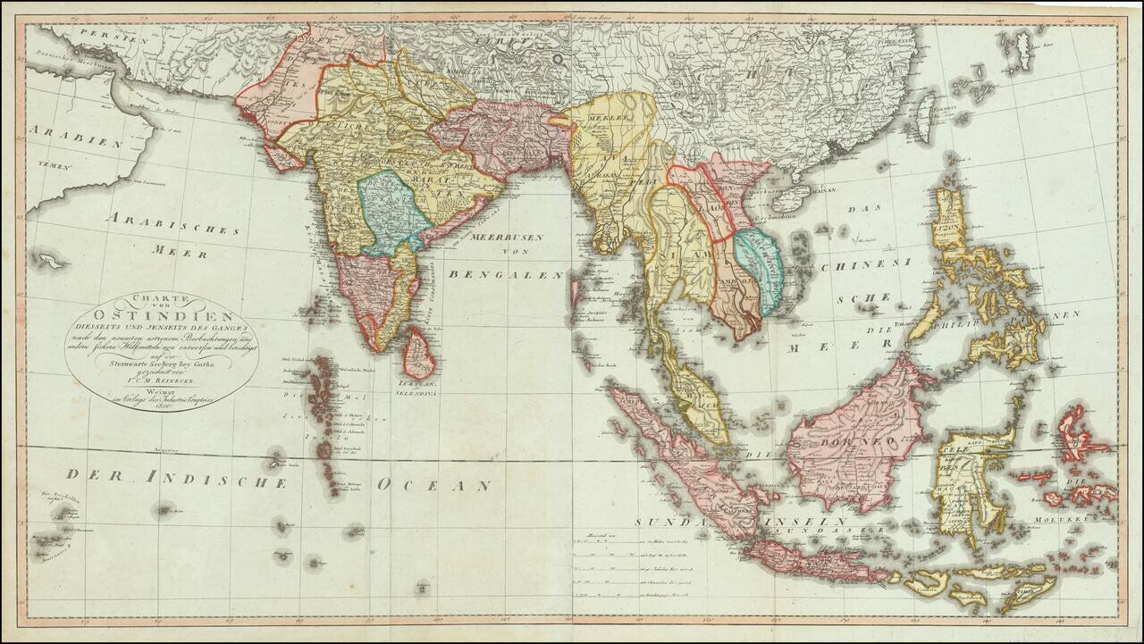
Fine, Rare German Map of South and Southeast Asia Sharply-executed map of the Indian Ocean and Western Pacific regions, encompassing the Indian subcontinent, Mainland Southeast Asia, Indonesia, Malaysia, the Moluccas, and the Philippines. The map is...
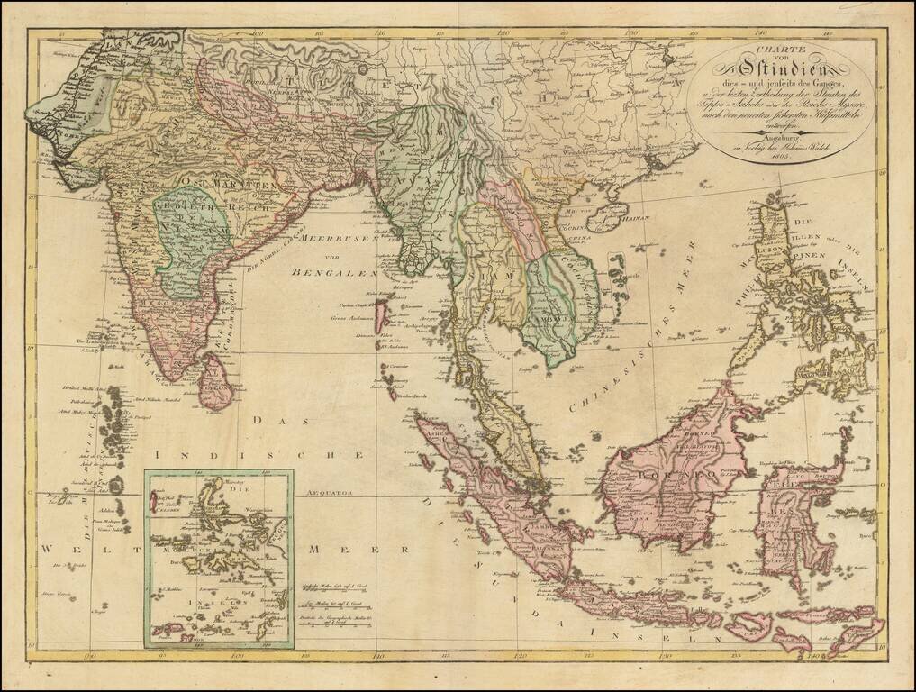
Scarce large format map of India, Southeast Asia and the Philippines, published in Augsburg by Johann Walch. The map gives a fine image of the Philippnes. Tonkin, Cochinchina (Vietnam), Laos, Siam (Thailand) and Camboja (Cambodia).
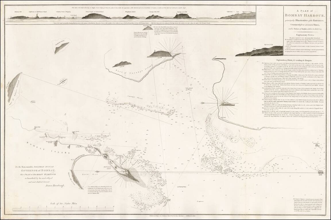
A fine early plan of Bombay (Mumbai) Harbor, first published from the survey work of James Horsburgh in 1806. The chart is the result of Horsburgh's survey work in Bombay in 1803 and 1804, with additions by an Admiralty assistant to 1844. It includes...
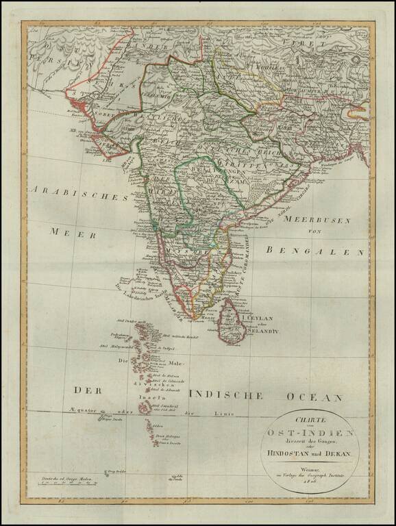
Detailed map of of India, from a scarce atlas published in Weimar. The map presents a fine depiction of the Maldives, along with political divisions in India. Some topographical information provided in Tibet and Nekpal (Nepal), including the location...
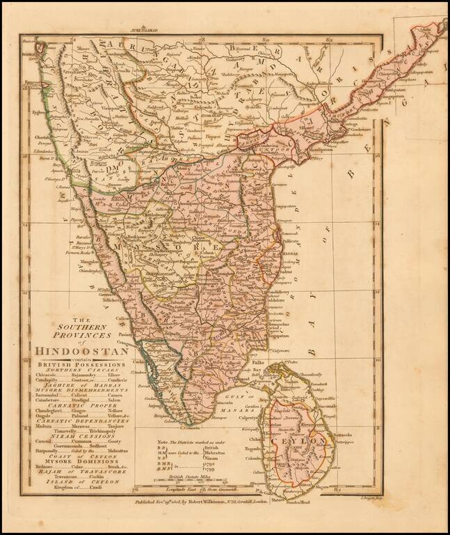
Delightful regional map of the Southern part of India and Ceylon, with nice details. Robert Wilkinson was active in London as a cartographic publisher from 1785 to 1825. He produced a number of nice works, including a General Atlas and a re-issuance...
![[Manuscript] Chart of the passage to the East of Banka laid down from Observations in the Ship Vansittart, by Cap. Lestock Wilson (locating famous ship wrecks in the Gaspar Strait!)](/map/small/49898.jpg)
Manuscript Sea Chart By Daniel Ross, Locating Numerous Shipwrecks in the Gaspar Strait Extremely rare chart of the strait on the east side of Banka (between Banka and Gaspar Island), site of a number of British, Chinese, Portuguese and American...