
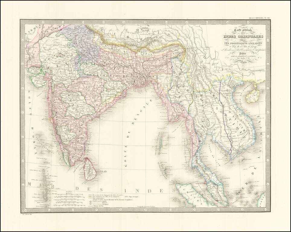
Detailed regional map of India and Southeast Asia, extending from the Gulf of Kambaye to the Gulf of Tonquin and from Sumatra and Ceylon to Tibet and the Himalayas. Shows towns mountains, rivers, lakes, islands, bays, etc. An excellent mid 19th...
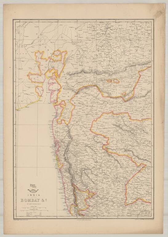
Highly detailed map of Bombay, from the Weekly Dispatch Atlas. 'The Weekly Dispatch' newspaper between the years 1856 and 1862, included in each edition, a map of a part of the world. During this period a total of 118 maps were issued. The maps bear...
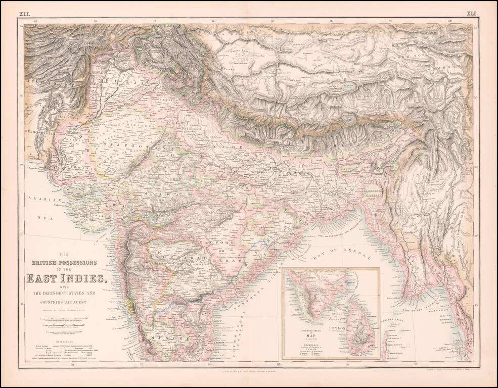
Highly detailed map of India, Pakistan, Afganistan, Tibet and the Himalayas, extending east to Siam. Inset of the southern tip of India and Ceylon.
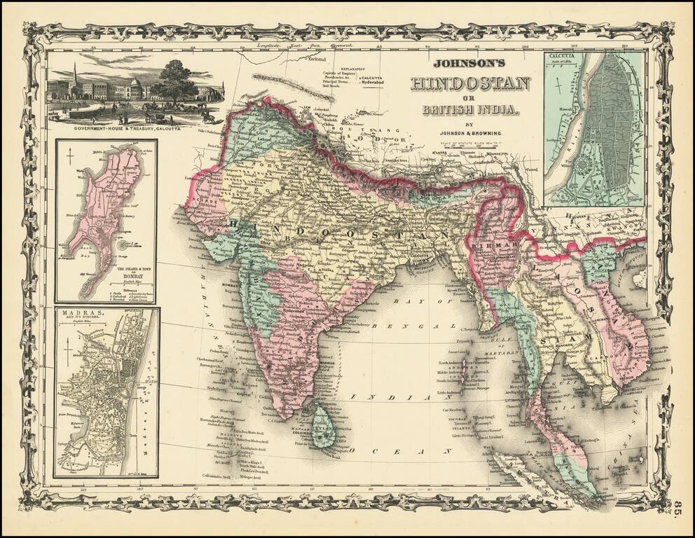
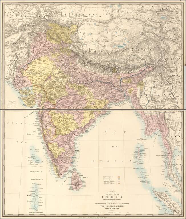
Scarce first edition of Johnson & Browning's map of India, Ceylon, Birmah, Laos, Vietnam, Cambodia, Thailand and part of Malaysia and Sumatra. Insets of Bombay, Madras and Calcutta. Vignette of Government House and Treasury in Calcutta. Colored by...
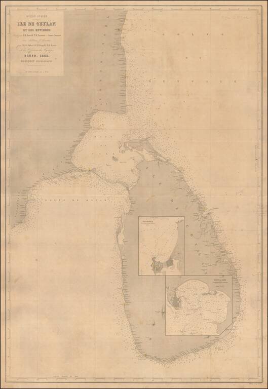
A Rare Large Chart of Sri Lanka Scarce large format sea chart of Sri Lanka and the adjacent coast of India with inset maps of the harbors at Colombo and Galle. Detail is confined to the coastlines, and includes soundings, navigational hazards and...
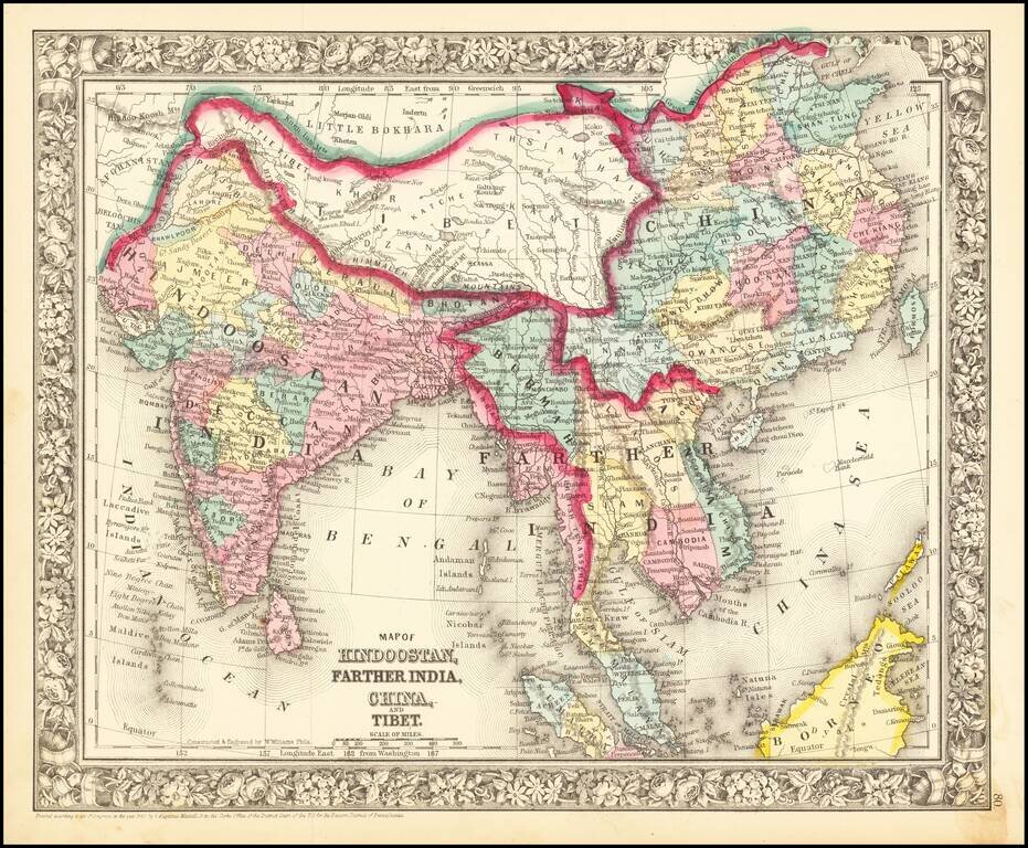
Nice mid-19th century map of India and Southeast Asia, including Cambodia, Siam, Burmah, Tonquin, Cochin China, and British Tenasserim. Shows roads, towns, rivers, mountains, etc. Decorative border.
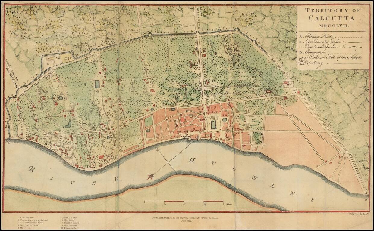
Scarce photo-lithograph of Thomas Kitchin's map of Calcutta, first issued in 1763. The map provides a plan of the territory ceded to the East India Company by the Nawab of Bengal after the Battle of Plassey in June 1757. The Company acquired all the...
![[Chandannagar] French Settlement of Chandernagore Surveyed Season 1870-71 with a portion of the River Hoogly, and of the Country on its Left Bank](/map/small/63527.jpg)
A Rare French Colonial India City Map Rare map of the city of Chandannagar in West Bengal, published by the Surveyor General of India in 1872. The map provides an exceptionally detailed look at the city, which at the time was one of three remaining...
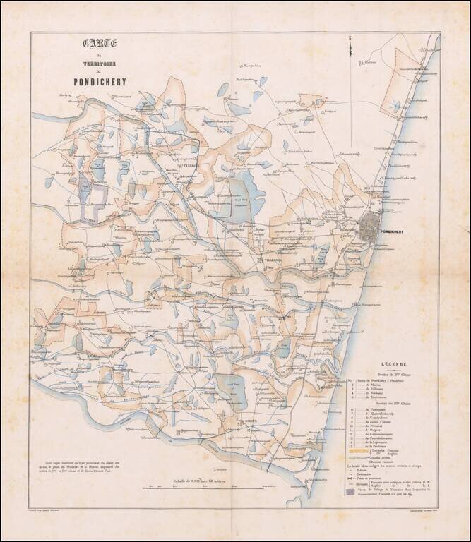
Detailed French Manuscript Map on Linen Showing French and English areas in the Territory of Puducherry Finely-executed manuscript map of the territory of Pondicherry, now known as Puducherry. The city, until 1954, was a French colonial outpost. This...
Showing political and administrative divisions, cities, towns, roads, railroads, mountains and rivers. Relief shown by hachures. Prime meridian is Greenwich. A fine detailed map of India and the Burmese coast. The map extends from Turkestan and...
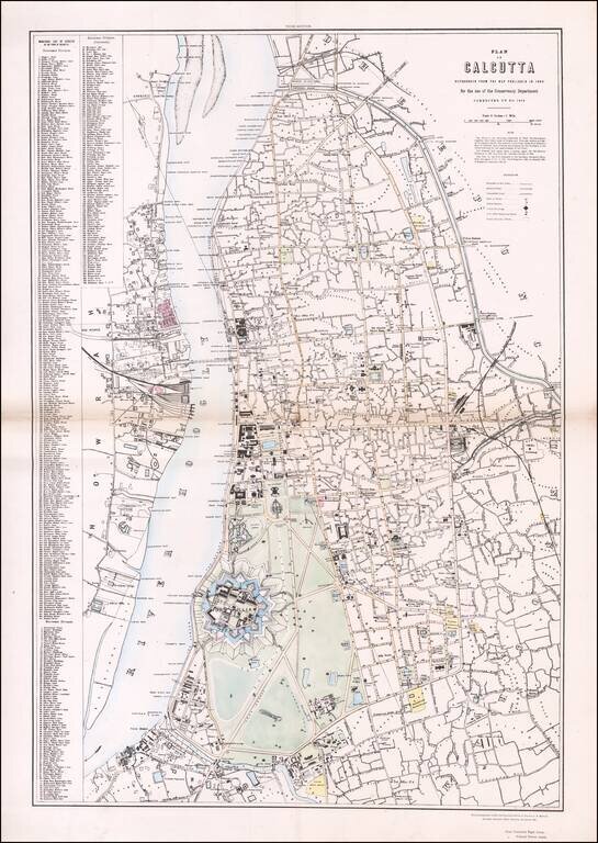
Rare Plan of Calcutta (now Kolkata, India) at the End of East India Company Rule Colored version of the detailed plan of Calcutta commissioned by the Conservancy Department. Corrected to 1874, this is the third edition of the plan and the only known...
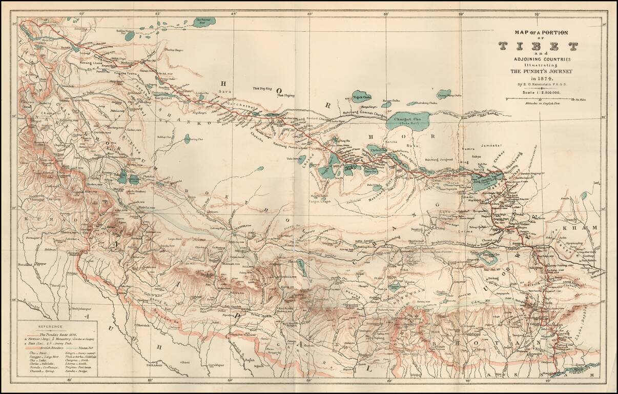
Fine map of a section of Tibet, illustrating "The Pundit's Journey" through the region, with the accompanying article from the Journal of the Royal Geographical Society, entitled Geographical Discoveries in Tibet. The journey was described in the...
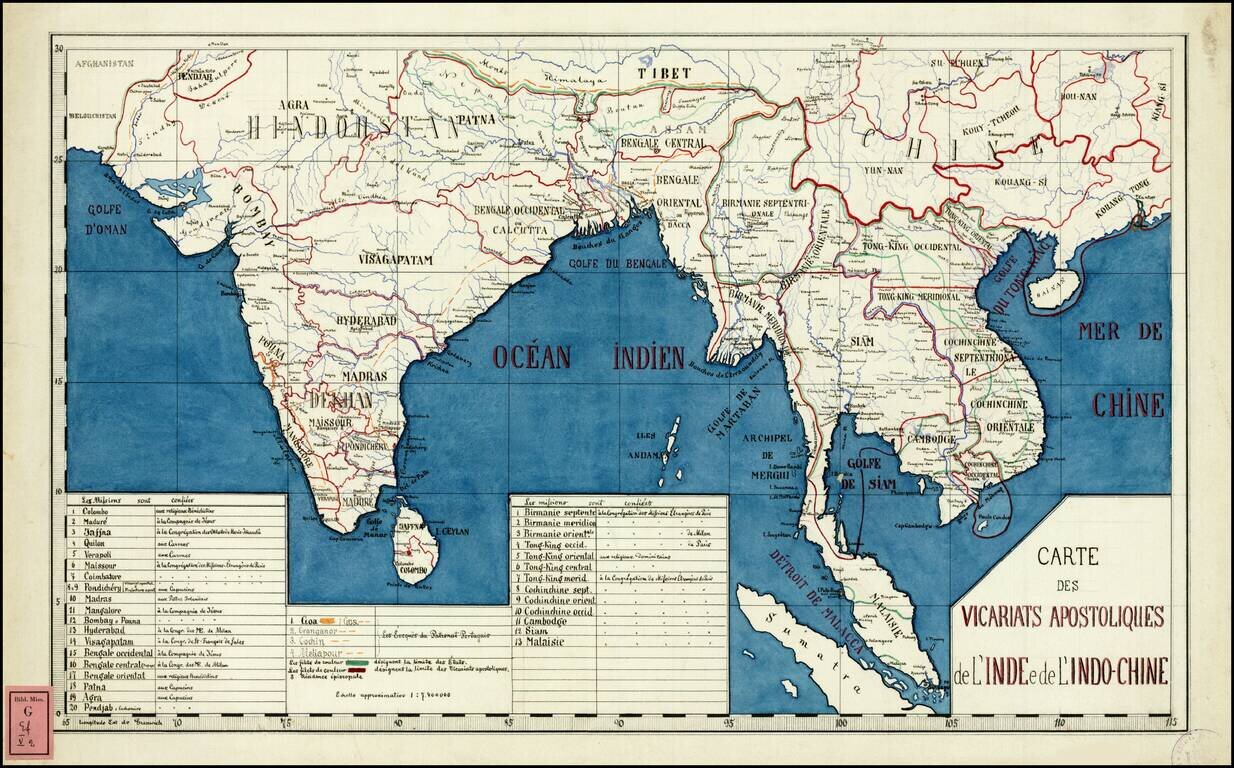
Rare and highly detailed map of Southeast Asia and India, divided into the regions established by the Catholic Missionaries. An extensive key at the bottom of the map identifies the various missions and branches of the Church which were overseeing...
![Карта Афганистана и Сопредѣльныхъ Странъ [Map of Afghanistan and the Bordering Countries].](/map/small/59123.jpg)
Russian Military Map of Afghanistan - Dating from The Great Game. Historically significant, rare military Russian map of Afghanistan and surrounding countries, compiled in the midst of the Great Game in Central Asia and outlining the new Russian lands...
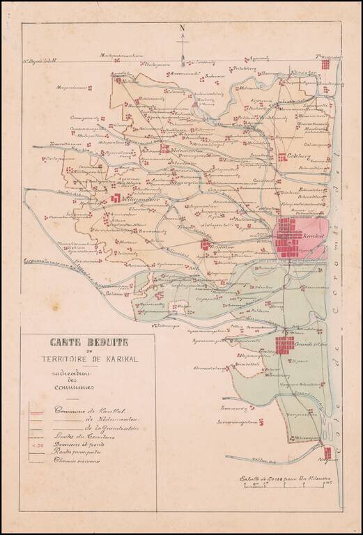
Manuscript Map of the Newly Created Administrative Territory of Karikal and its 3 Communes Fine french manuscript map of the Territory of Karikal, showing the territory as newly divided into divided into communes under the Decree of March 12, 1880....
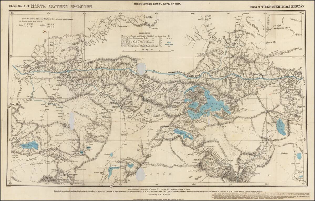
Rare Map of Northern India From the Trigonometrical Survey of India Highly detailed map of parts of Tibet, Sikhim and Bhutan, from the Trigonometrical Survey of India, printed in Dehraban in February of 1885. The map was part of the survey of the...