
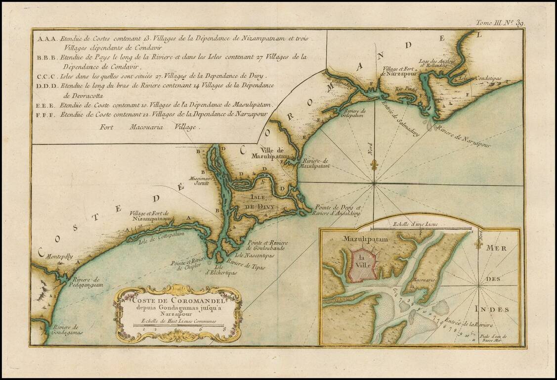
Finely engraved map of the Coromandel coast of India, from Jacques Nicolas Bellin's Le Petit Atlas Maritime Recueti de Cartes et Plans des Quatre Parlies du Monde en Cinq Volumes, first published in Paris in 1764. The focus is on the area around the...
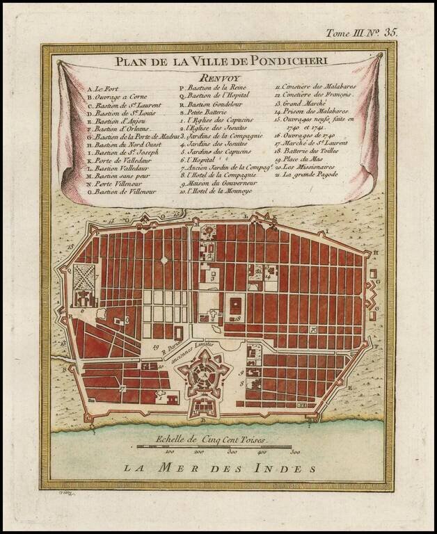
Finely engraved map of Puducherry (India), from Jacques Nicolas Bellin's Le Petit Atlas Maritime Recueti de Cartes et Plans des Quatre Parlies du Monde en Cinq Volumes, first published in Paris in 1764. Jacques Nicolas Bellin Jacques Nicolas Bellin...
Finely engraved map of India, from Jacques Nicolas Bellin's Le Petit Atlas Maritime Recueti de Cartes et Plans des Quatre Parlies du Monde en Cinq Volumes, first published in Paris in 1764. Jacques Nicolas Bellin Jacques Nicolas Bellin (1703-1772) is...
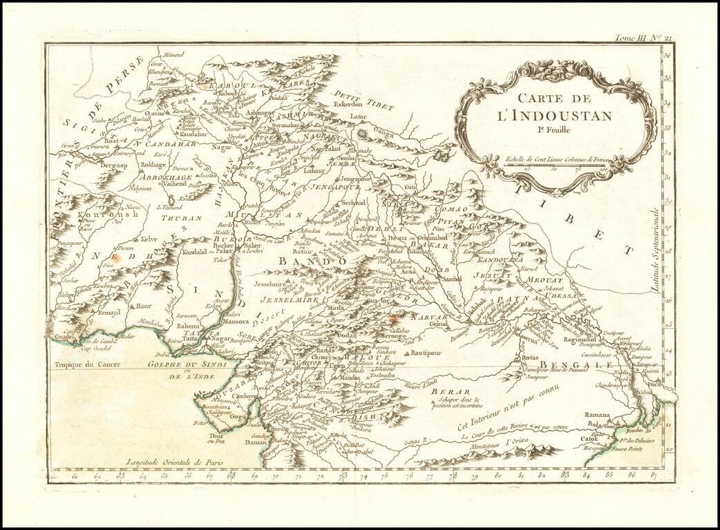
Finely engraved map of Afghanistan and Pakistan, from Jacques Nicolas Bellin's Le Petit Atlas Maritime Recueti de Cartes et Plans des Quatre Parlies du Monde en Cinq Volumes, first published in Paris in 1764. Jacques Nicolas Bellin Jacques Nicolas...
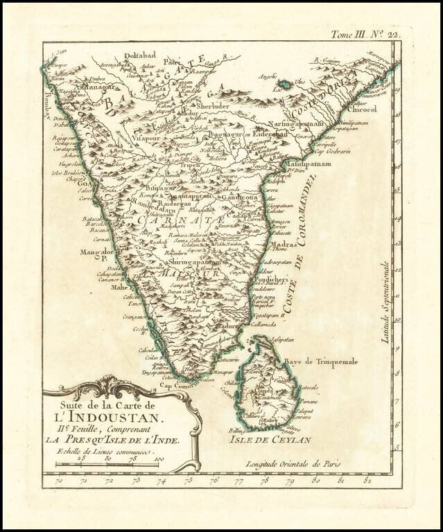
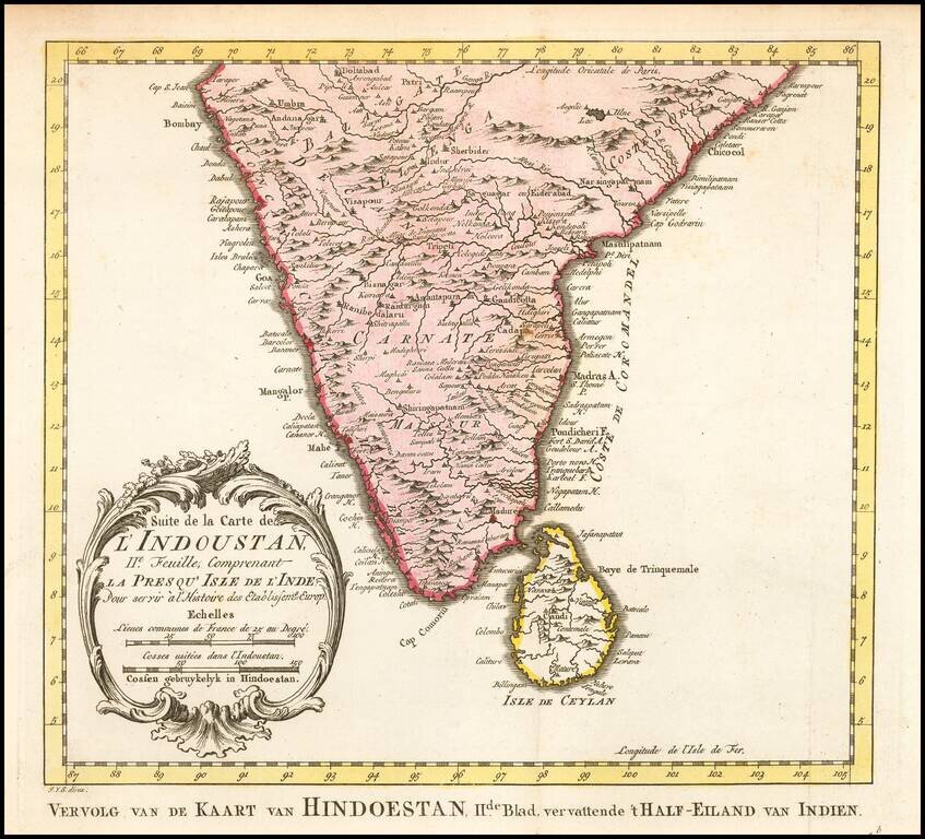
Finely engraved map of India, from Jacques Nicolas Bellin's Le Petit Atlas Maritime Recueti de Cartes et Plans des Quatre Parlies du Monde en Cinq Volumes, first published in Paris in 1764.
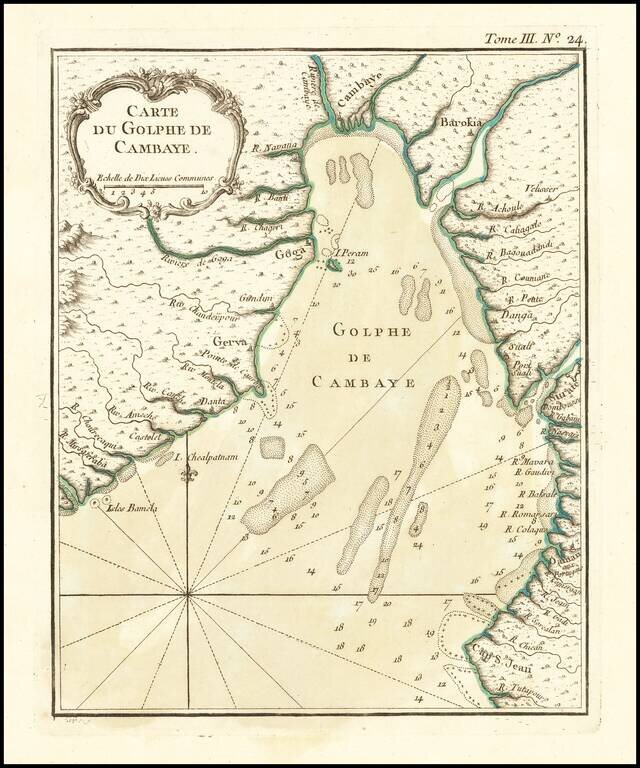
Finely engraved map of the Gulf of Khambhat, showing the region of Gujarat north of Surat. Jacques Nicolas Bellin's Le Petit Atlas Maritime Recueti de Cartes et Plans des Quatre Parlies du Monde en Cinq Volumes, first published in Paris in 1764.
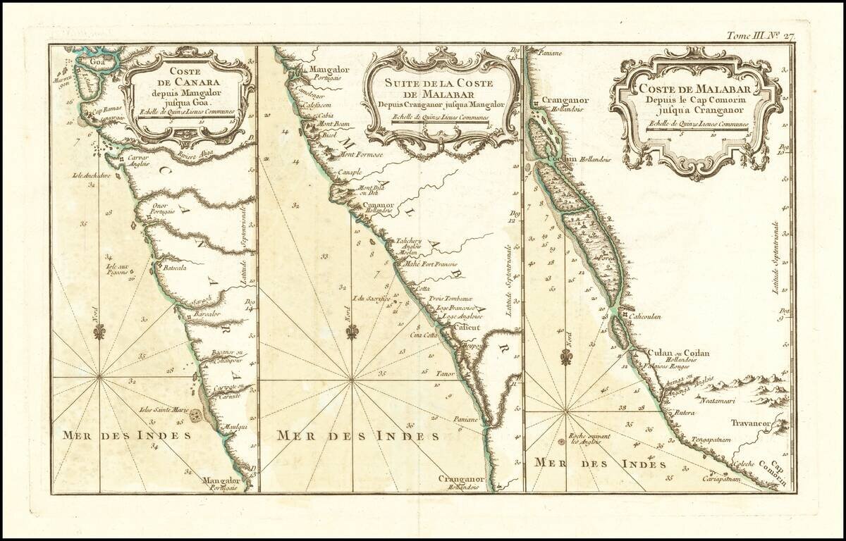
Finely engraved set of coastal maps, covering the west coast of India from Goa to Kodungallur. From Jacques Nicolas Bellin's Le Petit Atlas Maritime Recueti de Cartes et Plans des Quatre Parlies du Monde en Cinq Volumes, first published in Paris in 1764.
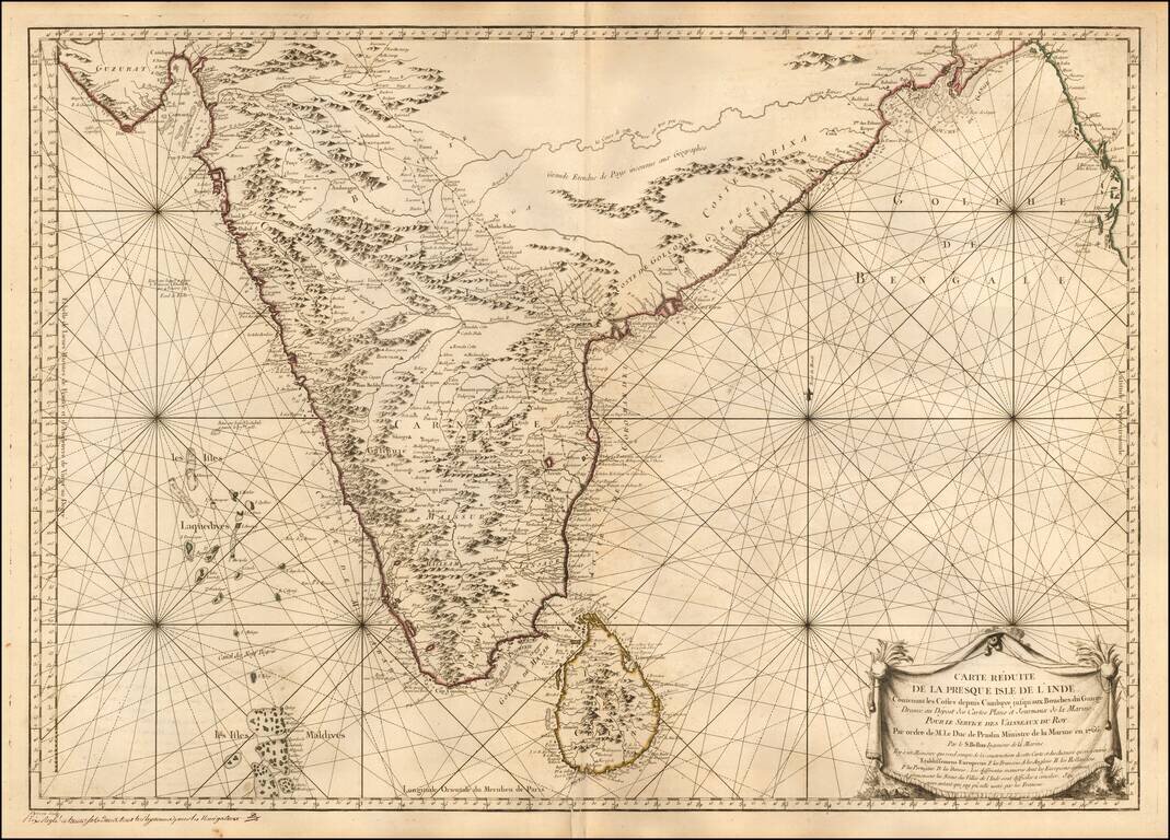
Striking map of India and Sri Lanka, extending from the Bay of Bengal and the mouth of the Ganges to Guzurat, and including a detailed treatment of the Maldives and Sri Lanka. One of the most influential Sea Charts of India in the mid 18th Century....
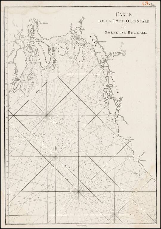
Detailed regional map of the Gulf of Bengal and the lower Ganges River. Marvelous detail.
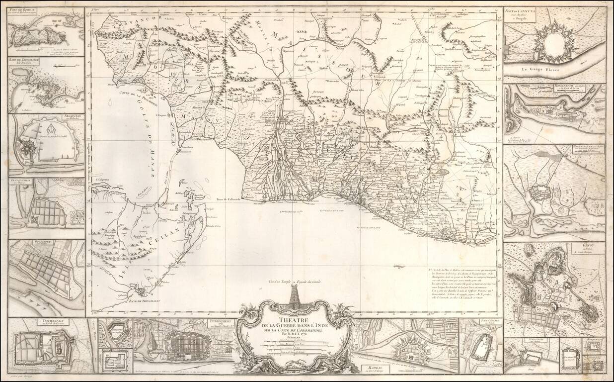
An Indian Theater of War Rarity Very beautiful and large map showing the coast of Coromandel, south-east of India, engraved by Jean-Baptiste Croisey. A fine large-scale map of the Indian coast from Madras to Cape Comorin, with east at the top, and...
![A Map of the Coast of Coromandel from the River Gadevari, to Cape Comorin [Sri Lanka]](/map/small/62976.jpg)
Detailed regional map of Southwestern India and Sri Lanka, published by Kitchin. The map is drawn primarily from D'Anville's map, as augmented by Kitchin using English sources, including: "The Route from Tritchinapoly to Tinevelley; as ascertained...
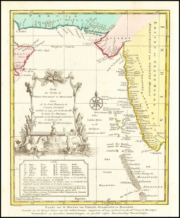
Detailed map of the region from the mouth of the Persian Gulf to the Maldives. Includes large decorative cartouche and compass rose.
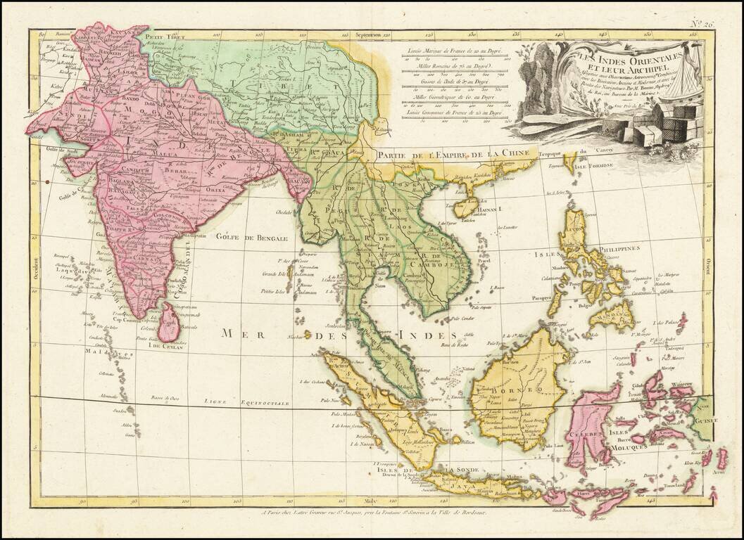
Scarce map of Southeast Asia, the Straits of Malacca, Philippines, Sumatra, Java, India etc., extending north to Canton and Macao, from Jean Lattre's Atlas Moderne. Includes a decorative allegorical cartouche showing the region as a place of commerce.
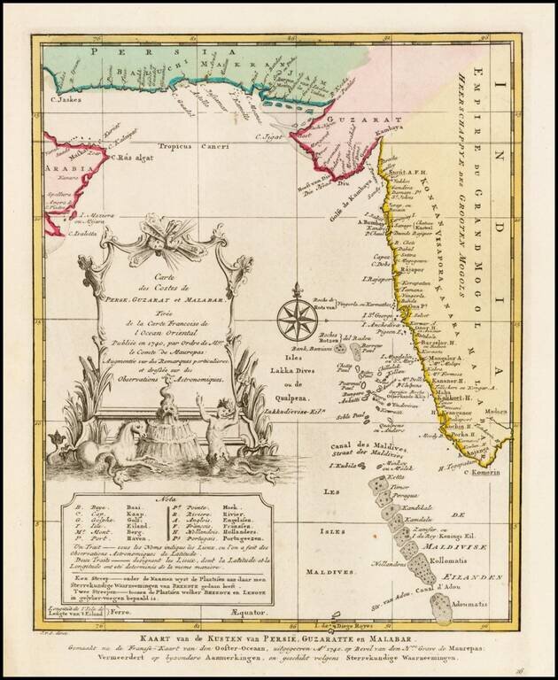
Detailed map of the region from the mouth of the Persian Gulf to the Maldives. Includes large decorative cartouche and compass rose.
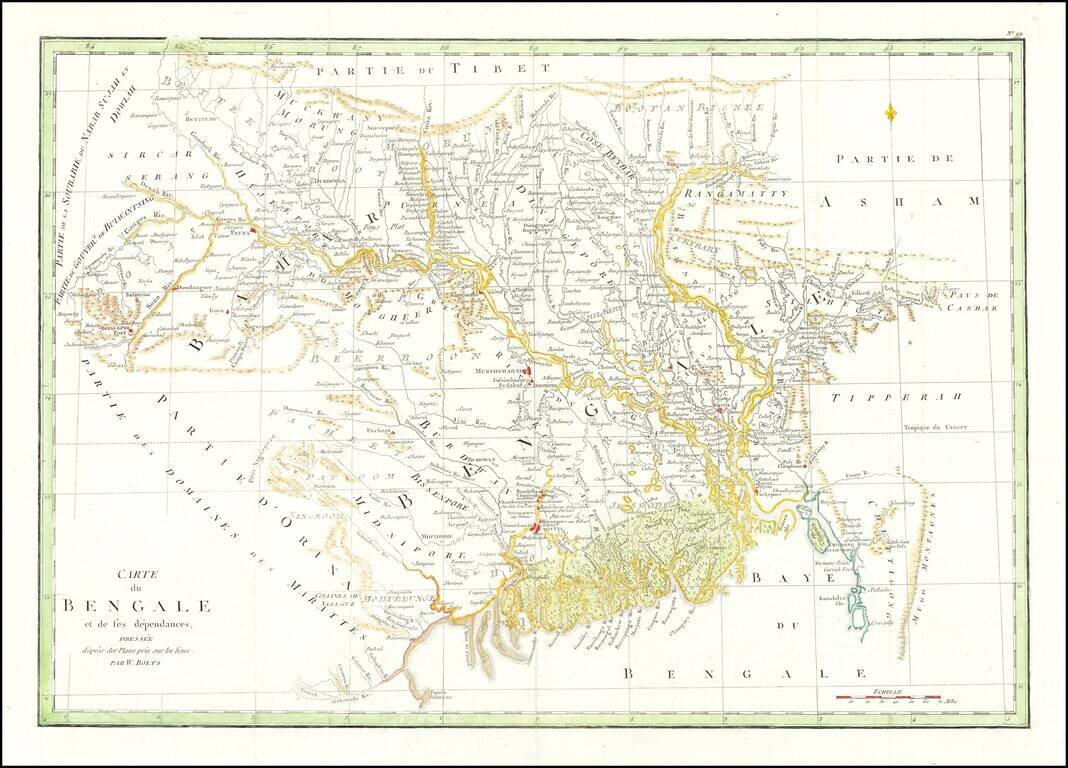
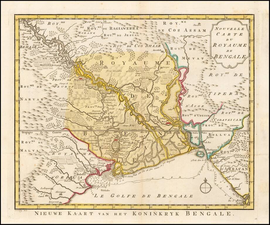
Striking map of Eastern India and Bangladesh, published in Paris. Extends from the Calcutta region in the west to Bangladesh. The map illustrates the work of William Bolts. William Bolts (1739-1808) was a Dutch-born eighteenth-century merchant active...
Detailed sea chart of the Bay of Bengal, engraved by De La Haye and published in the Neptune Orientale.