Map size in jpg-format: 17.7464MiB
Click to open in high resolution (open in new tab).
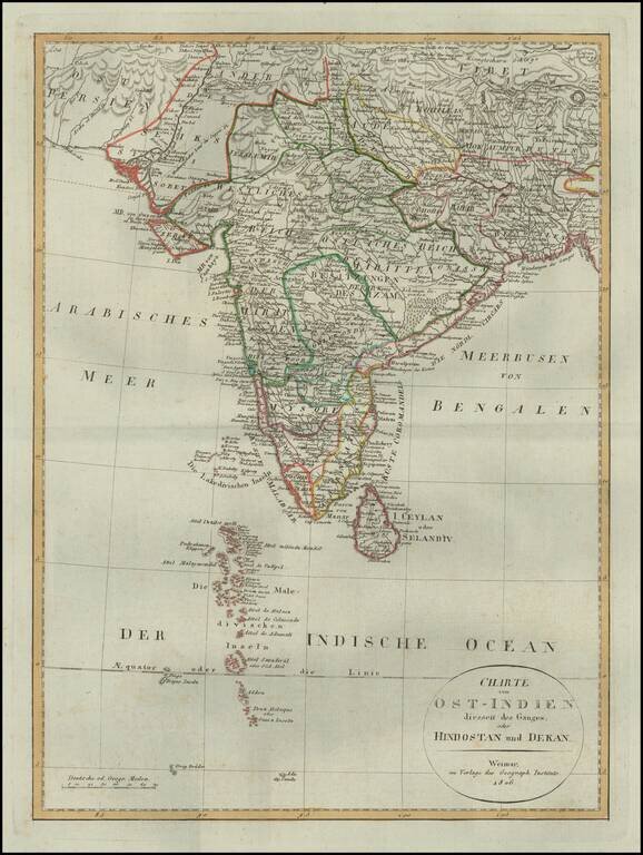
Detailed map of of India, from a scarce atlas published in Weimar.
The map presents a fine depiction of the Maldives, along with political divisions in India.
Some topographical information provided in Tibet and Nekpal (Nepal), including the location of Katmandur (Kathmandu).
If you are a student, write to us in telegram: @antiquemaps and indicate what material you need and for what work you need a map in high detail. We are ready to provide material on special terms. For students only!

![Il Disegno Della Terza Parte Dell' Asia [Gastaldi's Wall Map of SE Asia with extra panels!]](/map/small/30554hbp.jpg)
