Map size in jpg-format: 49.1263MiB
Click to open in high resolution (open in new tab).
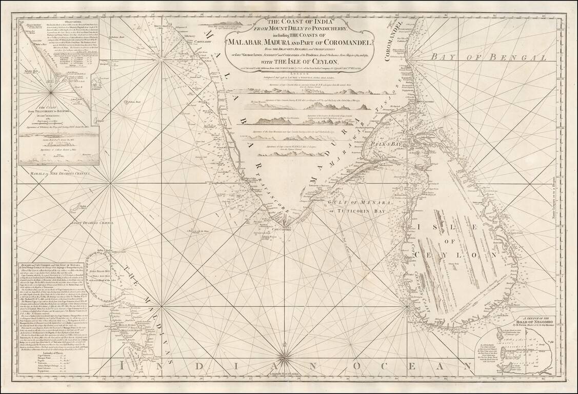
A Rare English Sea Chart of Ceylon and Southern India
Fine East India Company Sea Chart, covering the southern part of India and the island of Ceylon (Sri Lanka), published in London by Laurie & Whittle.
The chart was published separately and in the Oriental Pilot; Or, East India Directory . . . , published in London.
The chart includes numerous profile views for both the coast of India and the Island of Ceylon. At the top left corner, a more detailed set of Observations and sailing directions is included for the coast from Tellicherry to Calicut Road, based upon surveys by Lieut. George Lewis in 1783.
Below in the bottom left are a second set of Remarks by Lieutenant George Lewis on Cape Coromin and the Gulf of Manara, along with a very detailed treatment of the Maldives.
At the bottom right corner, a sectgion is entitled A Sketch of the Road of Negombo by M. Forten, Master of H.M. Ship Heroine.
Rarity
The chart is quite rare on the market. We are not aware of another example coming to market in a number of years.
James Whittle (1757-1818) was a British engraver and map printer. Whittle was employed by Robert Sayer (ca. 1725-1794). Together with Robert Laurie (1755?-1836), he took on Sayer’s business when the older man died in 1794. The two traded together as Laurie & Whittle until 1812, when Laurie retired. They had specialized in sea charts and maritime atlases. Whittle then partnered with Laurie’s son, Richard Holmes Laurie, until he died in 1818.
If you are a student, write to us in telegram: @antiquemaps and indicate what material you need and for what work you need a map in high detail. We are ready to provide material on special terms. For students only!

![Il Disegno Della Terza Parte Dell' Asia [Gastaldi's Wall Map of SE Asia with extra panels!]](/map/small/30554hbp.jpg)
