
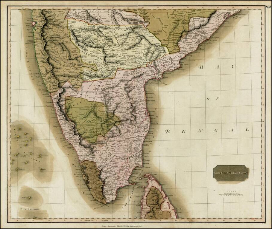
Fine old color example of Thomson's regional map of India, extending from Arungabad, Mahoor and Cicacole in the North, to the southern tip of India, including most of Celyon. Highly detailed, showing provinces, towns, roads, rivers, lakes, mountains,...
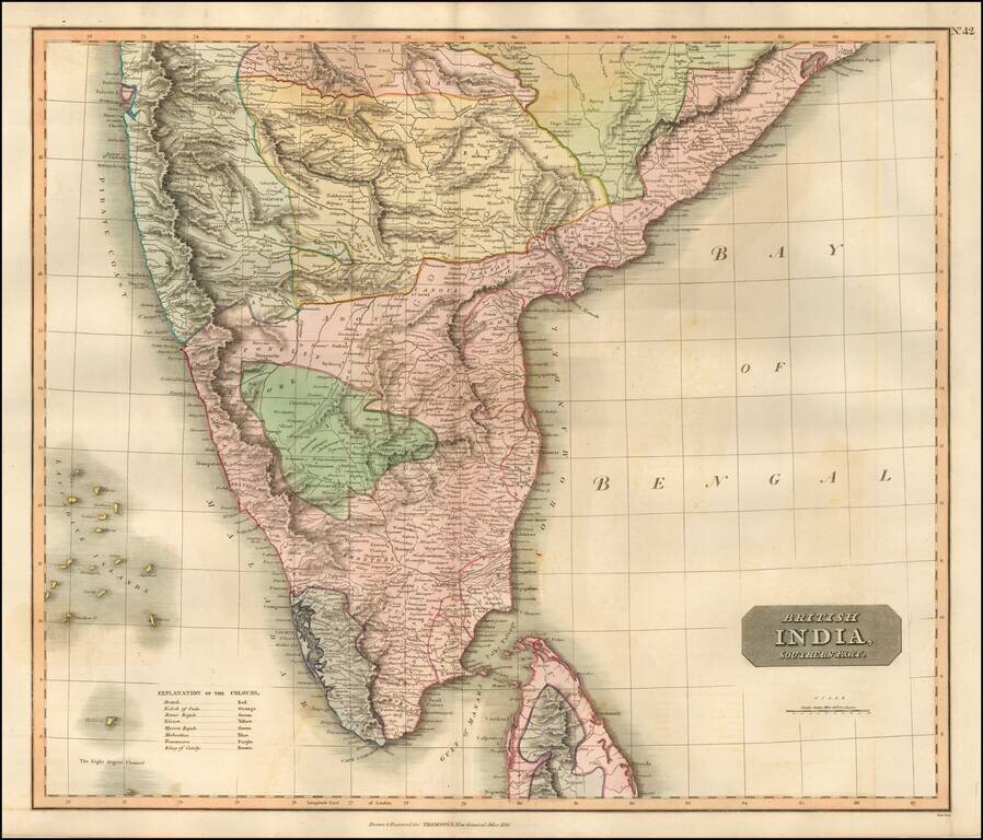
Nice example of Thomson's map of the Southern Part of India and Sri Lanka. Detailed regional map of India, extending from Arungabad, Mahoor and Cicacole in the North, to the southern tip of India, including most of Sri Lanka. The map shows provinces,...
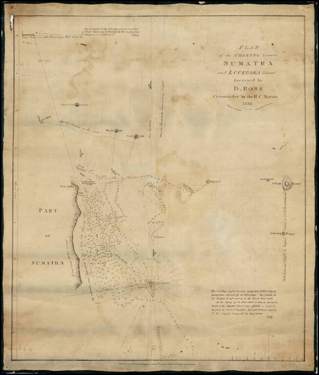
One of the Earliest Maps Lithographed in India -- From the "Father of the Indian Surveys" Extremely rare chart of the area between Sumatra and Lucepara Island, as surveyed by Captain Daniel Ross, one of the most prolific chart makers of his time....
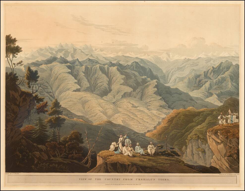
The First Views Taken by Europeans in the Himalayas. Fine hand-colored aquatint view engraved by Robert Havell & Son, after artwork by J. B. Fraser. James Baillie Fraser James Baillie Fraser (June 11, 1783 - January 1856) was a Scottish...
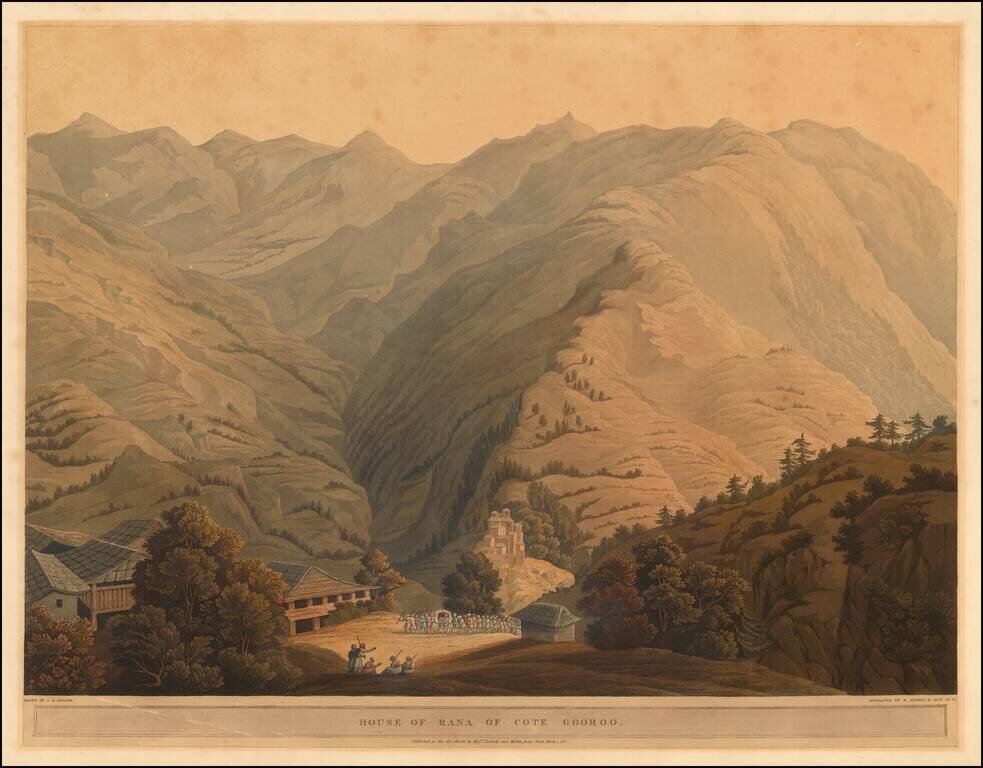
The First Views Taken by Europeans in the Himalayas. Fine hand-colored aquatint view engraved by Robert Havell & Son, after artwork by J. B. Fraser. The British Library describes the subject of the view thusly: The village of Kotgarh is...
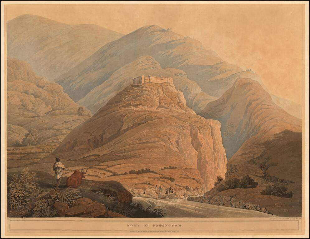
The First Views Taken by Europeans in the Himalayas. Fine hand-colored aquatint view engraved by Robert Havell & Son, after artwork by J. B. Fraser. The British Library describes the subject of the view thusly: The fortress at Raeengarh was...
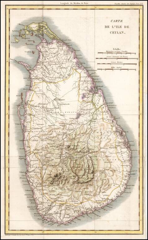
Rare French map of Ceylon, from the Celebrated Nouvelles Annales des Voyages . Engraved folding map from volume XVI of the Nouvelles Annales des Voyages, an important French serial issued throughout the first half of the 19th century, describing...
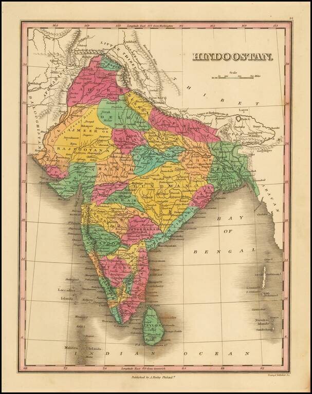
Detailed map of India and Sri Lanka, colored by cantons, from Finley's New General Atlas.
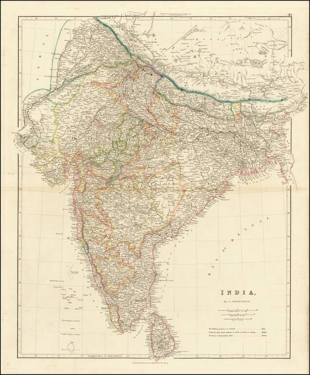
Striking example of Arrowsmith's map of India. The map appeared in Arrowsmith's London Atlas, one of the most popular English atlases of the mid-19th Century.
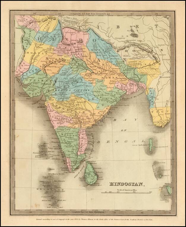
Full color example of the first edition of David Burr's map of India, which appeared in his Universal Atlas, first issued in 1836. Burr's Atlas was perhaps the most elegant American commercially published atlas of its time, utilizing wonderful wash...
![[India] General Karte von Vorderindien zur Ubersicht der Haupherhaltnisse den manen James Rennell dargebracht 1836](/map/small/61740.jpg)
Rare large format map of India, which appeared in Heinrich Berghaus's rare and important Atlas of Asia. Derived from the maps of James Rennell with significant additioins, the map is exceptionally detailed, one of the best compilations of information...
![[Map of East India] Карта Остъ-Индіи](/map/small/66723.jpg)
Detailed and very rare Russian-language India, Thailand, Southeast Asia, and Malaysia, published in Saint Petersburg in 1836. The key along the bottom of the map notes possessions of the imperial powers, from left to right: England, France, Portugal,...
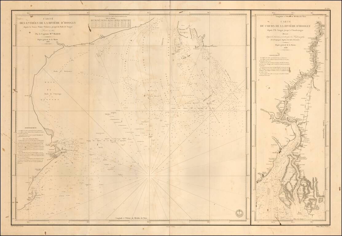
Finely detailed pair of sea charts, covering the northern part of the Bay of Bengal and a chart of the River from the coast to Calcutta and Hoogly. The chart at the right tracks the course of the Hooghly River northward, with an existing post road and...
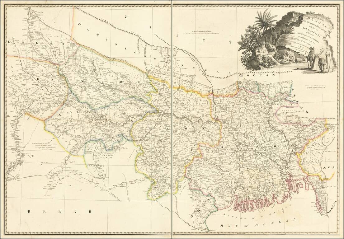
A Rare Late Edition by Wyld Detailed map of the Upper Indian provinces, extending to Tibet in the North and the Bay of Bengal in the South. Th map was drawn by James Rennell F.R.S., Surveyor General of India, and engraved from the original drawing in...
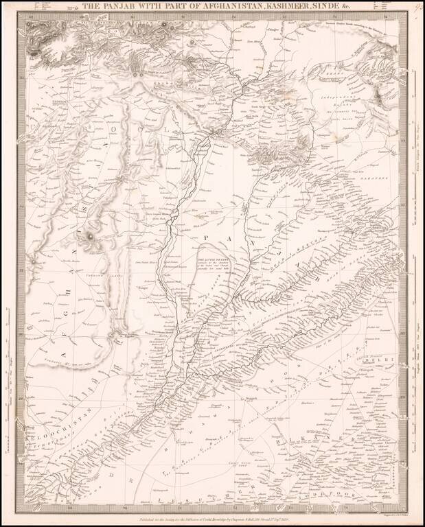
Highly detailed map of Northern India, Afghanistan and neighboring regions, from the Society for the Diffusion of Useful Knowledge. The map extends from north of the Khyber Pass to the northern part of India, focusing on the trade routes and roads in...
![[Northern India] (hand drawn map of Northern India)](/map/small/64513.jpg)
Finely executed manuscript map of the northern part of India, drawn by an anonymous French hand. The map's primary feature is the illustration of the primary topography of the region, including mountain, valleys, rivers, lakes and towns, with some...