logo

1797. Charte von Hindostan und der Halbinsel nach Rennels, Campbells, Pringles, Diroms, Zeichnungen entworfen von C. Mannert. . . . 1796

  • Charte von Hindostan und der Halbinsel nach Rennels, Campbells, Pringles, Diroms, Zeichnungen entworfen von C. Mannert.  . . . 1796

Charte von Hindostan und der Halbinsel nach Rennels, Campbells, Pringles, Diroms, Zeichnungen entworfen von C. Mannert. . . . 1796 information:

Year of creation: 
Resolution size (pixels): 
 17146x13222 px
Disk Size: 
 45.767MiB
Number of pages: 
 1
Place: 
 Nuremberg

Print information. Print size (Width x height in inches):
Printing at 72 dpi 
  238.14 х 183.64
Printing at 150 dpi 
 114.31 х 88.15
Printing at 300 dpi 
 57.15 х 44.07

An example of detailing the file of this map of in a printable high-resolution:

Click to open in high resolution (open in new tab).
Attention! this is just the central piece (central area 960x960 px) of the map file!
This is an example, so that you can see and study the level of detail of a given map. The entire Map will be fully available after payment!

Charte von Hindostan und der Halbinsel nach Rennels, Campbells, Pringles, Diroms, Zeichnungen entworfen von C. Mannert.  . . . 1796

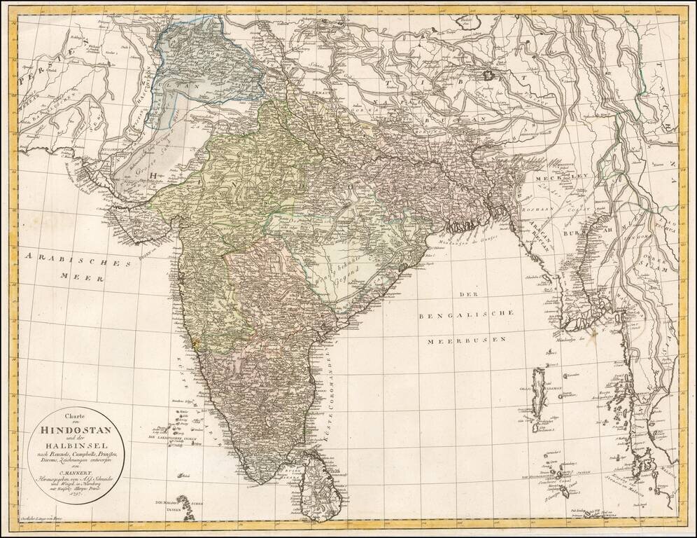
Rare late 18th Century map of India and environs, extending to Kandahar and Kabul in the west and Siam and Malaca in the east.

Includes Sri Lanka and the northern part of the Maldives.

A highly detailed map, which credits the prior work of James Rennell, John Campbell, A. T. Pringle and Alexander Dirom, each of which had written extensively about India in the prior decades.


Special conditions for students!

If you are a student, write to us in telegram: @antiquemaps and indicate what material you need and for what work you need a map in high detail. We are ready to provide material on special terms. For students only!

Item information:

Year of creation:
Size:
17146x13222 px
Disk:
45.767MiB
Number of pages:
1
Place:
Nuremberg
Author:
Adam Gottlieb Schneider.
$14.99

Related item