Map size in jpg-format: 17.1143MiB
Click to open in high resolution (open in new tab).
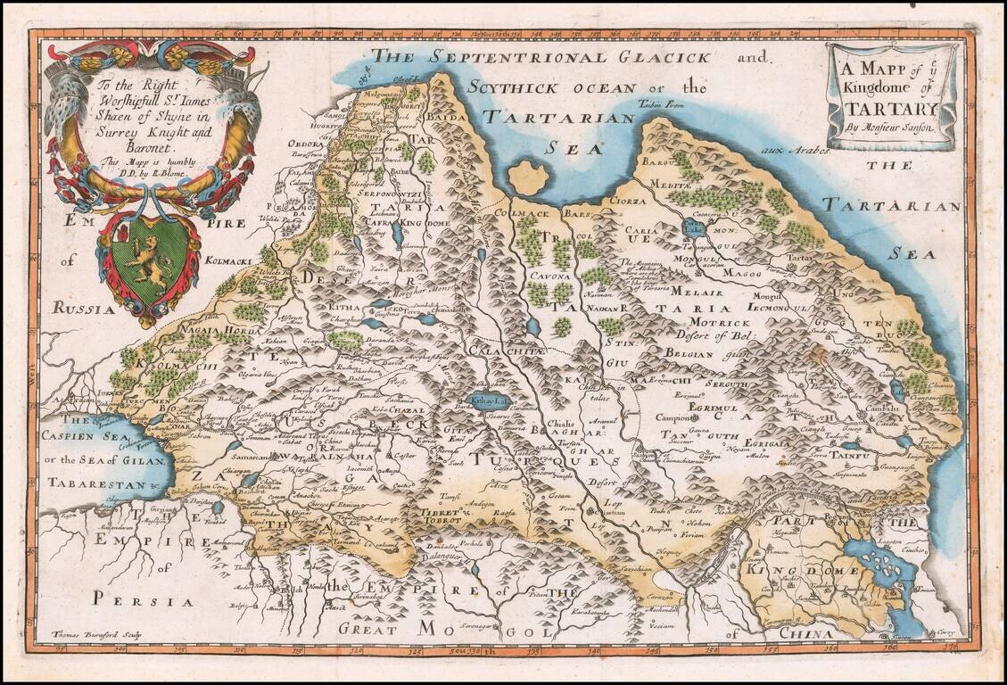
Rare Late State of the First Map of Tartaria Engraved In England.
Nicely colored example of this scarce map of Tartaria.
The present example is from a very late edition, where the title, dedication and coat of arms have been completely re-engraved. The original title of the map was A Generall Mapp of the Kingdoms of Tartaria . . .
The map is engraved by Thomas Burnford, one of the few maps attributed to Burnford.
Shows the Great Wall of China and extends west to the Caspian Sea. The map demonstrates the naïve engraving style characteristic of 17th Century English engravers, and features an elaborate heraldic cartouche and a dedication to ye Worshipfull Sr. James Shaen of Shyne in Surrey Knight and Boronet ...
Blome's maps, because of their rarity and importance in the history of English Cartography, are essential items for regional collectors. Blome first began engraving maps for his Geographical Description Of The Four Parts Of The World, in 1667. The completed volume was in small folio, and contained 24 maps (plus one duplicated), engraved by Francis Lamb, Thomas Burnford and Wenceslas Hollar. Blome's principal handicap in the production of the atlas was the lack of a domestic mapmaking environment comparable with that in Europe. Also, to finance his work, he undertook subscribers, in exchange for a promise to add their coat of arms to certain maps. In later editions, if the renewal fee was not paid, Blome added a different subscribers' coat of arms, leading to multiple images on various editions of the same map.
If you are a student, write to us in telegram: @antiquemaps and indicate what material you need and for what work you need a map in high detail. We are ready to provide material on special terms. For students only!
![[Martin Behaim Globe / Book] Pars Globi terrestris Ao. 1492 a Martino Behaim Equite Lusitano Norimbergae confecti Delineavit Christoph. Theoph de Murr 1778 (bound with:) Diplomatische Geschichte des Portugesischen berühmten Ritters Martin Behaims](/map/small/68828.jpg)
![Il Disegno Della Terza Parte Dell' Asia [Gastaldi's Wall Map of SE Asia with extra panels!]](/map/small/30554hbp.jpg)
![Chinae, olim Sinarum regionis nova descriptio. auctore Ludouico Georgio. [English Edition!]](/map/small/71123.jpg)