Map size in jpg-format: 7.84542MiB
Click to open in high resolution (open in new tab).
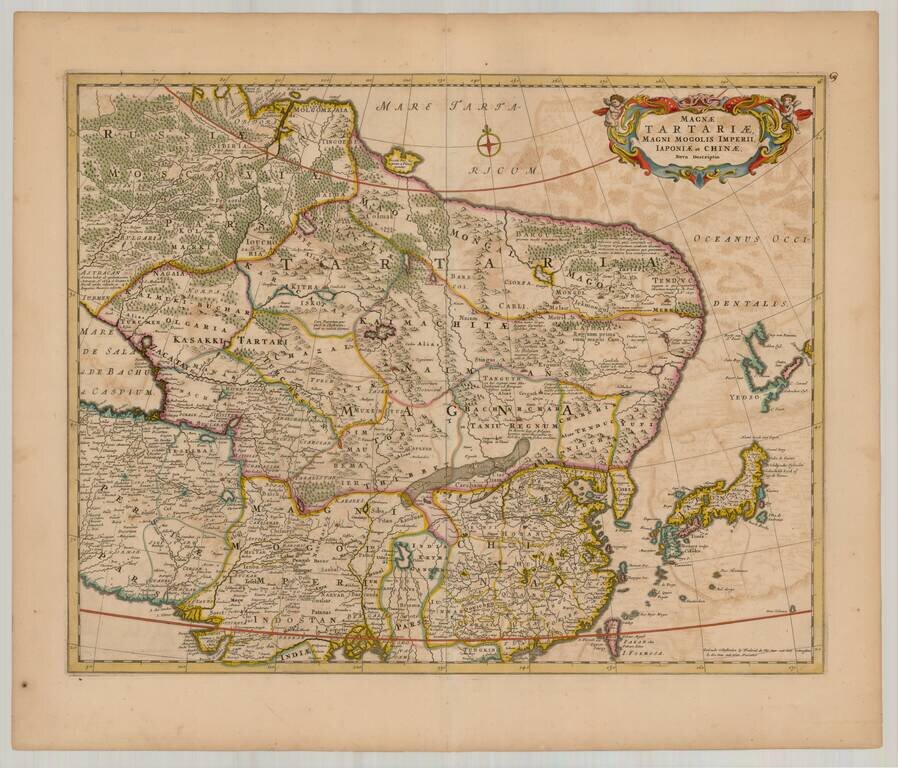
Nice old color example of De Wit's map of Northeastern Asia, extending from the Island of Formosa, the Ganges, and the eastern part of the Caspian to Yedso, Tartaria, Siberia and Molgomzaia in Russian Asia in North.
The Great Wall of China is shown, along with a nice representation of Japan and the mythical lands to the north. Russia is truncated with no Kamchatka peninsula and Yedso is shown according to the voyages of De Vries.
The mythical Chiammay Lacus is shown with its five major rivers.
Strapwork title cartouche with two putti and a compass rose embellish the map.
De Wit (1629 ca.-1706) was a mapmaker and mapseller who was born in Gouda but who worked and died in Amsterdam. He moved to the city in 1648, where he opened a printing operation under the name of The Three Crabs; later, he changed the name of his shop to The White Chart. From the 1660s onward, he published atlases with a variety of maps; he is best known for these atlases and his Dutch town maps. After Frederik’s death in 1706, his wife Maria ran the shop for four years before selling it. Their son, Franciscus, was a stockfish merchant and had no interest in the map shop. At the auction to liquidate the de Wit stock, most of the plates went to Pieter Mortier, whose firm eventually became Covens & Mortier, one of the biggest cartography houses of the eighteenth century.
If you are a student, write to us in telegram: @antiquemaps and indicate what material you need and for what work you need a map in high detail. We are ready to provide material on special terms. For students only!
![[Martin Behaim Globe / Book] Pars Globi terrestris Ao. 1492 a Martino Behaim Equite Lusitano Norimbergae confecti Delineavit Christoph. Theoph de Murr 1778 (bound with:) Diplomatische Geschichte des Portugesischen berühmten Ritters Martin Behaims](/map/small/68828.jpg)
![Il Disegno Della Terza Parte Dell' Asia [Gastaldi's Wall Map of SE Asia with extra panels!]](/map/small/30554hbp.jpg)
![Chinae, olim Sinarum regionis nova descriptio. auctore Ludouico Georgio. [English Edition!]](/map/small/71123.jpg)