
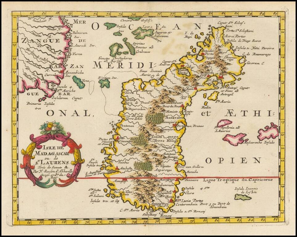
Exceptional old color example of this finely engraved map of Madagascar, first published by Sanson in 1657. Sanson notes the source of his map as Livio Sanuto and others. Livio Sanuto was a mid-16th Century Italian cosmographer and mathematician who...
![[Cape Verde] Pascaerte vande Soute Eylanden oftge Ilhas de Cabo Verde](/map/small/67911.jpg)
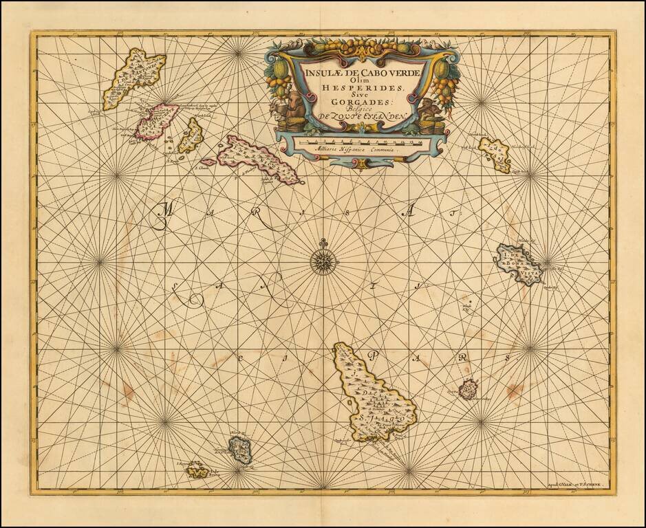
A Rare Early Sea Chart of Cape Verde Rare early sea chart of the the Cape Verde Islands by Johannes Van Loon. The islands shown with its towns and anchoring places. Island of Del Fuogo is shown with an erupting volcano. Very decorative map with a...
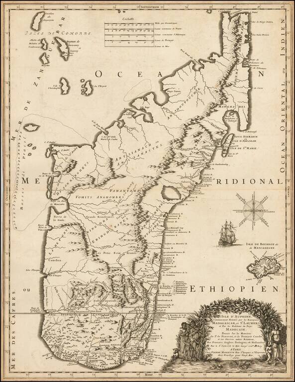
Finely engraved map of Madagascar, published by Pierre Mariette. The map was perhaps the finest and most up to date of its time, utilized by contemporary explorers. As noted in The Voyages Made by Sieur Du Bois To The Islands of Dauphine of Madagacar...
Detailed sea chart of the Cape Verde Islands, published in Amsterdam. Shows a volcano erupting on the Isla de Fuogo.
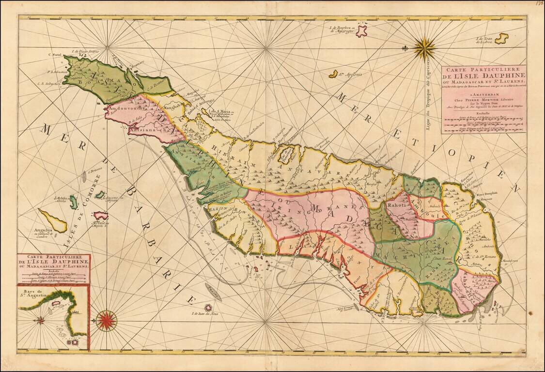
Madagascar -- Pirate Haven Fine old color example of Mortier's large sea of Madagascar, published in Amsterdam by Pierre Mortier. Fine large format chart of Madagascar, orientated with north to the left, appears in Pierre Mortier's sea-atlas, 'Le...
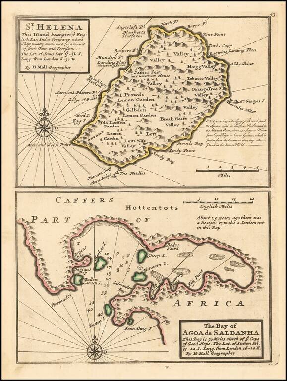
A nice example of Herman Moll's map of the island of St. Helena.
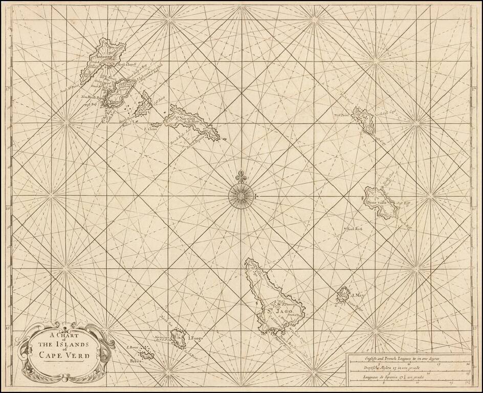
Nice example of Mount & Page's sea chart of the Cape Verde Islands, which appeared in the English Pilot, Book I. Located in the South Atlantic some 300 miles west of Africa, the Cape Verde archipelago was discovered by the Portuguese in 1460. The...
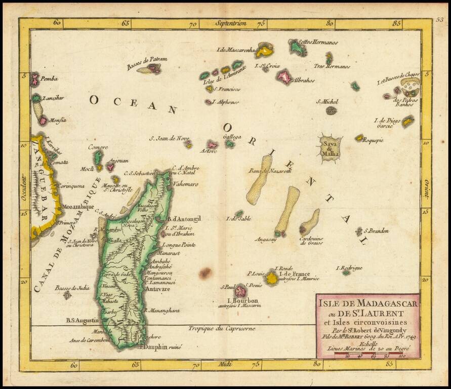
Detailed engraved map of Madagascar, the Mascarene Islands, and other nearby Indian Ocean African islands, published in De Vaugondy's first atlas. The map extends as far east as Chagos and as far west as Zanzibar.
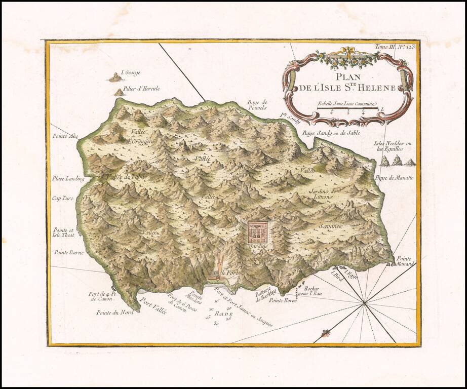
Fine early map of the St. Helene. Bellin's map Plan de l'Isle Ste Helene is largely is derived from the maps of Seller and Moll. The outline of the island essentially is that portrayed by Seller, with, for example, the very pronounced 'finger' of...
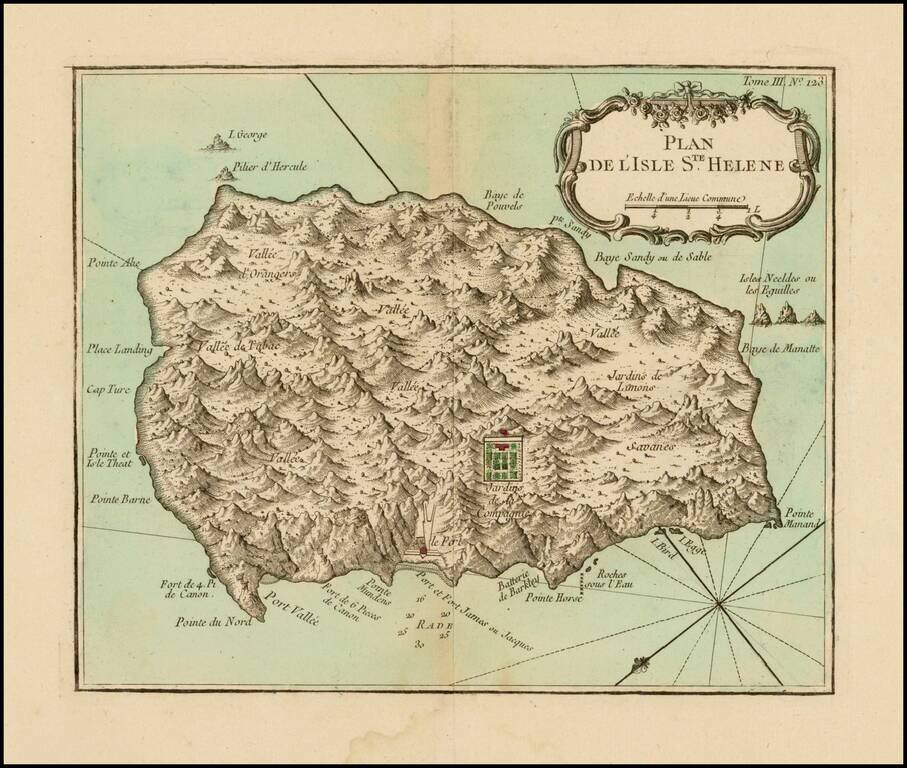
Fine early map of the St. Helene. Bellin's map Plan de l'Isle Ste Helene is largely is derived from the maps of Seller and Moll. The outline of the island essentially is that portrayed by Seller, with, for example, the very pronounced 'finger' of...
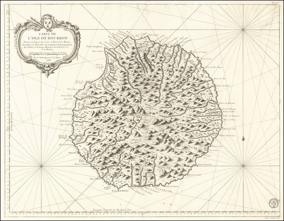
Fine French Sea Chart of Reunion Island Finely executed sea chart of the Island of Bourbon (Reunion Island), first issued in 1763. Rumsey notes: "Exceptional onboard document of this rare and fabulous maritime atlas, a masterpiece by the greatest...
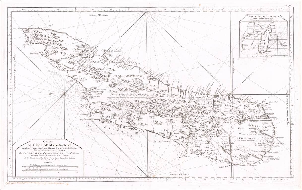
Fine early sea chart of the Madagascar, published by the French Hydrographical Department. This chart was produced by Jacques-Nicolas Bellin (1703-1772), France's preeminent maritime cartographer and the Premier Ingénieur of the Depot de la Marine...
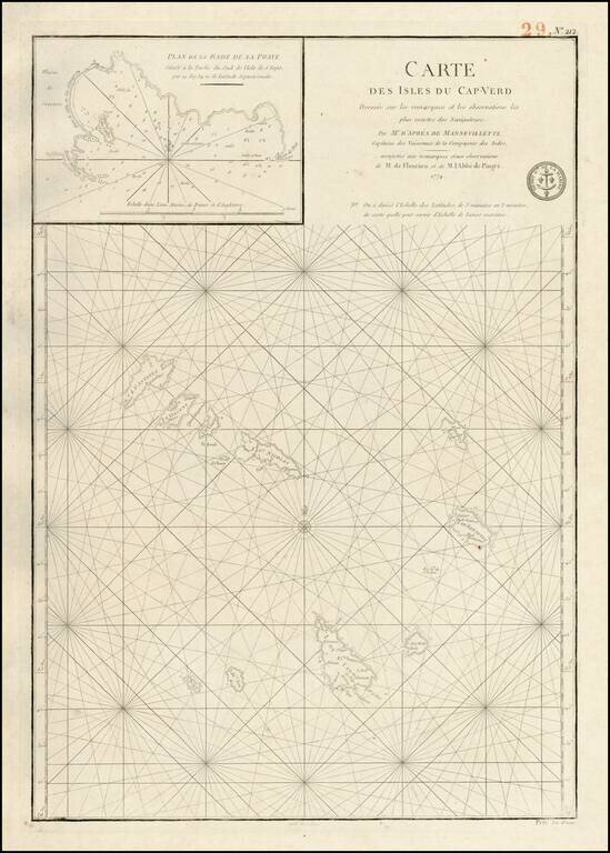
Detailed map of the Cape Verd Islands, with a large inset "Plan de la Rade de Praye" on the Island of S. Yago. Excellent and highly detailed chart from the Depot de la Marine, which was then perhaps the most prolific of all sea chart makers in the world.
A finely detailed chart of the Cape Verde Islands off the Coast of Africa, issued by the London publishers, Robert Sayer & John Bennett. This sheet of sea charts details the Cape Verde Islands. First settled by the Portuguese in 1462, it soon...
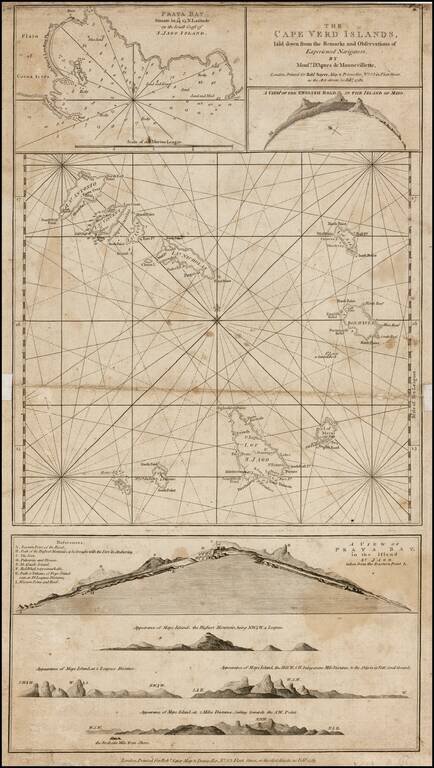
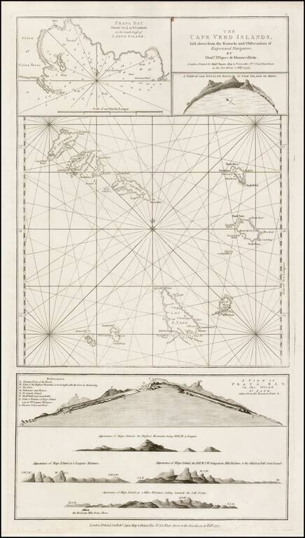
Detailed chart of the Cape Verde Islands off the Coast of Africa, with inset maps of Praya Bay, A View of the English Road, A View of Praya Bay and a group of recognition views.
Detailed map showing the Cape Verde islands, with a large inset of La Rade De La Praya. Shows towns, rivers, mountains, lakes, etc. Detailed map of the region from this classic 18th Century French atlas.