
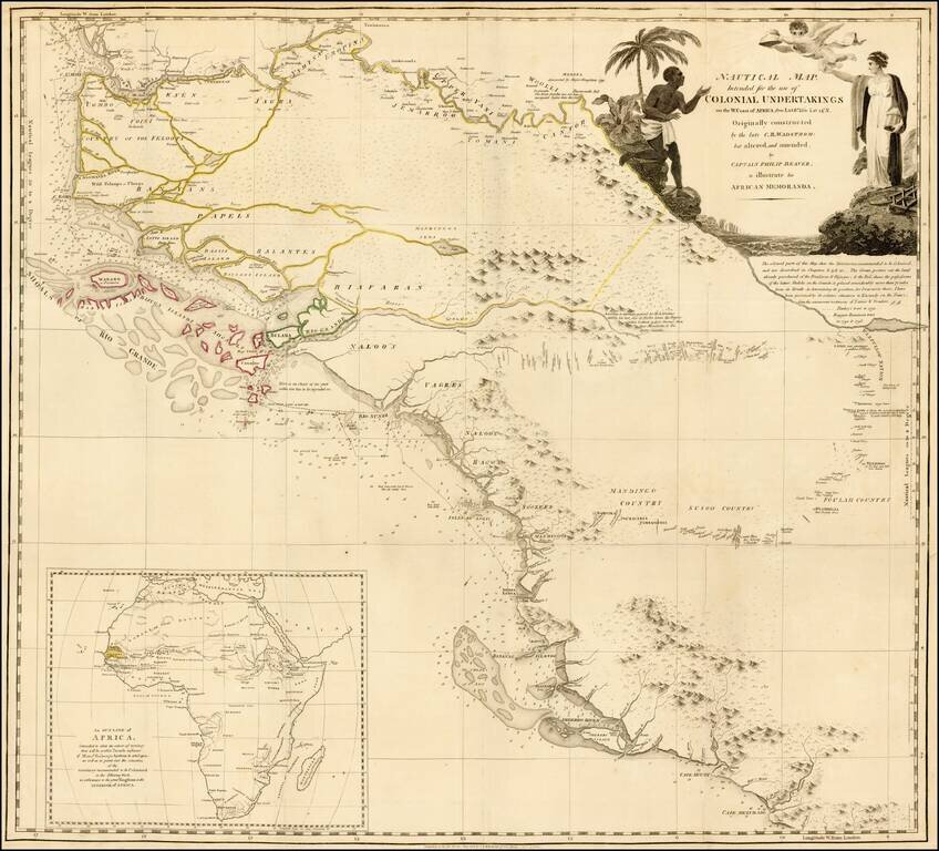
Detailed map of the region bounded by the Gambia River in the north and Cape Mezurado (Liberia) in the south, covering the countries of Gambia, Guinea, Sierra Leone and part of Gambia, which appeared in Captain Philip Beaver's A frican Memoranda:...
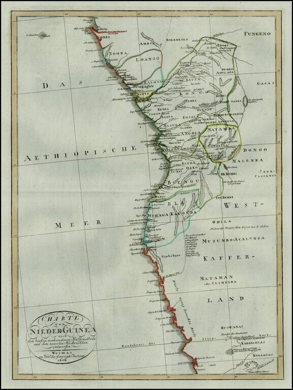
Rare early 19th Century map of the west coast of from Equatorial Guinea and Gabon to Namibia. The map is centered on Angola and the Congo.
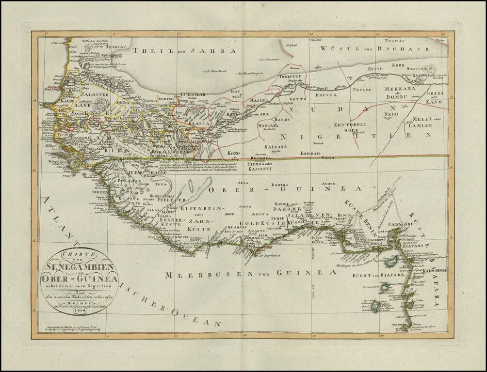
Scarce map of a portion of West Africa, published in Weimar in 1806. Incudes a fantastic depiction of the Sahara Desert in the north and the open unknown regions in the interior, with the extensive European Trading posts along the coastline. A scarce...
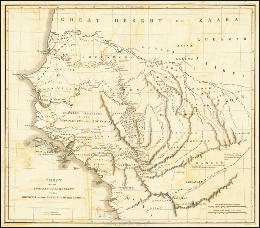
Scarce map of western Africa illustrating the travels of Gaspard Theodore Mollien to the sources of the Senegal and Gambia Rivers. The map covers modern day Senegal and Gambia along with Mauritania, Guinea, Guinea-Bissau and Mali, naming numerous...
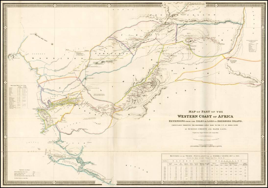
Rare separately issued map of a part of West Africa, showing Sierra Leone and the Southwestern Part of Guinea, published in London by James Wyld. Wyld's map presents one of the most detailed treatments of the country of Sierra Leon to appear on a...
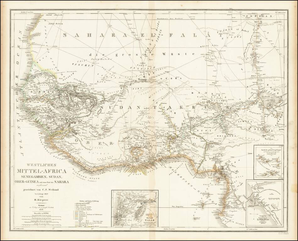
Fine large map of West Africa, published by German mapmaker Heinrich Kiepert in Weimar. Includes several insets, including an inset of the Free Colony of Liberia. Many early trade routes are located in the Sahara.
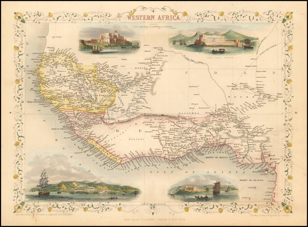
Decorative map of Western Africa, showing towns, roads, rivers, lakes, mountains, etc. Vignettes show Chirstianborg, Cape Coast Castle, Bakel and Sierra Leone. Engraved for R. Montgomery Martin's Illustrated Atlas. Tallis was one of the last great...
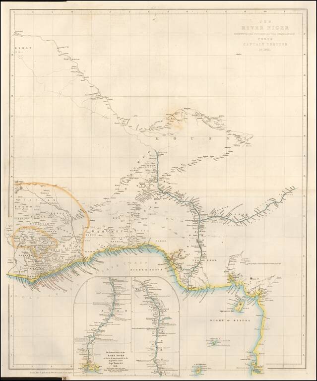
Fine large format map of the Course of the Niger River, published by John Arrowsmith in London. H.D. Trotter was the leader of an expedition up the Niger River, as part of a delegation of British Officers, including William Allen (1793–1864), under...
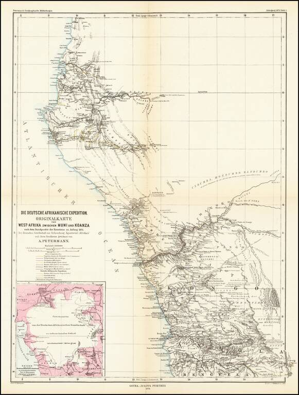
Detailed map of West Africa, showing explorers routes in the region. The map shows the expeditions between Muni River Region (Equatorial Guinea) to Koanza River Region of northern Angola. The map shows the routes of the following explorers: 16th...
![[Northern Nigeria Protectorate]](/map/small/70705.jpg)
A Map Prepared for the British Conquest of Northern Nigeria. Detailed map of Nigeria and vicinity, published by W. and A.K. Johnston for the Intelligence Division, of the War Office (UK). The map is framed by the Niger River, Benue River, and Lake...
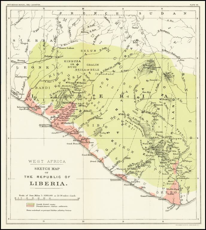
Mapping The Freed American Slave Efforts -- Republic of Liberia Scarce map of the Republic of Liberia, which illustrated an article by Sir Harry Johnston on Liberia, which was read at the Royal Geographical Society on March 27, 1905 and appeared in...
![[Cote d'Ivore] Dakar et le Cap Vert Vue cavaliere de la presqu'ilse caput pulcherrimum - dessinee et elumminee par Abou Siril](/map/small/58864.jpg)
A Whimsical View of Dakar Whimsical promotional / pictorial map of the area around Dakar in the Cote d'Ivore. Includes the note "Université de Dakar, Institut Français d'Afrique Noire" on verso. The map is signed by Theodore Monsou.
![[Madagascar] S. Lorenzo](/map/small/37926.jpg)
Marvelous example of Porcacchi's map of the Island of Madagascar. One of the earliest obtainable maps of the Island and one of the few published in the 16th Century. Excellent topographical detail, if a bit conjectural, and naming many locations....
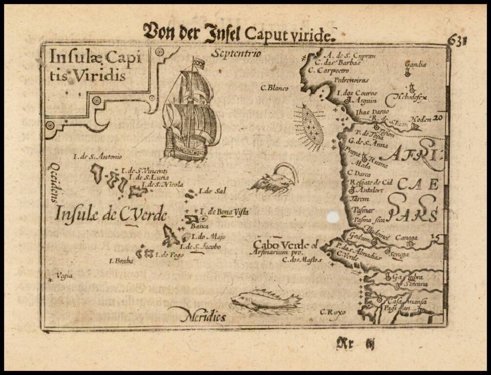
Nice example of this early state of Barent Langenes map of the Cape Verde Islands, which first appeared in the 1598 edition of Langenes Caert-Thresoor, published in Middelburg. Langenes's map was first issued in his Caert-Thresoor and later...
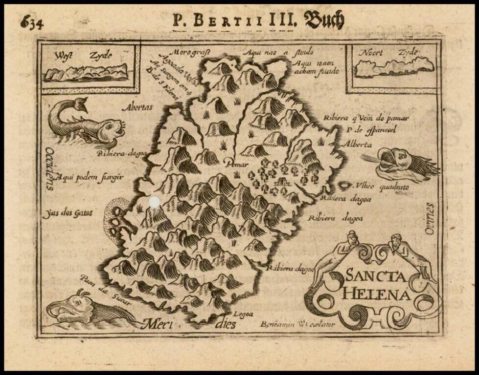
Nice example of this early state of Barent Langenes map of the island of St. Helana, which first appeared in the 1598 edition of Langenes Caert-Thresoor, published in Middelburg. Langenes's map was first issued in his Caert-Thresoor and later...
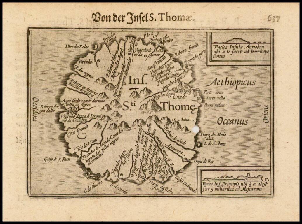
Nice example of this early state of Barent Langenes map of the island of St. Thomas, which first appeared in the 1598 edition of Langenes Caert-Thresoor, published in Middelburg. Langenes's map was first issued in his Caert-Thresoor and later...