
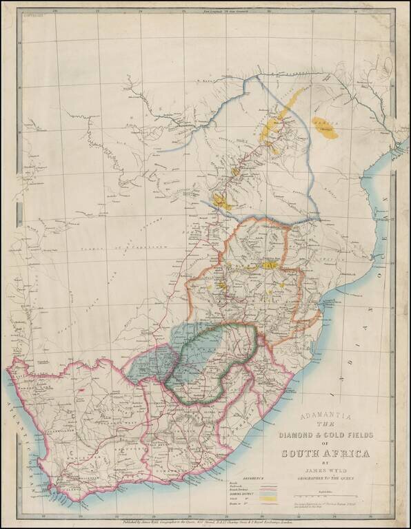
Rare map of the Adamantia region of South Africa, published by James Wyld in 1874. A very early map of the diamond fields. Pniel is shown but not Kimberley. The gold fields indicated are the Manica and Northern Gold Fields. The gold fields of the...
![[Bilene - Limpopo River -- Mozambique] Esboco Hydrographico do Rio Limpopo entre a Ilha dos Patos e o Vão do Gongunhana, abrangendo o rio Changâne até ao Monte Chibuto: feito pelo 1º tenente da Armada Alvaro Andréa commandante da Lancha C.ª Capêllo dur](/map/small/60869.jpg)
Bilene, Mozambique -- Rio Limpopo From Chibuto to Military Post of Languene Rare separately published map of a portion of the Limpopo River, from the Mount Chibuto Region to the Military Post of Languene, just north of Xai-Xai District. The map was...
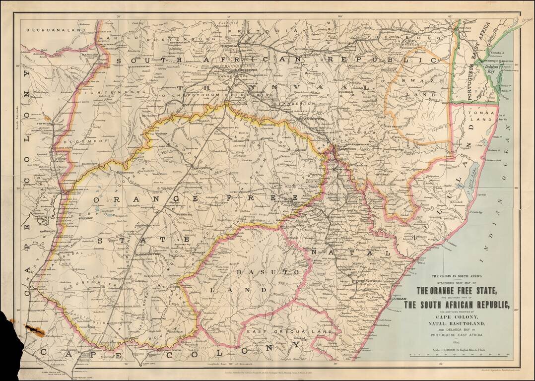
First edition of this scarce regional map of South Africa and neighboring regions, published during the "Crisis in South Africa." On December 30, 1880, a Boer republic was proclaimed and fighting broke out until the treaty of Pretoria (April 5, 1881)...
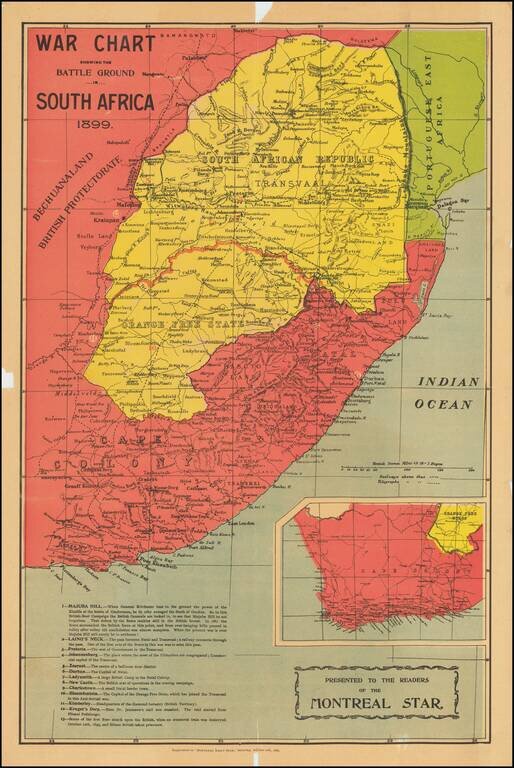
First Shots of the Second Boer War Large colorful map of South Africa, which appeared as a Supplement to the Montreal Dail Star, October 21, 1899. The map illustrates the state of affairs following the first week of Boer attacks against the British...
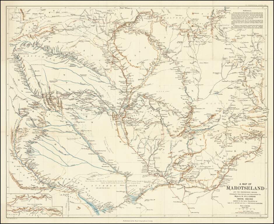
A Scarce Map Following Expeditions Exploring The Zambezi Basin An antique map showing western half of Zambia, collating the results from several expeditions to the region which occurred at the end of the 19th century. The area shown extends into parts...
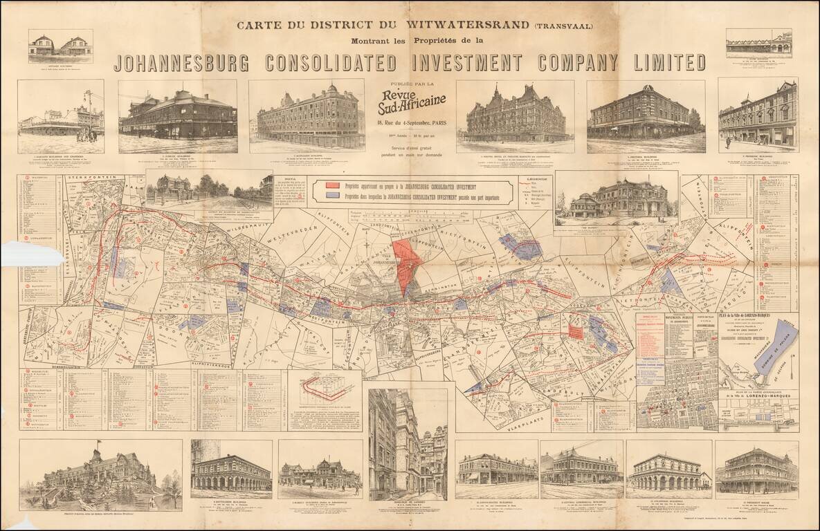
Highly detailed set of maps and profile views of buildings, promoting the activities of the Johannesburg Investment Company.
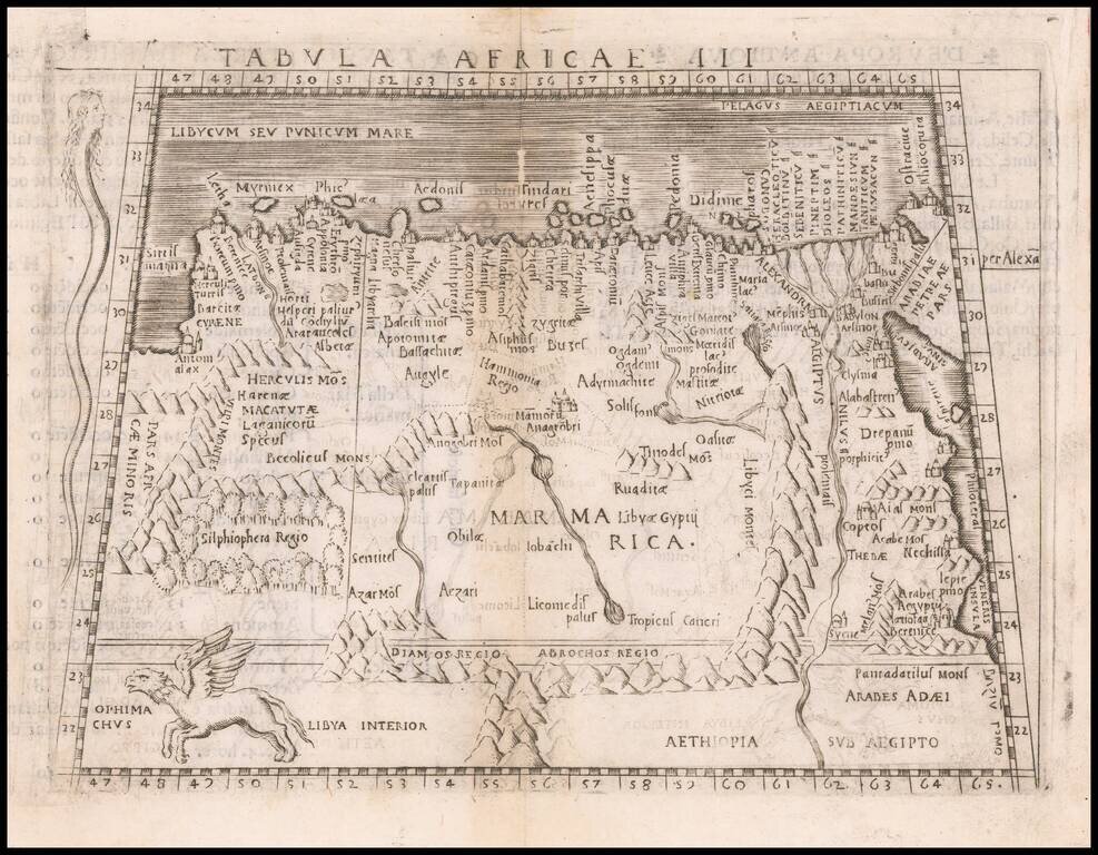
Nice example of Gastaldi's map of the northeastern portion of Africa, based on Ptolemy. The map extends east to Egypt and the Red Sea and south to Libya Interior. Snake with a human head and Ophimchus (winged creature) are shown. appear on the map....
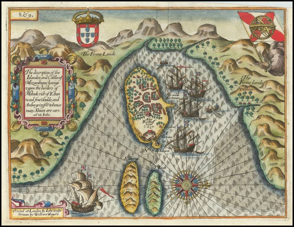
Rare English Edition! Decorative view of Melinde harbor on the island of Mozambique, which appeared in the rare English edition of Linschoten's Itinerario, Iohn Huighen van Linschoten. His discours of voyages . . . , published in London in 1598, and...
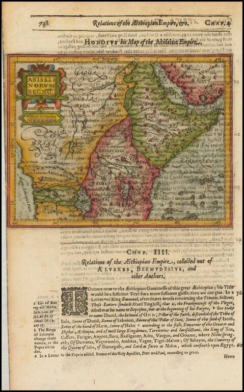
Detailed map of Prester John's Kingdom, extending from the Red Sea and Nubia the Angola, the Congo and Cafates. Shows a large lake Zaire. Includes a large decorative cartouche. Text discussion of Prester John. From the 1625-26 edition of Purchas His...
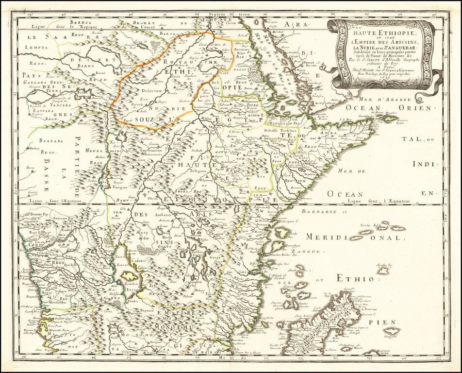
Nice example of the first edition of Sanson's map of the Red Sea and Abyssinia, south to Madagascar, Zanzibar and the Congo Region. Fabulous detail in the interior of the map, including towns, mountains, lakes, rivers and a host of other information....
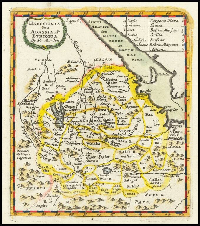
Scarce early English map of the region south of Egypt and the Red Sea. This first map appeared in Modern's rare Atlas Terestris, first published in 1687.
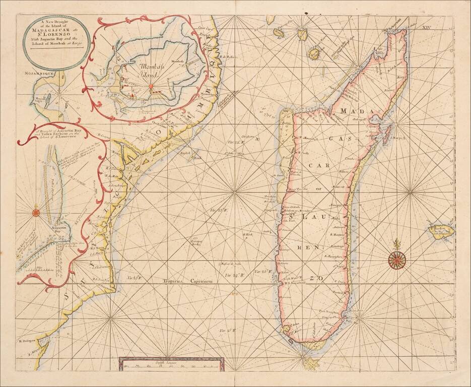
Scarce engraved sea chart of the coast of coast of Mozambique and the island of Madagascar with three insets of important ports north of Mozambique. This is an important map for Kenya as well, as it shows "Mombass Island", now Mombasa, with a...
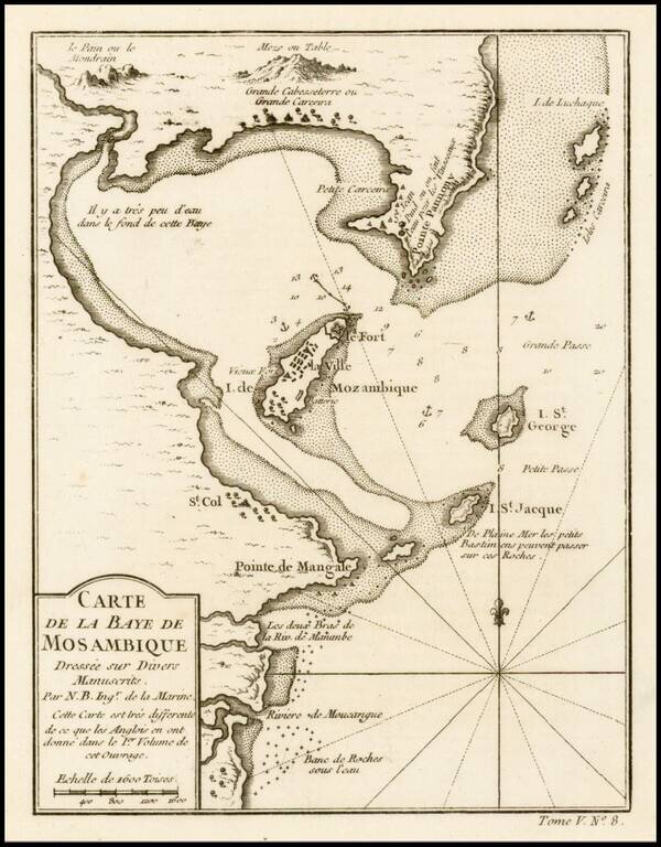
Fine example of this highly detailed map of the Bay of Mosambique, published by French Royal Geographer J.N. Bellin in Paris.
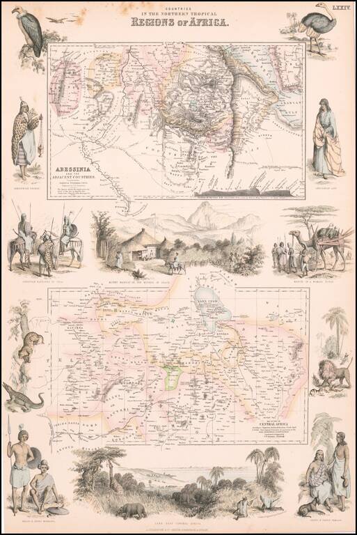
Decorative pair of maps of Abyssinia and Central Africa, published in Edinburgh. Includes large views of Mount Mamrat and Lake Tsad (Chad), with smaller vignettes of indigenous animals and peoples.
![[Lake Tanganyika, Lake Victoria and Northwest Tanzania]](/map/small/63611.jpg)
Fine early map of Northeast Tanzania, published as part of a Petermann & Hassenstein's map of Inner Africa. The map features a number of roads and the routes of 19th Century African explorers, including: Burton & Speke - 1857-58 Speke -...
![[Uganda - South Sudan ]](/map/small/63642.jpg)
Fine early map of Northern Uganda,Lake Albert and the southern part of South Sudan, published as part of a Petermann & Hassenstein's map of Inner Africa. The map features a number of roads and the routes of 19th Century African explorers,...