
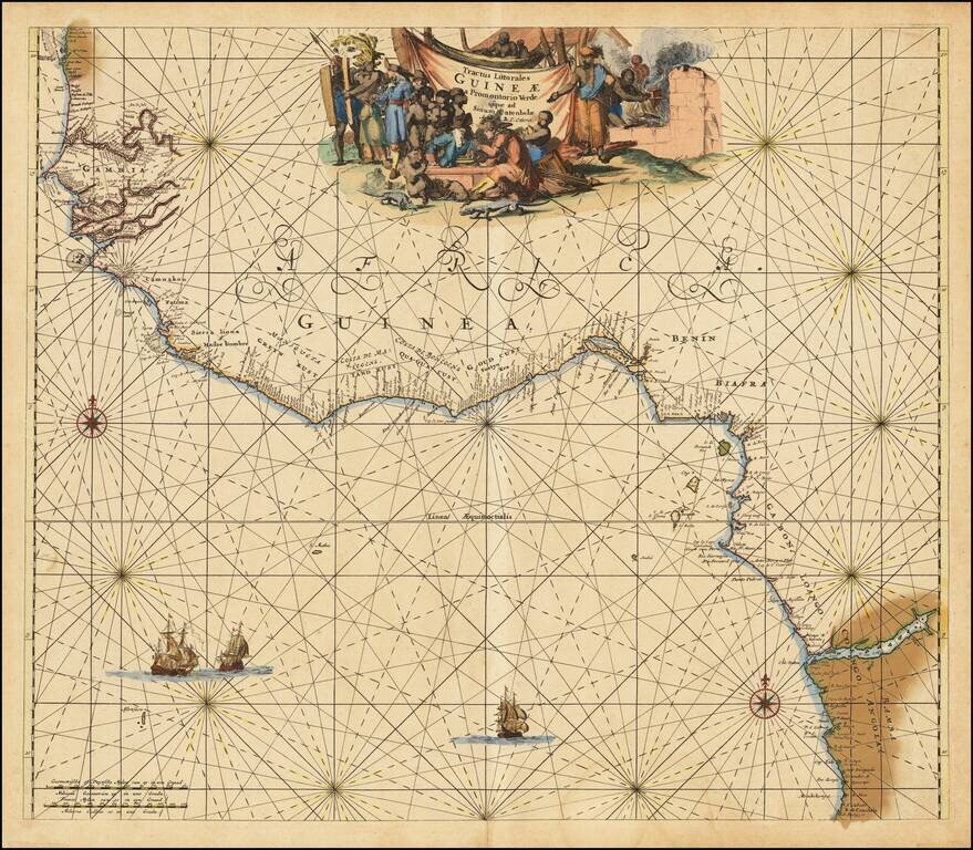
Nice old color example of this detailed sea chart of the West African Coast, from Senegal to Sierra Leone. Decorative cartouches, rhumblines, sailing ships and other decorative features embellish the map.
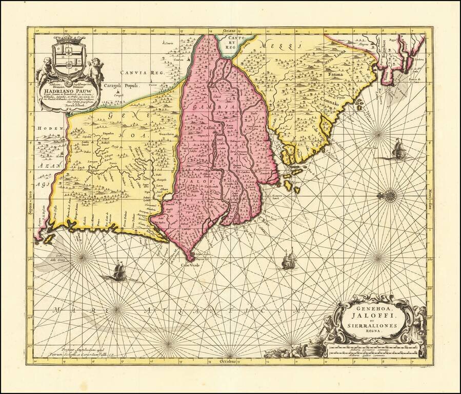
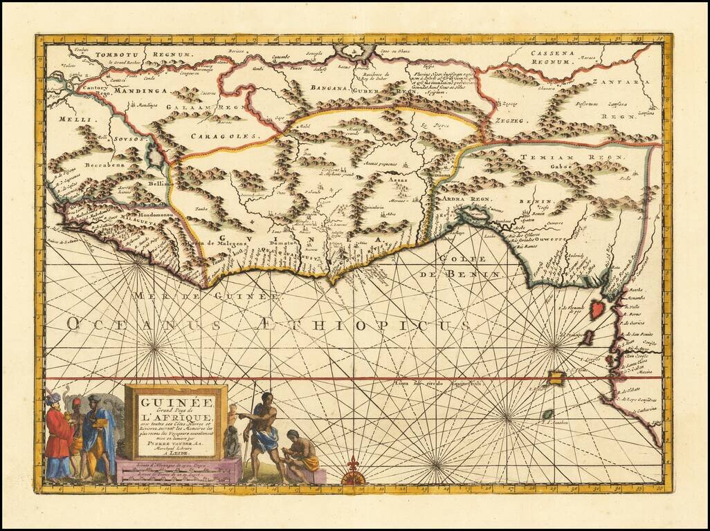
Decorative map of West Africa, published by Valk & Schenk in Amsterdam. The map includes numerous animals in the interior, sailing ships and several elegant cartouches. The sea is show with Rhumb lines. The first state of this fascinating map,...
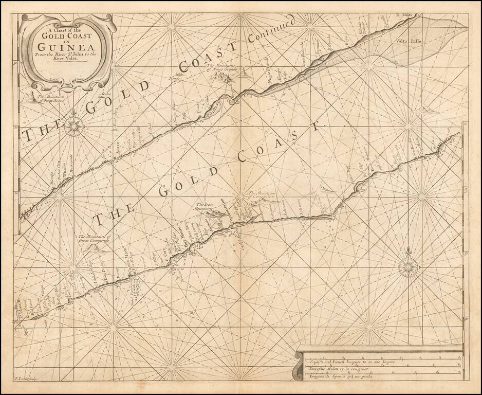
Rare English sea chart of the Gold Coast, published by Samuel Thornton. The chart includes 2 sections of the West African Coastline, along the Cape Coast of Ghana. A number of Western settlements are noted, including: Dutch Factory at Fort St. Jago...
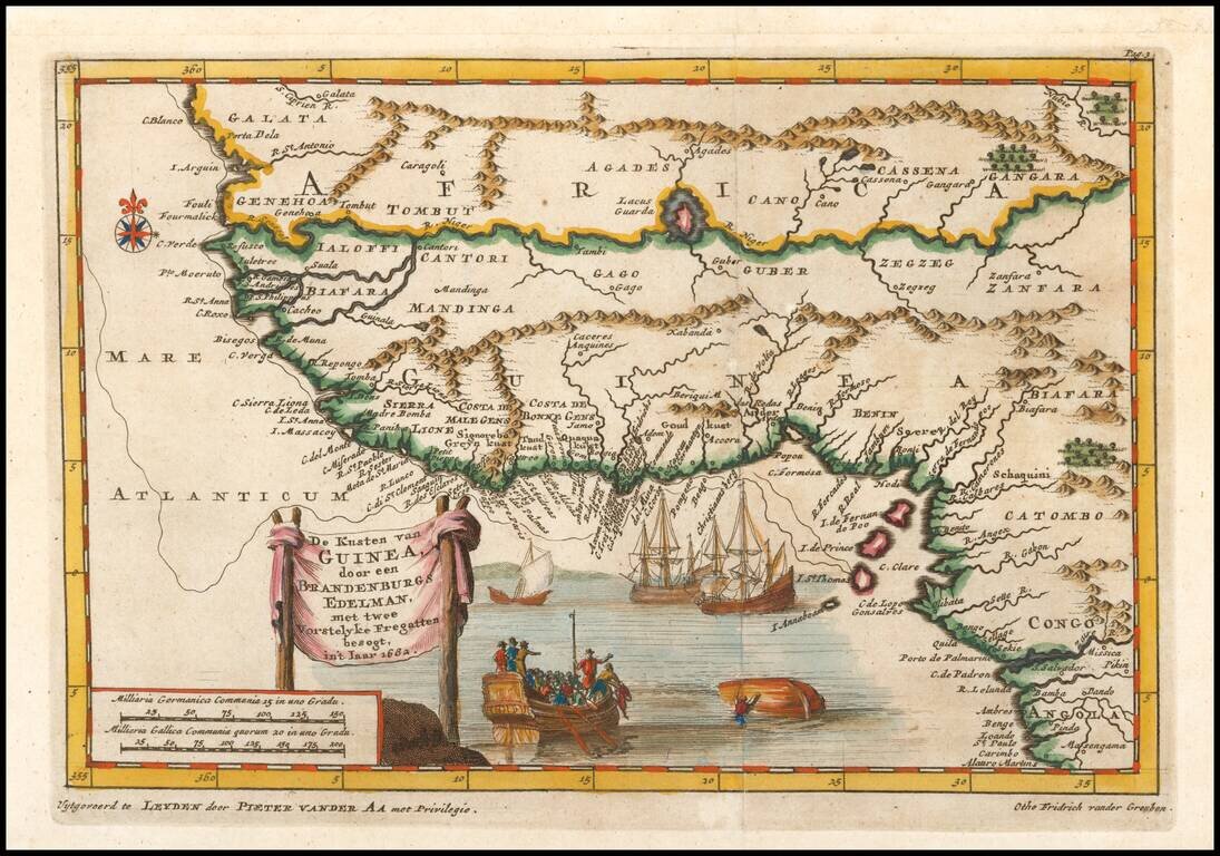
Sriking map of western Africa based upon the 1682 desciptions of Otho Frederic vander Greuben. Includes nice detail along the coast and in the interior, 4 ships (one capsized) and other decorative features.
Striking map of West Africa, including extensive notes in the interior and nice topographical details. Vander Aa's decorative maps were some of the best engraved and most interesting maps of the early 18th Century.
![[West Coast Africa: Sierra Leone, Liberia and Guinea]](/map/small/40123.jpg)
Fine Map of the West African Coastline From a Celebrated Voyage Collection Detailed, striking map of the coasts of Sierra Leone, Liberia, and Guinea, from the Churchills' famous voyage collection, published in London in 1732. It is based on the voyage...
![A Chart of the Gold Coast of Guinea from Rio da Costa to Rio da Volta [with a view of Cape Santa Appollonia]](/map/small/64635.jpg)
Detailed Map of the Gold Coast From a Celebrated Voyage Collection Finely-wrought map of the coast of Ghana, from the voyage account of Jean Barbot in the Churchill brothers’ renowned voyage collection, published in London in 1732. The maps of the...
Nice old color example of the Ottens sea chart of West Africa. The map extends from Senegal in the north to Angola in the south, centered on the Bay of Guinea. There is a wealth of navigational information including sandbanks and shoals. The chart is...
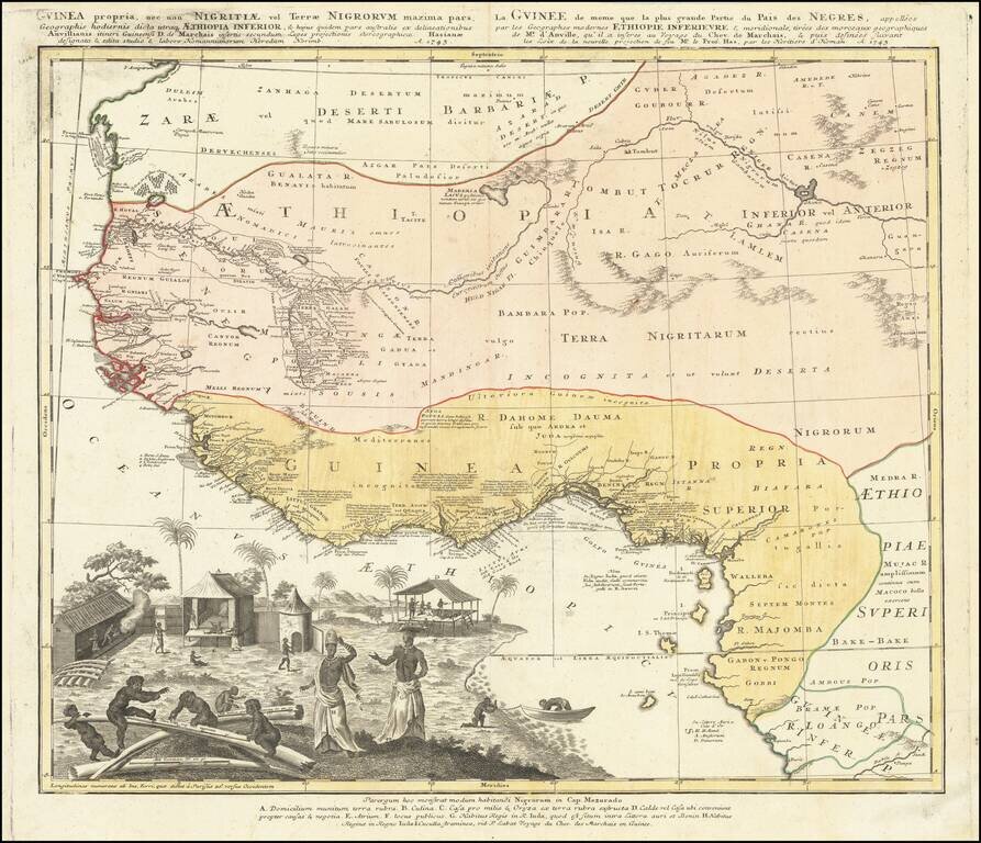
Strikingly-Illustrated Eighteenth-Century Atlas Map of West Africa Dynamic example of this highly decorative and detailed antique map of West Africa, published by the Homann Heirs in 1743. This is one of the best atlas maps of the region made during...
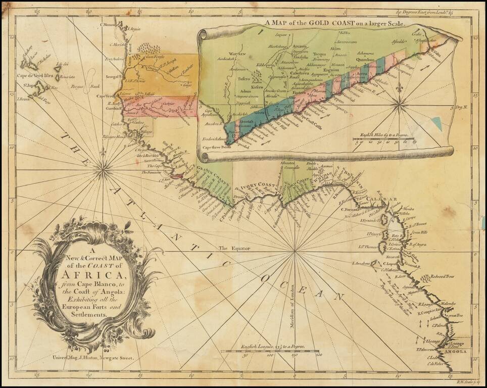
Detailed map of the of the West African Coastline, with a large inset of the Gold Coast, from an early edition of the Universal Magazine. These early Universal Magazine maps are quite rare on the market.
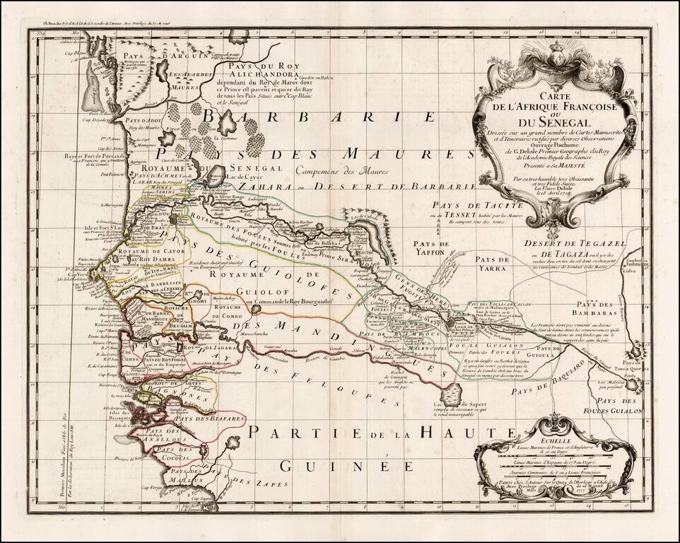
Fine example of Philppe Buache's edition of De L'Isle's highly detailed map of part of the West Coast of Africa, from Cap Blanc to the Pays des Mallus, centered on the Gambia River and Senegal River. Extraordinary detail along the two rivers, tracking...
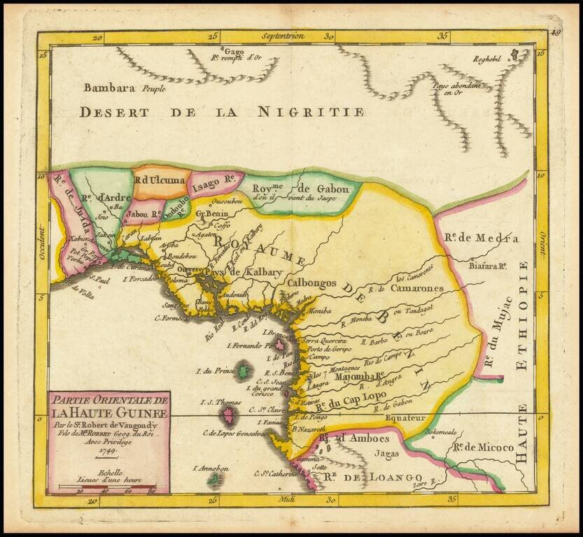
Detailed map of the Gulf of Guinea, published in Paris in 1749 Includes all or part of the modern countries of Ghana, Togo, Benin, Nigeria, Cameroon, Equatorial Ginea and Gabon, which at the time was primarily the "Kingdom of Benin."
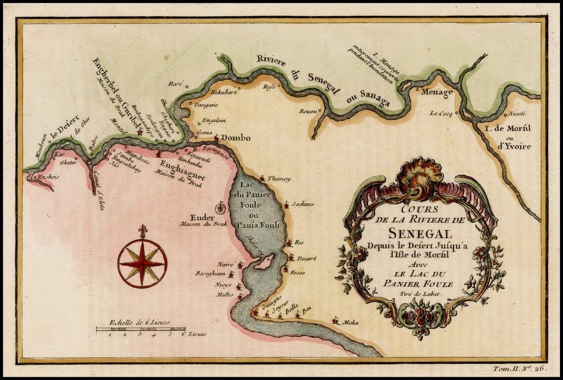
Detailed map of a part of the Senegal River, published by Bellin in Paris.
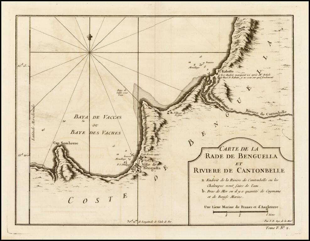
Detailed regional map of the region between Benguela, Angola and the Cantonbelle (Catumbela) River, from J.N. Bellin, the map maker to the King of France. The map includes Fort. Kabuto, which Bellin notes as having been identifed by the English and De...
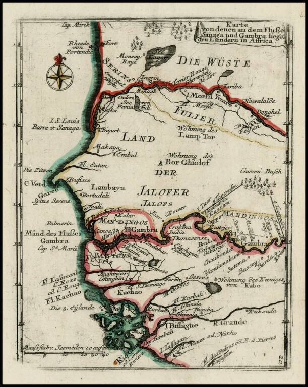
Scarce map of the coast of West Africa, centered on the Gambia Rive and Senegal River, from Heiden's Americanische urquelle derer innerlichen kriege des bedrängten Teutschlands.
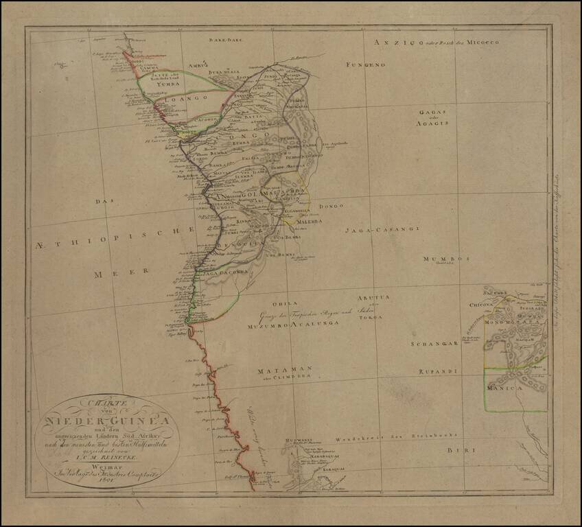
Fascinating German hand-colored engraved map of western central Africa, encompassing the Congo River Basin south to Angola. Congolese peoples are labelled and divided with hand-color into regions, with little detail shown outside of the coast. In the...