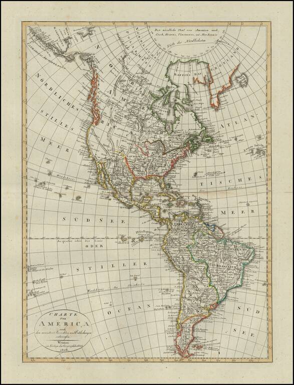
Scarce map of America, published in Weimar in 1806. The western part of North America is still relatively unknown, pre-dating the reports of Lewis & Clark and other western explorers. The map shows a very speculative Northwest Passage with a...
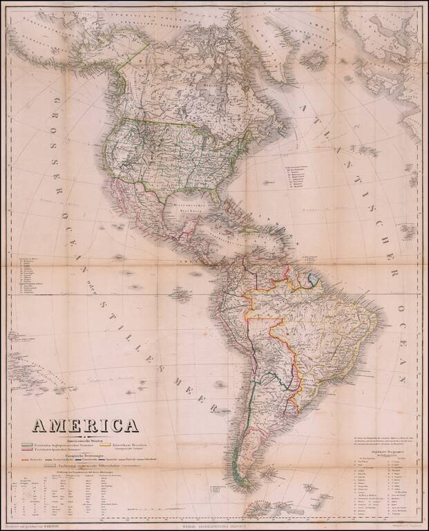
Rare Pocket Map of America, Celebrating World Conferences in Antwerp & Moscow Rare separately published map of America, published by the Weimar Geographische Institut, in conjunction with the International Geographical Conference in Antwerp of...
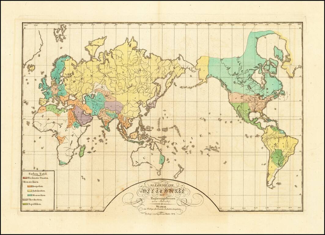
A World Map of Despots, Theocrats, Monarchs and Autocrats, etc. Rare map of the world, illustrating the the different governments of the world in 1817. The key locates 6 typles of Government: Federated States Monarchies - Despots Monarchies -...
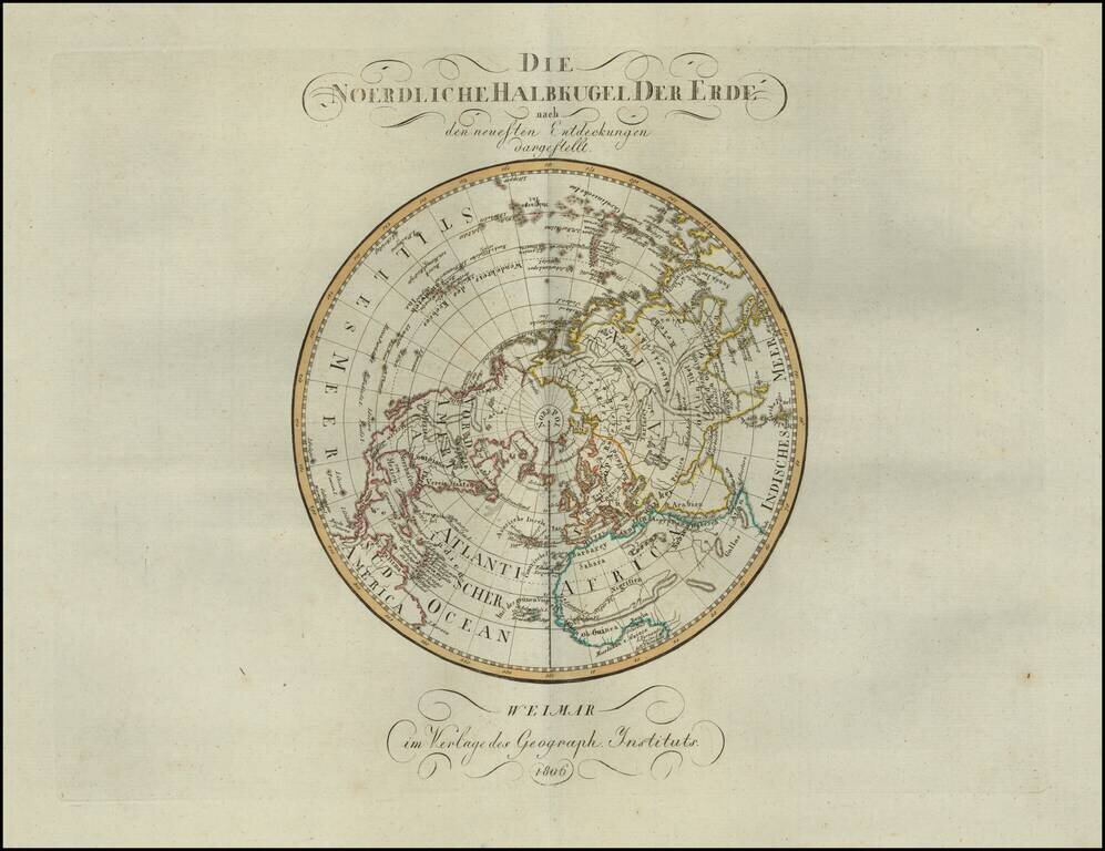
Rare map of the Northern Hemisphere, published in 1806. The map shows the incomplete understanding of the Northwest Passage, as well as still speculative details on the northwest coast of America and the interior parts of North America.
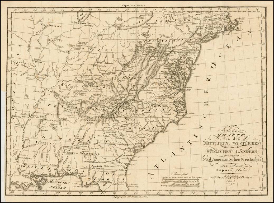
Rare early German map of the United States, in the first decade of the 19th Century. One of the most striking features of the map is the excellent treatment of the major western roads. The map provides and excellent treatment of the Indian Tribes...
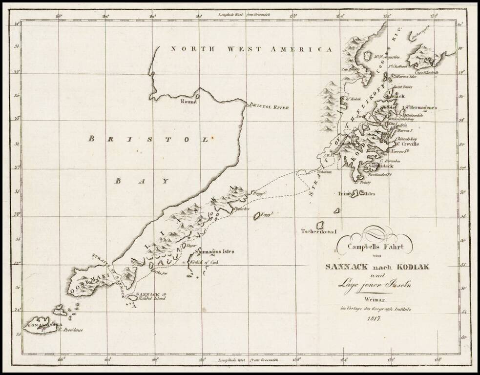
Rare map showing the tracks of Archibald Campbell's long boat trip from Sannack to Kodiak (then Russian America) in 1807. This map, showing the southwestern tip of Alaska and several Aleutian Islands, is from a German Serial containing numerous...
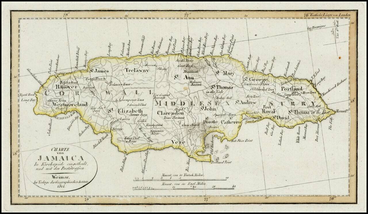
Detailed map of Jamaica, colored by Parishes. Shows Postal Roads, churches, towns, harbors, rivers, mountains and many other details. One of the earliest obtainable maps of Jamaica to locate postal roads.
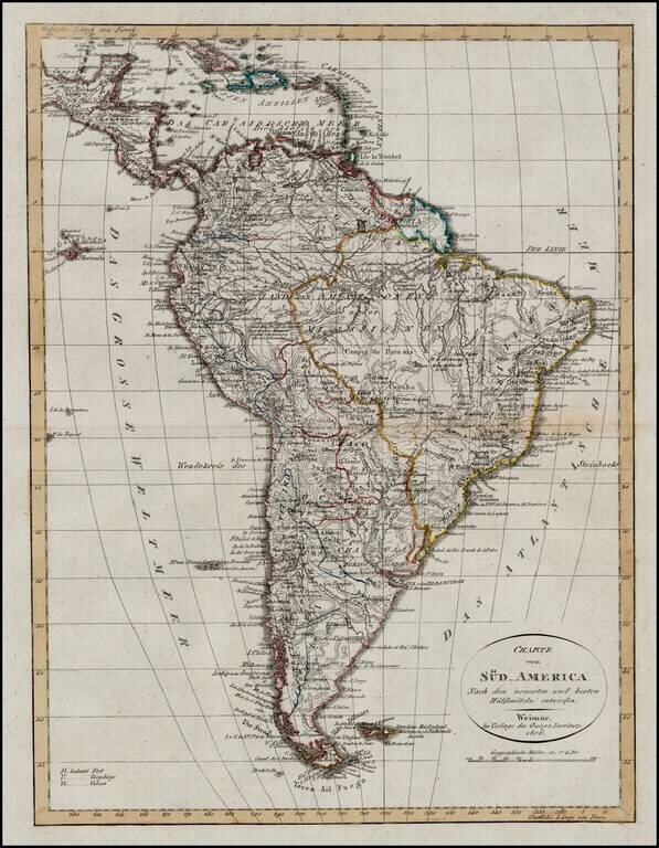
Scarce map of South America at the outset of its Century of Revolution. Highly detailed map wih extensive annotations throughout and a fine depiction of the Rivers and Mountains in the interior regions.
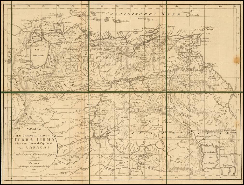
Rare separately published map of the northern part of South America. The map is focused on Venezuela and "Spanische Guyana." The map depicts the region in the year that Dutch Guyana was taken from the Netherlands by Britain.
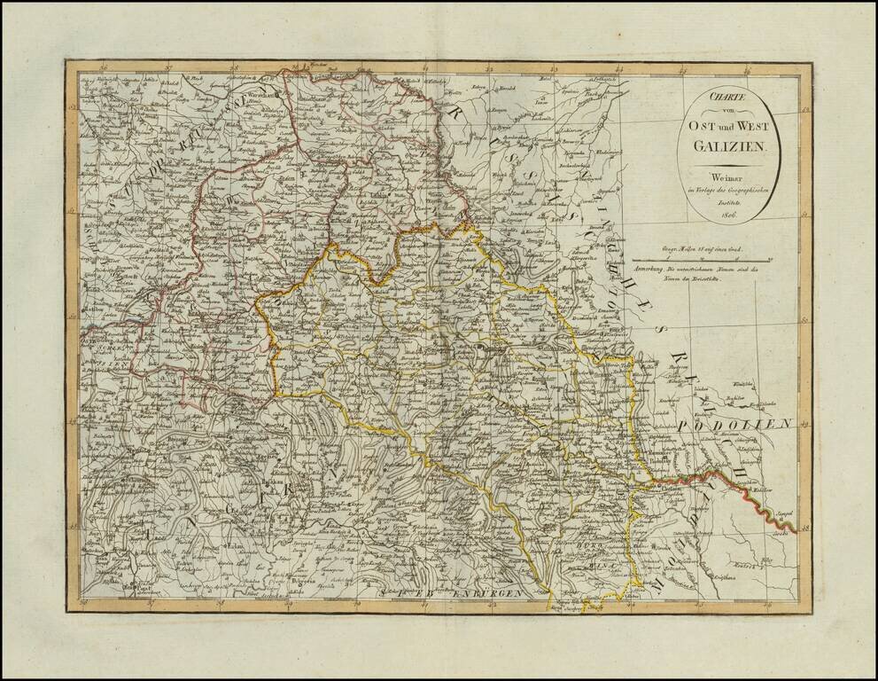
Scarce map of Eastern and Western Galizia in Poland, published in Weimar in 1806.
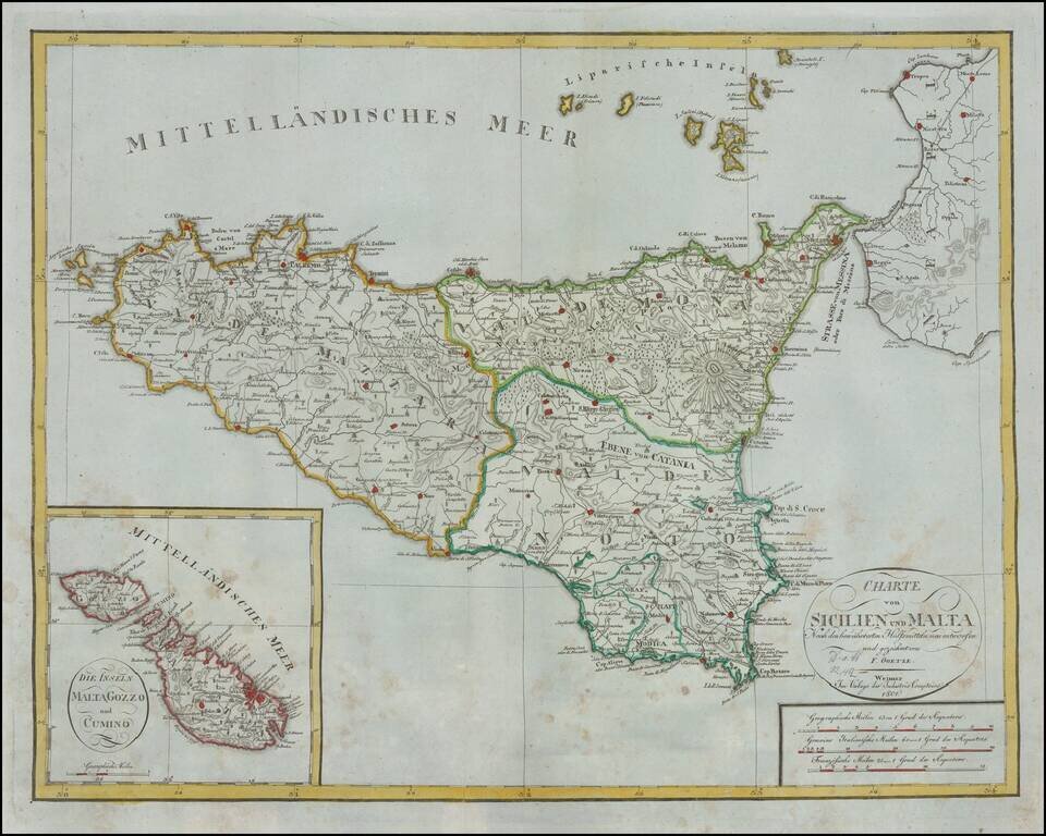
Rare early 19th Century map of Sicily and large inset map of Malta. Shows excellent detail in the interior of the Islands, including political subdivisions, topography and the location of Volcanoes on Sicily. This is the first time we have ever seen...
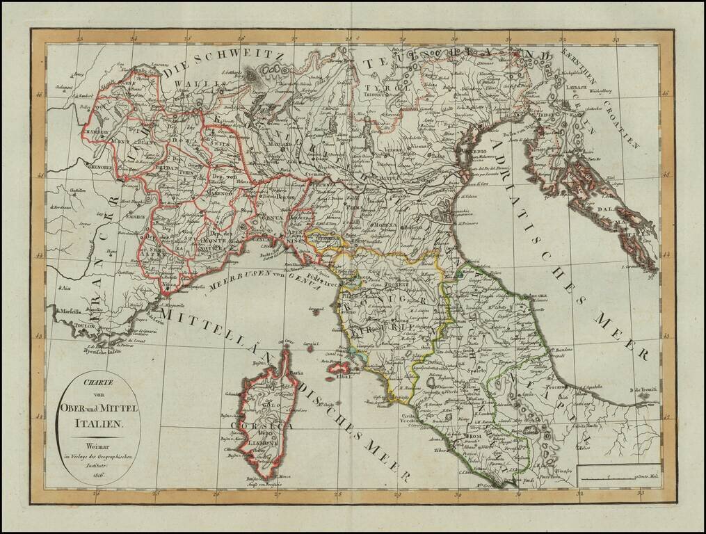
Scarce map of Northern Italy and Corsica, published in Weimar in 1806. A scarce map -- this is the first example we have seen.
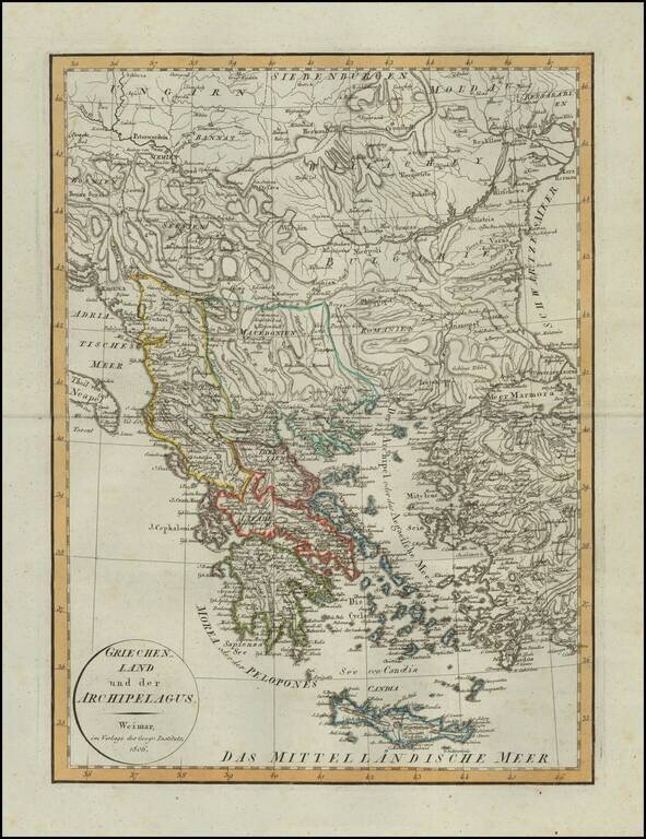
Scarce map of Greece, published in Weimar in 1806. A scarce map -- this is the first example we have seen.
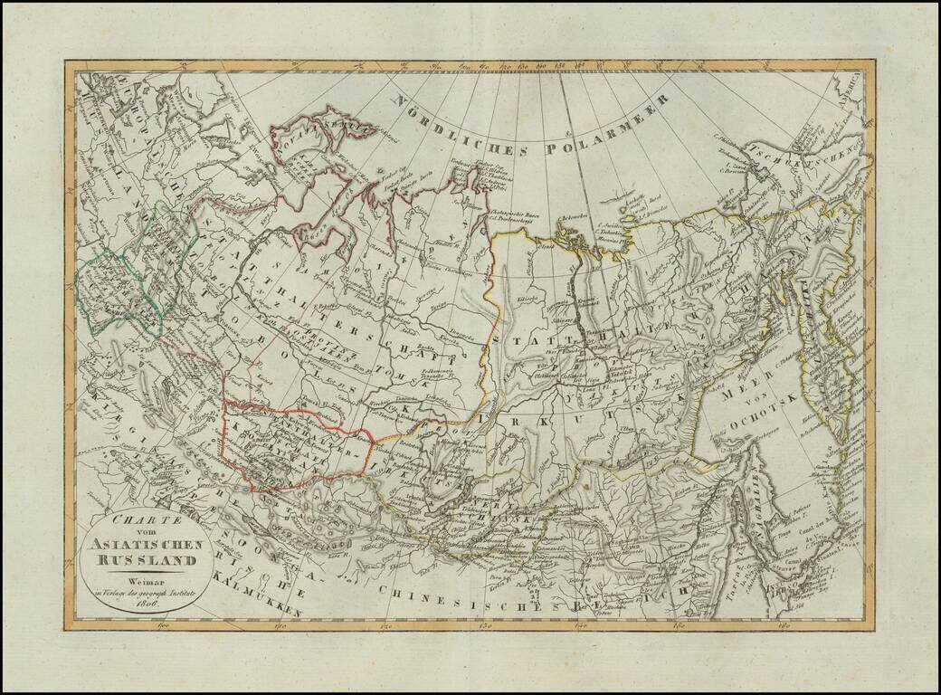
Scarce map of Russian Asia, published in Weimar in 1806.
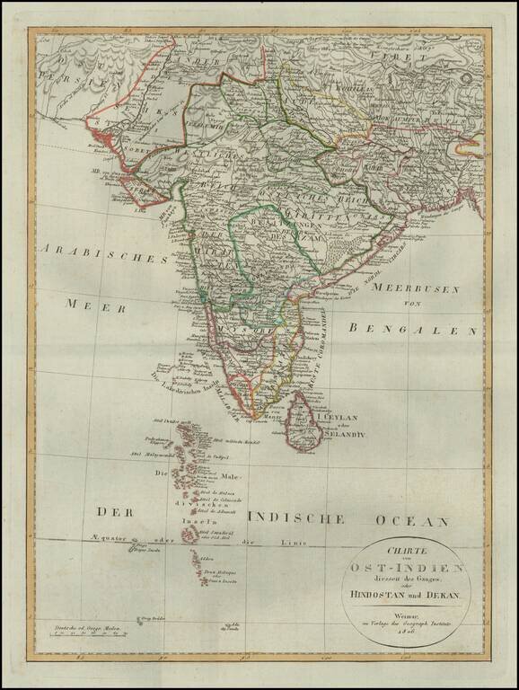
Detailed map of of India, from a scarce atlas published in Weimar. The map presents a fine depiction of the Maldives, along with political divisions in India. Some topographical information provided in Tibet and Nekpal (Nepal), including the location...
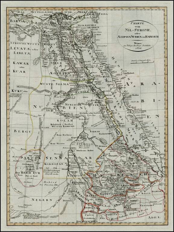
First edition of this scarce map of Egypt and Abyssinia, which was later copied in a pirated edition published in Prague.