logo

1806. Charte von Ober und Mittel Italien . . . 1806

  • Charte von Ober und Mittel Italien . . . 1806

Charte von Ober und Mittel Italien . . . 1806 information:

Year of creation: 
Resolution size (pixels): 
 10907x8252 px
Disk Size: 
 17.1777MiB
Number of pages: 
 1
Place: 
 Weimar

Print information. Print size (Width x height in inches):
Printing at 72 dpi 
  151.49 х 114.61
Printing at 150 dpi 
 72.71 х 55.01
Printing at 300 dpi 
 36.36 х 27.51

An example of detailing the file of this map of in a printable high-resolution:

Click to open in high resolution (open in new tab).
Attention! this is just the central piece (central area 960x960 px) of the map file!
This is an example, so that you can see and study the level of detail of a given map. The entire Map will be fully available after payment!

Charte von Ober und Mittel Italien . . . 1806

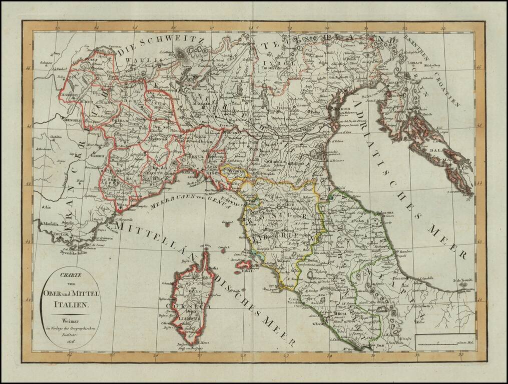
Scarce map of Northern Italy and Corsica, published in Weimar in 1806.

A scarce map -- this is the first example we have seen.


Special conditions for students!

If you are a student, write to us in telegram: @antiquemaps and indicate what material you need and for what work you need a map in high detail. We are ready to provide material on special terms. For students only!

Item information:

Year of creation:
Size:
10907x8252 px
Disk:
17.1777MiB
Number of pages:
1
Place:
Weimar
Author:
Weimar Geographische Institut.
$14.99

Related item