Map size in jpg-format: 48.3717MiB
Click to open in high resolution (open in new tab).
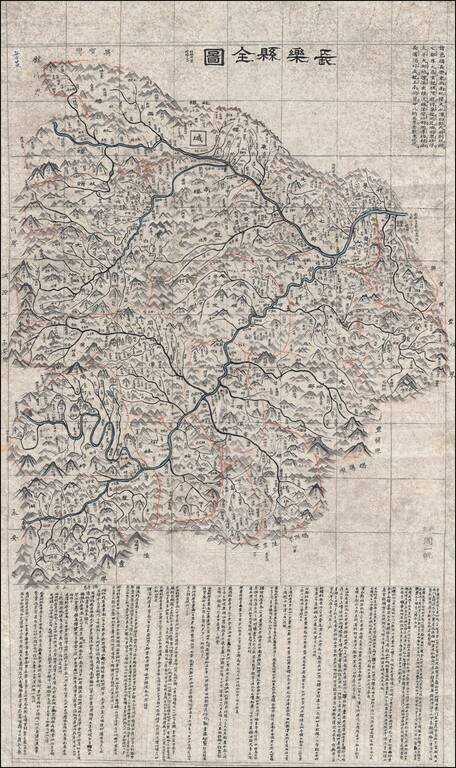
Hand Drawn Map of the Wuhua County in the Guangdong Province
Finely executed late Qing Dynasty Chinese manuscript map of Wuhua County, northeast of Hong Kong in eastern Guangdong Province, China.
The map, which uses the Qing name of the region, Changle, was composed by an anonymous Chinese cartographer, probably a regional government official.
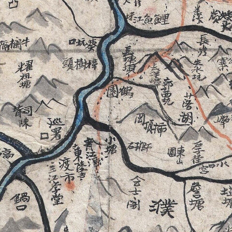
The map details the course of the Meijiang River as it divides into the Wuhua River, flowing to the northwest, and the Qinjiang River, flowing to the southeast. It labels numerous villages as well as many of the area's famous mountains, including Ma'an Shan, Yanwei Shan, Guija Shan, Dongshan Shan, among others.
A major walled city is illustrated near the divergence of the Wuhua and Tanxia Rivers, roughly in the location of modern ay Huachengzhen (华城镇). Orange borders define township divisions, with some 400 villages noted.
Extensive textual annotation in the upper right and along the bottom of the map, describe the governing structure of the region, giving some hint to the map's intended administrative purpose. Penciled in gridlines betray the hand of the cartographer and suggest this map may have been copied from another.
Dating
The map is undated, but from the style, paper, content, and workmanship, we can loosely date it to the late 18th or early 19th century.
Rarity
Chinese administrative maps from the late Qing are extremely rare and almost never appear on the market.
If you are a student, write to us in telegram: @antiquemaps and indicate what material you need and for what work you need a map in high detail. We are ready to provide material on special terms. For students only!
![[Martin Behaim Globe / Book] Pars Globi terrestris Ao. 1492 a Martino Behaim Equite Lusitano Norimbergae confecti Delineavit Christoph. Theoph de Murr 1778 (bound with:) Diplomatische Geschichte des Portugesischen berühmten Ritters Martin Behaims](/map/small/68828.jpg)
![Il Disegno Della Terza Parte Dell' Asia [Gastaldi's Wall Map of SE Asia with extra panels!]](/map/small/30554hbp.jpg)
![Chinae, olim Sinarum regionis nova descriptio. auctore Ludouico Georgio. [English Edition!]](/map/small/71123.jpg)