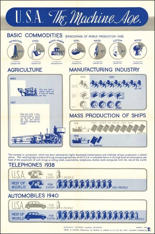
An interesting info-graphic, illustrating America's move toward industrialization in the 20th Century. The top line focuses in on the United States's increasing share of the productoin of Petroleum, Steel and Agricultural products. The next graphic...
![[World] Air France -- Reseau Aerien Postal](/map/small/65424.jpg)
Decorative Air France Map Poster by Atelier Percival, exhibiting the Air France Post Routes. Dated January 1848.
![[World] Air France](/map/small/67997.jpg)
Rare Reduce Sized Variant A decorative Air France poster map by Lucien Boucher, based on his 1948 map. The map presents a lively pictorial view of the World, with Air France routes extending to Buenos Aires, the Eastern United States, Tehran,...
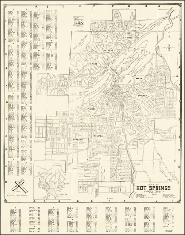
Detailed map of Hot Springs Arkansas, drawn by Robert S. Lowrey from data furnished by the City Engineer.
![Official Texas Brags Map of North America . . . Scale One Inch = 6 Texas Grapefruit [With Original Envelope!]](/map/small/68359.jpg)
Texas Brags with Original Mailing Envelope! Whimsical Map of North America, from a Texan's perspective. Places and names throughout the states are often incorrect or fictitious, satirizing a parochial attitude towards other parts of the country. For...
![[Kensington Metropolitan Park / Kent Lake] Scouting To Adventure Gold Rush of '48 Detroit Area Council Boy Scouts of America . . . 1948](/map/small/63032.jpg)
A Gold Rush Themed Scouting Retreat in 1948 Pictorial map of the Kensington Metropark area of Kent Lake, prepared in conjunction with the Detroit area Boy Scouts of America regional council, June 25, 26 and 27, 1948. The map provides a lively image...
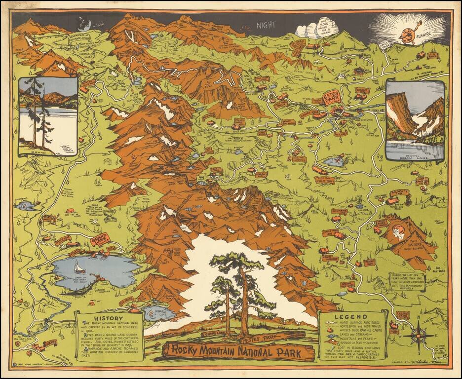
Striking Pictorial Map of Rock Mountain National Park, published by the Rocky Mountain Motor Company. In the foreground is Allens Park Village, Meeker Park, Granby and Reservoir. At the top of the map are the Headwaters of the Colorado River, Red...
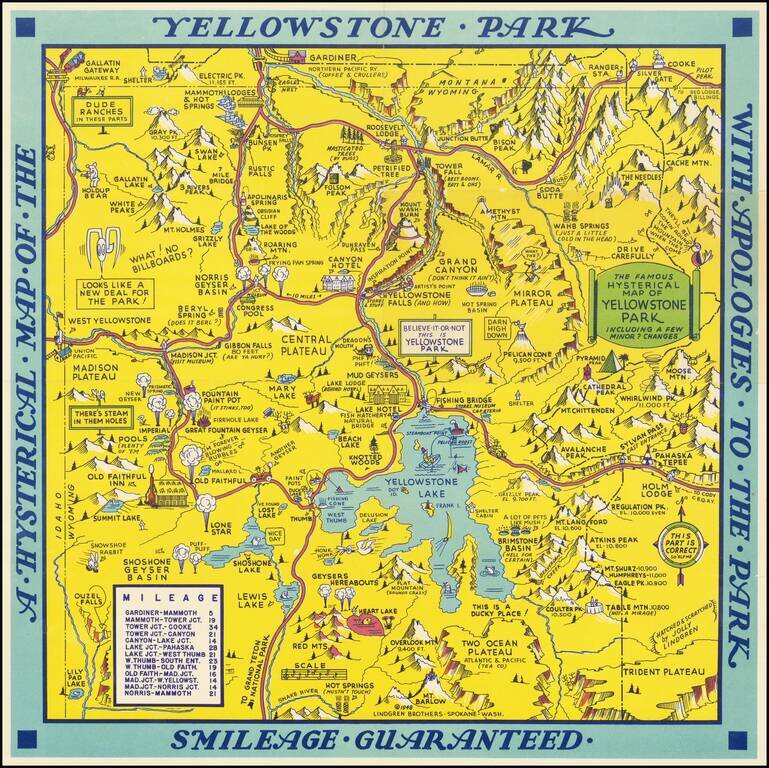
Scarce 1948 edition of the Jolly Lindgren map of Yellowstone, "Hatched & Scratched by Jolly Lindgren." This edition adds the table of miles at bottom left, among other changes, including the addition of Pilot Peak at the top right corner. This...
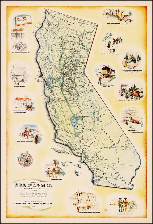
Decorative map of California, prepared under the direction of the California Centennial Commission to celebrate 100 years of California statehood. The map shows California as it was in 1848 and includes illustrations of the Bear Flag Revolt, San...
![[California] Honor Roll Foresters of America May 1, 1947 to May 1, 1948](/map/small/63016.jpg)
Previously unrecorded map of California, promoting the growth of the Foresters of America within California from May 1947 to May 1948. Includes the following information: 27 Courts Initiated 582 Re-instated 5 Net Gain 12 Courts Total - 59...
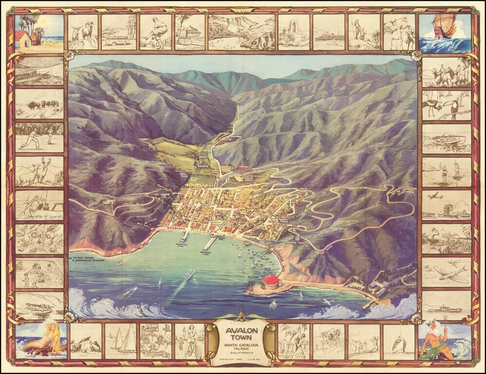
Pictorial Map of Avalon, During the Catalina Golden Age Decorative birdseye view of the town of Avalon on Santa Catalina Island, off the coast of Southern California. Includes a striking birdseye view of the town, Casino, harbor and vicinity, showing...
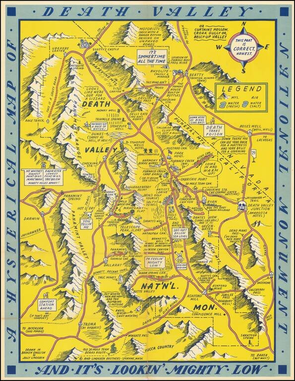
First edition of this humorous map of Death Valley. "Drawn In Broken English by Jolly Lindgren," this comic pictorial map is full of puns and comic vignettes related to Death Valley. The Lindgren Brothers issued a number of other silly whimsical maps...
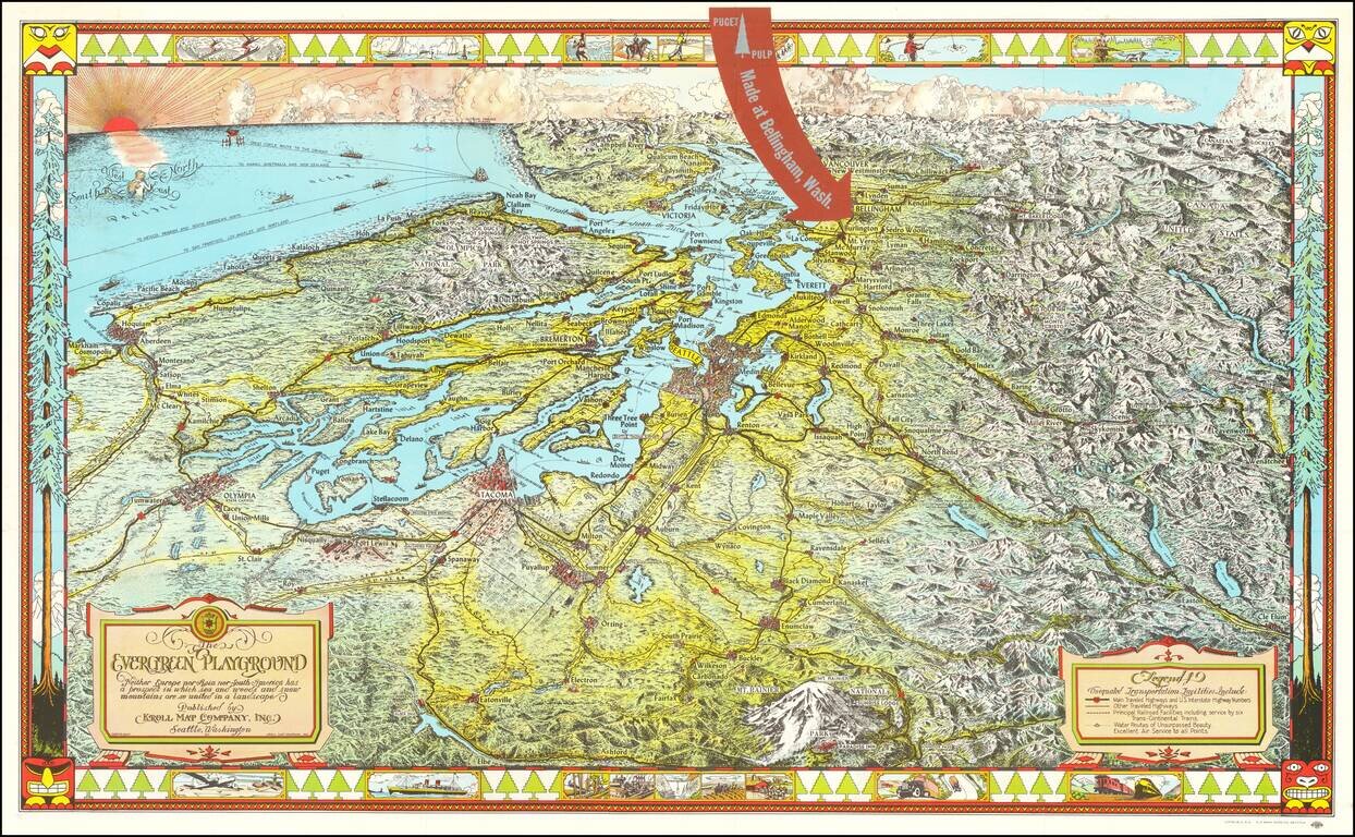
Fine large pictorial map of Puget Sound and the Northwestern Part of Washington State, which was included with a book on the history of paper pulp entitled Making Puget Pulp--A Pictorial Tour of Puget Sound Pulp & Timber's Plant At Bellingham,...
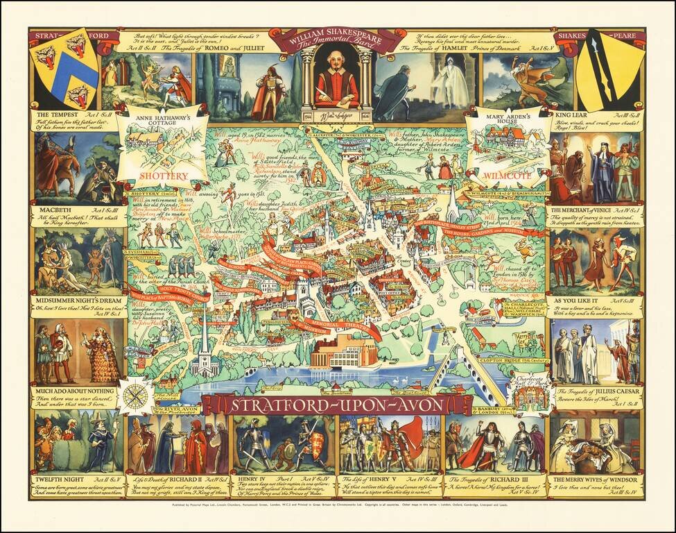
Rare pictorial map of Stratford-upon-Avon, the ancestral home of William Shakespeare. In the center, a map of the town is shown, naming streets, famous buildings, churches, parks, Inns, etc. The homes of famous locals are noted, with some William...
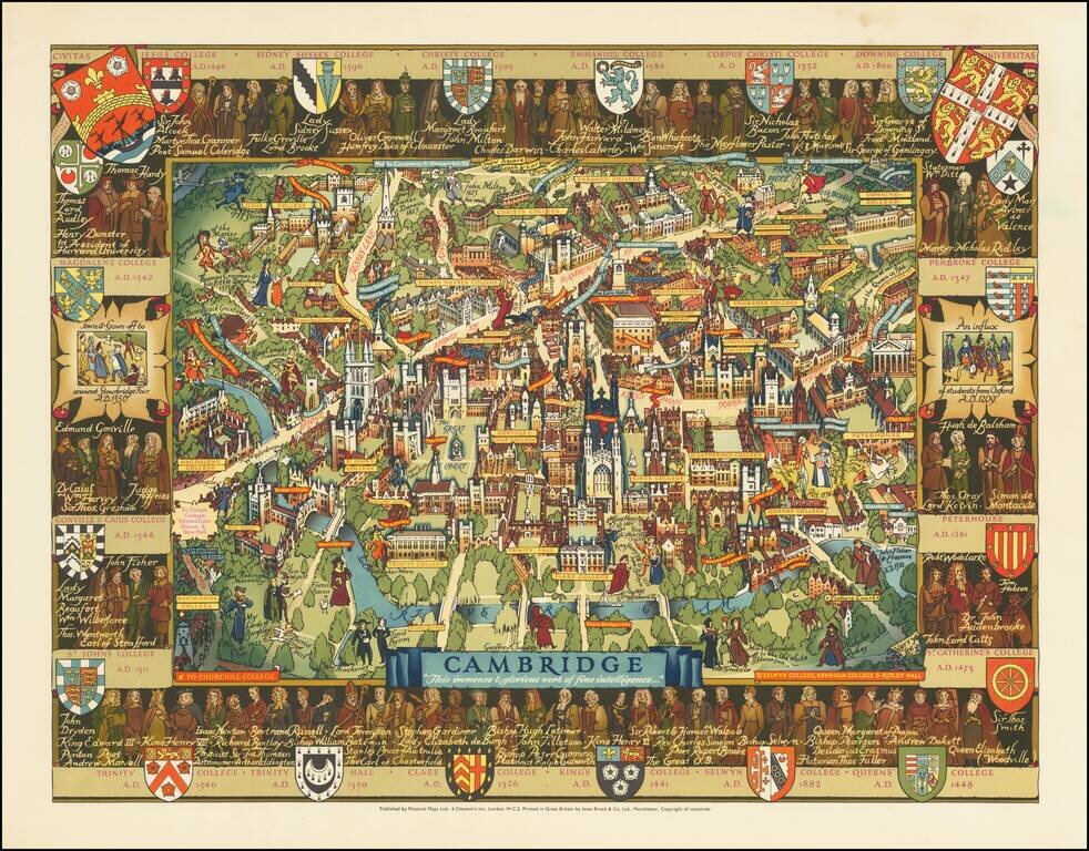
An attractive pictorial map of the idyllic and historical university town of Cambridge. The twenty-one constituent colleges of the university are all listed and shown around the map, save for Selwyn, Newnham, and Girton. The city is portrayed in...
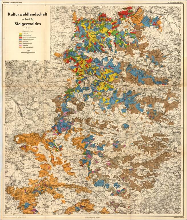
Cultural forest landscape in the Steigerwald of Germany, between Wurzberg and Nuremberg The map is color coded to show the predominant trees in each region.