![[Come To Dallas] Easy To Reach -- Hard To Leave](/map/small/63387.jpg)
Pictorial map of the United States, focusing on Dallas as the center of the country. The map shows distances from Dallas to many other major cities in the United States. The map was published as part of the centennial of the Republic of Texas...
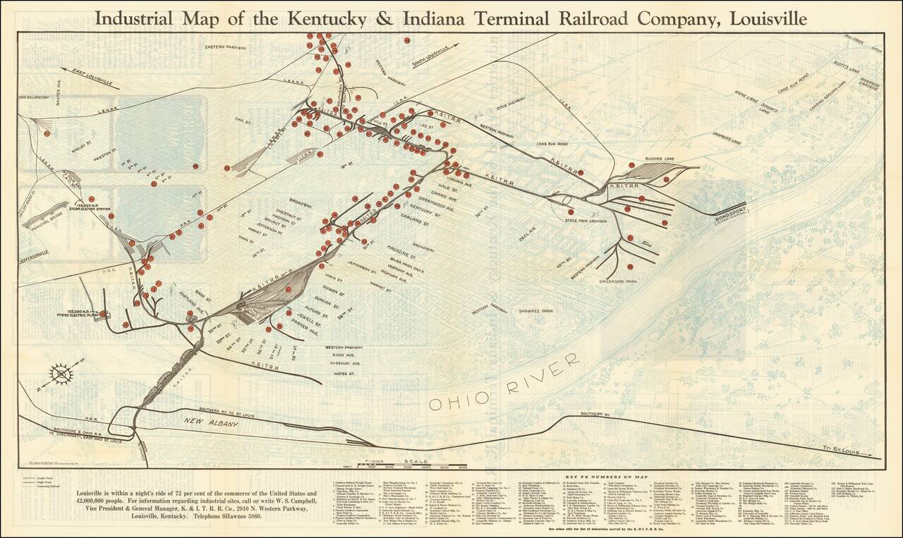
Louisville is within a night's ride of 72 per cent of the commerce of the United States and 42,000,000 People Interesting map of Louisville, Kentucky, highlighting the location of the railroad lines, major manufacturers, and freight houses in...
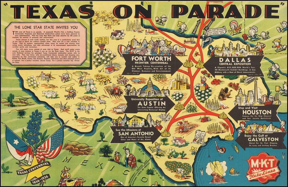
Rare Texas Centennial Pictorial Map, published by the MKT Katy Lines. The map highlights six destinations, Dallas, Houston, Austin, Galveston, San Antonio, and Fort Worth. The lively pictorial maps shows regional vignettes featuring the commerce and...
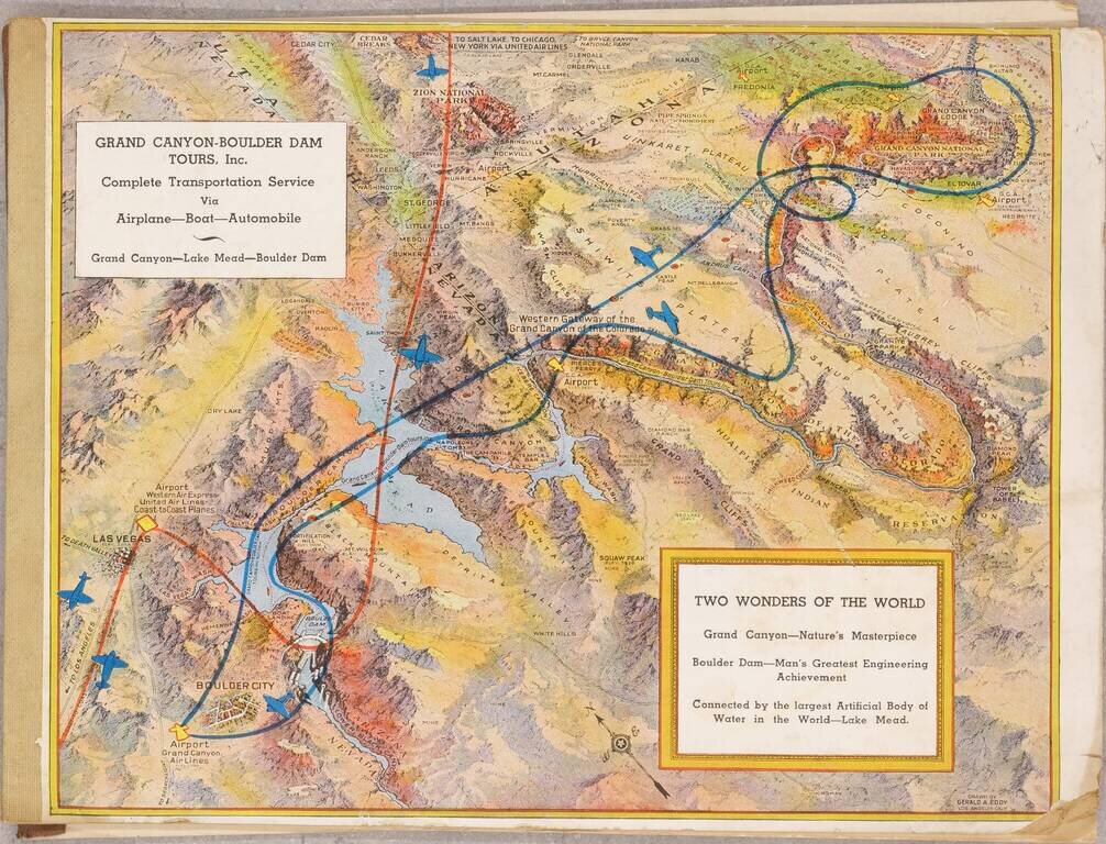
Pioneer Air Tours For The Grand Canyon July 1936 booklet outlining the services of the recently created Grand Canyon - Boulder Dam Tours Inc., with illustrated covers by famed pictorial map artist Gerald Eddy. The booklet outlines the tours offered...
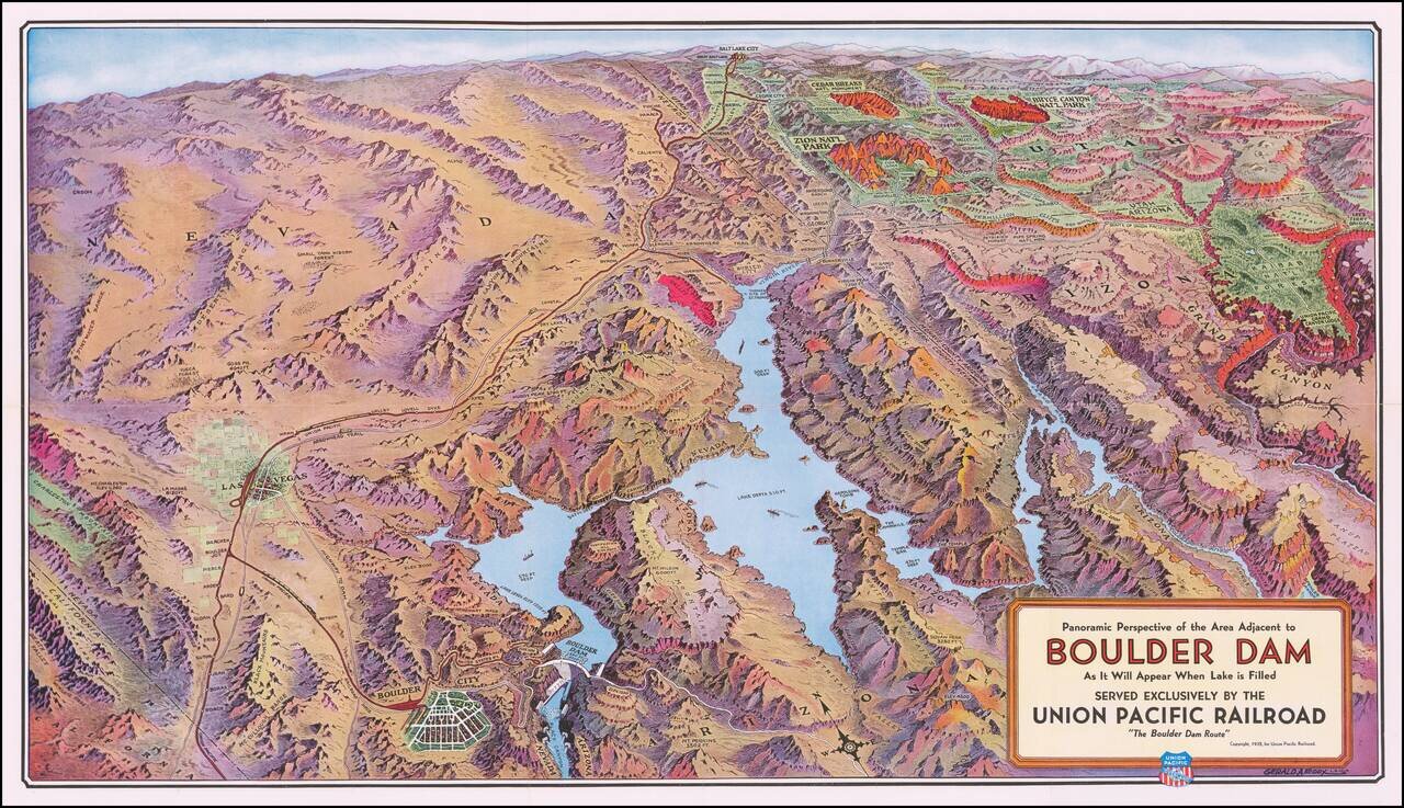
Boulder Dam & Environs Striking panoramic view of the Nevada, Utah, and Arizona desert, from Las Vegas to the Grand Canyon, published by the Union Pacific Railroad. The map extends east to the Union Pacific Grand Canyon Lodge on the north rim of...
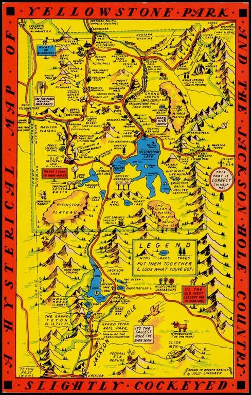
"Drawn in Broken English by Jolly Lindgren," this comic pictorial map is full of puns and comic vignettes related to Yellowstone and environs. The Lindgren brothers issued a number of other silly whimsical maps of national parks and other parts of the...
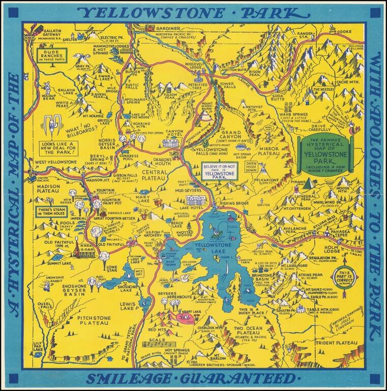
"Hatched & Scratched by Jolly Lindgren," this comic pictorial map is full of puns and comic vignettes related to Yellowstone and environs. The Lindgren Brothers issued a number of other silly whimsical maps of national parks and other parts of the...
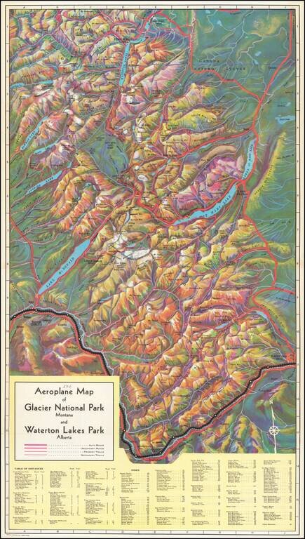
Rare birdseye view illustrating Glacier Park and environs, intended to promote the Great Northern Railway. Provides a fantastic topographical illustration of the area between Flathead River and the Glacier Park Hotel, with towns, mountains, roads,...
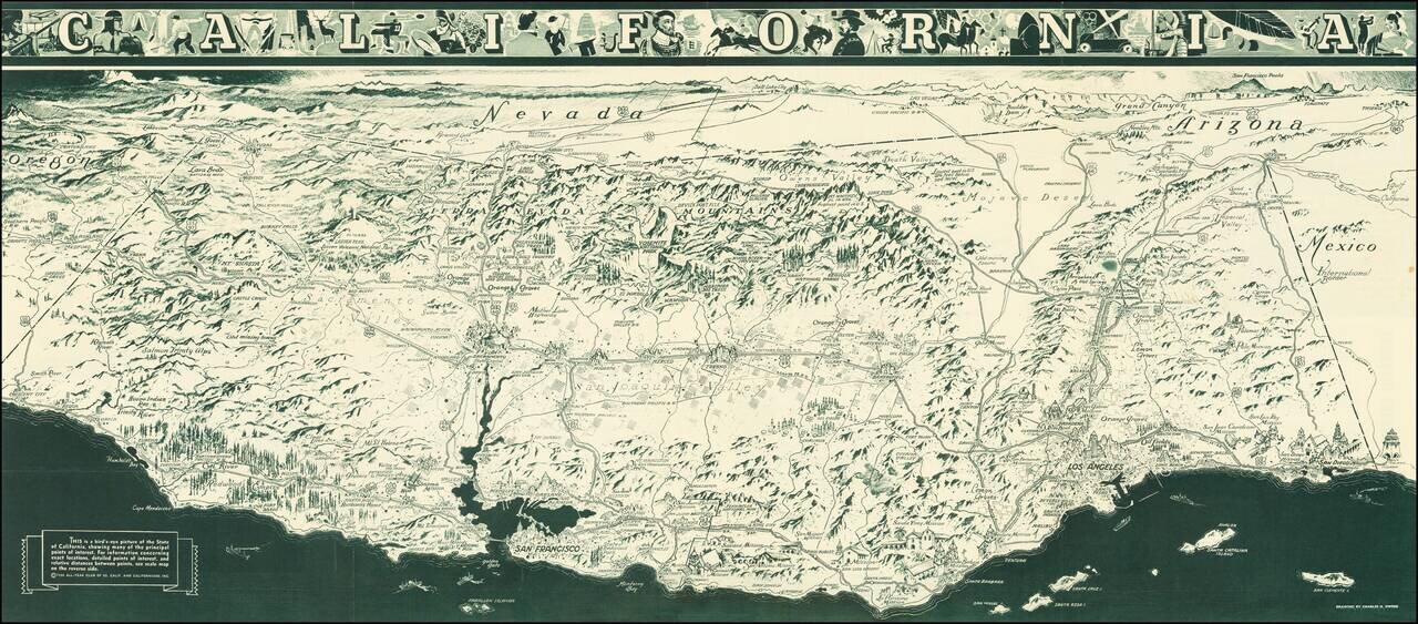
"While attractions for tourists are unlimited in California, it is necessary to advise persons seeking employment not to come here at this time. When opportunity arises California will gladly make it known." A striking Depression Era birds-eye view...
![[Hand Drawn Map By The Father of Modern Space Art] A Plan For The East Bay Prepared by Chesley Bonestell for the Purpose of Creating Interest in the Solution of that Problem. 1945.](/map/small/68505.jpg)
Waterfront Improvement Plan of the East Bay Drawn By The Father of Modern Space Art Hand drawn map illustrating a shoreline improvement plan of the East Bay, centered Berkeley, drawn by renowned American space and science fiction illustrator Chesley...
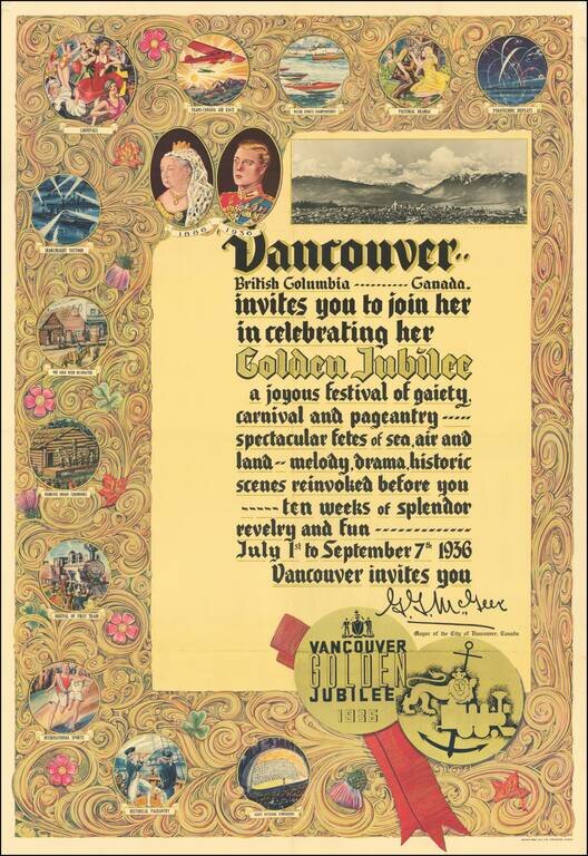
Beautiful color-printed poster commemorating the centennial of the founding of Vancouver, British Columbia, printed by Bulman Bros. in 1936. The full text of the poster reads: Vancouver.. British Columbia..... Canada. invites you to join her in...
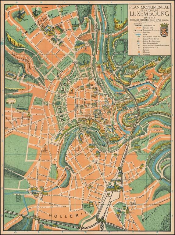
Superb color-printed view of Luxembourg City, with the monuments and landmarks of the city rendered pictorially. The map differentiates between parks, rivers, and built areas with green, orange, and blue, and the visual effect is quite pleasing. This...
![[Uniforms and Insignia of the German Army] Форма Обмундирования и Знаки Различия Германской Армии](/map/small/67803.jpg)
A very rare pre-World War II Soviet poster of Nazi-era German military uniforms. Underneath the title is an elaboration of colors used on the strap edging and buttonholes of troop uniforms, depending on their area of service. From left to right:...
![[Fascist Organizations of Germany] Фашистские Организации Германии](/map/small/67801.jpg)
One of the Most Dramatic Soviet Cartographic Appraisals of Nazi Germany. A fascinating Soviet poster map documenting the "Fascist Organizations of Germany", recording their structures, uniforms, and locations within the country, prior to the Second...
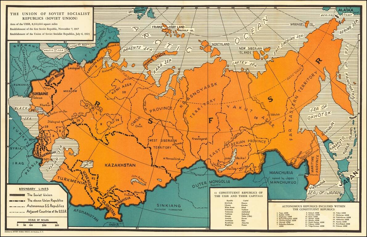
Soviet Russia Today was a pro-Communist magazine first published in February 1932, in New York, by the Friends of the Soviet Union. An interesting political map of the Soviet Union from the time of the Great Purge. The map pre-dates the annexation of...
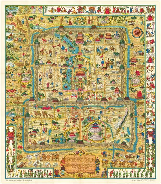
Scarce Variant Edition -- Different German Flag Finely executed pictorial map of Beijing, published by Frank Dorn and the Peiyang Press. Ltd. of Tientsin and Peiping, in 1936. The present example is a variant edition, with the flag of Germany being a...