logo

1936. Plan Monumental de la Ville de Luxembourg Édité par Feller Frères Impr. d'Art Luxbg.

  • Plan Monumental de la Ville de Luxembourg Édité par Feller Frères Impr. d'Art Luxbg.
  • Plan Monumental de la Ville de Luxembourg Édité par Feller Frères Impr. d'Art Luxbg.

Plan Monumental de la Ville de Luxembourg Édité par Feller Frères Impr. d'Art Luxbg. information:

Year of creation: 
Resolution size (pixels): 
 10083x13495 px
Disk Size: 
 40.6242MiB
Number of pages: 
 2
Place: 
 Luxembourg
Author: 

Print information. Print size (Width x height in inches):
Printing at 72 dpi 
  140.04 х 187.43
Printing at 150 dpi 
 67.22 х 89.97
Printing at 300 dpi 
 33.61 х 44.98

An example of detailing the file of this map of in a printable high-resolution:

Click to open in high resolution (open in new tab).
Attention! this is just the central piece (central area 960x960 px) of the map file!
This is an example, so that you can see and study the level of detail of a given map. The entire Map will be fully available after payment!

Plan Monumental de la Ville de Luxembourg Édité par Feller Frères Impr. d'Art Luxbg.

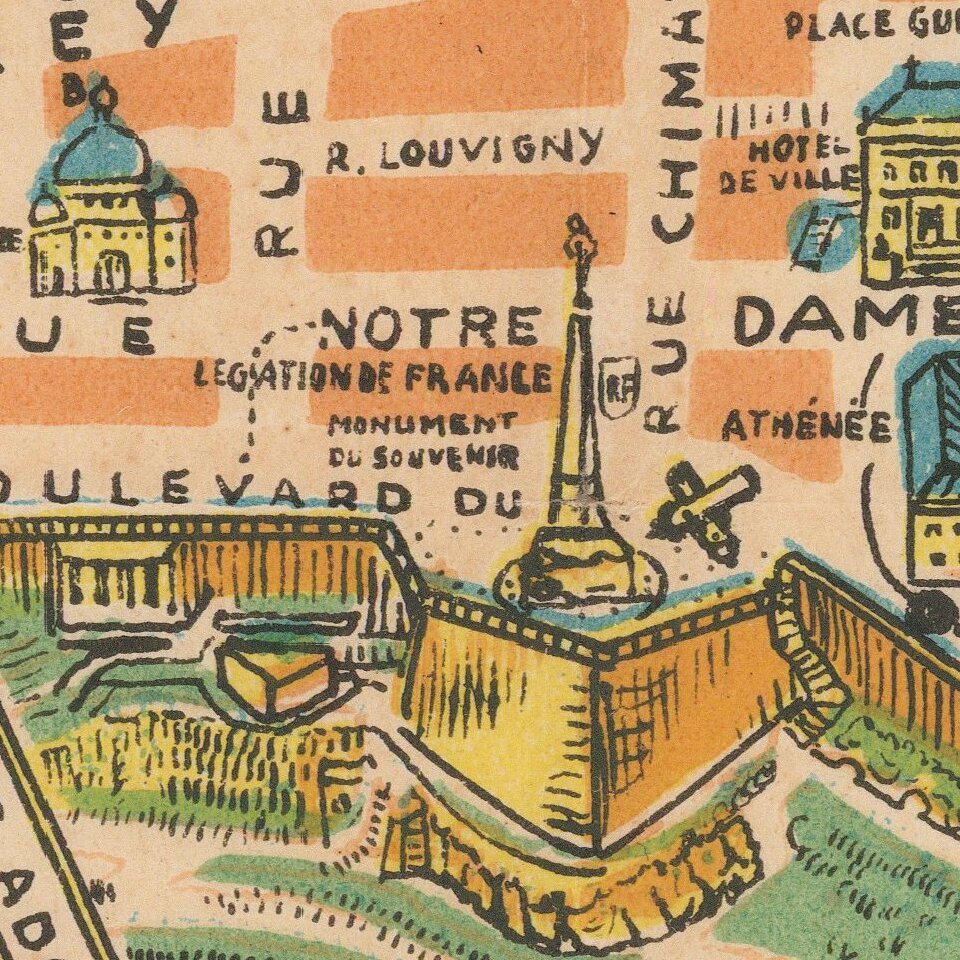
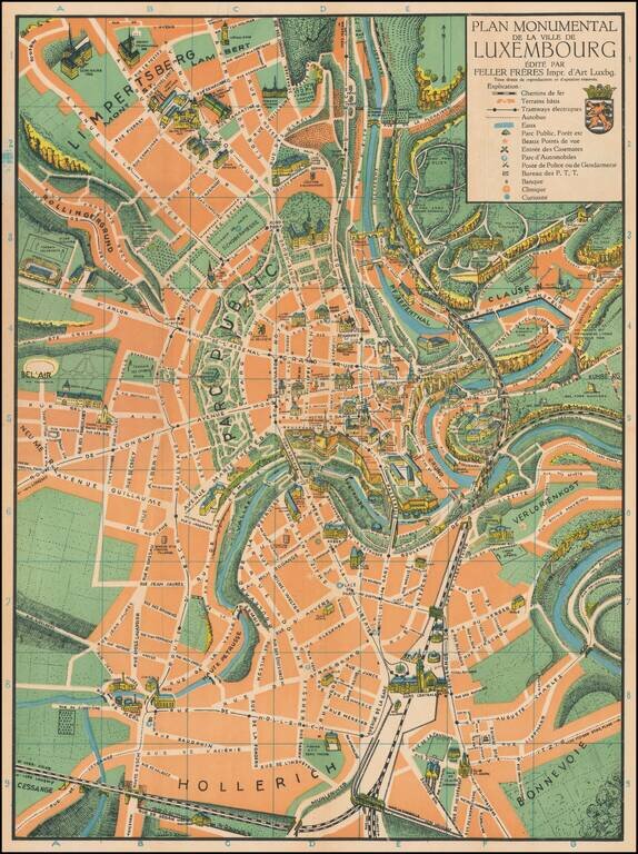
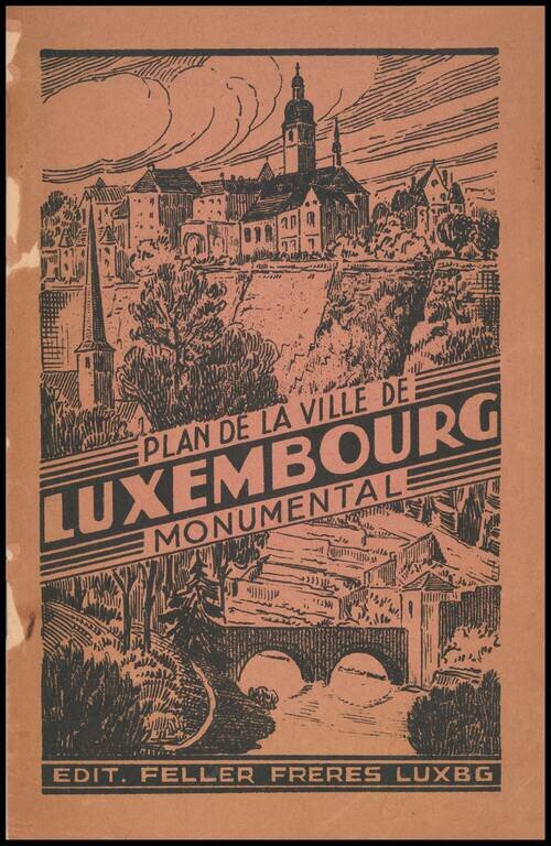
Superb color-printed view of Luxembourg City, with the monuments and landmarks of the city rendered pictorially.

The map differentiates between parks, rivers, and built areas with green, orange, and blue, and the visual effect is quite pleasing.

This is the 5th edition, dated 1936 on the pamphlet. The pamphlet serves as an extended key.


Special conditions for students!

If you are a student, write to us in telegram: @antiquemaps and indicate what material you need and for what work you need a map in high detail. We are ready to provide material on special terms. For students only!

Item information:

Year of creation:
Size:
10083x13495 px
Disk:
40.6242MiB
Number of pages:
2
Place:
Luxembourg
Author:
Feller Frères.
$14.99

Related item