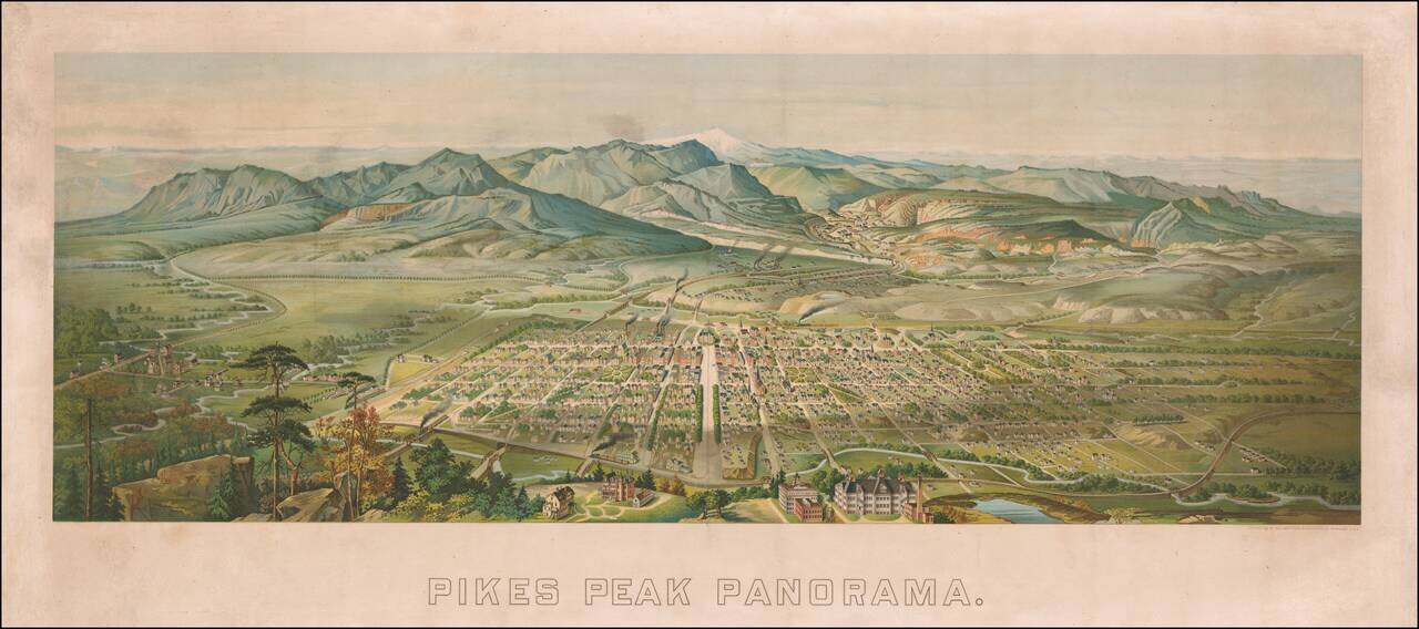
Rare birdseye view of Colorado Springs, Colorado, published by Henry Wellge. A fine color chromolithographic view, illustrating the city in the foreground, with the Rocky Mountains in the distance, including a snow-capped Pikes Peak. The view shows...
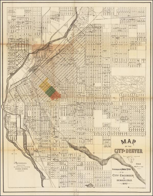
A Denver Rarity Rare large map of Denver, issued in 1890 by the City Engineer to illustrate the work on Denver's storm drain system. While the map is titled as accompanying and annual report, our research shows that it was likely only issued in 1890...
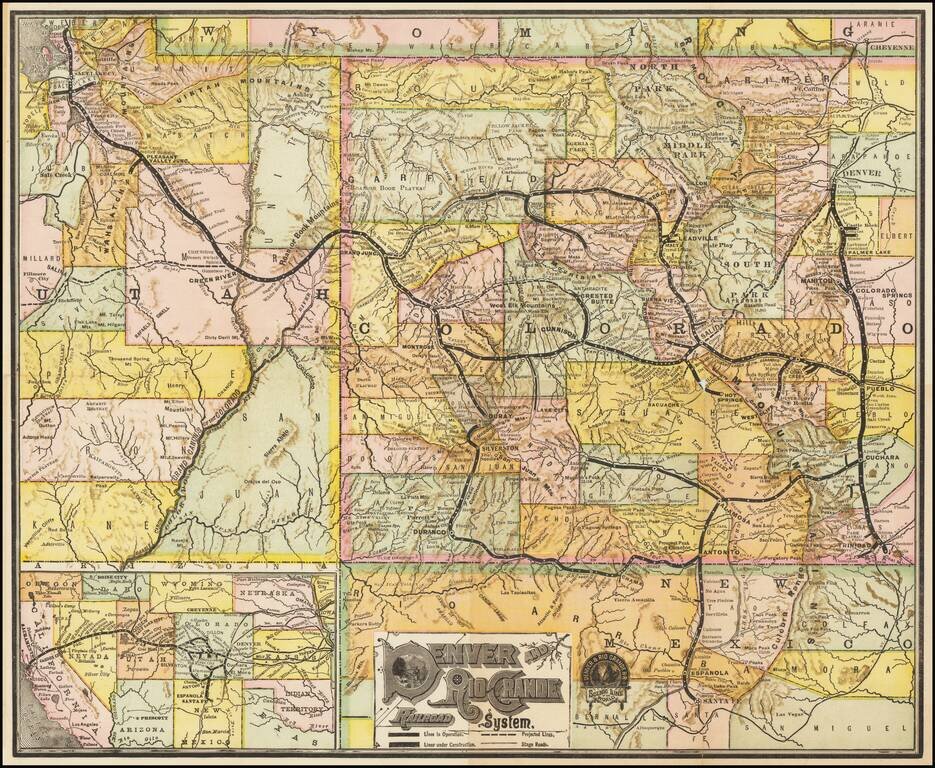
Detailed railroad map of Colorado and part of Utah. Promotional map for the Denver & Rio Grande Railroad. This map was revised several times over the decades.
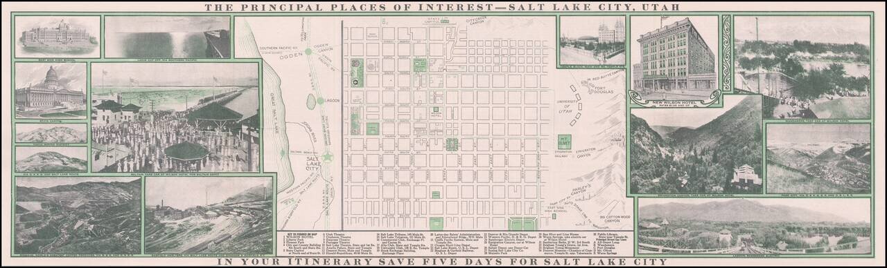
Decorative promotional map of Salt Lake City, published by the Wilson Hotel. The map includes an extensive promotional tract on the verso and a number of early photographs on either side of the map.
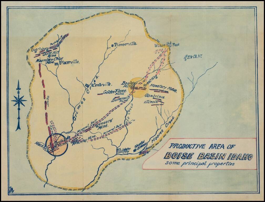
Fascinating mining map, showing the mining regions north of Idaho City, centered on Centerville, Idaho, in the area of the Boise National Forest. The map is centered on Grimes Creek and shows the mining regions between Moore Creek and Placerville....
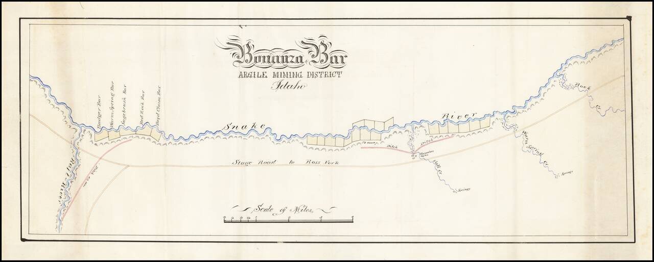
Fine hand drawn map of a section of the Snake River, tracking also the Stage Road to Ross Fork and illustrating Bonanza Bar. Bonanza Bar was centered on the mouth of Fall Creek, with Badger Bar, Warm Springs Bar, Sagebrush Bar, Bed Rock Bar and Boyd...
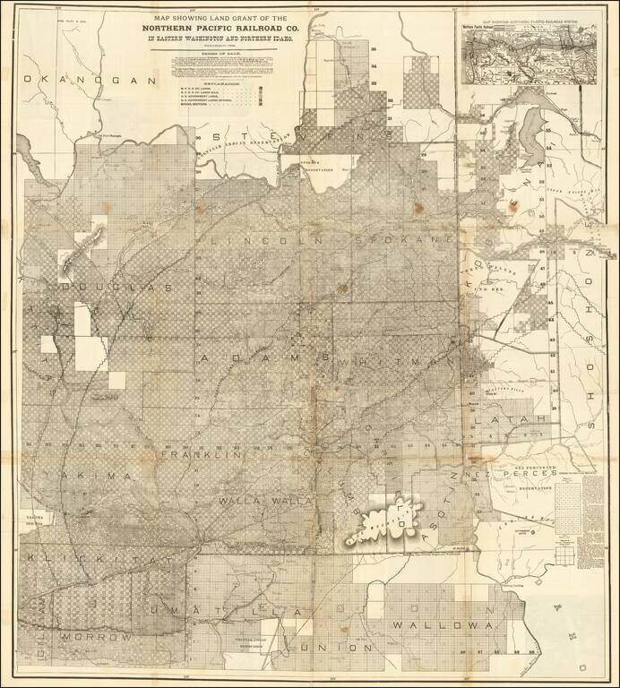
Rare large lithographed folding map showing land ownership opportunities in eastern Washington State and western Idaho, published to promote the lands owned and serviced by the Northern Pacific Railroad. The map is focused on the the growing...
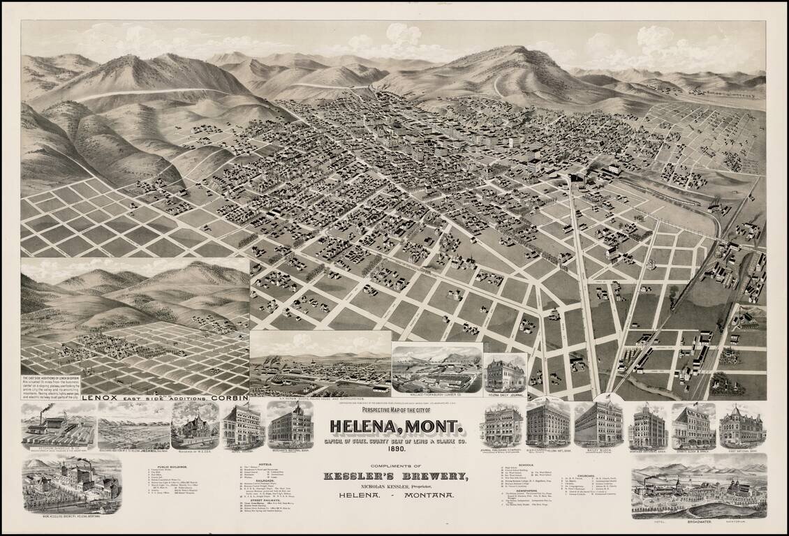
Striking birds-eye view of Helena, Montana. A large two-stone lithographic view of Helena, Montana, with streets named and all the buildings shown in perspective. There are seventeen inset views of outlying subdivisions, and specific buildings...
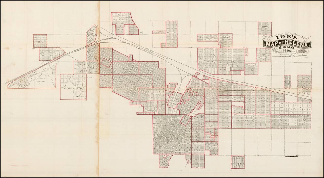
Highly detailed map of Helena, Montana , along with a number of its early additions, published in Helena by Arthur Ide and engraved by Bramblett & Beygem in Minneapolis. Nice example of Arthur Ide's map of Helena, Montana, published shortly after...
![[Untitled Map of Pittburg, California & Vicinity] Pittsburg Chamber of Commerce Trade Card](/map/small/19402.jpg)
An interesting trade card map, with promotional info for the Pittsburg Chamber of Commerce on the verso. See verso here: /gallery/enlarge/19402a
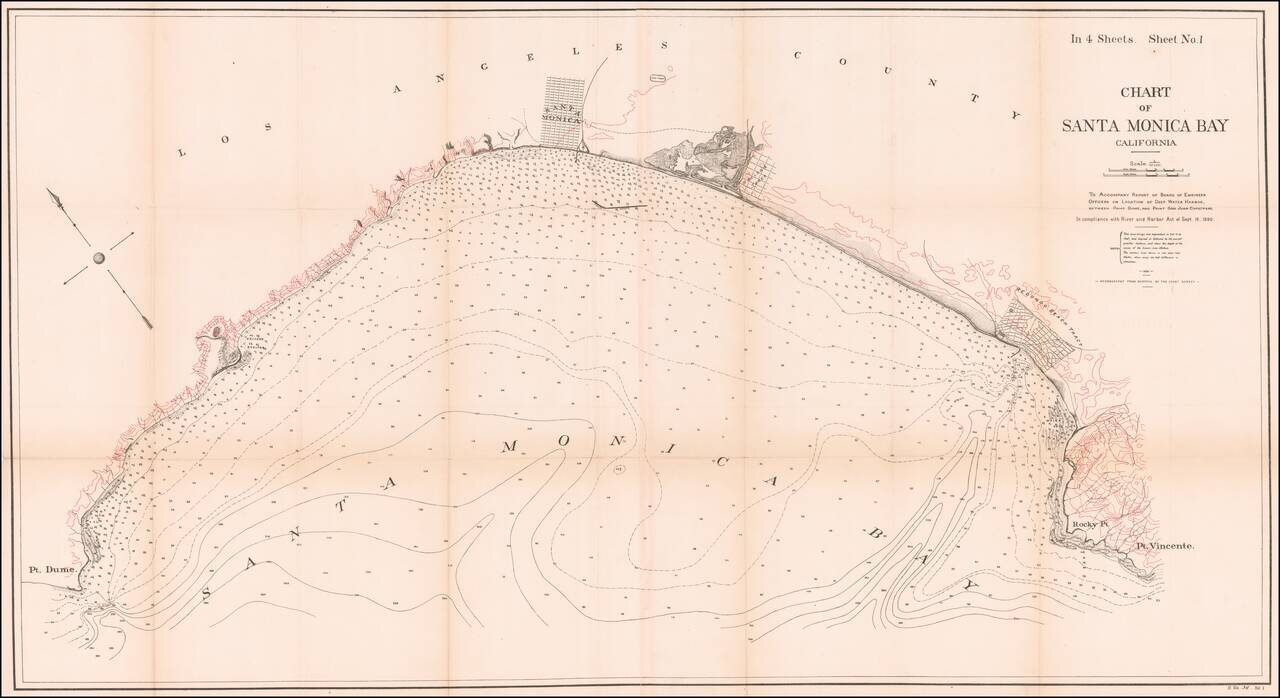
Fine 19th Century Sea Chart of Santa Monica Bay Detailed 4 sheet map of Santa Monica Bay, illustrating a report considering the feasibility of locating a deep water harbor in Santa Monica Bay, conducted by the Army Corps of Engineers in 1890. The...
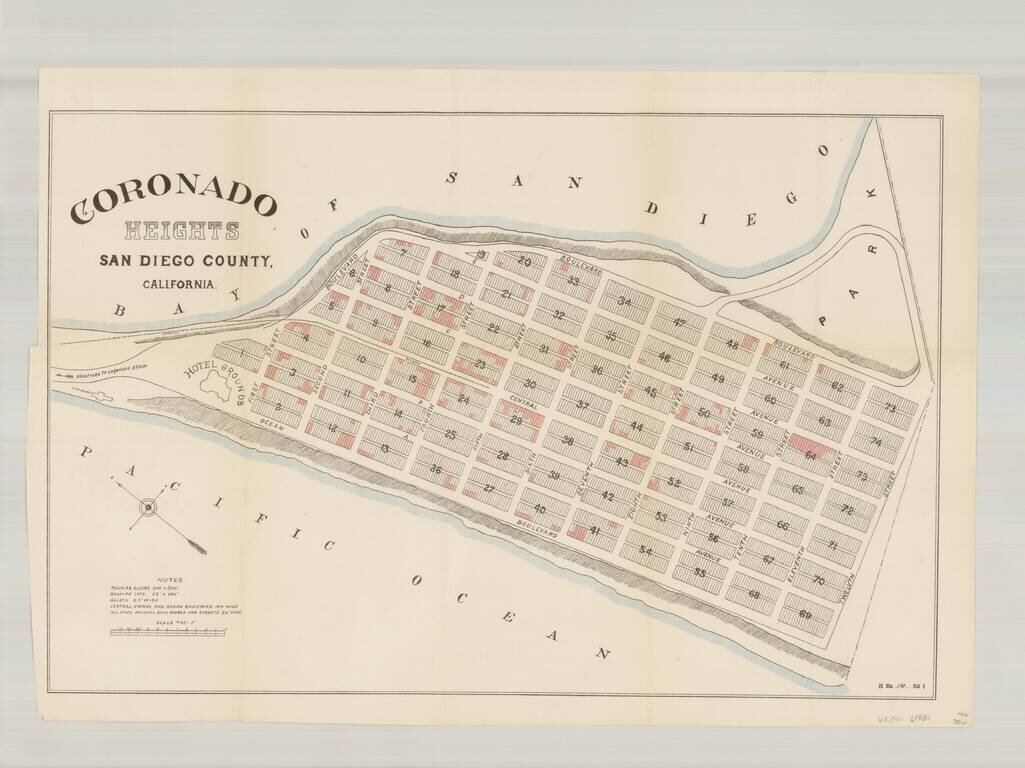
Rare plan of the north end of Imperial Beach, which at the time was planned as a community to be called Coronado Heights, just south of Coronado and the Strand. Located immediately south of the Strand, Coronado Heights would ultimately become a part...
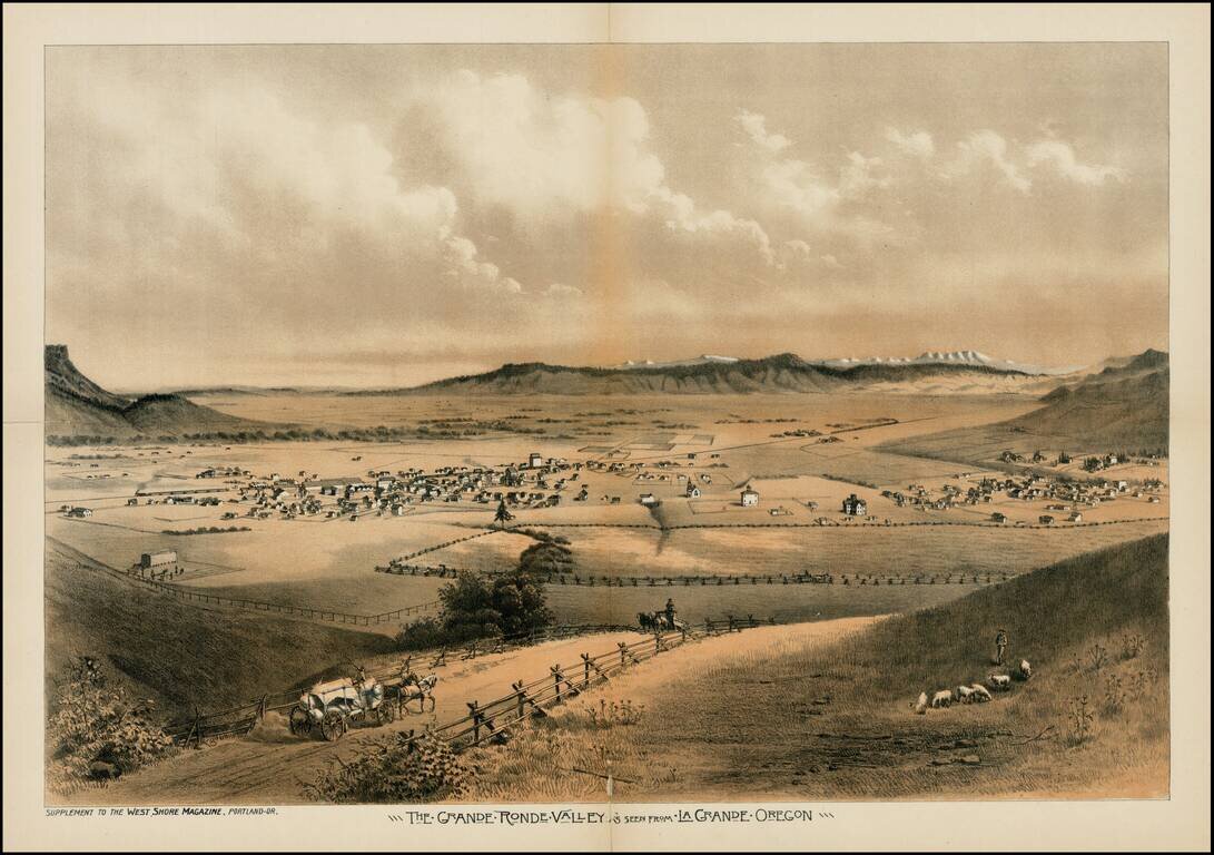
Fine early view of the Le Grande Ronde Valley, in Oregon, from West Shore Magazine. The Astor Expedition passed through the Le Grande Valley in 1811. Thereafter, it became a waypoint along the Oregon Trail. Since the 1840s, settlers headed toward the...
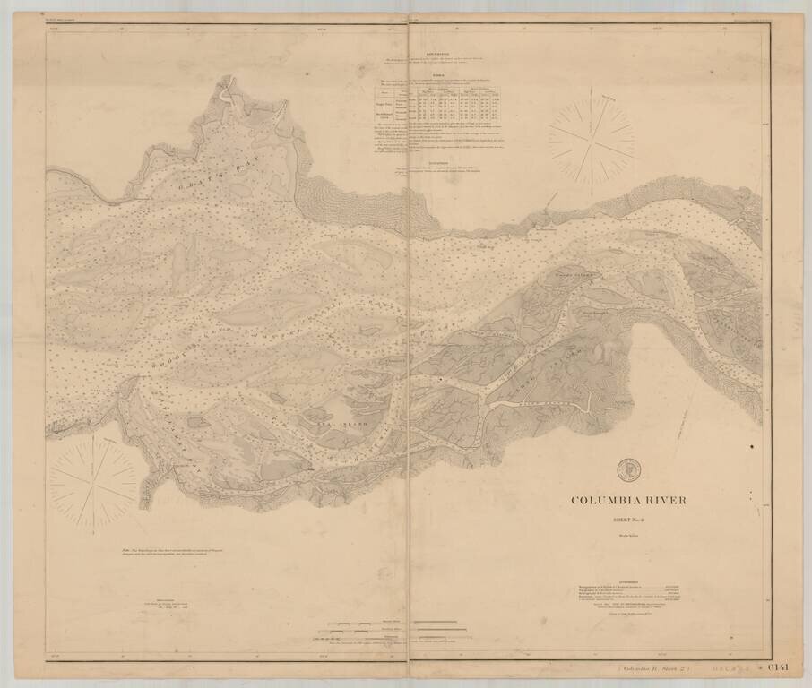
Detailed chart of the Columbia River, extending from the area near Astoria in the west to Skamokawa in the east. The chart is based upon Triangulation data compiled in 1852 and 1871, with topographical data compiled in 1868, 1870 and 1871 and...
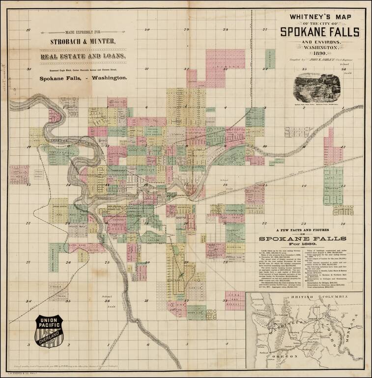
Early promotional map of the City of Spokane Falls (Spokane), Washington, which includes facts and figures encouraging early settlers, published at the beginning of Spokane's major boom period and at the time the Union Pacific Railroad was first...
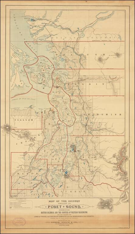
Rare separately published map of "the Puget Sound Country," published by Baker, Balch & Co. Civil, Mechanical and Electrical Engineers and lithographed by A. Zeese & Co. of Chicago. A remarkable advertising map issued to promote settlement,...