logo

1890. Chart of Santa Monica Bay California . . . 1890

  • Chart of Santa Monica Bay California  . . . 1890

Chart of Santa Monica Bay California . . . 1890 information:

Year of creation: 
Resolution size (pixels): 
 26152x14262 px
Disk Size: 
 57.2586MiB
Number of pages: 
 1
Place: 
 Washington

Print information. Print size (Width x height in inches):
Printing at 72 dpi 
  363.22 х 198.08
Printing at 150 dpi 
 174.35 х 95.08
Printing at 300 dpi 
 87.17 х 47.54

An example of detailing the file of this map of in a printable high-resolution:

Click to open in high resolution (open in new tab).
Attention! this is just the central piece (central area 960x960 px) of the map file!
This is an example, so that you can see and study the level of detail of a given map. The entire Map will be fully available after payment!

Chart of Santa Monica Bay California  . . . 1890

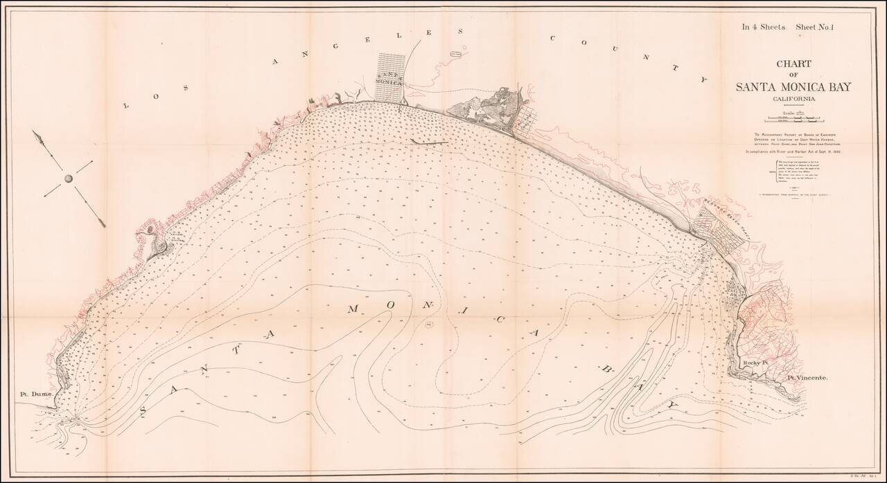
Fine 19th Century Sea Chart of Santa Monica Bay

Detailed 4 sheet map of Santa Monica Bay, illustrating a report considering the feasibility of locating a deep water harbor in Santa Monica Bay, conducted by the Army Corps of Engineers in 1890.

The full title of the map is: C hart of Santa Monica Bay California. To Accompany Report of Board of Engineer Officers on Location of a Deep Water Port Between Port Dume and Point San Juan Capistrano . . . 1890.

The finest large format map of Santa Monica Bay published in the 19th Century.


Special conditions for students!

If you are a student, write to us in telegram: @antiquemaps and indicate what material you need and for what work you need a map in high detail. We are ready to provide material on special terms. For students only!

Item information:

Year of creation:
Size:
26152x14262 px
Disk:
57.2586MiB
Number of pages:
1
Place:
Washington
Author:
U.S. Army Corps of Engineers.
$21.99

Related item