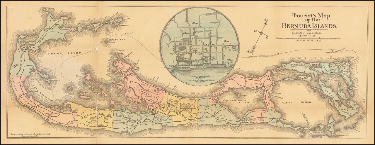
Scarce Tourist map of Bermuda, colored by parishes. Includes a large inset map of the town of Hamilton.
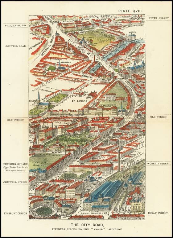
Antique wood-engraved view of London pointing north from Finsbury Circus towards Islington. The view was apparently drawn by Thomas Sulman (1834-1900) while flying in a balloon above London. The wood-engraving was done by George William Ruffle...
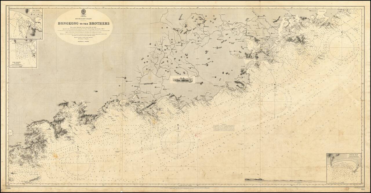
19th Century British Navigational Chart Scarce early sea chart of the coast of China, from Hong Kong and Lantao to Nan'ao Island and Dongshan. Engraved chart, including tidal information, compass roses, soundings, seabed notations, currents,...
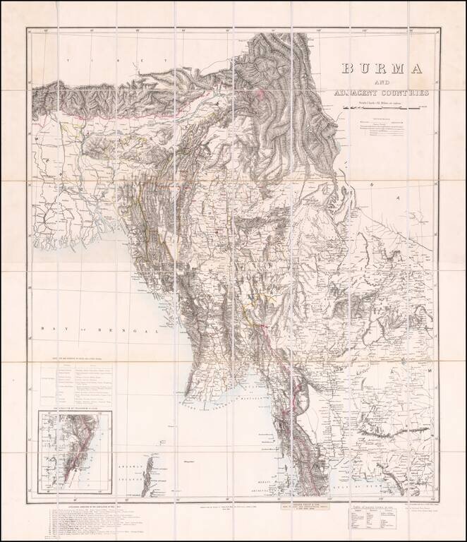
Published in Calcutta Finely executed map of Burma, compiled by Colonel Henry Ravenshaw Thullier and published by the Survey of India Office. One of the most accurate maps of Burma for of the period, derived from a host of contemporary sources...
![[South Vietnam & Cambodia] Carte de la Cochinchine . . . Dressee au Bureau Topographique Des Troupes De L'Indo-Chine Fevrier 1890](/map/small/62547.jpg)
Rare Hanoi Imprint of French South Vietnam -- First Railroad Line In Vietnam Illustrated Finely executed map of South Vietnam and part of Cambodia, published in Hanoi for the French Colonial Government. The map provides a highly detailed accounting...
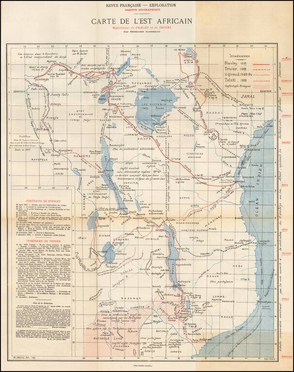
Rare map of East Africa, published by the Gazette Geographique in Paris. The map details the routes of 4 explorers in East Africa, along with the area in conflict between the English and the Portuguese. The explorer routes shown include: Henry...