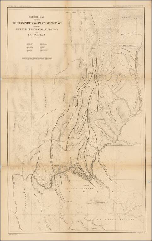
Finely detailed map of parts of Arizona and Utah, which appeared in the United States Geological Survey's At las To Accompany The Monograph On The Tertiary History Of The Grand Canon District By Capt. Clarence E. Dutton. The map provides a finely...
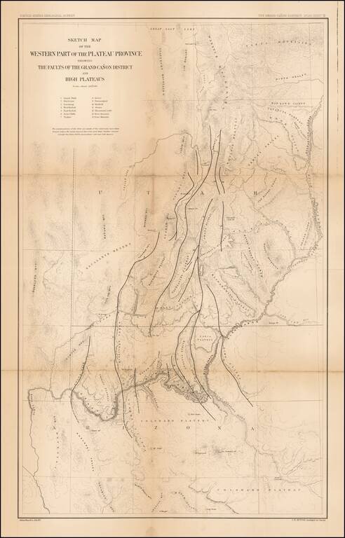
Finely detailed map of parts of Arizona and Utah, which appeared in the United States Geological Survey's At las To Accompany The Monograph On The Tertiary History Of The Grand Canon District By Capt. Clarence E. Dutton. The map provides a finely...
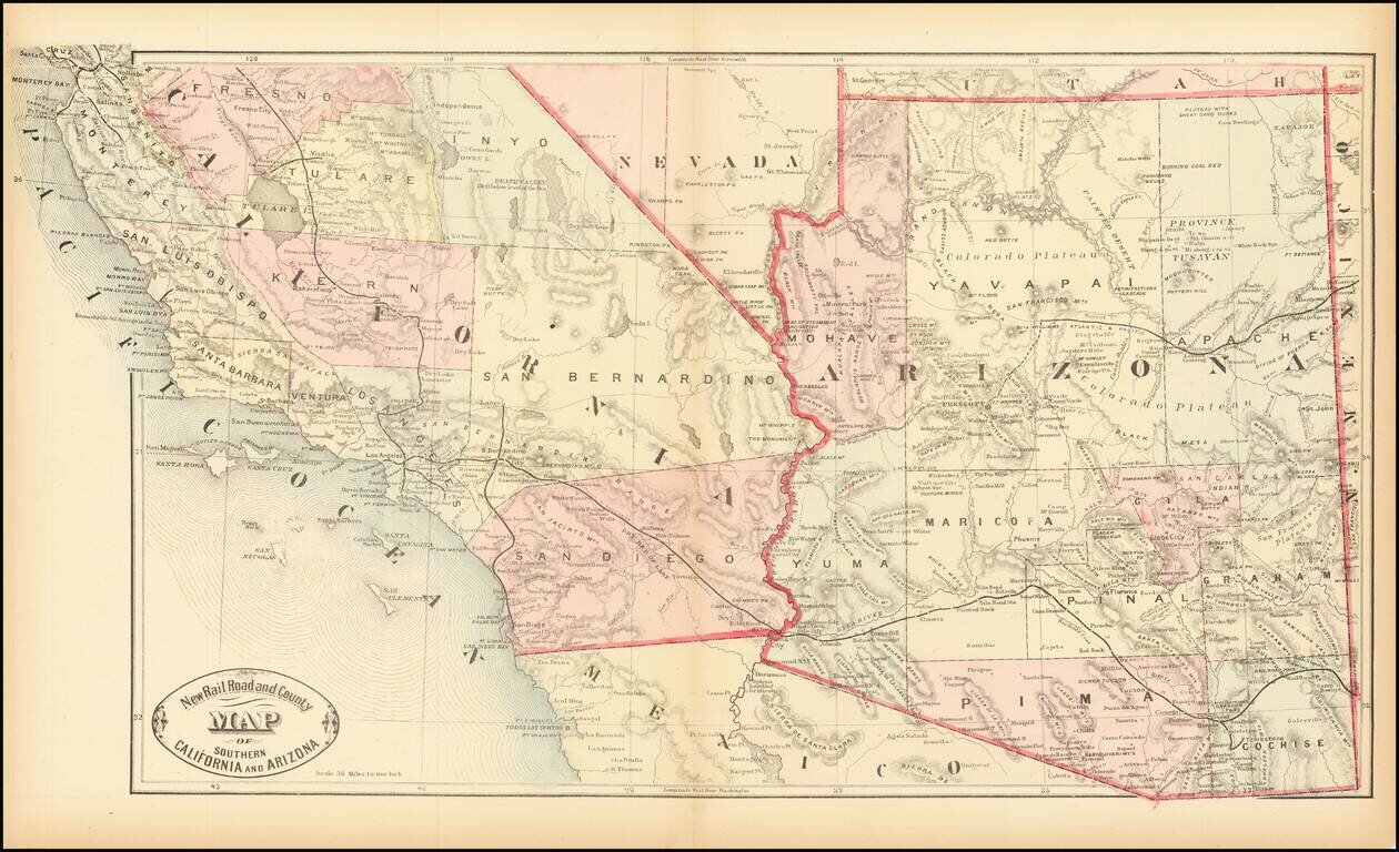
Scarce early map of Southern California and Arizona, focusing on the Railroad Lines then in operation. The map also shows a number of early towns, roads, mountains, lakes, mining regions and other important details. This is the first time we have...
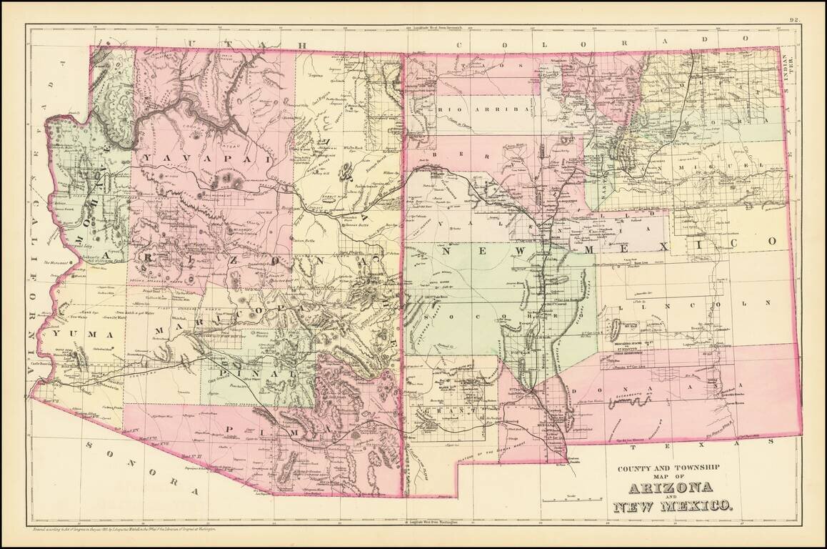
Detailed map of Arizona and New Mexico, colored by counties and showing towns, roads, railroads, rivers, lakes and a host of other information. The map predates the formation of Sierra County, New Mexico in 1884. One of the most detailed maps of the...
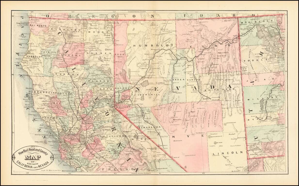
Scarce early map of Northern California and Nevada, focusing on the Railroad Lines then in operation. The map also shows a number of early towns, roads, mountains, lakes, mining regions and other important details. This is the first time we have...
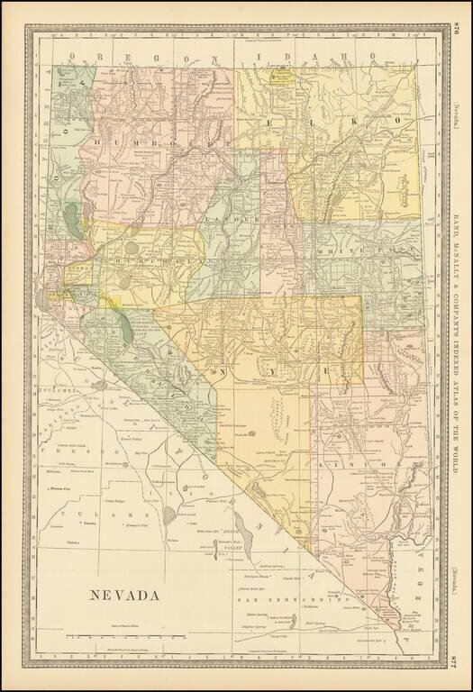
Including Roop County Fine early map of Nevada, colored by counties, and showing the extent of the township surveys to date, including the now extinct Roop County, which was the subject of a major boundary dispute. The year 1882 is an historically...
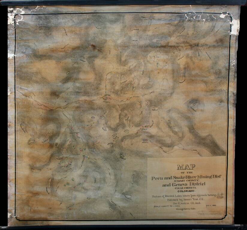
Highly detailed wall map of the area immediately south of Georgetown, Colorado, in the Peru Mining District, Snake River Mining District and Geneva Mining District, Summit County and Clear Creek County Colorado. Teal's map provides in fine detail the...
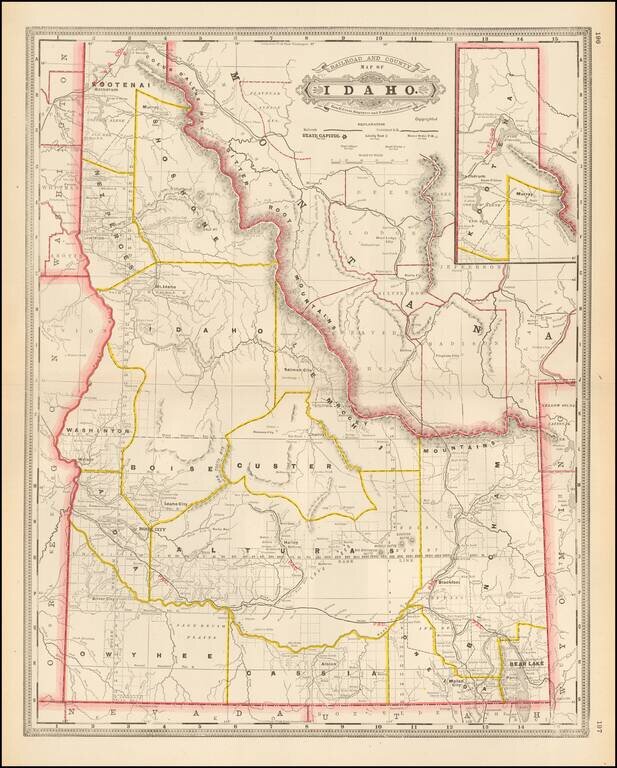
Early and highly detailed map showing railroads, towns, cities and mountain ranges. Early county configurations. Many early roads, rivers, mining areas, Indian names and other details.
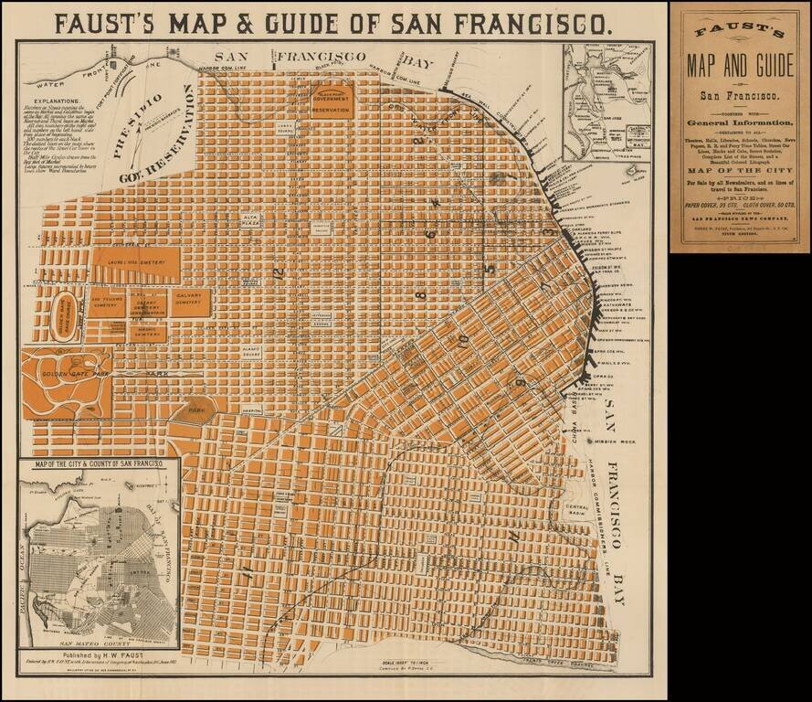
Very good example of Faust's map of the City of San Francisco. Not to be confused with his similar, but more common, map of the City and County of San Francisco, which extended to the Pacific in the west, and shows slightly less detail. The map...
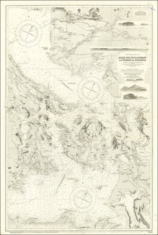
Excellent British Admiralty chart of the Strait of Juan de Fuca, focusing on the San Juan Islands, and also showing Victoria and Vancouver B.C. The chart was originally published in 1882 and was updated numerous times to 1924. Despite the fact that...
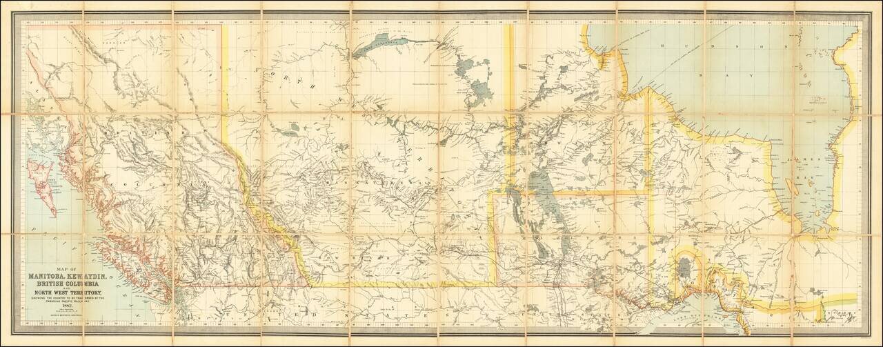
Impressive Canadian Railroad Map Showing the Proposed - But Never Realized - Province of Kewaydin. Color-lithographed antique folding map of Canada west of Ontario, published in Montreal in 1882 by the Dawson Brothers. The map features the Province...
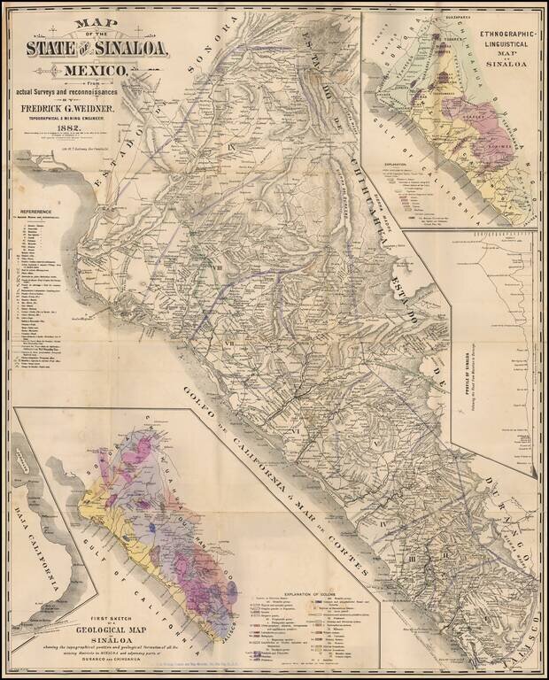
Rare map of Sinaloa in northwestern Mexico, lithographed by W.T. Galloway and published in San Francisco in 1882. While created for the mining industry, the map's most unique features is the large inset "Ethongraphic-Linguistic Map of Sinaloa,"...
![[Mocha, Yemen] Arabia -- Red Sea -- Mokha Road Surveyed by Commander Aldrich assisted by Lieutenants Pullen, Helby, Keary and Cust, H.M.S. Fawn 1882. [With an early View of Mocha!]](/map/small/68944.jpg)
Detailed map of the area around the town and port of Mocha in Western Yemen, published by the British Admiralty. The map includes extensive offshore soundings and coastal features, including the location of the city pier, 3 minarets, 4 mosques and...
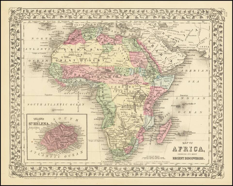
Decorative and detailed map of the African Continent, with an inset map of St. Helena. SA Mitchell Jr. acquired his father's former business from DeSilver in 1860 and relaunched a very successful atlas publishing business which survived another 20+...
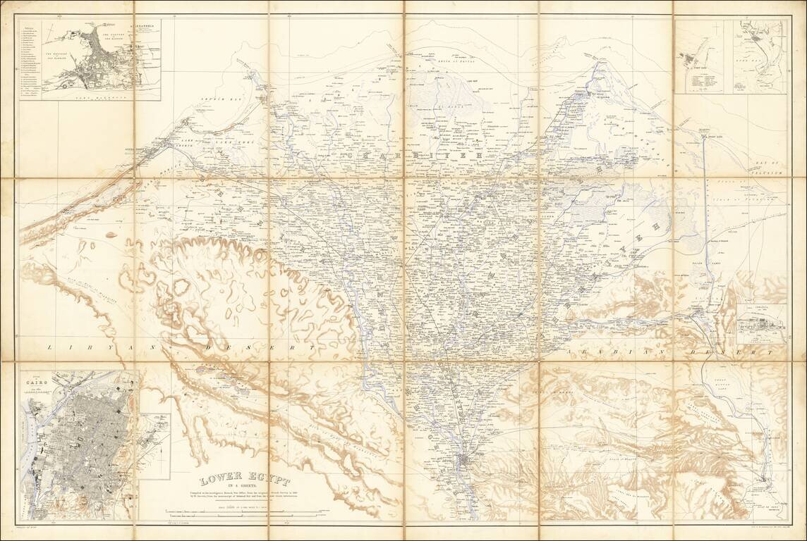
Egypt During the Anglo-Egyptian War Detailed military reconnaissance map of the Lower Nile Delta, published by the British War Department. The map extends from Cairo in the South, to Alexandria and Port Said in the north, and includes significant...
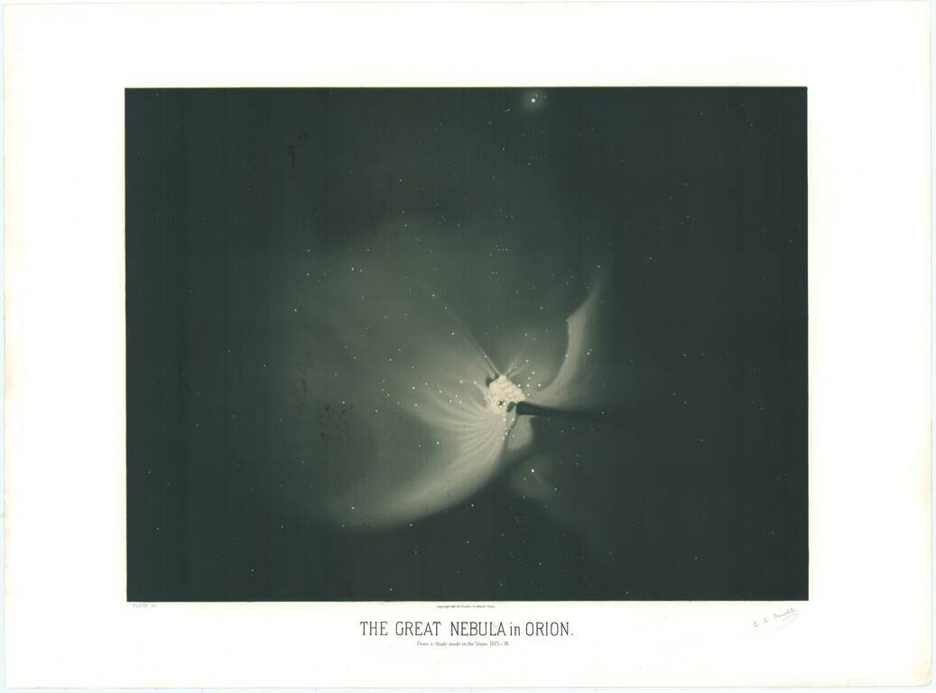
A Magnificent Depiction of Orion's Nebula. Made by the "Audubon of the Sky", Etienne Trouvelot. This is a beautiful color lithograph showing Orion's Nebula made by Etienne Trouvelot, relating his observations made in the fall of 1874. The...