![[3 Celestial Manuscript Maps & Drawings]](/map/small/65575.jpg)
Mystery Manuscript Celestial Calculations Three manuscript celestial maps, each on a large sheet of paper, drawn by an anonymous hand. Each map is drawn on a hemispheric model and includes pencil annotations locating constellations, each of which is...
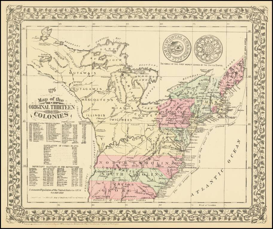
A charming historical map, showing the 13 colonies, Indian Tribes, and details dating to 1776, along with other important historical facts, populations, and Revolutionary War battle dates. A marvelous little map produced on the 100 year anniversary of...
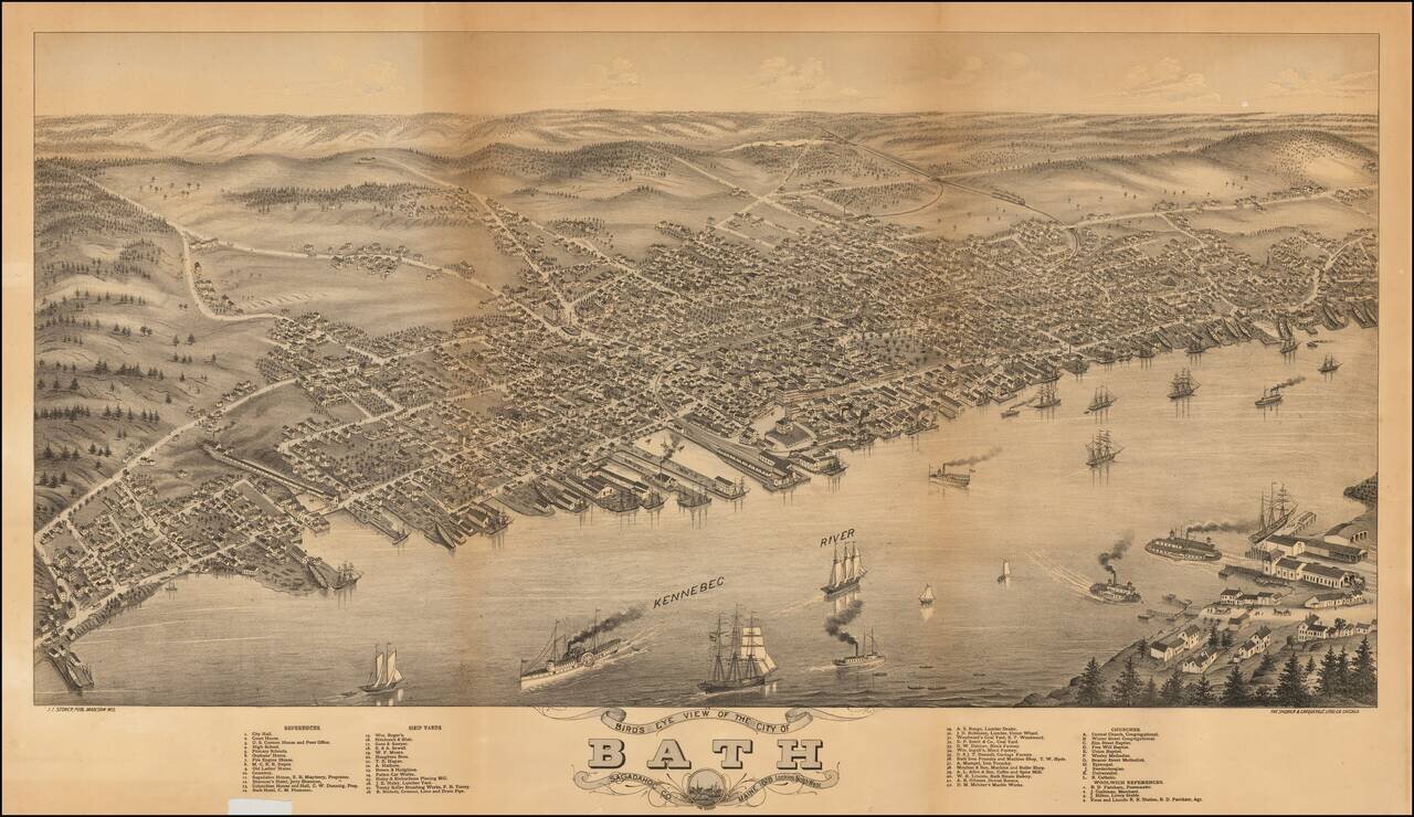
Rare Birdseye View of Bath, Maine, engraved by J.J. Stoner and lithographed by The Shober & Carqueville Litho. Co., in Chicago in 1878. The map presents a thriving image of the City of Bath on the Kennebec River, with steamships and sailing...
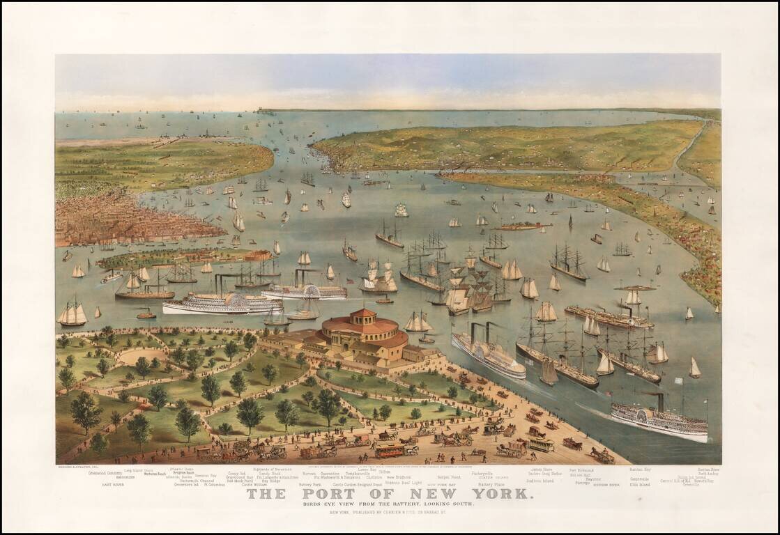
Currier & Ives' definitive 19th-century view of the bustling Harbor of New York. First state of Currier & Ive's striking view of New York Harbor, pre-dating the inclusion of the Statue of Liberty. In the foreground, a bustling Battery Park...
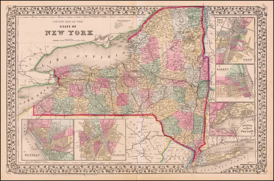
Detailed map of New York, colored by county, showing towns, roads, railroads, canals, etc. Insets of Long Island, New York Vicinity, Buffalo, Albany and Rochester. Decorative grapeleaf border. One of the most interesting NY atlas maps of the period.
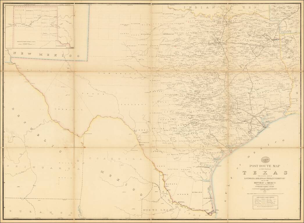
A Texas Sized Postal Map Without Post Routes! First state of this important early map showing the Official Post Offices and Postal Routes in Texas in the last decade of the 19th Century. The Key indicates that the map include Railroads, Mail...
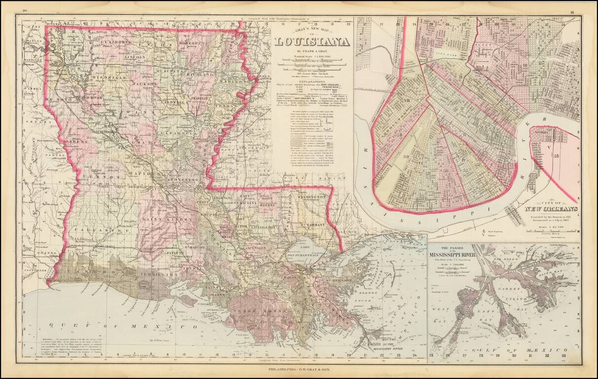
Highly detailed map of Louisiana, published by OW Gray & Son. The map is colored by parishes and showing towns, roads, railroads, swamps, Post Offices, islands, sand bars, soundings, shoals and a host of other details. Large insets of the City of...
![County Map of the States of Georgia and Alabama [Insets of Atlanta and Savannah]](/map/small/69561.jpg)
With Early Map of Atlanta! Nice full color map of Alabama and Georgia, published by SA Mitchell Jr. This is the first atlas map to include a plan of Atlanta. The map is hand colored by counties, and shows towns, roads, railroads, stations,...
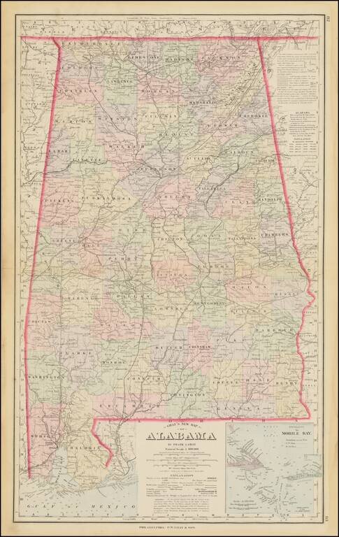
Detailed map of Alabama, colored by counties. Shows towns, township surveys, forts, swamps, lakes, rivers, railroads, roads, post offices, stations, etc. Large inset of the Entrance to Mobile Bay. Includes a table of census populations from 1810 to...
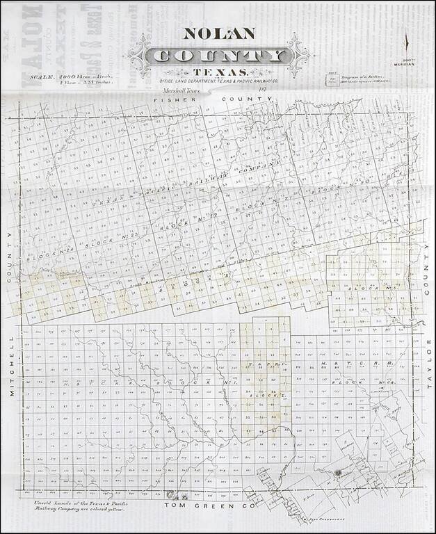
Rare early map of Nolan County, Texas, published by the Texas Pacific Railway Company. The Texas & Pacific Railway was chartered March 3, 1871, with the right to build a trans-continental line from Marshall, TX., to San Diego, CA. Work on the line...
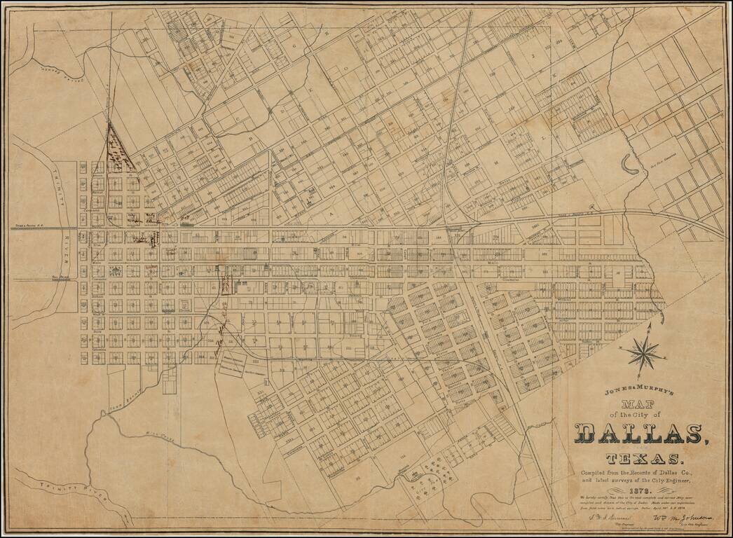
The Second-Earliest Printed Map of Dallas. One of Only Two Known Copies. Separately-issued lithographed map of Dallas, Texas by Dallas-based mapmaker Jones & Murphy. This is the second printed map of Dallas, following F. E. Butterfield and C. M....
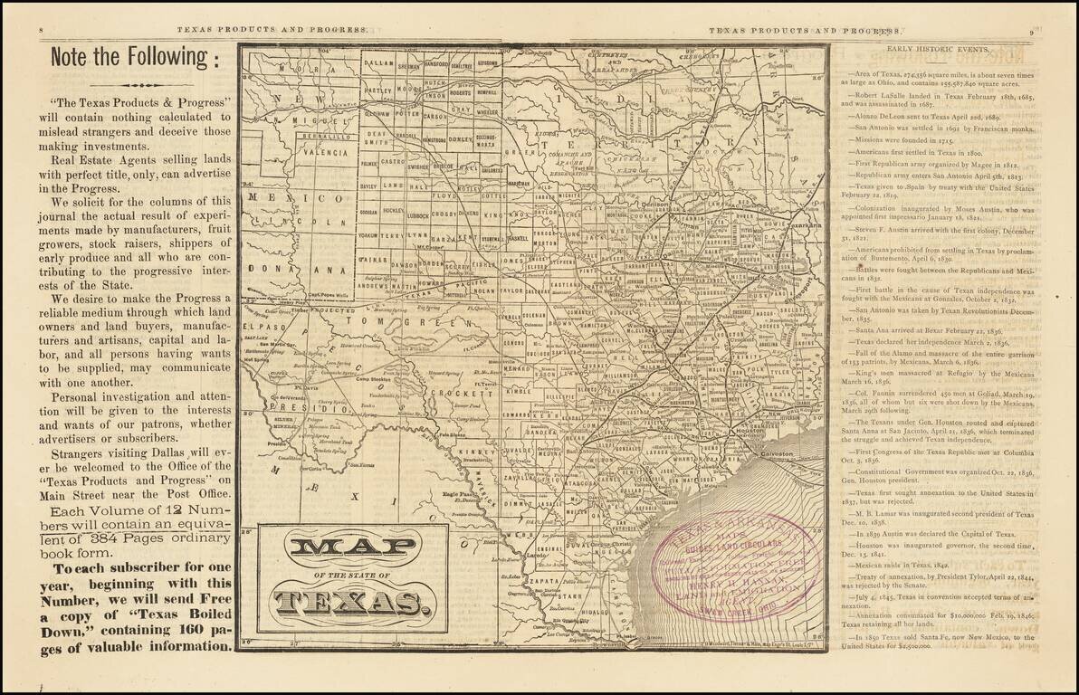
Rare Early Dallas Publication Volume 1, number 1 of this rare Texas promotional newspaper, "Devoted to the Industrial, Immigration and Educational Interests of Texas." This 16 page promotional work was used to promote emigration to Texas. The...
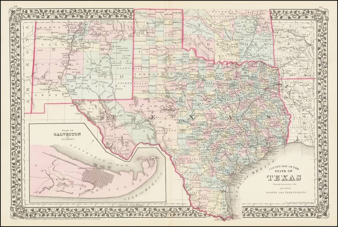
A detailed map of Texas, colored by counties and showing most of Indian Territory and New Mexico. The counties of Texas are still incomplete in the west. The map shows towns, railroads, rivers, springs, forts, and other important details throughout...
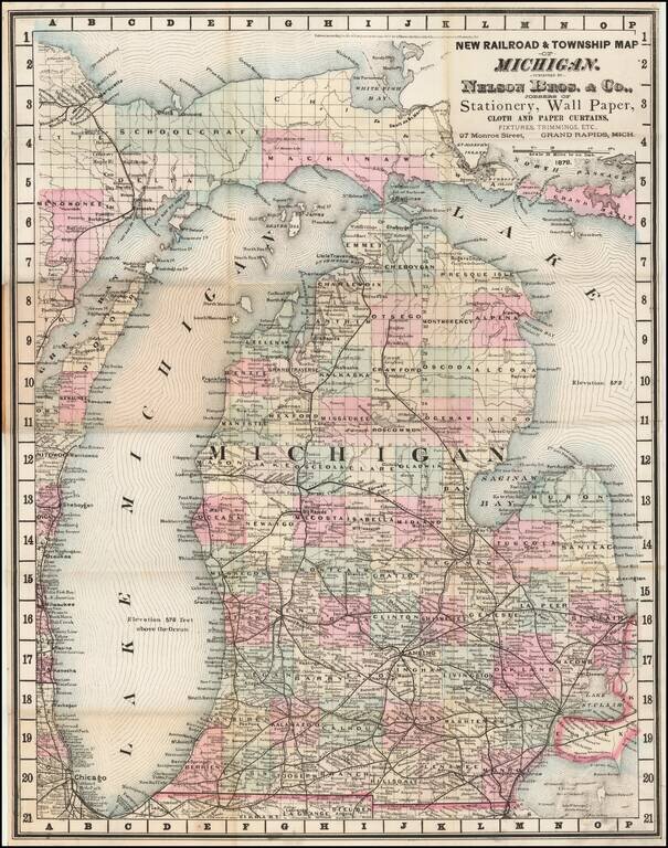
A Michigan Rarity Rare separately published pocket map of Michigan, published by Nelson Bros. & Co. of Grand Rapids Michigan. The map licensed from George F. Cram of Chicago, as noted in the copyright to the left of the title, dated 1878. Cram...
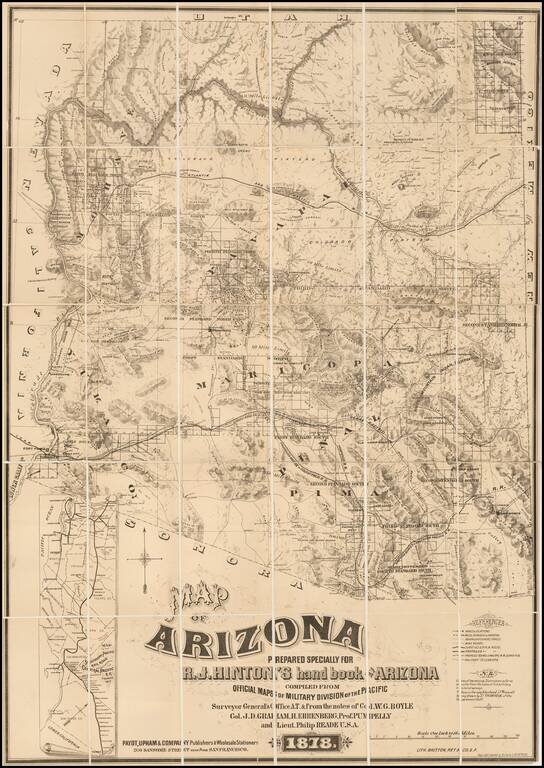
The First Privately Printed Large Format Map of Arizona Territory with Hinton's Hand Book. Hinton's map of Arizona was intended to be published with his hand book. However, as noted by Streeter, the map was accompanied by a note that the book would...
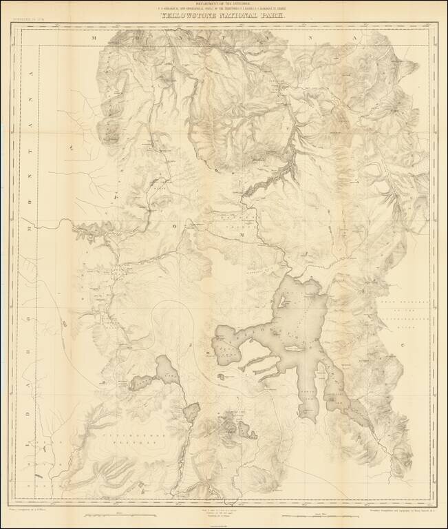
Second Hayden Survey Map of Yellowstone National Park A nice example of this fine large map of Yellowstone, prepared by the Department of the Interior. The map was prepared in connection with the second survey of the park by Ferdinand V. Hayden, the...