Map size in jpg-format: 1.65881MiB
Click to open in high resolution (open in new tab).
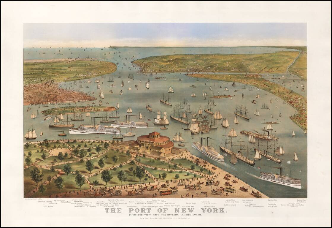
Currier & Ives' definitive 19th-century view of the bustling Harbor of New York.
First state of Currier & Ive's striking view of New York Harbor, pre-dating the inclusion of the Statue of Liberty.
In the foreground, a bustling Battery Park appears, surrounded by a rich tapestry of sailing ships and steam ships.
On the right, the map stretches out to show Brooklyn and Governor's Island, with Lower Manhattan Bay in the distance.
A very nice early example of the print, which, in later states, would come to include the Statue of Liberty.
If you are a student, write to us in telegram: @antiquemaps and indicate what material you need and for what work you need a map in high detail. We are ready to provide material on special terms. For students only!

![[Charles Lindbergh] Spirit of St. Louis](/map/small/69234.jpg)
![[Charles Lindbergh / New York to Paris View] Spirit of St. Louis](/map/small/69235.jpg)