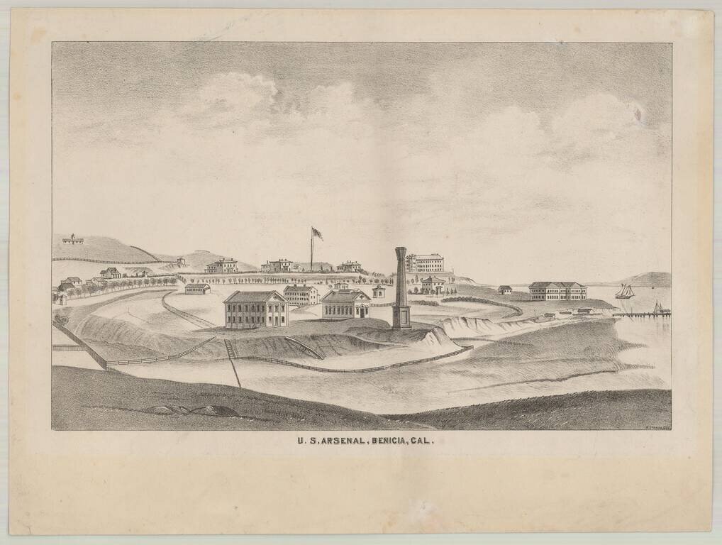
Rare separately issued lithographic view of Benicia, California, drawn by H. Straus. The view of Benecia and the Arsenal appeared in Thompson & West's Atlas of Solano County, but the present example is a rare separately published version, intended...
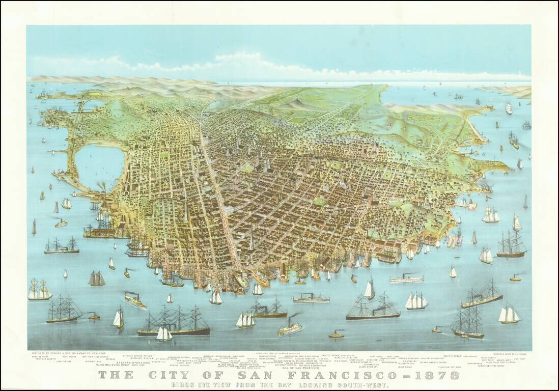
An early reproduction of Currier & Ives famous view of San Francisco, likely printed about 1920.
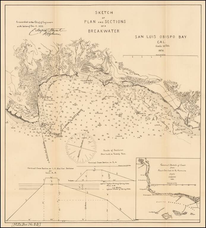
Scarce early map of San Luis Obispo area. Shows topographical contour lines and other details. Includes a model elevation for the breakwater and regional map. One of the earliest obtainable plans of San Luis Obispo.
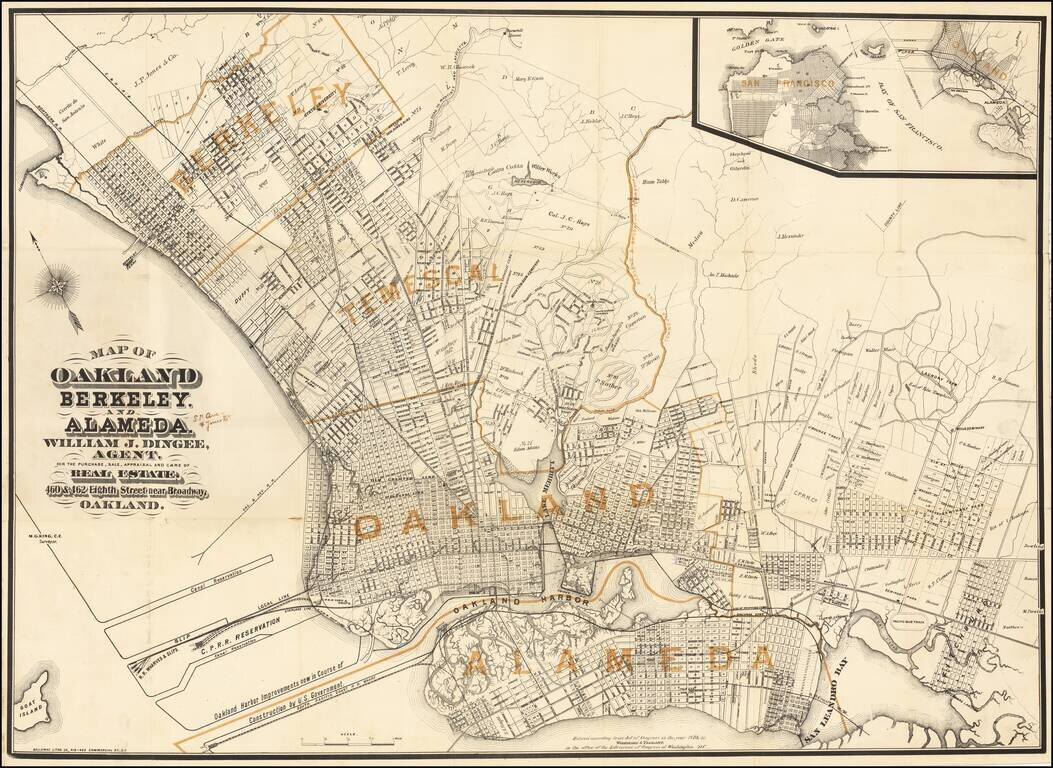
Published Shortly After Incorporation of the Town of Berkeley -- Early Map Promoting William Jackson Dingee Antique map of Oakland, Berkeley and surrounding areas, published in the first year of the real estate career of William Jackson Dingee and...
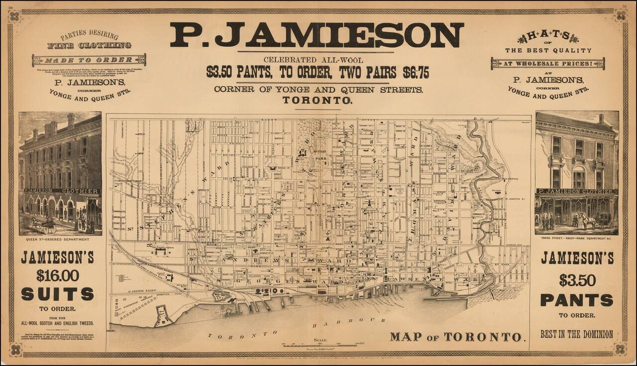
Rare double page map of Toronto, lithographed by Ralph Smith & Co. and published by Frederick B. Miles in Toronto. The map shows Toronto at a relatively early date. Streets are named, public squares, parks and buildings identified and wards...
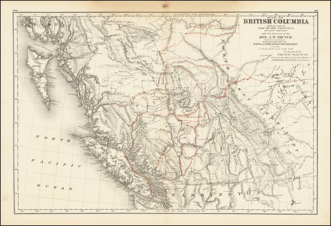
A historically important map of British Columbia after the province entered the Confederation which shows the proposed routes for the Canadian Pacific Railway. Following the establishment of the Canadian Confederation in 1867, Trutch worked to...
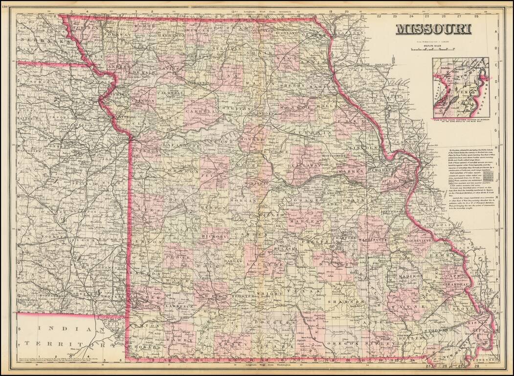
Highly detailed map of Missouri, published by OW Gray. The map is colored by counties and showing towns, roads, railroads, Post Offices, etc. Inset of the plan of the eastern portion of Missouri.
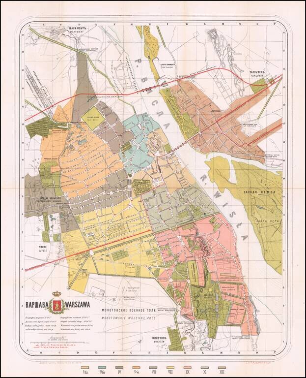
Warsaw-Published Antique Map of Warsaw, in both Polish and Russian. Color-lithographed antique folding map of Warsaw, issued in Warsaw in 1878 by the polish lithographer Felix Julian Kasprzykiewicz. The city is colored by ward (twelve in total), with...
![[Philippine Islands] East India Archipelago [Eastern Passage to China and Japan] [Chart No. 6] . . . 1878](/map/small/64039.jpg)
Nice example of James Imray's large sea chart of the Philippine Islands, published in London in 1878. The map treats the vast majority of the islands with fine detail, lacking only the northernmost part of Luzon and some of the southernmost islands....
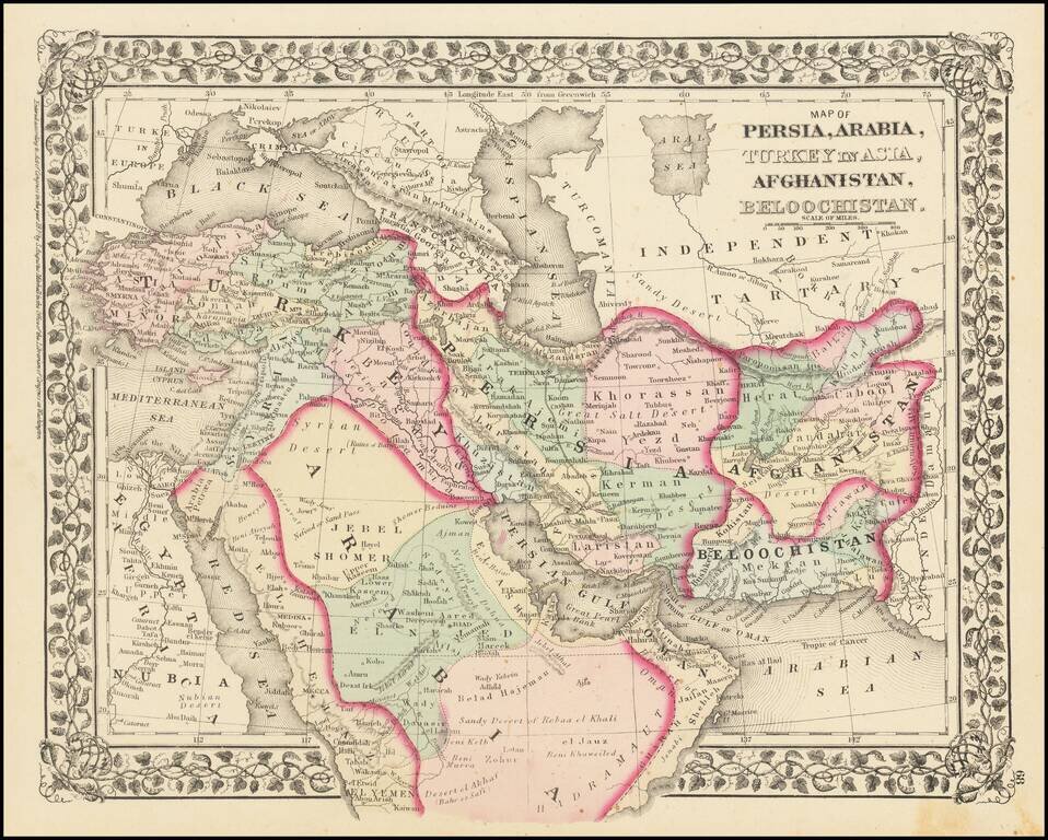
Fine example of Mitchell's map of the Middle East, Persia and Afghanistan, colored by tribal regions.

Rare Map of the Polar Regions, Updated To Show Adolf Erik Nordenskold's Progress in 1878 Toward Completion of the First Northeast Passage. Fine example of Edward Stanford's map of the North Polar Regions, featuring the furthest most points reached by...